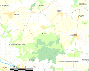
Contres (Contres)
- commune in Loir-et-Cher, France
- Country:

- Postal Code: 41700
- Coordinates: 47° 25' 8" N, 1° 25' 40" E


- GPS tracks (wikiloc): [Link]
- Area: 36.09 sq km
- Population: 3623
- Web site: http://www.ville-contres.fr/
- Wikipedia en: wiki(en)
- Wikipedia: wiki(fr)
- Wikidata storage: Wikidata: Q730148
- Wikipedia Commons Category: [Link]
- Freebase ID: [/m/03qd2dh]
- GeoNames ID: Alt: [6613884]
- SIREN number: [214100596]
- BnF ID: [15259335w]
- INSEE municipality code: 41059
- US National Archives Identifier: 10037837
Shares border with regions:


Soings-en-Sologne
- commune in Loir-et-Cher, France
- Country:

- Postal Code: 41230
- Coordinates: 47° 24' 48" N, 1° 31' 30" E


- GPS tracks (wikiloc): [Link]
- Area: 35.3 sq km
- Population: 1614


Oisly
- commune in Loir-et-Cher, France
- Country:

- Postal Code: 41700
- Coordinates: 47° 23' 22" N, 1° 22' 38" E


- GPS tracks (wikiloc): [Link]
- Area: 10.61 sq km
- Population: 369
- Web site: [Link]
Thenay
- commune in Loir-et-Cher, France
- Country:

- Postal Code: 41400
- Coordinates: 47° 23' 16" N, 1° 17' 17" E


- GPS tracks (wikiloc): [Link]
- Area: 20.03 sq km
- Population: 870


Sassay
- commune in Loir-et-Cher, France
- Country:

- Postal Code: 41700
- Coordinates: 47° 23' 35" N, 1° 26' 30" E


- GPS tracks (wikiloc): [Link]
- Area: 16.44 sq km
- Population: 1000


Feings
- commune in Loir-et-Cher, France
- Country:

- Postal Code: 41120
- Coordinates: 47° 26' 16" N, 1° 21' 10" E


- GPS tracks (wikiloc): [Link]
- Area: 16.52 sq km
- Population: 713


Fontaines-en-Sologne
- commune in Loir-et-Cher, France
- Country:

- Postal Code: 41250
- Coordinates: 47° 30' 34" N, 1° 33' 3" E


- GPS tracks (wikiloc): [Link]
- Area: 46.25 sq km
- Population: 630


Cheverny
- commune in Loir-et-Cher, France
- Country:

- Postal Code: 41700
- Coordinates: 47° 29' 57" N, 1° 27' 37" E


- GPS tracks (wikiloc): [Link]
- Area: 33 sq km
- Population: 1011
- Web site: [Link]


Fresnes
- commune in Loir-et-Cher, France
- Country:

- Postal Code: 41700
- Coordinates: 47° 26' 4" N, 1° 24' 43" E


- GPS tracks (wikiloc): [Link]
- Area: 16.02 sq km
- Population: 1140


Choussy
- commune in Loir-et-Cher, France
- Country:

- Postal Code: 41700
- Coordinates: 47° 22' 24" N, 1° 20' 48" E


- GPS tracks (wikiloc): [Link]
- AboveSeaLevel: 80 м m
- Area: 15.45 sq km
- Population: 339
- Web site: [Link]
