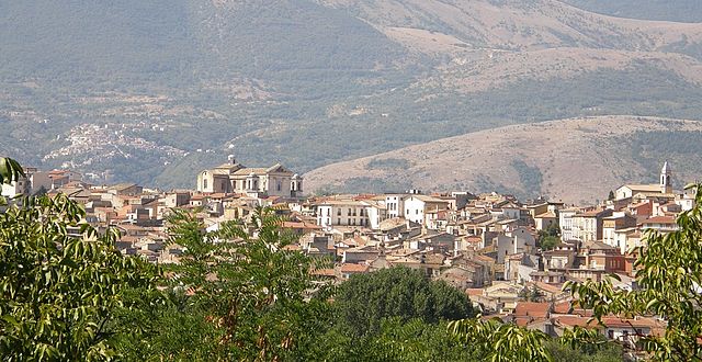
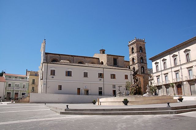
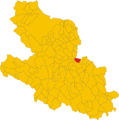
Corfinio (Corfinio)
.svg)
- Italian comune
 Hiking in Corfinio
Corfinio is a charming town located in the Abruzzo region of Italy, surrounded by stunning natural landscapes that offer a variety of hiking opportunities. Nestled on the edge of the Gran Sasso e Monti della Laga National Park, Corfinio provides a perfect base for hikers of all levels. Here are some highlights for hiking in the area:
Trails and Routes
-
Gran Sasso National Park: Just a short drive from Corfinio, this park features a variety of trails, from easy walks to more challenging hikes. Popular routes include the ascent to Corno Grande, the highest peak in the Apennines.
-
Majella National Park: Also nearby, Majella offers diverse trails with breathtaking views, dense forests, and majestic rock formations. Trails range from family-friendly walks to strenuous hikes.
-
Local Paths: There are numerous local paths that offer scenic views of the surrounding countryside, vineyards, and historic villages. The trails are often less crowded and provide a great way to experience the region’s natural beauty.
Attractions Along the Trails
- Historic Sites: While hiking, you can explore ancient ruins, castles, and charming villages like Corfinio itself, which has a rich history dating back to Roman times.
- Flora and Fauna: The area is home to diverse wildlife, including deer, wolves, and various bird species, as well as unique flora, making it a great spot for nature lovers and photographers.
Best Seasons for Hiking
- Spring (April to June): This is an ideal time to hike, as the weather is mild, flowers are in bloom, and trails are less crowded.
- Fall (September to October): Autumn offers stunning foliage and comfortable hiking temperatures, perfect for outdoor activities.
Tips for Hiking in Corfinio
- Preparation: Always check trail conditions before heading out and carry a map or GPS device.
- Gear: Wear appropriate hiking shoes, dress in layers, and bring plenty of water and snacks.
- Respect Nature: Follow the Leave No Trace principles to preserve the beauty of the natural environment.
- Local Guides: Consider hiring a local guide for more in-depth knowledge of the area's history and ecology.
Conclusion
Hiking in Corfinio offers a unique blend of natural beauty, rich history, and diverse trails suitable for everyone. Whether you are an experienced hiker seeking challenging paths or a casual walker looking for scenic strolls, you will find plenty of options to explore. Enjoy the adventure!
- Country:

- Postal Code: 67030
- Local Dialing Code: 0864
- Licence Plate Code: AQ
- Coordinates: 42° 7' 29" N, 13° 50' 33" E


- GPS tracks (wikiloc): [Link]
- AboveSeaLevel: 346 м m
- Area: 17.95 sq km
- Population: 1036
- Web site: http://www.comune.corfinio.gov.it
- Wikipedia en: wiki(en)
- Wikipedia: wiki(it)
- Wikidata storage: Wikidata: Q50090
- Wikipedia Commons Category: [Link]
- Freebase ID: [/m/0fg4q5]
- GeoNames ID: Alt: [6541202]
- VIAF ID: Alt: [246170108]
- OSM relation ID: [41788]
- WOEID: [714616]
- Google Maps Customer ID: [9432640053078885542]
- ISTAT ID: 066041
- Italian cadastre code: C999
Shares border with regions:

Pratola Peligna
- Italian comune
Hiking in Pratola Peligna
Pratola Peligna, located in the province of L’Aquila in the Abruzzo region of Italy, is a beautiful area known for its stunning landscapes and rich natural heritage. Here are some aspects to consider for hiking in this region:...
- Country:
- Postal Code: 67035
- Local Dialing Code: 0864
- Licence Plate Code: AQ
- Coordinates: 42° 5' 57" N, 13° 52' 29" E
- GPS tracks (wikiloc): [Link]
- AboveSeaLevel: 342 м m
- Area: 28.67 sq km
- Population: 7528
- Web site: [Link]

Raiano
- Italian comune
Hiking in Raiano
Raiano, located in the province of L'Aquila in the Abruzzo region of Italy, is a picturesque village surrounded by beautiful landscapes that offer excellent hiking opportunities. The area is characterized by its scenic mountains, lush valleys, and historical sites. Here are some key aspects to consider when hiking in and around Raiano:...
- Country:
- Postal Code: 67027
- Local Dialing Code: 0864
- Licence Plate Code: AQ
- Coordinates: 42° 6' 12" N, 13° 48' 56" E
- GPS tracks (wikiloc): [Link]
- AboveSeaLevel: 390 м m
- Area: 28.99 sq km
- Population: 2767
- Web site: [Link]
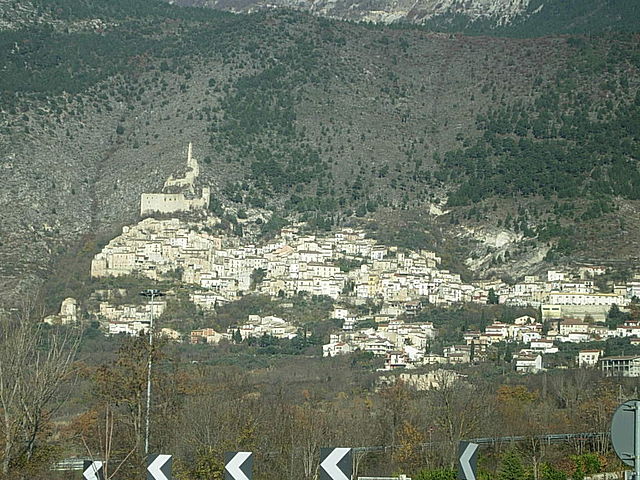

Roccacasale
- Italian comune
Hiking in Roccacasale
Roccacasale, located in the Abruzzo region of Italy, is a charming destination for hiking enthusiasts. The area is characterized by its stunning natural landscapes, rich biodiversity, and panoramic views of the surrounding mountains and valleys. Here are some highlights and tips for hiking in Roccacasale:...
- Country:
- Postal Code: 67030
- Local Dialing Code: 0864
- Licence Plate Code: AQ
- Coordinates: 42° 7' 26" N, 13° 53' 20" E
- GPS tracks (wikiloc): [Link]
- AboveSeaLevel: 450 м m
- Area: 17.31 sq km
- Population: 671
- Web site: [Link]
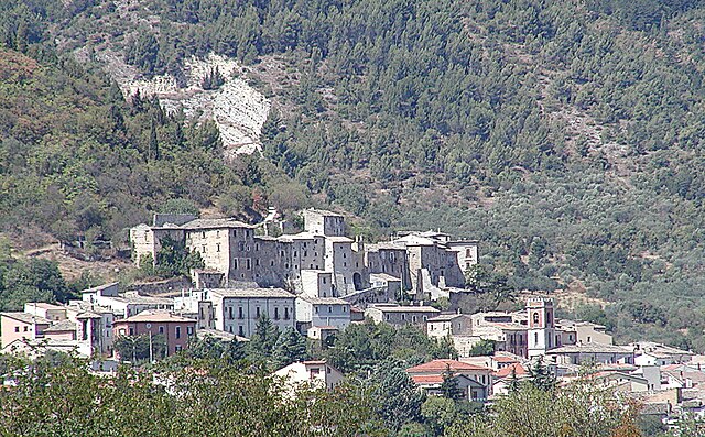
Vittorito
- Italian comune
Hiking in Vittorito
Vittorito is a small town located in the Abruzzo region of Italy, nestled in the mountainous landscape of the Apennines. The region is known for its stunning natural beauty, historical sites, and diverse hiking opportunities....
- Country:
- Postal Code: 67030
- Local Dialing Code: 0864
- Licence Plate Code: AQ
- Coordinates: 42° 7' 41" N, 13° 49' 3" E
- GPS tracks (wikiloc): [Link]
- AboveSeaLevel: 377 м m
- Area: 14.19 sq km
- Population: 850
- Web site: [Link]


Popoli
- Italian comune
Hiking in Popoli
Popoli, located in the Abruzzo region of Italy, is known for its stunning natural landscapes and is an excellent destination for hiking enthusiasts. Nestled in the foothills of the Apennine Mountains, Popoli offers a variety of trails that cater to different skill levels, from leisurely walks to more challenging hikes....
- Country:
- Postal Code: 65026
- Local Dialing Code: 085
- Licence Plate Code: PE
- Coordinates: 42° 10' 7" N, 13° 49' 48" E
- GPS tracks (wikiloc): [Link]
- AboveSeaLevel: 254 м m
- Area: 35.04 sq km
- Population: 5035
- Web site: [Link]


Salle, Abruzzo
- Italian comune
Hiking in Salle, Abruzzo
Salle, a charming village in the Abruzzo region of Italy, is surrounded by the stunning natural landscapes of the Majella National Park and the Gran Sasso and Monti della Laga National Park. This area offers a variety of hiking opportunities for all skill levels, featuring breathtaking views, rich biodiversity, and historical sites....
- Country:
- Postal Code: 65020
- Local Dialing Code: 085
- Licence Plate Code: PE
- Coordinates: 42° 10' 37" N, 13° 57' 35" E
- GPS tracks (wikiloc): [Link]
- AboveSeaLevel: 450 м m
- Area: 21.8 sq km
- Population: 291
- Web site: [Link]


Tocco da Casauria
- Italian comune
Hiking in Tocco da Casauria
Tocco da Casauria is a charming village located in the Abruzzo region of Italy, nestled in the foothills of the Majella mountain range. This area is known for its stunning landscapes, rich history, and outdoor activities, including hiking. Here are some details about hiking in and around Tocco da Casauria:...
- Country:
- Postal Code: 65028
- Local Dialing Code: 085
- Licence Plate Code: PE
- Coordinates: 42° 13' 0" N, 13° 55' 0" E
- GPS tracks (wikiloc): [Link]
- AboveSeaLevel: 356 м m
- Area: 29.67 sq km
- Population: 2640
- Web site: [Link]