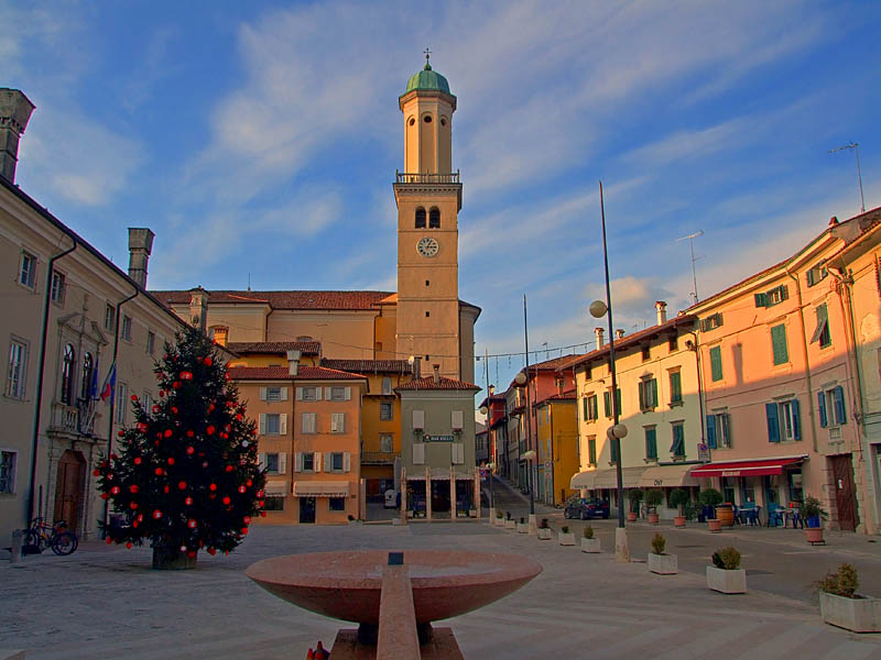
Corno di Rosazzo (Corno di Rosazzo)
.svg)
- Italian comune
 Hiking in Corno di Rosazzo
Corno di Rosazzo, located in the Friuli Venezia Giulia region of northeastern Italy, is a great area for hiking enthusiasts who appreciate both natural beauty and cultural heritage. The region is characterized by rolling hills, vineyards, and picturesque landscapes, making it ideal for outdoor activities. Here are some details and tips for hiking in Corno di Rosazzo:
Trails and Routes
-
Sentiero dei Cippi: This trail runs through vineyards and offers stunning views of the surrounding countryside. It's suitable for moderate hikers and often features informative signs about the local flora and fauna.
-
Monte Quarin Trail: A more challenging hike that takes you to Monte Quarin, where you can enjoy panoramic views of the Veneto and Friuli region. The ascent can be invigorating, and there are historical sites to explore, including an ancient castle.
-
Local Vineyards: Many trails pass through local vineyards, allowing hikers to stop, taste the local wines, and enjoy the lovely scenery. This can be a rewarding way to combine hiking with gastronomic experiences.
Tips for Hiking in Corno di Rosazzo
-
Best Time to Hike: Spring (April to June) and autumn (September to October) are the best times to hike here due to mild weather and vibrant scenery.
-
Equipment: Good hiking shoes are essential, as some trails can be uneven. Bring a map or a GPS device, as some trail markers may not always be clear.
-
Water and Snacks: Carry enough water and snacks, especially for longer hikes, as facilities can be sparse along some trails.
-
Respect Nature: The area is home to diverse wildlife, so it's important to stick to marked paths and minimize your impact on the environment.
-
Local Advice: It can be beneficial to stop by local tourism offices or consult with local hikers for up-to-date trail conditions and recommendations.
Cultural Aspects
Hiking in Corno di Rosazzo also provides an opportunity to experience the rich culture of the region. You can find ancient churches, historical ruins, and charming villages along the way. Don’t forget to sample the delicious local cuisine, which features fresh produce and distinctive wines, particularly white varieties from the area.
Overall, Corno di Rosazzo offers a beautiful combination of nature and culture, making it a fantastic hiking destination in Italy.
- Country:

- Postal Code: 33040
- Local Dialing Code: 0432
- Licence Plate Code: UD
- Coordinates: 45° 59' 0" N, 13° 27' 0" E


- GPS tracks (wikiloc): [Link]
- AboveSeaLevel: 88 м m
- Area: 12.62 sq km
- Population: 3170
- Web site: http://www.comune.corno-di-rosazzo.ud.it/
- Wikipedia en: wiki(en)
- Wikipedia: wiki(it)
- Wikidata storage: Wikidata: Q53250
- Wikipedia Commons Category: [Link]
- Freebase ID: [/m/0gk8qy]
- GeoNames ID: Alt: [6536310]
- VIAF ID: Alt: [243896463]
- OSM relation ID: [79150]
- UN/LOCODE: [ITODR]
- ISTAT ID: 030030
- Italian cadastre code: D027
Shares border with regions:

Cormons
- Italian comune
Hiking in Cormons
Cormons, located in the Friuli Venezia Giulia region of northeastern Italy, is surrounded by beautiful landscapes, making it an excellent destination for hiking enthusiasts. The area is characterized by rolling hills, vineyards, and stunning views of the Alps and the Adriatic Sea. Here are some highlights for hiking in and around Cormons:...
- Country:
- Postal Code: 34071
- Local Dialing Code: 0481
- Licence Plate Code: GO
- Coordinates: 45° 57' 0" N, 13° 28' 0" E
- GPS tracks (wikiloc): [Link]
- AboveSeaLevel: 56 м m
- Area: 35.09 sq km
- Population: 7347
- Web site: [Link]


Dolegna del Collio
- Italian comune
Hiking in Dolegna del Collio
Dolegna del Collio is a charming village located in the Collio region of northeastern Italy, in the Friuli Venezia Giulia region. Known for its stunning vineyards and picturesque landscapes, this area is a hidden gem for hikers. Here’s an overview of what you can expect when hiking in Dolegna del Collio:...
- Country:
- Postal Code: 34070
- Local Dialing Code: 0481
- Licence Plate Code: GO
- Coordinates: 46° 2' 0" N, 13° 29' 0" E
- GPS tracks (wikiloc): [Link]
- AboveSeaLevel: 90 м m
- Area: 12.88 sq km
- Population: 347
- Web site: [Link]
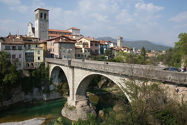

Cividale del Friuli
- Italian comune
Hiking in Cividale del Friuli
Cividale del Friuli, located in the Friuli Venezia Giulia region of northeastern Italy, is not only a town rich in history and culture but also a great destination for hiking enthusiasts. The surrounding landscapes are diverse, featuring rolling hills, vineyards, and views of the nearby Julian Alps. Here are some of the highlights of hiking in this area:...
- Country:
- Postal Code: 33043
- Local Dialing Code: 0432
- Licence Plate Code: UD
- Coordinates: 46° 5' 26" N, 13° 26' 6" E
- GPS tracks (wikiloc): [Link]
- AboveSeaLevel: 135 м m
- Area: 50 sq km
- Population: 11292
- Web site: [Link]


Manzano, Friuli
- Italian comune
Hiking in Manzano, Friuli
Manzano, located in the Friuli region of northeastern Italy, is a charming area known for its picturesque landscapes and hiking opportunities. While it may not be as famous as some of the other mountainous regions in Italy, it offers a variety of trails that cater to different skill levels and preferences....
- Country:
- Postal Code: 33044
- Local Dialing Code: 0432
- Licence Plate Code: UD
- Coordinates: 45° 59' 0" N, 13° 23' 0" E
- GPS tracks (wikiloc): [Link]
- AboveSeaLevel: 71 м m
- Area: 31.04 sq km
- Population: 6431
- Web site: [Link]


Premariacco
- Italian comune
Hiking in Premariacco
Premariacco, located in the Friuli Venezia Giulia region of northeastern Italy, offers a unique kaleidoscope of natural beauty and cultural heritage, making it an interesting destination for hiking enthusiasts. Here’s what you can expect when hiking in and around Premariacco:...
- Country:
- Postal Code: 33040
- Local Dialing Code: 0432
- Licence Plate Code: UD
- Coordinates: 46° 4' 0" N, 13° 24' 0" E
- GPS tracks (wikiloc): [Link]
- AboveSeaLevel: 110 м m
- Area: 39.89 sq km
- Population: 4071
- Web site: [Link]


Prepotto
- Italian comune
Hiking in Prepotto
Prepotto, located in the northeastern part of Italy, in the region of Friuli Venezia Giulia, is a beautiful destination for hiking enthusiasts. The area is known for its stunning landscapes, rolling hills, vineyards, and a rich cultural heritage....
- Country:
- Postal Code: 33040
- Local Dialing Code: 0432
- Licence Plate Code: UD
- Coordinates: 46° 2' 43" N, 13° 28' 45" E
- GPS tracks (wikiloc): [Link]
- AboveSeaLevel: 105 м m
- Area: 33.24 sq km
- Population: 753
- Web site: [Link]
San Giovanni al Natisone
- Italian comune
Hiking in San Giovanni al Natisone
San Giovanni al Natisone is a charming area located in the Friuli Venezia Giulia region of northeastern Italy. It offers a variety of hiking opportunities set against the backdrop of picturesque landscapes. Here are some highlights for hikers in the region:...
- Country:
- Postal Code: 33048
- Local Dialing Code: 0432
- Licence Plate Code: UD
- Coordinates: 45° 59' 0" N, 13° 24' 0" E
- GPS tracks (wikiloc): [Link]
- AboveSeaLevel: 66 м m
- Area: 24.06 sq km
- Population: 6137
- Web site: [Link]