
Province of Udine (provincia di Udine)
- province of Italy
The Province of Udine, located in the Friuli Venezia Giulia region of northeastern Italy, offers a rich variety of landscapes perfect for hiking enthusiasts. From the foothills of the Julian Alps to the picturesque landscapes of the Collio wine region, this area is filled with trails suitable for all skill levels.
Key Hiking Areas:
-
Julian Alps:
- Triglav National Park: Though primarily in Slovenia, the park extends into the northern part of Udine. It features towering peaks, deep valleys, and pristine lakes. Popular hikes include the trails to Mangart and Vršič Pass, where you can enjoy breathtaking views.
- Sella Nevea: A great starting point for hikes into the surrounding mountains. The area offers trails for various experience levels and access to high-altitude routes.
-
Carnic Alps:
- These mountains along the Italian-Austrian border provide stunning views and a network of trails. You can explore the paths that lead to various peaks and enjoy the serene beauty of alpine meadows and rugged rocky terrain.
-
Natisone Valley:
- A less-known but enchanting area, this valley features scenic landscapes, charming villages, and historical sites. The trails here are great for leisurely hikes and often pass by picturesque churches and old ruins.
-
Collio Region:
- Known for its vineyards, the Collio area offers beautiful rolling hills with many trails. Hikers can enjoy the combination of nature and local culture, tasting wine along the way.
Tips for Hiking in Udine:
-
Trail Difficulty: Be sure to check the difficulty of trails as they vary widely. Many routes are well-marked, but some may require more technical skills depending on the terrain.
-
Weather: The weather can change rapidly in the mountains, so always check the forecast and be prepared for different conditions.
-
Gear: Good hiking boots and weather-appropriate clothing are essential, especially for the more rugged trails. Consider carrying trekking poles for stability.
-
Local Knowledge: Engaging a local guide can enhance your experience, providing insights into the area's ecology, geology, and cultural heritage.
-
Safety: Always inform someone of your hiking plans and expected return time, carry sufficient water and snacks, and have a map or GPS device.
With its diverse landscapes and rich cultural elements, hiking in the Province of Udine can be a rewarding experience for both novice and seasoned hikers. Enjoy the breathtaking views and the tranquility of nature!
- Country:

- Capital: Udine
- Postal Code: 33015–33059; 33013; 33010–33011; 33100
- Local Dialing Code: 0427; 0433; 0432; 0431; 0428
- Licence Plate Code: UD
- Coordinates: 46° 4' 0" N, 13° 14' 0" E


- GPS tracks (wikiloc): [Link]
- Area: 4905 sq km
- Population: 528441
- Web site: http://www.provincia.udine.it
- Wikipedia en: wiki(en)
- Wikipedia: wiki(it)
- Wikidata storage: Wikidata: Q16294
- Wikipedia Commons Gallery: [Link]
- Wikipedia Commons Category: [Link]
- Freebase ID: [/m/04_y03]
- GeoNames ID: Alt: [3165071]
- VIAF ID: Alt: [132543614]
- GND ID: Alt: [4505876-3]
- archINFORM location ID: [2645]
- PACTOLS thesaurus ID: [pcrt3ZjM9dNipq]
- MusicBrainz area ID: [10699890-eca7-4c33-a089-24c79dc0e029]
- NUTS code: [ITH42]
- ISTAT ID: 030
- ISO 3166-2 code: IT-UD
Includes regions:


Rivignano Teor
- town in the province of Udine, Italy
Rivignano Teor, located in the Friuli Venezia Giulia region of Italy, offers a variety of scenic landscapes and opportunities for hiking enthusiasts. The area is characterized by its picturesque countryside, rivers, and proximity to natural reserves, making it an attractive destination for outdoor activities....
- Country:

- Postal Code: 33061
- Local Dialing Code: 0432
- Licence Plate Code: UD
- Coordinates: 45° 52' 47" N, 13° 2' 33" E


- GPS tracks (wikiloc): [Link]
- AboveSeaLevel: 16 м m
- Area: 47.43 sq km
- Population: 6363
- Web site: [Link]

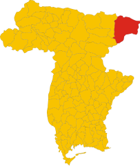
Tarvisio
- town in Italy
Tarvisio, located in the northeastern part of Italy near the borders with Austria and Slovenia, is a beautiful destination for hiking enthusiasts. It is situated in the Julian Alps and offers a wide range of trails that cater to various skill levels, from easy strolls to challenging treks. Here are some highlights of hiking in Tarvisio:...
- Country:

- Postal Code: 33018
- Local Dialing Code: 0428
- Licence Plate Code: UD
- Coordinates: 46° 30' 0" N, 13° 34' 0" E


- GPS tracks (wikiloc): [Link]
- AboveSeaLevel: 754 м m
- Area: 208.36 sq km
- Population: 4224
- Web site: [Link]


Udine
- Italian comune
Udine, located in the northeastern part of Italy, offers a variety of hiking opportunities that showcase its natural beauty and stunning landscapes. Here are some highlights about hiking in the Udine area:...
- Country:

- Postal Code: 33100
- Local Dialing Code: 0432
- Licence Plate Code: UD
- Coordinates: 46° 4' 0" N, 13° 14' 0" E


- GPS tracks (wikiloc): [Link]
- AboveSeaLevel: 113 м m
- Area: 57.17 sq km
- Population: 99341
- Web site: [Link]
Fiumicello Villa Vicentina
- comune in Italy
 Hiking in Fiumicello Villa Vicentina
Fiumicello Villa Vicentina, located in the Friuli Venezia Giulia region of northeastern Italy, is not typically known as a major hiking destination, but it offers a charming landscape and access to various outdoor activities. You can enjoy a combination of gentle walks and more adventurous trails in the surrounding countryside....
- Country:

- Licence Plate Code: UD
- Coordinates: 45° 47' 0" N, 13° 25' 0" E


- GPS tracks (wikiloc): [Link]
Treppo Ligosullo
- comune of Italy
Treppo Ligosullo is a small municipality in the Friuli Venezia Giulia region of northeastern Italy, nestled in the foothills of the Julian Alps. The area offers a range of hiking opportunities that cater to different skill levels, providing stunning views of the surrounding nature, including forests, meadows, and mountain landscapes....
- Country:

- Licence Plate Code: UD
- Coordinates: 46° 32' 0" N, 13° 4' 0" E


- GPS tracks (wikiloc): [Link]


Aiello del Friuli
- Italian comune
Aiello del Friuli, located in the Friuli Venezia Giulia region of northeastern Italy, offers a unique combination of natural beauty and cultural heritage. While it may not be as widely known for hiking as some other areas in the region, there are still opportunities for outdoor enthusiasts to enjoy the scenic landscapes and charm of the surrounding countryside....
- Country:

- Postal Code: 33041
- Local Dialing Code: 0431
- Licence Plate Code: UD
- Coordinates: 45° 52' 0" N, 13° 22' 0" E


- GPS tracks (wikiloc): [Link]
- AboveSeaLevel: 18 м m
- Area: 13.35 sq km
- Population: 2243
- Web site: [Link]


Amaro, Friuli
- Italian comune
Amaro, located in the Friuli Venezia Giulia region of northern Italy, is a fantastic destination for hiking enthusiasts. Nestled in the foothills of the Julian Alps, it offers breathtaking scenery, diverse landscapes, and a variety of trails catering to different skill levels. Here are some key highlights for hiking in the area:...
- Country:

- Postal Code: 33020
- Local Dialing Code: 0433
- Licence Plate Code: UD
- Coordinates: 46° 22' 30" N, 13° 5' 47" E


- GPS tracks (wikiloc): [Link]
- AboveSeaLevel: 296 м m
- Area: 33.26 sq km
- Population: 857
- Web site: [Link]


Ampezzo
- Italian comune
Ampezzo, located in the Friuli Venezia Giulia region of Italy, is a beautiful destination for hiking enthusiasts. Nestled in the Carnic Alps, it offers stunning landscapes, diverse trails, and ample opportunities to connect with nature....
- Country:

- Postal Code: 33021
- Local Dialing Code: 0433
- Licence Plate Code: UD
- Coordinates: 46° 25' 0" N, 12° 47' 0" E


- GPS tracks (wikiloc): [Link]
- AboveSeaLevel: 560 м m
- Area: 73 sq km
- Population: 983
- Web site: [Link]
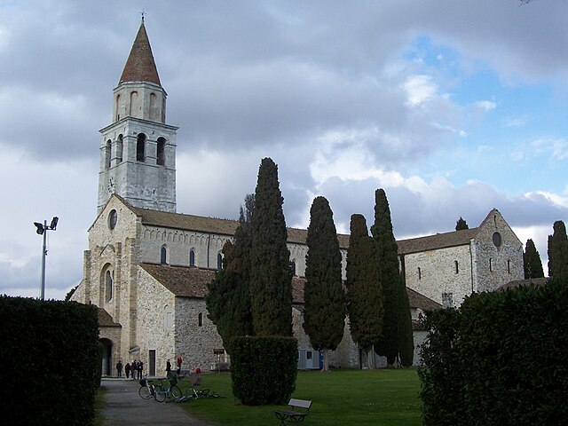

Aquileia
- ancient Roman city in Italy, at the head of the Adriatic at the edge of the lagoons
Aquileia, located in northeastern Italy near the Adriatic Sea, is renowned for its rich history and archaeological significance rather than its hiking trails. However, the surrounding region, particularly within the Friuli Venezia Giulia region, offers various hiking opportunities that allow you to explore both the natural beauty and historical sites....
- Country:

- Postal Code: 33051
- Local Dialing Code: 0431
- Licence Plate Code: UD
- Coordinates: 45° 46' 0" N, 13° 22' 0" E


- GPS tracks (wikiloc): [Link]
- AboveSeaLevel: 5 м m
- Area: 37.44 sq km
- Population: 3369
- Web site: [Link]
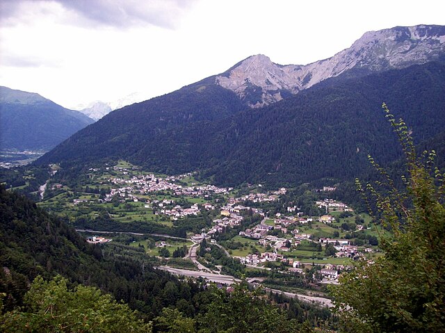

Arta Terme
- Italian comune
Arta Terme, located in the Friuli Venezia Giulia region of northeastern Italy, is a beautiful destination for hiking enthusiasts. This picturesque area is surrounded by the Carnic Alps and offers a range of trails suitable for all levels, from beginners to experienced hikers....
- Country:

- Postal Code: 33022
- Local Dialing Code: 0433
- Licence Plate Code: UD
- Coordinates: 46° 29' 0" N, 13° 1' 0" E


- GPS tracks (wikiloc): [Link]
- AboveSeaLevel: 422 м m
- Area: 42.77 sq km
- Population: 2076
- Web site: [Link]
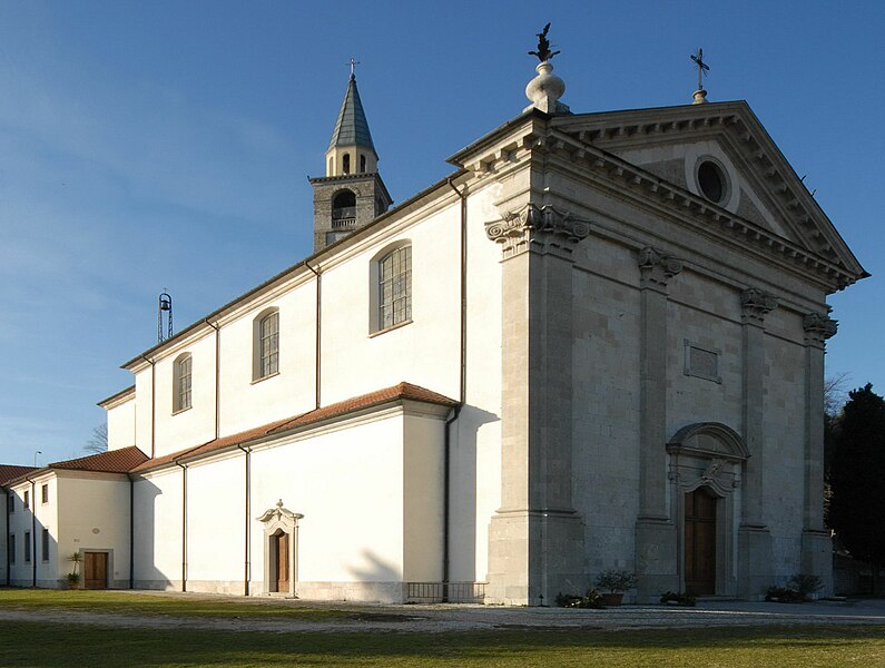

Artegna
- Italian comune
Artegna, located in the Friuli Venezia Giulia region of northeastern Italy, offers a variety of hiking opportunities that cater to different skill levels. The area is known for its stunning landscapes, rolling hills, and picturesque views of the surrounding mountains and countryside. Here are some highlights and tips for hiking in Artegna:...
- Country:

- Postal Code: 33011
- Local Dialing Code: 0432
- Licence Plate Code: UD
- Coordinates: 46° 14' 0" N, 13° 9' 0" E


- GPS tracks (wikiloc): [Link]
- AboveSeaLevel: 210 м m
- Area: 11.22 sq km
- Population: 2871
- Web site: [Link]


Attimis
- Italian comune
Attimis is a charming village located in the Friuli Venezia Giulia region of northeastern Italy. It is known for its beautiful natural landscapes, lush hills, and vineyards, which provide a stunning backdrop for hiking enthusiasts. Here are some points to consider if you are planning a hiking trip in and around Attimis:...
- Country:

- Postal Code: 33040
- Local Dialing Code: 0432
- Licence Plate Code: UD
- Coordinates: 46° 11' 0" N, 13° 18' 0" E


- GPS tracks (wikiloc): [Link]
- AboveSeaLevel: 133 м m
- Area: 33.24 sq km
- Population: 1744
- Web site: [Link]
Bagnaria Arsa
- Italian comune
Bagnaria Arsa, located in the Friuli Venezia Giulia region of northeastern Italy, offers a variety of hiking opportunities that showcase the natural beauty of the surrounding landscapes. This area is characterized by its rolling hills, scenic views, and rich cultural heritage....
- Country:

- Postal Code: 33050
- Local Dialing Code: 0432
- Licence Plate Code: UD
- Coordinates: 45° 53' 0" N, 13° 17' 0" E


- GPS tracks (wikiloc): [Link]
- AboveSeaLevel: 20 м m
- Area: 19.23 sq km
- Population: 3483
- Web site: [Link]
Basiliano
- Italian comune
Basiliano is a charming municipality located in the Friuli Venezia Giulia region of northern Italy. Although it may not be as well-known for hiking as some other areas in Italy, it offers a variety of beautiful landscapes, local trails, and access to the surrounding natural parks and hills. Here are some things to consider for hiking in and around Basiliano:...
- Country:

- Postal Code: 33031
- Local Dialing Code: 0432
- Licence Plate Code: UD
- Coordinates: 46° 1' 0" N, 13° 6' 0" E


- GPS tracks (wikiloc): [Link]
- AboveSeaLevel: 77 м m
- Area: 43.05 sq km
- Population: 5345
- Web site: [Link]


Bertiolo
- Italian comune
Bertiolo is a small town located in the Friuli Venezia Giulia region of northeastern Italy. While it might not be as famous as some of the larger towns or cities in Italy, it offers access to beautiful natural landscapes and hiking opportunities....
- Country:

- Postal Code: 33032
- Local Dialing Code: 0432
- Licence Plate Code: UD
- Coordinates: 45° 56' 42" N, 13° 3' 19" E


- GPS tracks (wikiloc): [Link]
- AboveSeaLevel: 33 м m
- Area: 26.07 sq km
- Population: 2423
- Web site: [Link]
Bicinicco
- Italian comune
Bicinicco is a small commune located in the Friuli Venezia Giulia region of Italy. While it may not be as well-known as some of the larger tourist destinations, it offers some beautiful landscapes and opportunities for hiking in the surrounding areas. Here are some key points to consider if you're planning to hike in and around Bicinicco:...
- Country:

- Postal Code: 33050
- Local Dialing Code: 0432
- Licence Plate Code: UD
- Coordinates: 45° 56' 0" N, 13° 15' 0" E


- GPS tracks (wikiloc): [Link]
- AboveSeaLevel: 37 м m
- Area: 16.01 sq km
- Population: 1867
- Web site: [Link]


Bordano
- Italian comune
Bordano, located in the Friuli Venezia Giulia region of northeastern Italy, is known for its stunning natural landscapes and rich cultural heritage, making it a wonderful destination for hiking enthusiasts. Here are some key points to consider for hiking in Bordano:...
- Country:

- Postal Code: 33010
- Local Dialing Code: 0432
- Licence Plate Code: UD
- Coordinates: 46° 19' 0" N, 13° 6' 0" E


- GPS tracks (wikiloc): [Link]
- AboveSeaLevel: 224 м m
- Area: 14.9 sq km
- Population: 736
- Web site: [Link]


Buja
- Italian comune
Hiking in Buja, a town located in the Friuli Venezia Giulia region of Italy, offers a range of scenic routes amid beautiful landscapes. Though Buja itself is not a major hiking destination, it serves as a gateway to numerous trails in the surrounding areas, particularly in the nearby Julian Alps and the Friuli Dolomites....
- Country:

- Postal Code: 33030
- Local Dialing Code: 0432
- Licence Plate Code: UD
- Coordinates: 46° 12' 44" N, 13° 7' 1" E


- GPS tracks (wikiloc): [Link]
- AboveSeaLevel: 213 м m
- Area: 25.51 sq km
- Population: 6484
- Web site: [Link]
Buttrio
- Italian comune
Buttrio is a charming village located in the Friuli Venezia Giulia region of northeastern Italy, known for its stunning landscapes, vineyards, and historical architecture. Hiking around Buttrio offers picturesque views of the surrounding hills, vineyards, and the nearby Colli Orientali del Friuli....
- Country:

- Postal Code: 33042
- Local Dialing Code: 0432
- Licence Plate Code: UD
- Coordinates: 46° 1' 0" N, 13° 20' 0" E


- GPS tracks (wikiloc): [Link]
- AboveSeaLevel: 79 м m
- Area: 17.78 sq km
- Population: 4079
- Web site: [Link]
Camino al Tagliamento
- Italian comune
 Hiking in Camino al Tagliamento
The Camino al Tagliamento, also known as the "Way of the Tagliamento," is a scenic hiking route in the Friuli Venezia Giulia region of northeastern Italy. This trail follows the Tagliamento River, one of the last wild rivers in Europe, and offers hikers a chance to experience stunning natural landscapes, diverse wildlife, and picturesque villages along the way....
- Country:

- Postal Code: 33030
- Local Dialing Code: 0432
- Licence Plate Code: UD
- Coordinates: 45° 55' 39" N, 12° 56' 41" E


- GPS tracks (wikiloc): [Link]
- AboveSeaLevel: 34 м m
- Area: 22.32 sq km
- Population: 1614
- Web site: [Link]
Campoformido
- Italian comune
Campoformido, located in the Friuli Venezia Giulia region of northern Italy, offers some beautiful hiking opportunities amidst picturesque landscapes. The area is characterized by rolling hills, agricultural fields, and stunning views of the surrounding mountains, particularly the Carnic Alps to the north and the Julian Alps to the northwest....
- Country:

- Postal Code: 33030
- Local Dialing Code: 0432
- Licence Plate Code: UD
- Coordinates: 46° 1' 0" N, 13° 10' 0" E


- GPS tracks (wikiloc): [Link]
- AboveSeaLevel: 78 м m
- Area: 21.93 sq km
- Population: 7891
- Web site: [Link]


Campolongo Tapogliano
- Italian comune
 Hiking in Campolongo Tapogliano
Campolongo Tapogliano, located in the Friuli Venezia Giulia region of northeastern Italy, offers a variety of hiking opportunities set against a picturesque backdrop of rolling hills and verdant landscapes. Here are some key points to consider for hiking in this area:...
- Country:

- Postal Code: 33040
- Local Dialing Code: 0431
- Licence Plate Code: UD
- Coordinates: 45° 52' 0" N, 13° 23' 0" E


- GPS tracks (wikiloc): [Link]
- AboveSeaLevel: 16 м m
- Area: 11.02 sq km
- Population: 1155
- Web site: [Link]
Carlino
- Italian comune
Carlino is a charming village located in the Friuli Venezia Giulia region of Italy, and it offers a range of hiking opportunities that showcase the stunning natural beauty of the area. Here are some highlights to consider when planning your hiking adventure in and around Carlino:...
- Country:

- Postal Code: 33050
- Local Dialing Code: 0431
- Licence Plate Code: UD
- Coordinates: 45° 48' 0" N, 13° 11' 0" E


- GPS tracks (wikiloc): [Link]
- AboveSeaLevel: 5 м m
- Area: 30.23 sq km
- Population: 2784
- Web site: [Link]
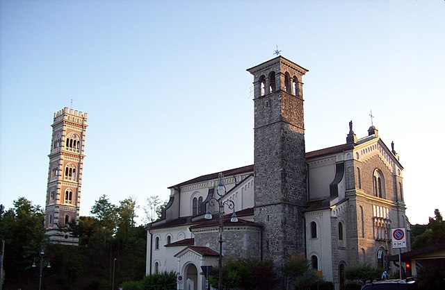

Cassacco
- Italian comune
Cassacco, located in the province of Udine in the Friuli Venezia Giulia region of northeastern Italy, offers a variety of hiking opportunities suitable for different skill levels. The surrounding landscape features rolling hills, vineyards, and panoramic views of the Alps, making it an attractive destination for outdoor enthusiasts....
- Country:

- Postal Code: 33010
- Local Dialing Code: 0432
- Licence Plate Code: UD
- Coordinates: 46° 10' 0" N, 13° 11' 0" E


- GPS tracks (wikiloc): [Link]
- AboveSeaLevel: 179 м m
- Area: 11.68 sq km
- Population: 2910
- Web site: [Link]
Castions di Strada
- Italian comune
Castions di Strada is a small village located in the Friuli Venezia Giulia region of northeastern Italy. While it may not be as popular as other hiking destinations in the region, it is surrounded by beautiful landscapes and offers some charming hiking opportunities through the surrounding countryside....
- Country:

- Postal Code: 33050
- Local Dialing Code: 0432
- Licence Plate Code: UD
- Coordinates: 45° 54' 0" N, 13° 11' 0" E


- GPS tracks (wikiloc): [Link]
- AboveSeaLevel: 23 м m
- Area: 32.84 sq km
- Population: 3767
- Web site: [Link]


Cavazzo Carnico
- Italian comune
Cavazzo Carnico, located in the Friuli Venezia Giulia region of northeastern Italy, is a fantastic destination for hiking enthusiasts. Nestled between the beautiful Julian Alps and the Carnic Alps, the area is known for its stunning landscapes, diverse flora and fauna, and rich cultural heritage....
- Country:

- Postal Code: 33020
- Local Dialing Code: 0433
- Licence Plate Code: UD
- Coordinates: 46° 22' 0" N, 13° 2' 0" E


- GPS tracks (wikiloc): [Link]
- AboveSeaLevel: 290 м m
- Area: 39.44 sq km
- Population: 1024
- Web site: [Link]
Cercivento
- Italian comune
Cercivento is a picturesque village located in the Friuli Venezia Giulia region of northeastern Italy, surrounded by stunning landscapes that offer a variety of hiking opportunities. The area is characterized by its beautiful mountains, rolling hills, and rich biodiversity....
- Country:

- Postal Code: 33020
- Local Dialing Code: 0433
- Licence Plate Code: UD
- Coordinates: 46° 32' 0" N, 12° 59' 0" E


- GPS tracks (wikiloc): [Link]
- AboveSeaLevel: 607 м m
- Area: 15.78 sq km
- Population: 672
- Web site: [Link]
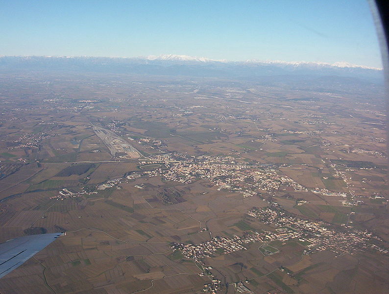

Cervignano del Friuli
- Italian comune
 Hiking in Cervignano del Friuli
Cervignano del Friuli, located in the Friuli Venezia Giulia region of northeastern Italy, offers a range of hiking opportunities characterized by its picturesque landscapes, rich history, and proximity to both natural and cultural attractions....
- Country:

- Postal Code: 33050; 33052
- Local Dialing Code: 0431
- Licence Plate Code: UD
- Coordinates: 45° 49' 23" N, 13° 20' 6" E


- GPS tracks (wikiloc): [Link]
- AboveSeaLevel: 2 м m
- Area: 29.17 sq km
- Population: 13881
- Web site: [Link]
Chiopris-Viscone
- Italian comune
Chiopris-Viscone is a small town located in the Friuli Venezia Giulia region of Italy, near the border with Slovenia. It offers a unique blend of scenic landscapes, rich local culture, and opportunities for outdoor activities, including hiking. Here are some things to consider when hiking in or around Chiopris-Viscone:...
- Country:

- Postal Code: 33040
- Local Dialing Code: 0432
- Licence Plate Code: UD
- Coordinates: 45° 55' 36" N, 13° 24' 15" E


- GPS tracks (wikiloc): [Link]
- AboveSeaLevel: 33 м m
- Area: 9.21 sq km
- Population: 648
- Web site: [Link]

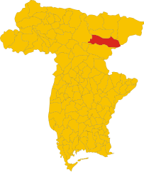
Chiusaforte
- Italian comune
Chiusaforte, located in the Friuli Venezia Giulia region of Italy, is a great destination for hiking enthusiasts. Nestled in the Julian Alps, this area offers a stunning landscape characterized by towering mountains, lush valleys, and clear rivers....
- Country:

- Postal Code: 33010
- Local Dialing Code: 0433
- Licence Plate Code: UD
- Coordinates: 46° 24' 0" N, 13° 19' 0" E


- GPS tracks (wikiloc): [Link]
- AboveSeaLevel: 391 м m
- Area: 100.2 sq km
- Population: 628
- Web site: [Link]
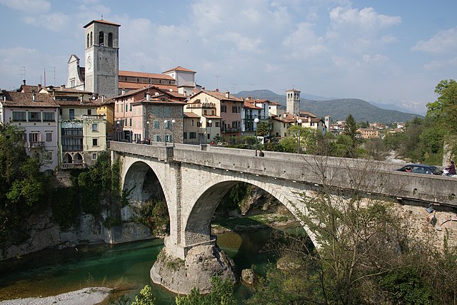

Cividale del Friuli
- Italian comune
Cividale del Friuli, located in the Friuli Venezia Giulia region of northeastern Italy, is not only a town rich in history and culture but also a great destination for hiking enthusiasts. The surrounding landscapes are diverse, featuring rolling hills, vineyards, and views of the nearby Julian Alps. Here are some of the highlights of hiking in this area:...
- Country:

- Postal Code: 33043
- Local Dialing Code: 0432
- Licence Plate Code: UD
- Coordinates: 46° 5' 26" N, 13° 26' 6" E


- GPS tracks (wikiloc): [Link]
- AboveSeaLevel: 135 м m
- Area: 50 sq km
- Population: 11292
- Web site: [Link]
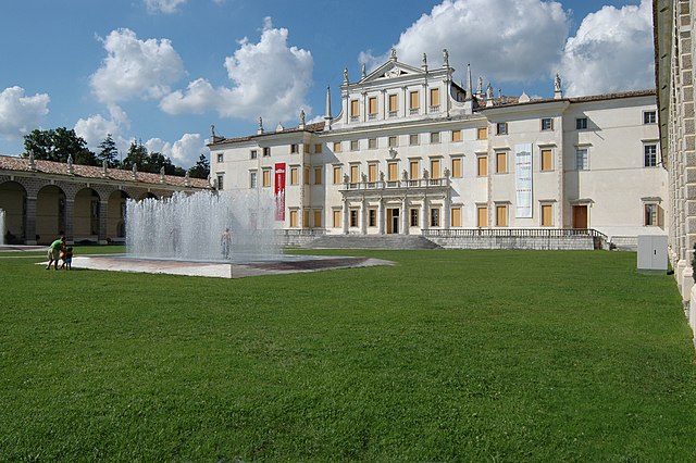

Codroipo
- Italian comune
Codroipo, located in the Friuli Venezia Giulia region of northeastern Italy, offers a unique experience for hikers. The area is characterized by a mix of flat plains and gentle hills, making it suitable for hikers of all skill levels. While Codroipo itself may not be a well-known hiking destination, it's surrounded by beautiful landscapes and trails that can appeal to nature lovers....
- Country:

- Postal Code: 33033
- Local Dialing Code: 0432
- Licence Plate Code: UD
- Coordinates: 45° 57' 41" N, 12° 58' 39" E


- GPS tracks (wikiloc): [Link]
- AboveSeaLevel: 43 м m
- Area: 75.22 sq km
- Population: 16165
- Web site: [Link]


Colloredo di Monte Albano
- Italian comune
 Hiking in Colloredo di Monte Albano
Colloredo di Monte Albano is a charming town located in the Friuli Venezia Giulia region of northeastern Italy. It is surrounded by beautiful landscapes, including hills and forests, which makes it an excellent location for hiking enthusiasts. Here’s a guide to what you might expect when hiking in this area:...
- Country:

- Postal Code: 33010
- Local Dialing Code: 0432
- Licence Plate Code: UD
- Coordinates: 46° 10' 0" N, 13° 8' 0" E


- GPS tracks (wikiloc): [Link]
- AboveSeaLevel: 218 м m
- Area: 21.75 sq km
- Population: 2187
- Web site: [Link]


Comeglians
- Italian comune
Comeglians is a charming village located in the Friuli Venezia Giulia region of northeastern Italy, nestled in the heart of the Carnic Alps. The area is ideal for hiking enthusiasts, offering a variety of trails that cater to different skill levels and preferences. Here’s a breakdown of what you can expect when hiking in Comeglians:...
- Country:

- Postal Code: 33023
- Local Dialing Code: 0433
- Licence Plate Code: UD
- Coordinates: 46° 31' 0" N, 12° 53' 0" E


- GPS tracks (wikiloc): [Link]
- AboveSeaLevel: 553 м m
- Area: 19.41 sq km
- Population: 491
- Web site: [Link]
Corno di Rosazzo
- Italian comune
Corno di Rosazzo, located in the Friuli Venezia Giulia region of northeastern Italy, is a great area for hiking enthusiasts who appreciate both natural beauty and cultural heritage. The region is characterized by rolling hills, vineyards, and picturesque landscapes, making it ideal for outdoor activities. Here are some details and tips for hiking in Corno di Rosazzo:...
- Country:

- Postal Code: 33040
- Local Dialing Code: 0432
- Licence Plate Code: UD
- Coordinates: 45° 59' 0" N, 13° 27' 0" E


- GPS tracks (wikiloc): [Link]
- AboveSeaLevel: 88 м m
- Area: 12.62 sq km
- Population: 3170
- Web site: [Link]


Coseano
- Italian comune
Coseano is a quaint town located in the Friuli-Venezia Giulia region of northeastern Italy. The area is known for its picturesque landscapes and proximity to various hiking opportunities. While Coseano itself might not be a major hiking hub, it serves as a gateway to several nearby hiking trails and natural attractions....
- Country:

- Postal Code: 33030
- Local Dialing Code: 0432
- Licence Plate Code: UD
- Coordinates: 46° 6' 0" N, 13° 1' 0" E


- GPS tracks (wikiloc): [Link]
- AboveSeaLevel: 121 м m
- Area: 23.8 sq km
- Population: 2181
- Web site: [Link]
Dignano
- Italian comune
Dignano, also known as Dignano di Dignano, is a small town located in the Istria region of Croatia, surrounded by beautiful landscapes and scenic trails. While it may not be as widely known as other hiking destinations in Croatia, it offers an authentic experience for those interested in exploring the natural beauty of the Istrian countryside....
- Country:

- Postal Code: 33030
- Local Dialing Code: 0432
- Licence Plate Code: UD
- Coordinates: 46° 5' 0" N, 12° 56' 0" E


- GPS tracks (wikiloc): [Link]
- AboveSeaLevel: 110 м m
- Area: 27.54 sq km
- Population: 2302
- Web site: [Link]


Dogna
- Italian comune
Dogna is a small town located in the Friuli Venezia Giulia region of northeastern Italy, nestled in the Julian Alps. It's known for its beautiful landscapes and outdoor recreational opportunities, including hiking. Here are some key points to consider if you're planning a hiking trip in the Dogna area:...
- Country:

- Postal Code: 33010
- Local Dialing Code: 0428
- Licence Plate Code: UD
- Coordinates: 46° 26' 53" N, 13° 18' 54" E


- GPS tracks (wikiloc): [Link]
- AboveSeaLevel: 430 м m
- Area: 70.37 sq km
- Population: 168
- Web site: [Link]


Drenchia
- Italian comune
Drenchia is a charming town located in the Friuli Venezia Giulia region of northeastern Italy, known for its stunning natural landscapes and rich history. While Drenchia itself is a small community, it serves as a gateway to explore the beautiful surrounding countryside, particularly the nearby Julian Alps and the Northeast Slovenian region....
- Country:

- Postal Code: 33040
- Local Dialing Code: 0432
- Licence Plate Code: UD
- Coordinates: 46° 11' 2" N, 13° 38' 11" E


- GPS tracks (wikiloc): [Link]
- AboveSeaLevel: 663 м m
- Area: 12.01 sq km
- Population: 113
- Web site: [Link]
Enemonzo
- Italian comune
Enemonzo is a picturesque commune located in the Friuli Venezia Giulia region of northeastern Italy, known for its beautiful landscapes and outdoor activities, including hiking. Here are some highlights and tips for hiking in and around Enemonzo:...
- Country:

- Postal Code: 33020
- Local Dialing Code: 0433
- Licence Plate Code: UD
- Coordinates: 46° 24' 30" N, 12° 52' 46" E


- GPS tracks (wikiloc): [Link]
- AboveSeaLevel: 398 м m
- Area: 23.76 sq km
- Population: 1305
- Web site: [Link]


Faedis
- Italian comune
Faedis, a picturesque village located in the Friuli Venezia Giulia region of northeastern Italy, offers a variety of hiking opportunities amidst stunning landscapes. Here are some highlights of hiking in and around Faedis:...
- Country:

- Postal Code: 33040
- Local Dialing Code: 0432
- Licence Plate Code: UD
- Coordinates: 46° 9' 0" N, 13° 21' 0" E


- GPS tracks (wikiloc): [Link]
- AboveSeaLevel: 176 м m
- Area: 46.78 sq km
- Population: 2871
- Web site: [Link]


Fagagna
- Italian comune
Fagagna is a charming village located in the Friuli-Venezia Giulia region of northeastern Italy. It's surrounded by beautiful landscapes, making it a great spot for hiking enthusiasts. Here are some details to consider for hiking in and around Fagagna:...
- Country:

- Postal Code: 33034
- Local Dialing Code: 0432
- Licence Plate Code: UD
- Coordinates: 46° 7' 0" N, 13° 5' 0" E


- GPS tracks (wikiloc): [Link]
- AboveSeaLevel: 177 м m
- Area: 37.19 sq km
- Population: 6296
- Web site: [Link]
Flaibano
- Italian comune
Flaibano is a charming village located in the Friuli Venezia Giulia region of Italy. The surrounding area offers a variety of hiking opportunities that cater to different skill levels, with stunning views of mountains, valleys, and picturesque landscapes....
- Country:

- Postal Code: 33030
- Local Dialing Code: 0432
- Licence Plate Code: UD
- Coordinates: 46° 3' 0" N, 12° 59' 0" E


- GPS tracks (wikiloc): [Link]
- AboveSeaLevel: 104 м m
- Area: 17.32 sq km
- Population: 1122
- Web site: [Link]


Forgaria nel Friuli
- Italian comune
Forgaria nel Friuli is a picturesque town located in the Friuli-Venezia Giulia region of Italy. Nestled near the eastern foothills of the Carnic Alps, it offers a range of hiking opportunities suitable for various skill levels. Here are some highlights of hiking in this area:...
- Country:

- Postal Code: 33030
- Local Dialing Code: 0427
- Licence Plate Code: UD
- Coordinates: 46° 13' 0" N, 12° 58' 0" E


- GPS tracks (wikiloc): [Link]
- AboveSeaLevel: 270 м m
- Area: 28.94 sq km
- Population: 1773
- Web site: [Link]


Forni Avoltri
- commune and town in Italy
Forni Avoltri is a charming village located in the Friuli Venezia Giulia region of northeastern Italy, surrounded by the stunning landscapes of the Carnic Alps. The area is well-known for its beautiful hiking trails, which cater to a variety of skill levels, from beginners to more experienced hikers....
- Country:

- Postal Code: 33020
- Local Dialing Code: 0433
- Licence Plate Code: UD
- Coordinates: 46° 35' 0" N, 12° 47' 0" E


- GPS tracks (wikiloc): [Link]
- AboveSeaLevel: 888 м m
- Area: 80.75 sq km
- Population: 562
- Web site: [Link]


Forni di Sopra
- Italian comune
Forni di Sopra is a beautiful destination for hiking enthusiasts, located in the Friuli Venezia Giulia region of northeastern Italy. Nestled in the Carnic Alps, it offers a stunning backdrop of lush valleys, rugged mountains, and pristine landscapes. Here are some key points about hiking in Forni di Sopra:...
- Country:

- Postal Code: 33024
- Local Dialing Code: 0433
- Licence Plate Code: UD
- Coordinates: 46° 25' 0" N, 12° 35' 0" E


- GPS tracks (wikiloc): [Link]
- AboveSeaLevel: 907 м m
- Area: 81.66 sq km
- Population: 955
- Web site: [Link]


Forni di Sotto
- Italian comune
Forni di Sotto is a beautiful gem in the Friuli Venezia Giulia region of northern Italy, nestled in the Carnic Alps. This area is known for its stunning natural landscapes, rich biodiversity, and a variety of hiking trails suitable for all levels of experience. Here are some highlights about hiking in Forni di Sotto:...
- Country:

- Postal Code: 33020
- Local Dialing Code: 0433
- Licence Plate Code: UD
- Coordinates: 46° 24' 0" N, 12° 40' 0" E


- GPS tracks (wikiloc): [Link]
- AboveSeaLevel: 777 м m
- Area: 93.6 sq km
- Population: 583
- Web site: [Link]


Gemona del Friuli
- Italian comune
Gemona del Friuli, located in the Friuli Venezia Giulia region of northeastern Italy, is a beautiful destination for hiking enthusiasts. This area is characterized by stunning mountainous landscapes, rich history, and vibrant local culture. Here are some key points about hiking in and around Gemona del Friuli:...
- Country:

- Postal Code: 33013
- Local Dialing Code: 0432
- Licence Plate Code: UD
- Coordinates: 46° 16' 27" N, 13° 7' 21" E


- GPS tracks (wikiloc): [Link]
- AboveSeaLevel: 272 м m
- Area: 56.06 sq km
- Population: 10869
- Web site: [Link]
Gonars
- Italian comune
Gonars, a small town in northeastern Italy, is located in the region of Friuli Venezia Giulia. While it may not be a primary destination for hikers compared to more prominent national parks or mountainous areas in Italy, it offers beautiful landscapes and trails for outdoor enthusiasts, particularly for those interested in exploring the countryside and enjoying scenic walks....
- Country:

- Postal Code: 33050
- Local Dialing Code: 0432
- Licence Plate Code: UD
- Coordinates: 45° 54' 0" N, 13° 14' 0" E


- GPS tracks (wikiloc): [Link]
- AboveSeaLevel: 21 м m
- Area: 19.82 sq km
- Population: 4718
- Web site: [Link]
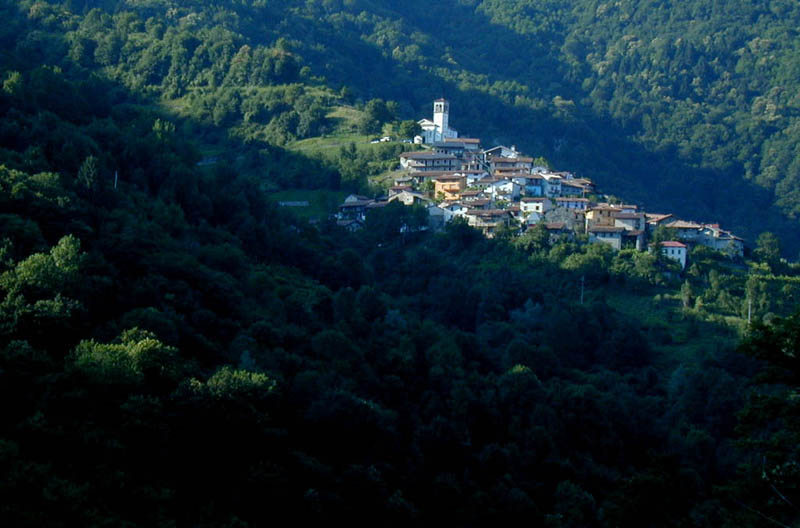

Grimacco
- Italian comune
Grimacco is a small village located in the region of Friuli Venezia Giulia in northeastern Italy. It's nestled in the scenic hills near the Julian Alps, making it a lovely spot for hiking enthusiasts. Here are some highlights about hiking in and around Grimacco:...
- Country:

- Postal Code: 33040
- Local Dialing Code: 0432
- Licence Plate Code: UD
- Coordinates: 46° 9' 20" N, 13° 34' 11" E


- GPS tracks (wikiloc): [Link]
- AboveSeaLevel: 248 м m
- Area: 16.11 sq km
- Population: 334
- Web site: [Link]
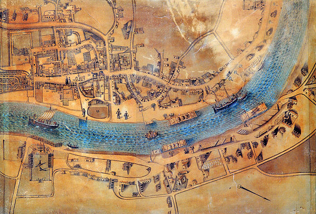

Latisana
- Italian comune
Latisana, located in the Friuli Venezia Giulia region of Italy, offers a variety of outdoor activities, including hiking, thanks to its proximity to both the coast and the beautiful surrounding landscapes. While Latisana itself is not a mountainous area, it serves as a great base for exploring nearby natural attractions....
- Country:

- Postal Code: 33053
- Local Dialing Code: 0431
- Licence Plate Code: UD
- Coordinates: 45° 47' 0" N, 13° 0' 0" E


- GPS tracks (wikiloc): [Link]
- AboveSeaLevel: 7 м m
- Area: 37.8 sq km
- Population: 13478
- Web site: [Link]


Lauco
- Italian comune
Lauco, a beautiful area located in the Friuli Venezia Giulia region of northeastern Italy, is known for its stunning landscapes, rich biodiversity, and scenic trails. Here are some key points to consider if you’re planning to hike in Lauco:...
- Country:

- Postal Code: 33029
- Local Dialing Code: 0433
- Licence Plate Code: UD
- Coordinates: 46° 25' 0" N, 12° 56' 0" E


- GPS tracks (wikiloc): [Link]
- AboveSeaLevel: 719 м m
- Area: 34.76 sq km
- Population: 726
- Web site: [Link]
Lestizza
- Italian comune
Lestizza is a quaint town located in the Friuli Venezia Giulia region of northeastern Italy. While it might not be as famous as some of Italy's more well-known hiking destinations, it offers a serene environment with potential for lovely hikes in the surrounding countryside....
- Country:

- Postal Code: 33050
- Local Dialing Code: 0432
- Licence Plate Code: UD
- Coordinates: 45° 57' 0" N, 13° 8' 0" E


- GPS tracks (wikiloc): [Link]
- AboveSeaLevel: 24 м m
- Area: 34.32 sq km
- Population: 3771
- Web site: [Link]


Lignano Sabbiadoro
- Italian comune
Lignano Sabbiadoro, located on the Adriatic coast in Italy, is primarily known for its beautiful beaches and vibrant summer tourism atmosphere. While it's not a mountainous area renowned for traditional hiking, it does offer various opportunities for outdoor enthusiasts to enjoy nature and explore the surrounding areas....
- Country:

- Postal Code: 33054
- Local Dialing Code: 0431
- Licence Plate Code: UD
- Coordinates: 45° 39' 18" N, 13° 5' 35" E


- GPS tracks (wikiloc): [Link]
- AboveSeaLevel: 2 м m
- Area: 15.71 sq km
- Population: 6950
- Web site: [Link]


Ligosullo
- Italian comune
Ligosullo is a picturesque area in the Friuli Venezia Giulia region of Italy, known for its scenic landscapes and great hiking opportunities. Nestled in the eastern Alps, the region offers a variety of trails that cater to different skill levels, making it an excellent destination for both casual walkers and experienced hikers....
- Country:

- Postal Code: 33020
- Local Dialing Code: 0433
- Licence Plate Code: UD
- Coordinates: 46° 32' 22" N, 13° 4' 27" E


- GPS tracks (wikiloc): [Link]
- AboveSeaLevel: 948 м m
- Area: 16.85 sq km
- Population: 104
- Web site: [Link]
Lusevera
- Italian comune
Lusevera is a picturesque village located in the Friuli-Venezia Giulia region of northeastern Italy. Known for its stunning natural landscapes, Lusevera offers a fantastic hiking experience for outdoor enthusiasts....
- Country:

- Postal Code: 33010
- Local Dialing Code: 0432
- Licence Plate Code: UD
- Coordinates: 46° 16' 0" N, 13° 16' 0" E


- GPS tracks (wikiloc): [Link]
- AboveSeaLevel: 325 м m
- Area: 53.05 sq km
- Population: 625
- Web site: [Link]
Magnano in Riviera
- Italian comune
Magnano in Riviera is a small village nestled in the beautiful Friuli Venezia Giulia region of northeastern Italy. The area is known for its stunning landscapes, lush greenery, and rich natural heritage, making it an excellent destination for hiking enthusiasts. Here are a few key points to consider if you plan to hike in and around Magnano in Riviera:...
- Country:

- Postal Code: 33010
- Local Dialing Code: 0432
- Licence Plate Code: UD
- Coordinates: 46° 14' 0" N, 13° 10' 0" E


- GPS tracks (wikiloc): [Link]
- AboveSeaLevel: 201 м m
- Area: 8.34 sq km
- Population: 2328
- Web site: [Link]
Majano
- Italian comune
Majano, a charming town in the Friuli Venezia Giulia region of northeastern Italy, offers a variety of hiking opportunities that showcase its beautiful landscapes, historic sites, and rich cultural heritage. Here are some key points to consider when planning a hiking trip in Majano and its surroundings:...
- Country:

- Postal Code: 33030
- Local Dialing Code: 0432
- Licence Plate Code: UD
- Coordinates: 46° 11' 0" N, 13° 4' 0" E


- GPS tracks (wikiloc): [Link]
- AboveSeaLevel: 170 м m
- Area: 28.28 sq km
- Population: 5932
- Web site: [Link]


Malborghetto Valbruna
- Italian comune
 Hiking in Malborghetto Valbruna
Malborghetto Valbruna is a picturesque village located in the Valcanale region of northeastern Italy, close to the Austrian border. It is surrounded by stunning Alpine scenery and offers a variety of hiking opportunities for all skill levels. Here are some highlights and tips for hiking in this area:...
- Country:

- Postal Code: 33010
- Local Dialing Code: 0428
- Licence Plate Code: UD
- Coordinates: 46° 30' 24" N, 13° 26' 22" E


- GPS tracks (wikiloc): [Link]
- AboveSeaLevel: 721 м m
- Area: 124.21 sq km
- Population: 919
- Web site: [Link]


Manzano, Friuli
- Italian comune
Manzano, located in the Friuli region of northeastern Italy, is a charming area known for its picturesque landscapes and hiking opportunities. While it may not be as famous as some of the other mountainous regions in Italy, it offers a variety of trails that cater to different skill levels and preferences....
- Country:

- Postal Code: 33044
- Local Dialing Code: 0432
- Licence Plate Code: UD
- Coordinates: 45° 59' 0" N, 13° 23' 0" E


- GPS tracks (wikiloc): [Link]
- AboveSeaLevel: 71 м m
- Area: 31.04 sq km
- Population: 6431
- Web site: [Link]
Marano Lagunare
- Italian comune
Marano Lagunare is a charming coastal town located in the Friuli Venezia Giulia region of northeastern Italy. It lies near the Laguna di Marano, a beautiful lagoon known for its biodiversity, scenic views, and rich wildlife. While Marano Lagunare is not primarily known as a hiking destination, there are plenty of opportunities for outdoor activities, including walking and hiking in the surrounding areas....
- Country:

- Postal Code: 33050
- Local Dialing Code: 0431
- Licence Plate Code: UD
- Coordinates: 45° 46' 0" N, 13° 10' 0" E


- GPS tracks (wikiloc): [Link]
- AboveSeaLevel: 2 м m
- Area: 90 sq km
- Population: 1811
- Web site: [Link]
Martignacco
- Italian comune
Martignacco is a charming municipality located in the Friuli Venezia Giulia region of northeastern Italy. It offers a variety of hiking opportunities, particularly in the surrounding natural areas. Here are some highlights and tips for hiking in and around Martignacco:...
- Country:

- Postal Code: 33035
- Local Dialing Code: 0432
- Licence Plate Code: UD
- Coordinates: 46° 6' 0" N, 13° 8' 0" E


- GPS tracks (wikiloc): [Link]
- AboveSeaLevel: 148 м m
- Area: 26.68 sq km
- Population: 6812
- Web site: [Link]
Mereto di Tomba
- Italian comune
Mereto di Tomba, located in the Friuli Venezia Giulia region of Italy, is a charming area that offers various hiking opportunities, especially for those looking to explore the natural beauty of northern Italy. The landscape is characterized by rolling hills, vineyards, and views of the surrounding mountains, making it a picturesque spot for outdoor activities....
- Country:

- Postal Code: 33036
- Local Dialing Code: 0432
- Licence Plate Code: UD
- Coordinates: 46° 3' 0" N, 13° 2' 0" E


- GPS tracks (wikiloc): [Link]
- AboveSeaLevel: 98 м m
- Area: 27.30 sq km
- Population: 2606
- Web site: [Link]


Moggio Udinese
- Italian comune
Moggio Udinese, located in the Friuli-Venezia Giulia region of northeastern Italy, is a charming destination for hiking enthusiasts. Nestled in the Julian Alps, the area is characterized by lush landscapes, picturesque valleys, and majestic mountain views. Here are some highlights and tips for hiking in and around Moggio Udinese:...
- Country:

- Postal Code: 33015
- Local Dialing Code: 0433
- Licence Plate Code: UD
- Coordinates: 46° 25' 0" N, 13° 12' 0" E


- GPS tracks (wikiloc): [Link]
- AboveSeaLevel: 341 м m
- Area: 142.44 sq km
- Population: 1703
- Web site: [Link]


Moimacco
- Italian comune
Moimacco is a small town located in the Friuli-Venezia Giulia region of northeastern Italy. It may not be as widely known as some other hiking destinations, but the surrounding area offers beautiful landscapes and opportunities for outdoor activities. Here’s what you should know about hiking in and around Moimacco:...
- Country:

- Postal Code: 33040
- Local Dialing Code: 0432
- Licence Plate Code: UD
- Coordinates: 46° 6' 0" N, 13° 23' 0" E


- GPS tracks (wikiloc): [Link]
- AboveSeaLevel: 121 м m
- Area: 11.77 sq km
- Population: 1678
- Web site: [Link]
Montenars
- Italian comune
Montenars is a charming village located in the Friuli Venezia Giulia region of northeastern Italy, known for its beautiful landscapes and opportunities for outdoor activities, including hiking. The surrounding area is rich in natural beauty, featuring rolling hills, lush forests, and impressive views of the Julian Alps....
- Country:

- Postal Code: 33010
- Local Dialing Code: 0432
- Licence Plate Code: UD
- Coordinates: 46° 15' 0" N, 13° 11' 0" E


- GPS tracks (wikiloc): [Link]
- AboveSeaLevel: 472 м m
- Area: 20.59 sq km
- Population: 513
- Web site: [Link]


Mortegliano
- Italian comune
Mortegliano is a quaint town located in the Friuli Venezia Giulia region of northern Italy. While it may not be as widely known for its hiking trails as other areas in the region, it is surrounded by beautiful landscapes and natural scenery that can be explored through various outdoor activities, including hiking....
- Country:

- Postal Code: 33050
- Local Dialing Code: 0432
- Licence Plate Code: UD
- Coordinates: 45° 57' 0" N, 13° 10' 0" E


- GPS tracks (wikiloc): [Link]
- AboveSeaLevel: 41 м m
- Area: 30.05 sq km
- Population: 4969
- Web site: [Link]


Moruzzo
- Italian comune
Moruzzo is a charming village in the Friuli Venezia Giulia region of northeastern Italy. Surrounded by beautiful landscapes, it offers various hiking opportunities for both novice and experienced hikers....
- Country:

- Postal Code: 33030
- Local Dialing Code: 0432
- Licence Plate Code: UD
- Coordinates: 46° 7' 0" N, 13° 7' 0" E


- GPS tracks (wikiloc): [Link]
- AboveSeaLevel: 267 м m
- Area: 17.78 sq km
- Population: 2499
- Web site: [Link]
Muzzana del Turgnano
- Italian comune
 Hiking in Muzzana del Turgnano
Muzzana del Turgnano is a small village located in the Friuli Venezia Giulia region of northeastern Italy. While it may not be as widely known for hiking as larger national parks or mountainous areas, there are still opportunities to explore the area’s picturesque countryside and natural beauty....
- Country:

- Postal Code: 33055
- Local Dialing Code: 0431
- Licence Plate Code: UD
- Coordinates: 45° 49' 0" N, 13° 8' 0" E


- GPS tracks (wikiloc): [Link]
- AboveSeaLevel: 7 м m
- Area: 24.29 sq km
- Population: 2499
- Web site: [Link]

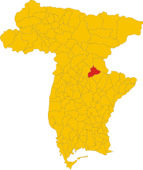
Nimis
- Italian comune
Nimis is an intriguing area located in the Hälsingland region of Sweden, known for its striking natural beauty and unique landscapes. The area is primarily known for the Nimis structure, an art installation made from driftwood, which attracts visitors and hikers alike. While Nimis is not a traditional hiking destination, it provides opportunities for outdoor enthusiasts to explore the surrounding areas....
- Country:

- Postal Code: 33045
- Local Dialing Code: 0432
- Licence Plate Code: UD
- Coordinates: 46° 12' 0" N, 13° 16' 0" E


- GPS tracks (wikiloc): [Link]
- AboveSeaLevel: 207 м m
- Area: 33.9 sq km
- Population: 2711
- Web site: [Link]


Osoppo
- Italian comune
Osoppo is a small town located in the Friuli Venezia Giulia region of northern Italy, surrounded by beautiful landscapes and a rich mix of natural and historical features. It offers various hiking opportunities that cater to different experience levels. Here are some key points about hiking in and around Osoppo:...
- Country:

- Postal Code: 33010
- Local Dialing Code: 0432
- Licence Plate Code: UD
- Coordinates: 46° 15' 0" N, 13° 5' 0" E


- GPS tracks (wikiloc): [Link]
- AboveSeaLevel: 185 м m
- Area: 22.4 sq km
- Population: 2865
- Web site: [Link]

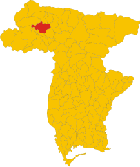
Ovaro
- Italian comune
Ovaro is a beautiful town located in the Friuli Venezia Giulia region of northeastern Italy. It's situated in the Carnic Alps and is surrounded by stunning natural landscapes, making it a great destination for hiking enthusiasts. Here are some key points to consider when hiking in and around Ovaro:...
- Country:

- Postal Code: 33025
- Local Dialing Code: 0433
- Licence Plate Code: UD
- Coordinates: 46° 29' 0" N, 12° 52' 0" E


- GPS tracks (wikiloc): [Link]
- AboveSeaLevel: 525 м m
- Area: 57.9 sq km
- Population: 1875
- Web site: [Link]
Pagnacco
- Italian comune
Pagnacco is a charming town located in the Friuli Venezia Giulia region of northeastern Italy, situated near the city of Udine. The area is known for its picturesque landscapes, rolling hills, and natural beauty, making it a great destination for hiking enthusiasts....
- Country:

- Postal Code: 33010
- Local Dialing Code: 0432
- Licence Plate Code: UD
- Coordinates: 46° 7' 0" N, 13° 11' 0" E


- GPS tracks (wikiloc): [Link]
- AboveSeaLevel: 170 м m
- Area: 14.93 sq km
- Population: 5059
- Web site: [Link]
Palazzolo dello Stella
- Italian comune
 Hiking in Palazzolo dello Stella
Palazzolo dello Stella is a charming village located in the Friuli Venezia Giulia region of northeastern Italy. While it's not widely known as a primary hiking destination, the surrounding areas offer opportunities for nature walks and hikes that showcase the beautiful landscape and rich culture of the region....
- Country:

- Postal Code: 33056
- Local Dialing Code: 0431
- Licence Plate Code: UD
- Coordinates: 45° 48' 0" N, 13° 5' 0" E


- GPS tracks (wikiloc): [Link]
- AboveSeaLevel: 5 м m
- Area: 34.55 sq km
- Population: 2893
- Web site: [Link]
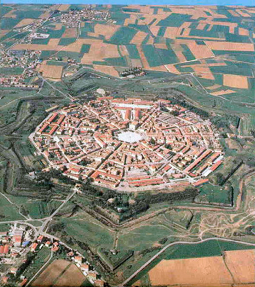

Palmanova
- Italian town and comune in northeastern Italy, in the Province Udine
Palmanova, located in the Friuli Venezia Giulia region of Italy, is a unique destination known for its star-shaped fortress design dating back to the 16th century. While it is primarily recognized for its historical significance and architecture, the surrounding area offers several opportunities for hiking and exploring nature....
- Country:

- Postal Code: 33057
- Local Dialing Code: 0432
- Licence Plate Code: UD
- Coordinates: 45° 54' 0" N, 13° 19' 0" E


- GPS tracks (wikiloc): [Link]
- AboveSeaLevel: 27 м m
- Area: 13.3 sq km
- Population: 5419
- Web site: [Link]


Paluzza
- Italian comune
Paluzza is a charming town situated in the Friuli Venezia Giulia region of northeastern Italy, surrounded by the stunning features of the Carnic Alps. Hiking in Paluzza offers a wide variety of trails suitable for different skill levels, making it a great destination for both beginners and experienced hikers....
- Country:

- Postal Code: 33026
- Local Dialing Code: 0433
- Licence Plate Code: UD
- Coordinates: 46° 32' 0" N, 13° 1' 0" E


- GPS tracks (wikiloc): [Link]
- AboveSeaLevel: 605 м m
- Area: 69.75 sq km
- Population: 2158
- Web site: [Link]

Pasian di Prato
- Italian comune
Pasian di Prato is a municipality located in the Friuli Venezia Giulia region of northeastern Italy, known for its beautiful natural landscapes and proximity to the Julian Alps. While it may not be the most widely recognized hiking destination, it offers several trails and opportunities for outdoor enthusiasts....
- Country:

- Postal Code: 33037
- Local Dialing Code: 0432
- Licence Plate Code: UD
- Coordinates: 46° 3' 0" N, 13° 12' 0" E


- GPS tracks (wikiloc): [Link]
- AboveSeaLevel: 106 м m
- Area: 15.41 sq km
- Population: 9363
- Web site: [Link]


Paularo
- Italian comune
Paularo, located in the Friuli Venezia Giulia region of northeastern Italy, is a charming destination for hikers and outdoor enthusiasts. Nestled within the beautiful backdrop of the Carnic Alps, it offers a variety of trails that cater to different skill levels, making it an attractive spot for both novice and seasoned hikers....
- Country:

- Postal Code: 33027
- Local Dialing Code: 0433
- Licence Plate Code: UD
- Coordinates: 46° 32' 0" N, 13° 7' 0" E


- GPS tracks (wikiloc): [Link]
- AboveSeaLevel: 648 м m
- Area: 84.24 sq km
- Population: 2556
- Web site: [Link]
Pavia di Udine
- Italian comune
Pavia di Udine is a charming village located in the northeastern part of Italy, within the Friuli Venezia Giulia region. It offers a unique blend of natural beauty, cultural heritage, and outdoor activities, making it a great destination for hiking enthusiasts....
- Country:

- Postal Code: 33050
- Local Dialing Code: 0432
- Licence Plate Code: UD
- Coordinates: 46° 0' 0" N, 13° 18' 0" E


- GPS tracks (wikiloc): [Link]
- AboveSeaLevel: 60 м m
- Area: 34.34 sq km
- Population: 5573
- Web site: [Link]
Pocenia
- Italian comune
Pocenia is a small town located in the Friuli Venezia Giulia region of northeastern Italy. While it may not be as famous as some other hiking destinations in Italy, it offers access to beautiful countryside and is in proximity to several natural attractions in the region....
- Country:

- Postal Code: 33050
- Local Dialing Code: 0432
- Licence Plate Code: UD
- Coordinates: 45° 50' 11" N, 13° 6' 6" E


- GPS tracks (wikiloc): [Link]
- AboveSeaLevel: 9 м m
- Area: 23.98 sq km
- Population: 2479
- Web site: [Link]


Pontebba
- Italian comune
Pontebba, located in the Friuli Venezia Giulia region of northeastern Italy, is a fantastic destination for hiking enthusiasts. Nestled at the foot of the Julian Alps, it offers stunning landscapes, a variety of trails, and rich natural and cultural heritage....
- Country:

- Postal Code: 33016
- Local Dialing Code: 0428
- Licence Plate Code: UD
- Coordinates: 46° 30' 0" N, 13° 19' 0" E


- GPS tracks (wikiloc): [Link]
- AboveSeaLevel: 568 м m
- Area: 99.66 sq km
- Population: 1397
- Web site: [Link]
Porpetto
- Italian comune
Hiking in Porpetto, located in the Friuli Venezia Giulia region of Italy, offers a delightful blend of scenic landscapes, cultural landmarks, and nature experiences. While Porpetto itself is a small town, it is surrounded by beautiful areas that are great for hiking....
- Country:

- Postal Code: 33050
- Local Dialing Code: 0431
- Licence Plate Code: UD
- Coordinates: 45° 51' 0" N, 13° 13' 0" E


- GPS tracks (wikiloc): [Link]
- AboveSeaLevel: 10 м m
- Area: 18.05 sq km
- Population: 2577
- Web site: [Link]


Povoletto
- Italian comune
Povoletto is a picturesque municipality located in the Friuli Venezia Giulia region of northeastern Italy. The area offers a variety of hiking opportunities, showcasing its beautiful landscapes, rich natural diversity, and cultural heritage. Here are some highlights for hiking in Povoletto:...
- Country:

- Postal Code: 33040
- Local Dialing Code: 0432
- Licence Plate Code: UD
- Coordinates: 46° 7' 0" N, 13° 17' 0" E


- GPS tracks (wikiloc): [Link]
- AboveSeaLevel: 116 м m
- Area: 38.41 sq km
- Population: 5425
- Web site: [Link]

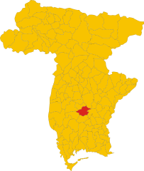
Pozzuolo del Friuli
- Italian comune
Pozzuolo del Friuli is a charming municipality located in the Friuli Venezia Giulia region of northeastern Italy. Known for its scenic landscapes and rich cultural heritage, it offers opportunities for outdoor activities, including hiking....
- Country:

- Postal Code: 33050
- Local Dialing Code: 0432
- Licence Plate Code: UD
- Coordinates: 45° 58' 5" N, 13° 11' 49" E


- GPS tracks (wikiloc): [Link]
- AboveSeaLevel: 67 м m
- Area: 34.37 sq km
- Population: 6927
- Web site: [Link]
Pradamano
- Italian comune
Pradamano, located in the Friuli Venezia Giulia region of Italy, is a charming area known for its picturesque landscapes. While it's not as famous for hiking as some of the more mountainous areas of Italy, there are still several opportunities for those who enjoy nature and want to explore the surrounding countryside....
- Country:

- Postal Code: 33040
- Local Dialing Code: 0432
- Licence Plate Code: UD
- Coordinates: 46° 2' 0" N, 13° 18' 0" E


- GPS tracks (wikiloc): [Link]
- AboveSeaLevel: 96 м m
- Area: 15.91 sq km
- Population: 3617
- Web site: [Link]
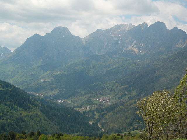

Prato Carnico
- Italian comune
Prato Carnico is a beautiful alpine village located in the Friuli Venezia Giulia region of northeastern Italy. It's set in the Carnic Alps, offering stunning natural landscapes that are perfect for hiking enthusiasts. Here are some highlights and tips for hiking in the Prato Carnico area:...
- Country:

- Postal Code: 33020
- Local Dialing Code: 0433
- Licence Plate Code: UD
- Coordinates: 46° 31' 0" N, 12° 49' 0" E


- GPS tracks (wikiloc): [Link]
- AboveSeaLevel: 686 м m
- Area: 81.72 sq km
- Population: 898
- Web site: [Link]
Precenicco
- Italian comune
Precenicco is a small town located in the Friuli Venezia Giulia region of northeastern Italy. It offers a charming rural landscape and is close to several natural and historical attractions, making it an interesting base for hikes....
- Country:

- Postal Code: 33050
- Local Dialing Code: 0431
- Licence Plate Code: UD
- Coordinates: 45° 48' 0" N, 13° 5' 0" E


- GPS tracks (wikiloc): [Link]
- AboveSeaLevel: 5 м m
- Area: 27.23 sq km
- Population: 1450
- Web site: [Link]


Premariacco
- Italian comune
Premariacco, located in the Friuli Venezia Giulia region of northeastern Italy, offers a unique kaleidoscope of natural beauty and cultural heritage, making it an interesting destination for hiking enthusiasts. Here’s what you can expect when hiking in and around Premariacco:...
- Country:

- Postal Code: 33040
- Local Dialing Code: 0432
- Licence Plate Code: UD
- Coordinates: 46° 4' 0" N, 13° 24' 0" E


- GPS tracks (wikiloc): [Link]
- AboveSeaLevel: 110 м m
- Area: 39.89 sq km
- Population: 4071
- Web site: [Link]
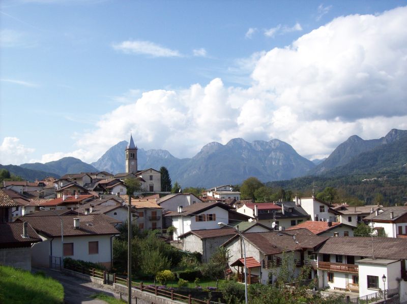

Preone
- Italian comune
Preone is a picturesque village located in the Friuli Venezia Giulia region of Italy, nestled in the foothills of the Carnic Alps. This area offers a variety of hiking opportunities suitable for different skill levels, surrounded by breathtaking landscapes, rich flora and fauna, and stunning mountain views....
- Country:

- Postal Code: 33020
- Local Dialing Code: 0433
- Licence Plate Code: UD
- Coordinates: 46° 24' 0" N, 12° 52' 0" E


- GPS tracks (wikiloc): [Link]
- AboveSeaLevel: 461 м m
- Area: 22.47 sq km
- Population: 234
- Web site: [Link]


Prepotto
- Italian comune
Prepotto, located in the northeastern part of Italy, in the region of Friuli Venezia Giulia, is a beautiful destination for hiking enthusiasts. The area is known for its stunning landscapes, rolling hills, vineyards, and a rich cultural heritage....
- Country:

- Postal Code: 33040
- Local Dialing Code: 0432
- Licence Plate Code: UD
- Coordinates: 46° 2' 43" N, 13° 28' 45" E


- GPS tracks (wikiloc): [Link]
- AboveSeaLevel: 105 м m
- Area: 33.24 sq km
- Population: 753
- Web site: [Link]
Pulfero
- Italian comune
Pulfero, located in the Friuli Venezia Giulia region of Italy, is a beautiful destination for hikers. Known for its stunning natural landscapes, the area offers a variety of trails that cater to different skill levels, from easy walks to challenging hikes....
- Country:

- Postal Code: 33046
- Local Dialing Code: 0432
- Licence Plate Code: UD
- Coordinates: 46° 10' 24" N, 13° 29' 4" E


- GPS tracks (wikiloc): [Link]
- AboveSeaLevel: 184 м m
- Area: 48.68 sq km
- Population: 923
- Web site: [Link]

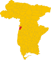
Ragogna
- Italian comune
Ragogna is a lovely location situated in the Friuli Venezia Giulia region of northeastern Italy. Nestled in the foothills of the Alps, it offers stunning landscapes and a variety of hiking opportunities. Here are some key points to consider when planning a hike in Ragogna:...
- Country:

- Postal Code: 33030
- Local Dialing Code: 0432
- Licence Plate Code: UD
- Coordinates: 46° 11' 18" N, 12° 59' 42" E


- GPS tracks (wikiloc): [Link]
- AboveSeaLevel: 235 м m
- Area: 22.03 sq km
- Population: 2858
- Web site: [Link]
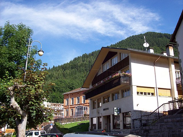

Ravascletto
- place and commune in Italy
Ravascletto, located in the Friuli Venezia Giulia region of Italy, is a beautiful destination for hiking enthusiasts. Nestled within the Carnic Alps, it offers a range of hiking trails that cater to various skill levels, making it an ideal spot for both beginners and experienced hikers....
- Country:

- Postal Code: 33020
- Local Dialing Code: 0433
- Licence Plate Code: UD
- Coordinates: 46° 32' 0" N, 12° 55' 0" E


- GPS tracks (wikiloc): [Link]
- AboveSeaLevel: 952 м m
- Area: 26.48 sq km
- Population: 530
- Web site: [Link]


Raveo
- Italian comune
Raveo, located in the Friuli Venezia Giulia region of northern Italy, offers a variety of beautiful hiking opportunities set against the backdrop of the stunning Friulian Alps. The area is known for its rich natural beauty, featuring lush forests, alpine meadows, and diverse wildlife, making it perfect for both casual walkers and experienced hikers....
- Country:

- Postal Code: 33029
- Local Dialing Code: 0433
- Licence Plate Code: UD
- Coordinates: 46° 26' 0" N, 12° 52' 0" E


- GPS tracks (wikiloc): [Link]
- AboveSeaLevel: 518 м m
- Area: 12.6 sq km
- Population: 446
- Web site: [Link]


Reana del Rojale
- Italian comune
Reana del Rojale is a charming village located in the Friuli Venezia Giulia region of northern Italy. It offers a beautiful natural landscape and is an excellent destination for hiking enthusiasts. Here are some key points about hiking in Reana del Rojale:...
- Country:

- Postal Code: 33010
- Local Dialing Code: 0432
- Licence Plate Code: UD
- Coordinates: 46° 9' 0" N, 13° 14' 0" E


- GPS tracks (wikiloc): [Link]
- AboveSeaLevel: 168 м m
- Area: 20.33 sq km
- Population: 4905
- Web site: [Link]


Remanzacco
- Italian comune
Remanzacco, located in the Friuli-Venezia Giulia region of Italy, is an area rich in natural beauty, making it a fantastic destination for hiking enthusiasts. Here are some highlights and tips for hiking in this region:...
- Country:

- Postal Code: 33047
- Local Dialing Code: 0432
- Licence Plate Code: UD
- Coordinates: 46° 5' 0" N, 13° 19' 0" E


- GPS tracks (wikiloc): [Link]
- AboveSeaLevel: 110 м m
- Area: 30.99 sq km
- Population: 6134
- Web site: [Link]


Resia, Friuli
- Italian comune
Resia, located in the Friuli Venezia Giulia region of northern Italy, is a breathtaking destination for hiking enthusiasts. Nestled in the heart of the Julian Alps, it offers a variety of trails that cater to different skill levels, from leisurely walks to more challenging hikes....
- Country:

- Postal Code: 33010
- Local Dialing Code: 0433
- Licence Plate Code: UD
- Coordinates: 46° 22' 5" N, 13° 18' 7" E


- GPS tracks (wikiloc): [Link]
- AboveSeaLevel: 492 м m
- Area: 119.31 sq km
- Population: 1000
- Web site: [Link]

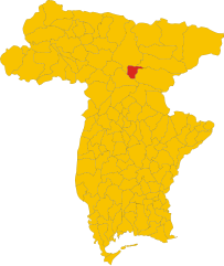
Resiutta
- Italian comune
Resiutta, a charming village located in the Friuli Venezia Giulia region of northern Italy, serves as a great base for hiking enthusiasts. The area is nestled in the Julian Alps and is surrounded by stunning natural landscapes, including forests, mountains, and rivers, offering a variety of hiking trails for different skill levels....
- Country:

- Postal Code: 33010
- Local Dialing Code: 0433
- Licence Plate Code: UD
- Coordinates: 46° 24' 0" N, 13° 13' 0" E


- GPS tracks (wikiloc): [Link]
- AboveSeaLevel: 316 м m
- Area: 20.36 sq km
- Population: 286
- Web site: [Link]


Rigolato
- Italian comune
Rigolato is a charming village located in the Friuli Venezia Giulia region of northeastern Italy. It sits in the heart of the Carnic Alps, making it a fantastic destination for hiking enthusiasts. Here are some highlights and tips for hiking in Rigolato:...
- Country:

- Postal Code: 33020
- Local Dialing Code: 0433
- Licence Plate Code: UD
- Coordinates: 46° 33' 0" N, 12° 51' 0" E


- GPS tracks (wikiloc): [Link]
- AboveSeaLevel: 760 м m
- Area: 30.77 sq km
- Population: 428
- Web site: [Link]
Rive d'Arcano
- Italian comune
Rive d'Arcano, located in the Friuli Venezia Giulia region of Italy, offers a variety of landscapes and hiking opportunities. The area is characterized by its picturesque hills, lush vineyards, and views of the surrounding mountains, making it an appealing destination for hikers of all skill levels....
- Country:

- Postal Code: 33030
- Local Dialing Code: 0432
- Licence Plate Code: UD
- Coordinates: 46° 8' 0" N, 13° 2' 0" E


- GPS tracks (wikiloc): [Link]
- AboveSeaLevel: 175 м m
- Area: 22.57 sq km
- Population: 2467
- Web site: [Link]
Ronchis
- Italian comune
Ronchis is a small village located in the Friuli Venezia Giulia region of northeastern Italy. While it may not be a prominent hiking destination in itself, the surrounding area offers several opportunities for hiking and outdoor activities, especially in the nearby natural parks and hills....
- Country:

- Postal Code: 33050
- Local Dialing Code: 0431
- Licence Plate Code: UD
- Coordinates: 45° 49' 0" N, 13° 7' 0" E


- GPS tracks (wikiloc): [Link]
- AboveSeaLevel: 15 м m
- Area: 18.4 sq km
- Population: 2013
- Web site: [Link]


Ruda
- Italian comune
Ruda, located in the Friuli Venezia Giulia region of Italy, is surrounded by beautiful landscapes and rich natural heritage, making it an excellent area for hiking. Here's an overview of what you can expect when hiking in and around Ruda:...
- Country:

- Postal Code: 33050
- Local Dialing Code: 0431
- Licence Plate Code: UD
- Coordinates: 45° 50' 0" N, 13° 24' 0" E


- GPS tracks (wikiloc): [Link]
- AboveSeaLevel: 12 м m
- Area: 19.47 sq km
- Population: 2900
- Web site: [Link]


San Daniele del Friuli
- Italian comune
 Hiking in San Daniele del Friuli
San Daniele del Friuli, located in the Friuli Venezia Giulia region of northeastern Italy, is known not only for its famous prosciutto but also for its picturesque landscapes and hiking opportunities. The area is characterized by rolling hills, vineyards, and lush countryside, making it an appealing destination for hiking enthusiasts....
- Country:

- Postal Code: 33038
- Local Dialing Code: 0432
- Licence Plate Code: UD
- Coordinates: 46° 9' 0" N, 13° 1' 0" E


- GPS tracks (wikiloc): [Link]
- AboveSeaLevel: 252 м m
- Area: 34.78 sq km
- Population: 7987
- Web site: [Link]
San Giorgio di Nogaro
- Italian comune
 Hiking in San Giorgio di Nogaro
San Giorgio di Nogaro is a charming town located in the Friuli Venezia Giulia region of Italy, near the northeastern coast. While it might not be as famous for hiking as some mountainous areas in Italy, it does offer a few opportunities for outdoor enthusiasts to explore the natural beauty of the surrounding landscape....
- Country:

- Postal Code: 33058
- Local Dialing Code: 0431
- Licence Plate Code: UD
- Coordinates: 45° 50' 0" N, 13° 12' 0" E


- GPS tracks (wikiloc): [Link]
- AboveSeaLevel: 7 м m
- Area: 25.49 sq km
- Population: 7467
- Web site: [Link]
San Giovanni al Natisone
- Italian comune
 Hiking in San Giovanni al Natisone
San Giovanni al Natisone is a charming area located in the Friuli Venezia Giulia region of northeastern Italy. It offers a variety of hiking opportunities set against the backdrop of picturesque landscapes. Here are some highlights for hikers in the region:...
- Country:

- Postal Code: 33048
- Local Dialing Code: 0432
- Licence Plate Code: UD
- Coordinates: 45° 59' 0" N, 13° 24' 0" E


- GPS tracks (wikiloc): [Link]
- AboveSeaLevel: 66 м m
- Area: 24.06 sq km
- Population: 6137
- Web site: [Link]


San Leonardo
- Italian comune
San Leonardo is a charming village located in the Friuli-Venezia Giulia region of northeastern Italy. The area is known for its stunning natural landscapes, characterized by rolling hills, lush forests, and picturesque vineyards. Hiking in this region offers a variety of trails that cater to different skill levels and preferences, making it an excellent destination for outdoor enthusiasts....
- Country:

- Postal Code: 33040
- Local Dialing Code: 0432
- Licence Plate Code: UD
- Coordinates: 46° 7' 7" N, 13° 31' 53" E


- GPS tracks (wikiloc): [Link]
- AboveSeaLevel: 168 м m
- Area: 26.91 sq km
- Population: 1110
- Web site: [Link]

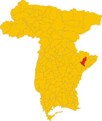
San Pietro al Natisone
- Italian comune
 Hiking in San Pietro al Natisone
San Pietro al Natisone, located in the northeastern part of Italy, near the border with Slovenia, is a beautiful area for hiking enthusiasts. The region features stunning natural landscapes, including rolling hills, dense forests, and the Natisone River. Here are some key highlights regarding hiking in this area:...
- Country:

- Postal Code: 33049
- Local Dialing Code: 0432
- Licence Plate Code: UD
- Coordinates: 46° 7' 48" N, 13° 29' 14" E


- GPS tracks (wikiloc): [Link]
- AboveSeaLevel: 175 м m
- Area: 23.97 sq km
- Population: 2134
- Web site: [Link]
San Vito al Torre
- Italian comune
San Vito al Torre is a charming small town in the Friuli Venezia Giulia region of northeastern Italy, known for its scenic landscapes and proximity to the beautiful surroundings of the Italian countryside. While it may not be as widely recognized as other hiking destinations, it offers several opportunities for those looking to explore nature....
- Country:

- Postal Code: 33050
- Local Dialing Code: 0432
- Licence Plate Code: UD
- Coordinates: 45° 54' 0" N, 13° 22' 0" E


- GPS tracks (wikiloc): [Link]
- AboveSeaLevel: 17 м m
- Area: 11.92 sq km
- Population: 1268
- Web site: [Link]
San Vito di Fagagna
- Italian comune
San Vito di Fagagna, located in the Friuli Venezia Giulia region of northeastern Italy, offers a variety of hiking opportunities amidst beautiful landscapes and rich cultural history. The area is characterized by rolling hills, vineyards, and scenic views of the surrounding countryside and the nearby Alps....
- Country:

- Postal Code: 33030
- Local Dialing Code: 0432
- Licence Plate Code: UD
- Coordinates: 46° 5' 0" N, 13° 4' 0" E


- GPS tracks (wikiloc): [Link]
- AboveSeaLevel: 135 м m
- Area: 8.57 sq km
- Population: 1661
- Web site: [Link]


Santa Maria la Longa
- Italian comune
 Hiking in Santa Maria la Longa
Santa Maria la Longa is a charming village located in the northeastern part of Italy, in the region of Friuli Venezia Giulia. While it's a small village, its proximity to natural landscapes and the surrounding areas provides some lovely opportunities for hiking and outdoor activities....
- Country:

- Postal Code: 33050
- Local Dialing Code: 0432
- Licence Plate Code: UD
- Coordinates: 45° 56' 1" N, 13° 17' 24" E


- GPS tracks (wikiloc): [Link]
- AboveSeaLevel: 38 м m
- Area: 19.6 sq km
- Population: 2313
- Web site: [Link]
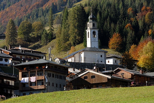

Sauris
- Italian comune
Sauris, a picturesque village located in the Friuli Venezia Giulia region of Italy, is a hidden gem for hikers. Nestled in the Julian Alps, it offers stunning landscapes, rich cultural heritage, and an array of hiking trails suitable for various experience levels....
- Country:

- Postal Code: 33020
- Local Dialing Code: 0433
- Licence Plate Code: UD
- Coordinates: 46° 27' 58" N, 12° 42' 31" E


- GPS tracks (wikiloc): [Link]
- AboveSeaLevel: 1212 м m
- Area: 41.49 sq km
- Population: 405
- Web site: [Link]
Savogna
- Italian comune
Savogna is a charming small village located in the region of Friuli Venezia Giulia in northeastern Italy. This area features beautiful natural landscapes, making it a great destination for hiking enthusiasts. Here are some highlights of hiking in Savogna:...
- Country:

- Postal Code: 33040
- Local Dialing Code: 0432
- Licence Plate Code: UD
- Coordinates: 46° 9' 34" N, 13° 32' 0" E


- GPS tracks (wikiloc): [Link]
- AboveSeaLevel: 235 м m
- Area: 22.17 sq km
- Population: 380
- Web site: [Link]


Sedegliano
- Italian comune
Sedegliano is a charming town located in the Friuli Venezia Giulia region of northeastern Italy. While it may not be widely known as a hiking destination, the surrounding areas offer some beautiful landscapes and opportunities for walking and hiking enthusiasts. Here’s what you need to know about hiking near Sedegliano:...
- Country:

- Postal Code: 33039
- Local Dialing Code: 0432
- Licence Plate Code: UD
- Coordinates: 46° 0' 50" N, 12° 58' 29" E


- GPS tracks (wikiloc): [Link]
- AboveSeaLevel: 84 м m
- Area: 50.53 sq km
- Population: 3766
- Web site: [Link]
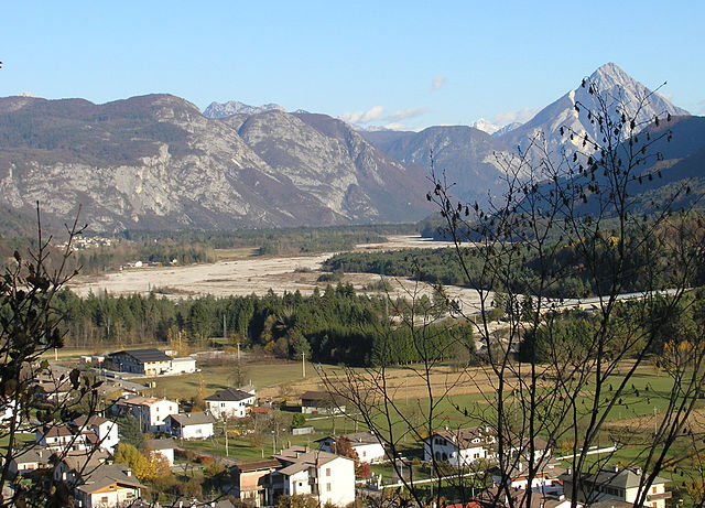

Socchieve
- Italian comune
Socchieve, a picturesque area in the Julian Alps of Italy, is known for its stunning natural landscapes and diverse hiking trails suitable for a variety of skill levels. Here’s what you can expect when hiking in Socchieve:...
- Country:

- Postal Code: 33020
- Local Dialing Code: 0433
- Licence Plate Code: UD
- Coordinates: 46° 23' 48" N, 12° 50' 53" E


- GPS tracks (wikiloc): [Link]
- AboveSeaLevel: 480 м m
- Area: 66.12 sq km
- Population: 896
- Web site: [Link]


Stregna
- Italian comune
Stregna is a picturesque area located in the Friuli Venezia Giulia region of northeastern Italy, close to the border with Slovenia. This region is characterized by its stunning natural landscapes, including rolling hills, dense forests, and beautiful views of the surrounding mountains. Here's what you can expect when hiking in Stregna:...
- Country:

- Postal Code: 33040
- Local Dialing Code: 0432
- Licence Plate Code: UD
- Coordinates: 46° 7' 37" N, 13° 34' 38" E


- GPS tracks (wikiloc): [Link]
- AboveSeaLevel: 404 м m
- Area: 19.69 sq km
- Population: 348
- Web site: [Link]


Sutrio
- Italian comune
Sutrio is a charming village located in the Friuli Venezia Giulia region of northeastern Italy, and it's known for its stunning natural landscapes and rich cultural heritage. Hiking in this area can be a delightful experience, as it offers a variety of trails suitable for different skill levels....
- Country:

- Postal Code: 33020
- Local Dialing Code: 0433
- Licence Plate Code: UD
- Coordinates: 46° 30' 50" N, 12° 59' 25" E


- GPS tracks (wikiloc): [Link]
- AboveSeaLevel: 565 м m
- Area: 20.75 sq km
- Population: 1296
- Web site: [Link]


Taipana
- Italian comune
Taipana is a lesser-known gem in Italy, located in the region of Friuli Venezia Giulia. While it may not be a prominent hiking destination compared to more famous areas, it offers beautiful landscapes and a tranquil environment for hiking enthusiasts looking to explore more off-the-beaten-path locations....
- Country:

- Postal Code: 33040
- Local Dialing Code: 0432
- Licence Plate Code: UD
- Coordinates: 46° 15' 0" N, 13° 20' 0" E


- GPS tracks (wikiloc): [Link]
- AboveSeaLevel: 478 м m
- Area: 65.44 sq km
- Population: 596
- Web site: [Link]
Talmassons
- Italian comune
Talmassons is a charming area located in the Friuli Venezia Giulia region of northeastern Italy, known for its picturesque landscapes, lush vegetation, and serene hiking trails. While it may not be as widely recognized as some other hiking destinations, it offers a unique experience for outdoor enthusiasts....
- Country:

- Postal Code: 33030
- Local Dialing Code: 0432
- Licence Plate Code: UD
- Coordinates: 45° 56' 0" N, 13° 7' 0" E


- GPS tracks (wikiloc): [Link]
- AboveSeaLevel: 30 м m
- Area: 43.05 sq km
- Population: 4045
- Web site: [Link]


Tarcento
- Italian comune
Tarcento, located in the Friuli Venezia Giulia region of Italy, offers beautiful hiking opportunities for outdoor enthusiasts. Nestled in a picturesque valley surrounded by the stunning Julian Alps and the nearby rivers, Tarcento is a great base for exploring the natural features of the area....
- Country:

- Postal Code: 33017
- Local Dialing Code: 0432
- Licence Plate Code: UD
- Coordinates: 46° 13' 0" N, 13° 13' 0" E


- GPS tracks (wikiloc): [Link]
- AboveSeaLevel: 230 м m
- Area: 35.42 sq km
- Population: 8964
- Web site: [Link]
Tavagnacco
- Italian comune
Tavagnacco is a beautiful area located in the Friuli Venezia Giulia region of Italy, near the city of Udine. It offers a variety of hiking opportunities that showcase the natural beauty and cultural heritage of the region. Here are some highlights and considerations for hiking in Tavagnacco:...
- Country:

- Postal Code: 33010
- Local Dialing Code: 0432
- Licence Plate Code: UD
- Coordinates: 46° 8' 0" N, 13° 13' 0" E


- GPS tracks (wikiloc): [Link]
- AboveSeaLevel: 137 м m
- Area: 15.37 sq km
- Population: 14981
- Web site: [Link]
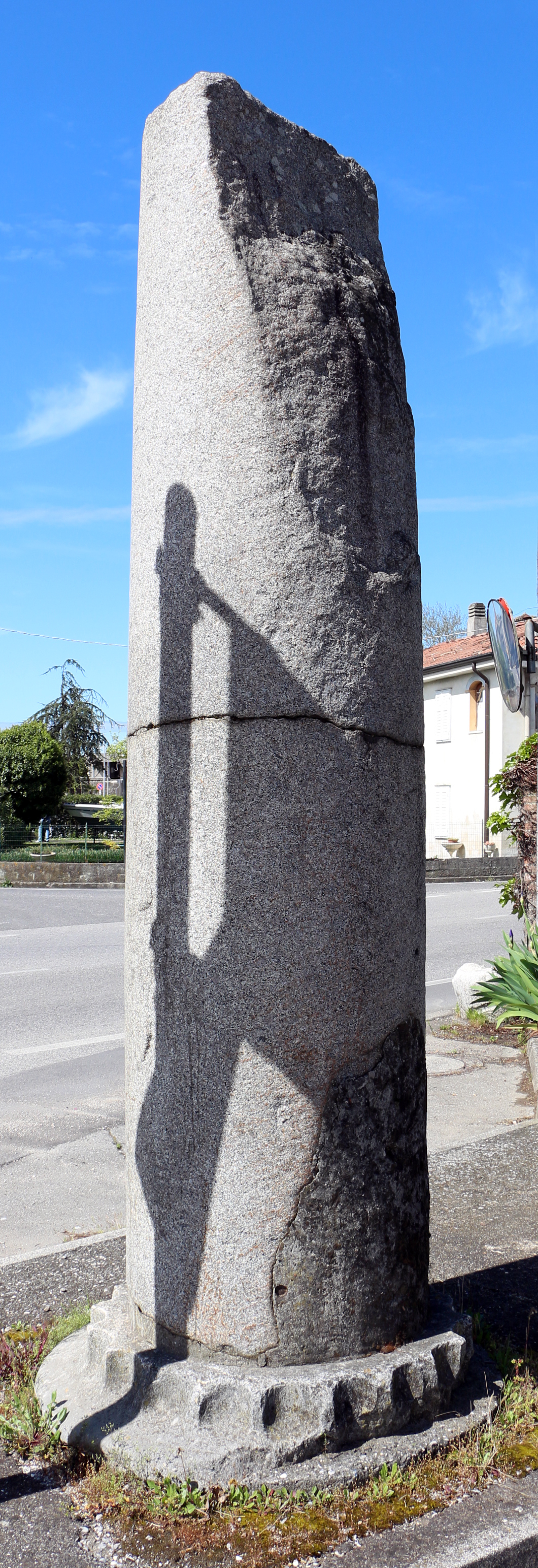

Terzo d'Aquileia
- Italian comune
Terzo d'Aquileia is a small town located in the Friuli Venezia Giulia region of Italy, known for its rich history, beautiful landscapes, and proximity to both cultural sites and natural scenery. While it may not be as widely recognized as some other hiking destinations in Italy, it offers a unique experience for hikers looking for a blend of history and nature....
- Country:

- Postal Code: 33050
- Local Dialing Code: 0431
- Licence Plate Code: UD
- Coordinates: 45° 48' 0" N, 13° 20' 0" E


- GPS tracks (wikiloc): [Link]
- AboveSeaLevel: 5 м m
- Area: 28.36 sq km
- Population: 2843
- Web site: [Link]
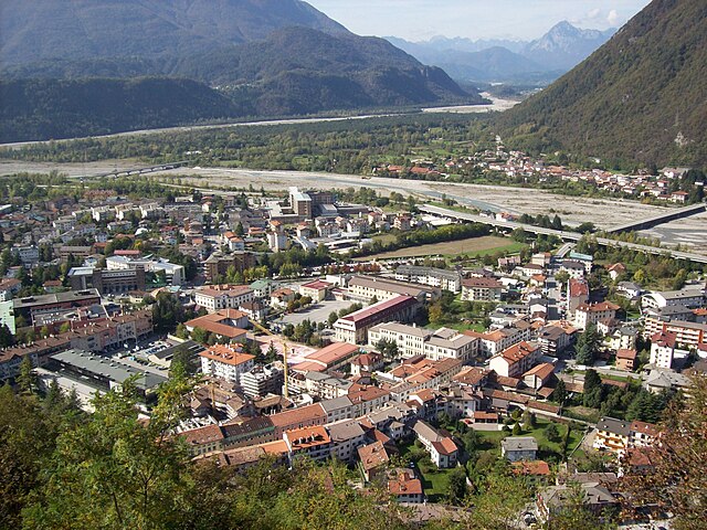

Tolmezzo
- Italian comune
Tolmezzo, located in the Carnia region of the Friuli Venezia Giulia area of northeastern Italy, is a fantastic destination for hiking enthusiasts. Surrounded by the stunning Carnic Alps and lush valleys, it offers a variety of trails catering to all experience levels, from beginners to seasoned hikers....
- Country:

- Postal Code: 33028
- Local Dialing Code: 0433 487911
- Licence Plate Code: UD
- Coordinates: 46° 24' 0" N, 13° 1' 0" E


- GPS tracks (wikiloc): [Link]
- AboveSeaLevel: 323 м m
- Area: 64.62 sq km
- Population: 10191
- Web site: [Link]
Torreano
- Italian comune
Torreano, located in the region of Friuli Venezia Giulia in Italy, offers a variety of hiking opportunities amidst beautiful natural landscapes. The area is characterized by rolling hills, vineyards, and charming villages, making it an excellent destination for outdoor enthusiasts....
- Country:

- Postal Code: 33040
- Local Dialing Code: 0432
- Licence Plate Code: UD
- Coordinates: 46° 8' 0" N, 13° 26' 0" E


- GPS tracks (wikiloc): [Link]
- AboveSeaLevel: 189 м m
- Area: 34.99 sq km
- Population: 2129
- Web site: [Link]

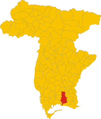
Torviscosa
- Italian comune
Torviscosa is a small town located in the Friuli Venezia Giulia region of Italy. While it is not a major hiking destination compared to some other Italian regions, there are still opportunities for outdoor enthusiasts to explore the natural beauty of the area and nearby landscapes....
- Country:

- Postal Code: 33050
- Local Dialing Code: 0431
- Licence Plate Code: UD
- Coordinates: 45° 49' 0" N, 13° 17' 0" E


- GPS tracks (wikiloc): [Link]
- AboveSeaLevel: 3 м m
- Area: 48.62 sq km
- Population: 2829
- Web site: [Link]


Trasaghis
- Italian comune
Trasaghis, located in the Friuli Venezia Giulia region of northeastern Italy, is an excellent destination for hiking enthusiasts. The area is known for its stunning natural landscapes, characterized by lush forests, picturesque valleys, and serene lakes. Here are some key points to consider when hiking in Trasaghis:...
- Country:

- Postal Code: 33010
- Local Dialing Code: 0432
- Licence Plate Code: UD
- Coordinates: 46° 17' 0" N, 13° 5' 0" E


- GPS tracks (wikiloc): [Link]
- AboveSeaLevel: 217 м m
- Area: 77.85 sq km
- Population: 2222
- Web site: [Link]


Treppo Grande
- Italian comune
Treppo Grande is a picturesque area located in the Friuli Venezia Giulia region of northeastern Italy, often celebrated for its stunning landscapes and varied hiking opportunities. Although not as widely known as some other Italian hiking destinations, it offers a unique mix of natural beauty, cultural heritage, and outdoor activities....
- Country:

- Postal Code: 33010
- Local Dialing Code: 0432
- Licence Plate Code: UD
- Coordinates: 46° 12' 0" N, 13° 9' 0" E


- GPS tracks (wikiloc): [Link]
- AboveSeaLevel: 231 м m
- Area: 11.32 sq km
- Population: 1719
- Web site: [Link]

Tricesimo
- Italian comune
Tricesimo is a charming town located in the Friuli Venezia Giulia region of Italy, not far from Udine. It boasts a beautiful landscape that is perfect for hiking enthusiasts. Here are some highlights for hiking in and around Tricesimo:...
- Country:

- Postal Code: 33019
- Local Dialing Code: 0432
- Licence Plate Code: UD
- Coordinates: 46° 9' 0" N, 13° 13' 0" E


- GPS tracks (wikiloc): [Link]
- AboveSeaLevel: 199 м m
- Area: 17.68 sq km
- Population: 7687
- Web site: [Link]
Trivignano Udinese
- Italian comune
Trivignano Udinese, located in the Friuli Venezia Giulia region of northeastern Italy, offers a beautiful landscape for hiking enthusiasts. The area is characterized by its rolling hills, lush vegetation, and proximity to the picturesque mountains of the Julian Alps. Here are some aspects to consider when hiking in and around Trivignano Udinese:...
- Country:

- Postal Code: 33050
- Local Dialing Code: 0432
- Licence Plate Code: UD
- Coordinates: 45° 57' 0" N, 13° 20' 0" E


- GPS tracks (wikiloc): [Link]
- AboveSeaLevel: 43 м m
- Area: 18.46 sq km
- Population: 1635
- Web site: [Link]
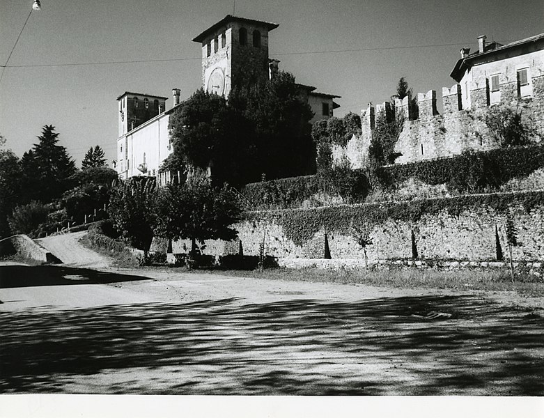

Varmo
- Italian comune
Varmo, located in the Friuli Venezia Giulia region of northeastern Italy, is not widely known as a hiking destination compared to other areas in Italy, but it offers some beautiful landscapes and trails that can be enjoyed by hikers. The region is characterized by its stunning natural scenery, including rolling hills, rivers, and nearby mountains....
- Country:

- Postal Code: 33030
- Local Dialing Code: 0432
- Licence Plate Code: UD
- Coordinates: 45° 53' 0" N, 12° 59' 0" E


- GPS tracks (wikiloc): [Link]
- AboveSeaLevel: 18 м m
- Area: 34.92 sq km
- Population: 2725
- Web site: [Link]

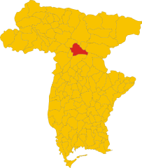
Venzone
- Italian comune
Venzone is a picturesque town located in the Friuli Venezia Giulia region of northeastern Italy. Surrounded by stunning natural landscapes, it offers a great base for hiking enthusiasts. Here’s what you can expect when hiking in and around Venzone:...
- Country:

- Postal Code: 33010
- Local Dialing Code: 0432
- Licence Plate Code: UD
- Coordinates: 46° 19' 49" N, 13° 8' 18" E


- GPS tracks (wikiloc): [Link]
- AboveSeaLevel: 230 м m
- Area: 54.55 sq km
- Population: 2011
- Web site: [Link]


Verzegnis
- Italian comune
Verzegnis is a picturesque village located in the Friuli Venezia Giulia region of northeastern Italy. It's nestled in the Carnic Alps, which offer stunning landscapes, rich biodiversity, and a variety of hiking opportunities suitable for all levels of experience....
- Country:

- Postal Code: 33020
- Local Dialing Code: 0433
- Licence Plate Code: UD
- Coordinates: 46° 22' 59" N, 12° 58' 33" E


- GPS tracks (wikiloc): [Link]
- AboveSeaLevel: 407 м m
- Area: 39.33 sq km
- Population: 863
- Web site: [Link]
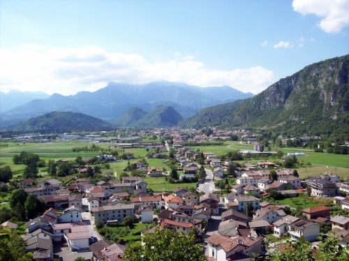

Villa Santina
- Italian comune
Villa Santina is a charming town located in the Friuli Venezia Giulia region of northeastern Italy, known for its stunning natural landscapes and outdoor activities, including hiking. Nestled in the Carnic Alps, the area offers a variety of trails suitable for different skill levels, making it an excellent destination for both novice and experienced hikers....
- Country:

- Postal Code: 33029
- Local Dialing Code: 0433
- Licence Plate Code: UD
- Coordinates: 46° 25' 0" N, 12° 55' 0" E


- GPS tracks (wikiloc): [Link]
- AboveSeaLevel: 363 м m
- Area: 12.99 sq km
- Population: 2204
- Web site: [Link]


Visco, Friuli
- Italian comune
Visco, located in the Friuli-Venezia Giulia region of Italy, is a quaint village offering a beautiful backdrop for hiking enthusiasts. The area is rich in both natural beauty and cultural heritage, making it an excellent destination for hikers of all skill levels....
- Country:

- Postal Code: 33040
- Local Dialing Code: 0432
- Licence Plate Code: UD
- Coordinates: 45° 54' 0" N, 13° 21' 0" E


- GPS tracks (wikiloc): [Link]
- AboveSeaLevel: 27 м m
- Area: 3.52 sq km
- Population: 786
- Web site: [Link]


Zuglio
- Italian comune
Zuglio, located in the Friuli Venezia Giulia region of Italy, is a charming destination for hiking enthusiasts. This area is steeped in history and natural beauty, making it a perfect spot for both leisurely walks and more challenging hikes....
- Country:

- Postal Code: 33020
- Local Dialing Code: 0433
- Licence Plate Code: UD
- Coordinates: 46° 27' 44" N, 13° 1' 30" E


- GPS tracks (wikiloc): [Link]
- AboveSeaLevel: 425 м m
- Area: 18.21 sq km
- Population: 583
- Web site: [Link]
Shares border with regions:


Province of Belluno
- one of seven provinces in the Italian region Veneto
The Province of Belluno, located in the Veneto region of northern Italy, is a spectacular destination for hiking enthusiasts. This province is predominantly covered by the Dolomites, a UNESCO World Heritage site known for its stunning landscapes, unique geological formations, and rich biodiversity. Here are some key points about hiking in the Province of Belluno:...
- Country:

- Capital: Belluno
- Postal Code: 32010–32047; 32100
- Local Dialing Code: 0437; 0439; 0436; 0435
- Licence Plate Code: BL
- Coordinates: 46° 8' 27" N, 12° 12' 56" E


- GPS tracks (wikiloc): [Link]
- Area: 3677 sq km
- Population: 209550
- Web site: [Link]

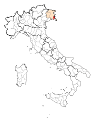
Province of Gorizia
- province of Italy
The Province of Gorizia, located in northeastern Italy, offers a diverse range of hiking opportunities due to its varied landscapes, rich history, and beautiful natural environments. Here are some key points to consider if you're planning to hike in this area:...
- Country:

- Capital: Gorizia
- Postal Code: 34070–34079; 34170
- Local Dialing Code: 0481; 0431
- Licence Plate Code: GO
- Coordinates: 45° 56' 23" N, 13° 37' 24" E


- GPS tracks (wikiloc): [Link]
- Area: 466.02 sq km
- Web site: [Link]


Province of Pordenone
- province of Italy
 Hiking in Province of Pordenone
The Province of Pordenone, located in the Friuli Venezia Giulia region of northeastern Italy, offers stunning landscapes and diverse hiking opportunities. From the foothills of the Alps to the lush valleys and picturesque towns, here's an overview of what you can expect when hiking in this area:...
- Country:

- Capital: Pordenone
- Postal Code: 33170; 33090–33099; 33076–33087; 33072–33074; 33070
- Local Dialing Code: 0427; 0434; 0432
- Licence Plate Code: PN
- Coordinates: 45° 57' 0" N, 12° 41' 0" E


- GPS tracks (wikiloc): [Link]
- Area: 2178 sq km
- Web site: [Link]

Province of Venice
- former province in the region of Veneto, Italy
Hiking in the Province of Venice offers a unique combination of natural beauty, cultural heritage, and diverse landscapes. While the province is widely known for its famous city of Venice and charming islands like Murano and Burano, it also includes picturesque rural areas and stunning natural parks that are great for hiking....
- Country:

- Capital: Venice
- Postal Code: 30010–30039; 30121–30176
- Local Dialing Code: 049; 0431; 0426; 0422; 0421; 041
- Licence Plate Code: VE
- Coordinates: 45° 27' 0" N, 12° 24' 0" E


- GPS tracks (wikiloc): [Link]
- Area: 2472.91 sq km
- Population: 857841
- Web site: [Link]


Carinthia
- state of Austria
Carinthia, located in the southern part of Austria, is a fantastic destination for hiking enthusiasts. The region is known for its stunning landscapes, which include majestic mountains, deep valleys, pristine lakes, and lush forests. Here are some highlights and tips for hiking in Carinthia:...
- Country:

- Capital: Klagenfurt
- Coordinates: 46° 45' 40" N, 13° 49' 8" E


- GPS tracks (wikiloc): [Link]
- AboveSeaLevel: 1449 м m
- Area: 9535.97 sq km
- Population: 560300
- Web site: [Link]
