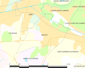
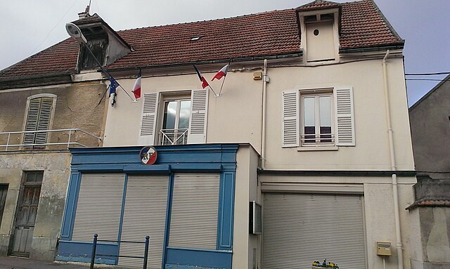
Couilly-Pont-aux-Dames (Couilly-Pont-aux-Dames)

- commune in Seine-et-Marne, France
- Country:

- Postal Code: 77860
- Coordinates: 48° 53' 4" N, 2° 51' 28" E


- GPS tracks (wikiloc): [Link]
- Area: 4.75 sq km
- Population: 2175
- Web site: http://couilly.free.fr
- Wikipedia en: wiki(en)
- Wikipedia: wiki(fr)
- Wikidata storage: Wikidata: Q257909
- Wikipedia Commons Category: [Link]
- Freebase ID: [/m/02qbv1d]
- Freebase ID: [/m/02qbv1d]
- GeoNames ID: Alt: [3023296]
- GeoNames ID: Alt: [3023296]
- SIREN number: [217701283]
- SIREN number: [217701283]
- BnF ID: [15275469x]
- BnF ID: [15275469x]
- VIAF ID: Alt: [126939565]
- VIAF ID: Alt: [126939565]
- GND ID: Alt: [4302565-1]
- GND ID: Alt: [4302565-1]
- Library of Congress authority ID: Alt: [n94024535]
- Library of Congress authority ID: Alt: [n94024535]
- INSEE municipality code: 77128
- INSEE municipality code: 77128
Shares border with regions:


Condé-Sainte-Libiaire
- commune in Seine-et-Marne, France
- Country:
- Postal Code: 77450
- Coordinates: 48° 53' 53" N, 2° 49' 54" E
- GPS tracks (wikiloc): [Link]
- Area: 2.15 sq km
- Population: 1405
- Web site: [Link]


Quincy-Voisins
- commune in Seine-et-Marne, France
- Country:
- Postal Code: 77860
- Coordinates: 48° 53' 58" N, 2° 52' 25" E
- GPS tracks (wikiloc): [Link]
- Area: 10.33 sq km
- Population: 5468
- Web site: [Link]

Montry
- commune in Seine-et-Marne, France
- Country:
- Postal Code: 77450
- Coordinates: 48° 53' 12" N, 2° 49' 40" E
- GPS tracks (wikiloc): [Link]
- Area: 2.86 sq km
- Population: 3574
- Web site: [Link]

Villiers-sur-Morin
- commune in Seine-et-Marne, France
- Country:
- Postal Code: 77580
- Coordinates: 48° 51' 37" N, 2° 52' 46" E
- GPS tracks (wikiloc): [Link]
- Area: 6.28 sq km
- Population: 1925
- Web site: [Link]


Bouleurs
- commune in Seine-et-Marne, France
- Country:
- Postal Code: 77580
- Coordinates: 48° 52' 52" N, 2° 54' 23" E
- GPS tracks (wikiloc): [Link]
- Area: 8.25 sq km
- Population: 1498


Saint-Germain-sur-Morin
- commune in Seine-et-Marne, France
- Country:
- Postal Code: 77860
- Coordinates: 48° 52' 57" N, 2° 51' 2" E
- GPS tracks (wikiloc): [Link]
- Area: 4.81 sq km
- Population: 3561
- Web site: [Link]


Crécy-la-Chapelle
- commune in Seine-et-Marne, France
- Country:
- Postal Code: 77580
- Coordinates: 48° 51' 32" N, 2° 54' 27" E
- GPS tracks (wikiloc): [Link]
- Area: 15.78 sq km
- Population: 4279
- Web site: [Link]