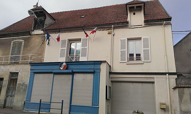
Crécy-la-Chapelle (Crécy-la-Chapelle)

- commune in Seine-et-Marne, France
- Country:

- Postal Code: 77580
- Coordinates: 48° 51' 32" N, 2° 54' 27" E


- GPS tracks (wikiloc): [Link]
- Area: 15.78 sq km
- Population: 4279
- Web site: http://www.crecylachapelle.eu
- Wikipedia en: wiki(en)
- Wikipedia: wiki(fr)
- Wikidata storage: Wikidata: Q839527
- Wikipedia Commons Category: [Link]
- Freebase ID: [/m/02qbxx8]
- Freebase ID: [/m/02qbxx8]
- GeoNames ID: Alt: [3022623]
- GeoNames ID: Alt: [3022623]
- SIREN number: [217701424]
- SIREN number: [217701424]
- BnF ID: [15275483g]
- BnF ID: [15275483g]
- VIAF ID: Alt: [192135815]
- VIAF ID: Alt: [192135815]
- Library of Congress authority ID: Alt: [n85380585]
- Library of Congress authority ID: Alt: [n85380585]
- PACTOLS thesaurus ID: [pcrtlsbI7Qr0U2]
- PACTOLS thesaurus ID: [pcrtlsbI7Qr0U2]
- MusicBrainz area ID: [2a716663-cd61-4691-bf46-c398950e6785]
- MusicBrainz area ID: [2a716663-cd61-4691-bf46-c398950e6785]
- INSEE municipality code: 77142
- INSEE municipality code: 77142
Shares border with regions:


Tigeaux
- commune in Seine-et-Marne, France
- Country:
- Postal Code: 77163
- Coordinates: 48° 49' 36" N, 2° 54' 4" E
- GPS tracks (wikiloc): [Link]
- Area: 6.12 sq km
- Population: 378
- Web site: [Link]


Voulangis
- commune in Seine-et-Marne, France
- Country:
- Postal Code: 77580
- Coordinates: 48° 51' 6" N, 2° 53' 48" E
- GPS tracks (wikiloc): [Link]
- Area: 9.58 sq km
- Population: 1532


Maisoncelles-en-Brie
- commune in Seine-et-Marne, France
- Country:
- Postal Code: 77580
- Coordinates: 48° 51' 48" N, 2° 59' 26" E
- GPS tracks (wikiloc): [Link]
- Area: 13.57 sq km
- Population: 865
- Web site: [Link]


Sancy
- commune in Seine-et-Marne, France
- Country:
- Postal Code: 77580
- Coordinates: 48° 53' 11" N, 2° 57' 33" E
- GPS tracks (wikiloc): [Link]
- Area: 5.48 sq km
- Population: 378


Couilly-Pont-aux-Dames
- commune in Seine-et-Marne, France
- Country:
- Postal Code: 77860
- Coordinates: 48° 53' 4" N, 2° 51' 28" E
- GPS tracks (wikiloc): [Link]
- Area: 4.75 sq km
- Population: 2175
- Web site: [Link]

Villiers-sur-Morin
- commune in Seine-et-Marne, France
- Country:
- Postal Code: 77580
- Coordinates: 48° 51' 37" N, 2° 52' 46" E
- GPS tracks (wikiloc): [Link]
- Area: 6.28 sq km
- Population: 1925
- Web site: [Link]


Bouleurs
- commune in Seine-et-Marne, France
- Country:
- Postal Code: 77580
- Coordinates: 48° 52' 52" N, 2° 54' 23" E
- GPS tracks (wikiloc): [Link]
- Area: 8.25 sq km
- Population: 1498

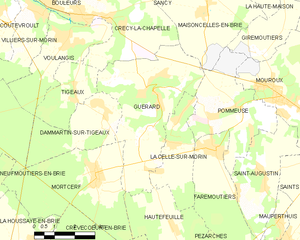
Guérard
- commune in Seine-et-Marne, France
- Country:
- Postal Code: 77580
- Coordinates: 48° 49' 29" N, 2° 57' 29" E
- GPS tracks (wikiloc): [Link]
- Area: 19.8 sq km
- Population: 2366
- Web site: [Link]

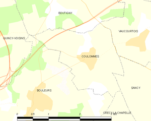
Coulommes
- commune in Seine-et-Marne, France
- Country:
- Postal Code: 77580
- Coordinates: 48° 53' 29" N, 2° 55' 44" E
- GPS tracks (wikiloc): [Link]
- Area: 3.68 sq km
- Population: 414
- Web site: [Link]