Cousances-les-Forges (Cousances-les-Forges)

- commune in Meuse, France
- Country:

- Postal Code: 55170
- Coordinates: 48° 36' 37" N, 5° 5' 3" E


- GPS tracks (wikiloc): [Link]
- AboveSeaLevel: 175 м m
- Area: 18.13 sq km
- Population: 1712
- Web site: http://www.cousanceslesforges.fr
- Wikipedia en: wiki(en)
- Wikipedia: wiki(fr)
- Wikidata storage: Wikidata: Q220738
- Wikipedia Commons Category: [Link]
- Freebase ID: [/m/03qdqbp]
- GeoNames ID: Alt: [3022853]
- SIREN number: [215501321]
- BnF ID: [152647997]
- PACTOLS thesaurus ID: [pcrt74LXUl0RHt]
- INSEE municipality code: 55132
Shares border with regions:

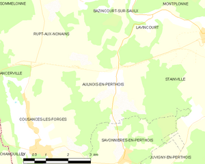
Aulnois-en-Perthois
- commune in Meuse, France
- Country:
- Postal Code: 55170
- Coordinates: 48° 38' 6" N, 5° 7' 45" E
- GPS tracks (wikiloc): [Link]
- Area: 10.75 sq km
- Population: 515


Chamouilley
- commune in Haute-Marne, France
- Country:
- Postal Code: 52410
- Coordinates: 48° 36' 21" N, 5° 2' 39" E
- GPS tracks (wikiloc): [Link]
- Area: 7.81 sq km
- Population: 817


Savonnières-en-Perthois
- commune in Meuse, France
- Country:
- Postal Code: 55170
- Coordinates: 48° 36' 19" N, 5° 7' 56" E
- GPS tracks (wikiloc): [Link]
- Area: 10.07 sq km
- Population: 419


Ancerville
- commune in Meuse, France
- Country:
- Postal Code: 55170
- Coordinates: 48° 38' 9" N, 5° 1' 11" E
- GPS tracks (wikiloc): [Link]
- AboveSeaLevel: 200 м m
- Area: 21.58 sq km
- Population: 2770
- Web site: [Link]

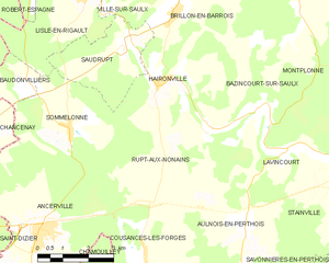
Rupt-aux-Nonains
- commune in Meuse, France
- Country:
- Postal Code: 55170
- Coordinates: 48° 40' 15" N, 5° 6' 50" E
- GPS tracks (wikiloc): [Link]
- Area: 20.4 sq km
- Population: 359
Narcy
- commune in Haute-Marne, France
- Country:
- Postal Code: 52170
- Coordinates: 48° 35' 2" N, 5° 5' 11" E
- GPS tracks (wikiloc): [Link]
- Area: 11.12 sq km
- Population: 255