Cravencères (Cravencères)

- commune in Gers, France
- Country:

- Postal Code: 32110
- Coordinates: 43° 45' 57" N, 0° 2' 9" E


- GPS tracks (wikiloc): [Link]
- Area: 9.09 sq km
- Population: 94
- Wikipedia en: wiki(en)
- Wikipedia: wiki(fr)
- Wikidata storage: Wikidata: Q997130
- Wikipedia Commons Category: [Link]
- Freebase ID: [/m/03nrpl7]
- GeoNames ID: Alt: [6431898]
- SIREN number: [213201130]
- BnF ID: [15255700c]
- INSEE municipality code: 32113
Shares border with regions:

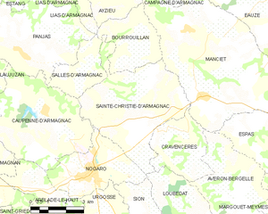
Sainte-Christie-d'Armagnac
- commune in Gers, France
- Country:
- Postal Code: 32370
- Coordinates: 43° 47' 5" N, 0° 0' 31" E
- GPS tracks (wikiloc): [Link]
- Area: 22.5 sq km
- Population: 393


Loubédat
- commune in Gers, France
- Country:
- Postal Code: 32110
- Coordinates: 43° 44' 46" N, 0° 1' 34" E
- GPS tracks (wikiloc): [Link]
- Area: 9.46 sq km
- Population: 112
Manciet
- commune in Gers, France
- Country:
- Postal Code: 32370
- Coordinates: 43° 47' 58" N, 0° 2' 27" E
- GPS tracks (wikiloc): [Link]
- Area: 42.11 sq km
- Population: 805


Avéron-Bergelle
- commune in Gers, France
- Country:
- Postal Code: 32290
- Coordinates: 43° 44' 41" N, 0° 4' 11" E
- GPS tracks (wikiloc): [Link]
- Area: 14.7 sq km
- Population: 149