Creil (Creil)

- commune in Oise, France
- Country:

- Postal Code: 60100
- Coordinates: 49° 15' 28" N, 2° 28' 58" E


- GPS tracks (wikiloc): [Link]
- AboveSeaLevel: 27 м m
- Area: 11.09 sq km
- Population: 35575
- Web site: http://www.mairie-creil.fr
- Wikipedia en: wiki(en)
- Wikipedia: wiki(fr)
- Wikidata storage: Wikidata: Q331087
- Wikipedia Commons Category: [Link]
- Freebase ID: [/m/07_xlr]
- Freebase ID: [/m/07_xlr]
- GeoNames ID: Alt: [6438650]
- GeoNames ID: Alt: [6438650]
- SIREN number: [216001743]
- SIREN number: [216001743]
- BnF ID: [15267414x]
- BnF ID: [15267414x]
- VIAF ID: Alt: [153615862]
- VIAF ID: Alt: [153615862]
- GND ID: Alt: [4218459-9]
- GND ID: Alt: [4218459-9]
- Library of Congress authority ID: Alt: [n81078221]
- Library of Congress authority ID: Alt: [n81078221]
- MusicBrainz area ID: [d2c91bb3-f5d6-4dad-9414-894db1a865d5]
- MusicBrainz area ID: [d2c91bb3-f5d6-4dad-9414-894db1a865d5]
- Quora topic ID: [Creil]
- Quora topic ID: [Creil]
- Encyclopædia Britannica Online ID: [place/Creil]
- Encyclopædia Britannica Online ID: [place/Creil]
- NKCR AUT ID: [ge949873]
- NKCR AUT ID: [ge949873]
- YouTube channel ID: [UCpjK6NhgTDOb4CAekSiVV3Q]
- YouTube channel ID: [UCpjK6NhgTDOb4CAekSiVV3Q]
- INSEE municipality code: 60175
- INSEE municipality code: 60175
Shares border with regions:


Verneuil-en-Halatte
- commune in Oise, France
- Country:
- Postal Code: 60550
- Coordinates: 49° 16' 35" N, 2° 31' 20" E
- GPS tracks (wikiloc): [Link]
- Area: 22.26 sq km
- Population: 4690
- Web site: [Link]

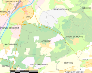
Apremont
- commune in Oise, France
- Country:
- Postal Code: 60300
- Coordinates: 49° 13' 24" N, 2° 30' 32" E
- GPS tracks (wikiloc): [Link]
- Area: 13.62 sq km
- Population: 679
- Web site: [Link]

Saint-Maximin
- commune in Oise, France
- Country:
- Postal Code: 60740
- Coordinates: 49° 13' 16" N, 2° 26' 48" E
- GPS tracks (wikiloc): [Link]
- Area: 12.33 sq km
- Population: 3119
- Web site: [Link]


Nogent-sur-Oise
- commune in Oise, France
- Country:
- Postal Code: 60180
- Coordinates: 49° 16' 29" N, 2° 28' 3" E
- GPS tracks (wikiloc): [Link]
- Area: 7.46 sq km
- Population: 19414
- Web site: [Link]


Montataire
- commune in Oise, France
- Country:
- Postal Code: 60160
- Coordinates: 49° 15' 20" N, 2° 26' 18" E
- GPS tracks (wikiloc): [Link]
- Area: 10.66 sq km
- Population: 13360
- Web site: [Link]