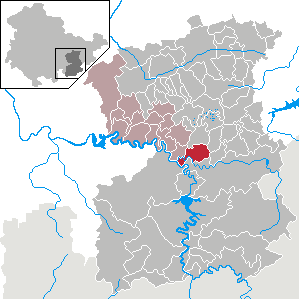
Crispendorf (Crispendorf)
- municipality of Germany
Crispendorf is a picturesque village located in the Thuringian Forest in Germany. It's a great destination for hikers due to its beautiful landscapes, rich flora and fauna, and well-marked trails. Here are some key points to consider when hiking in Crispendorf:
Trails and Routes
-
Well-Marked Trails: The region has a variety of hiking trails that vary in difficulty and length. Most trails are well-signposted, making it easy for hikers to navigate the area.
-
Scenic Views: Hiking in Crispendorf offers beautiful views of the surrounding forest, valleys, and sometimes even glimpses of the distant mountains.
-
Nature Highlights: As you hike, you can expect to see diverse plant life and, if you're lucky, some local wildlife. The Thuringian Forest is known for its rich biodiversity.
-
Typical Routes: Popular hikes include routes leading to nearby peaks or attractions, such as the Rennsteig, the most famous hiking trail in Thuringia, which runs through the Thuringian Forest.
Preparation
-
Weather Conditions: Be mindful of the weather, as it can change rapidly in the forest. Check forecasts before heading out and dress in layers.
-
Footwear: Proper hiking boots are essential for comfort and safety. The terrain can be rugged in parts, so make sure you have good grip.
-
Supplies: Bring enough water and snacks, especially if planning a longer hike. A backpack with essentials like a first aid kit, map, and compass is recommended.
-
Local Information: It's a good idea to stop by any local tourist information centers for maps and up-to-date advice on trail conditions.
Safety Tips
-
Stay on Marked Trails: To minimize your impact on the environment and for your safety, always stick to designated trails.
-
Group Hiking: If possible, hike with a friend or group. This enhances safety and makes the experience more enjoyable.
-
Wildlife Awareness: Be respectful of nature and keep a safe distance from any wildlife you encounter.
Hiking in Crispendorf offers a wonderful opportunity to connect with nature and explore the scenic beauty of the Thuringian Forest. Whether you are an experienced hiker or a beginner, there's a trail suited for everyone. Enjoy your hiking adventure!
- Country:

- Postal Code: 07924
- Local Dialing Code: 03663
- Licence Plate Code: SOK
- Coordinates: 50° 36' 0" N, 11° 44' 0" E


- GPS tracks (wikiloc): [Link]
- AboveSeaLevel: 430 м m
- Area: 11.31 sq km
- Population: 378
- Web site: http://www.vg-ranis-ziegenrueck.de/
- Wikipedia en: wiki(en)
- Wikipedia: wiki(de)
- Wikidata storage: Wikidata: Q472998
- Wikipedia Commons Category: [Link]
- Freebase ID: [/m/03cddbd]
- GeoNames ID: Alt: [2939742]
- VIAF ID: Alt: [233947550]
- OSM relation ID: [2179155]
- GND ID: Alt: [7711785-2]
- Historical Gazetteer (GOV) ID: [CRIORFJO50UO]
- German municipality key: 16075013
Shares border with regions:


Schleiz
- municipality of Germany
Schleiz, located in the Thuringia region of Germany, offers a lovely setting for hiking enthusiasts with its picturesque landscapes, rolling hills, and diverse natural beauty. Here’s what you can expect when hiking in the Schleiz area:...
- Country:

- Postal Code: 07907
- Local Dialing Code: 036647; 036645; 03663
- Coordinates: 50° 35' 0" N, 11° 49' 0" E


- GPS tracks (wikiloc): [Link]
- AboveSeaLevel: 432 м m
- Area: 83.15 sq km
- Population: 8464
- Web site: [Link]

