Saale-Orla-Kreis (Saale-Orla-Kreis)

- district in Thuringia, Germany
 Hiking in Saale-Orla-Kreis
Hiking in Saale-Orla-Kreis, located in the Free State of Thuringia, Germany, offers a wonderful experience for outdoor enthusiasts. The region is characterized by its diverse landscapes, which include rolling hills, dense forests, vibrant meadows, and charming villages. Here’s a brief overview of what hikers can expect in this area:
Trails and Routes
-
Hiking Trails: Saale-Orla-Kreis features a well-maintained network of hiking trails that cater to various experience levels. Popular trails include the Thuringian Forest Trail and several local paths that weave through the natural scenery.
-
Scenic Views: The region is known for its panoramic views, particularly from higher elevations. Look out for vantage points where you can admire the Saale River valley and the surrounding countryside.
-
Nature Parks: The area is near several natural reserves and parks, such as the Thuringian Forest Nature Park, which provides opportunities for longer treks and immersion in nature.
Flora and Fauna
-
Biodiversity: Hikers will encounter diverse flora and fauna, including ancient beech forests, wildflowers, and various bird species, making it a great spot for nature lovers and birdwatchers.
-
Seasonal Changes: Each season offers a different experience. Spring brings blooming flowers, summer provides lush greenery, autumn showcases a riot of colors, and winter offers a serene, quiet beauty.
Local Culture and Attractions
-
Historical Sites: Along the hiking trails, you may come across historical sites, such as castles, churches, and remnants of old fortifications, which add cultural richness to the hiking experience.
-
Culinary Delights: Don’t miss the opportunity to stop at local inns or guesthouses to try traditional Thuringian cuisine, such as Thüringer bratwurst or cabbage dishes.
Safety and Preparation
-
Maps and Guides: It’s essential to have a good map or guidebook, as trail markings can vary. Local tourist information centers can provide updated maps and suggestions for routes.
-
Weather Preparedness: Be prepared for changing weather conditions, especially in the hilly areas. Dress in layers and make sure to bring rain gear if necessary.
Accessibility
- Getting There: The Saale-Orla-Kreis is accessible by public transport, with train and bus services linking to nearby cities. Consider using local transport to reach trailheads.
Overall, hiking in Saale-Orla-Kreis can be a rewarding experience filled with natural beauty, cultural insights, and opportunities for adventure. Whether you’re looking for a leisurely stroll or a challenging hike, this region has something to offer for every hiker.
- Country:

- Capital: Schleiz
- Licence Plate Code: SOK
- Coordinates: 50° 34' 48" N, 11° 45' 0" E


- GPS tracks (wikiloc): [Link]
- AboveSeaLevel: 472 м m
- Area: 1151.3 sq km
- Population: 82951
- Web site: http://www.saale-orla-kreis.de/
- Wikipedia en: wiki(en)
- Wikipedia: wiki(de)
- Wikidata storage: Wikidata: Q7883
- Wikipedia Commons Category: [Link]
- Wikipedia Commons Maps Category: [Link]
- Freebase ID: [/m/01zbxq]
- GeoNames ID: Alt: [6547394]
- VIAF ID: Alt: [236986539]
- OSM relation ID: [62339]
- GND ID: Alt: [4393699-4]
- archINFORM location ID: [5679]
- NUTS code: [DEG0K]
- BabelNet ID: [02865877n]
- German district key: 16075
Includes regions:
Triptis
- municipal association in Thuringia, Germany
Hiking in Triptis
Triptis, located in the Thuringia region of Germany, offers some scenic hiking opportunities that are perfect for outdoor enthusiasts looking to explore the natural beauty of the area. The region is characterized by its picturesque landscapes, including forests, rolling hills, and panoramic views....


Pößneck
- town in Thuringia, Germany
Hiking in Pößneck
Pößneck is a small town located in the Thuringia region of Germany. While it may not be as well-known for hiking as some larger areas, the surrounding landscapes offer beautiful trails suitable for outdoor enthusiasts. Here are some key highlights for hiking in and around Pößneck:...
- Country:
- Postal Code: 07381
- Local Dialing Code: 03647
- Licence Plate Code: LBS; SCZ; PN; SOK
- Coordinates: 50° 42' 0" N, 11° 36' 0" E
- GPS tracks (wikiloc): [Link]
- AboveSeaLevel: 220 м m
- Area: 24 sq km
- Population: 11981
- Web site: [Link]


Neustadt an der Orla
- municipality of Germany
Hiking in Neustadt an der Orla
Neustadt an der Orla is a charming town located in the Thuringia region of Germany, surrounded by beautiful landscapes that make it an excellent destination for hiking enthusiasts. The town is nestled in the picturesque Orla valley, offering a variety of trails and scenic views that cater to different skill levels....
- Country:
- Postal Code: 07806
- Local Dialing Code: 036481
- Licence Plate Code: SOK
- Coordinates: 50° 44' 0" N, 11° 45' 0" E
- GPS tracks (wikiloc): [Link]
- AboveSeaLevel: 300 м m
- Area: 36.52 sq km
- Population: 8026
- Web site: [Link]


Bad Lobenstein
- municipality of Germany
Hiking in Bad Lobenstein
Bad Lobenstein, located in the Thuringia region of Germany, offers a beautiful setting for hiking enthusiasts. Known for its picturesque landscapes, rolling hills, and dense forests, this small spa town serves as a great base for various hiking trails....
- Country:
- Postal Code: 07356
- Local Dialing Code: 036651
- Coordinates: 50° 27' 8" N, 11° 38' 21" E
- GPS tracks (wikiloc): [Link]
- AboveSeaLevel: 560 м m
- Area: 48.94 sq km
- Population: 5997
- Web site: [Link]


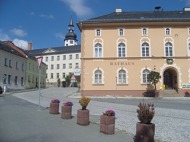
Schleiz
- municipality of Germany
Hiking in Schleiz
Schleiz, located in the Thuringia region of Germany, offers a lovely setting for hiking enthusiasts with its picturesque landscapes, rolling hills, and diverse natural beauty. Here’s what you can expect when hiking in the Schleiz area:...
- Country:
- Postal Code: 07907
- Local Dialing Code: 036647; 036645; 03663
- Coordinates: 50° 35' 0" N, 11° 49' 0" E
- GPS tracks (wikiloc): [Link]
- AboveSeaLevel: 432 м m
- Area: 83.15 sq km
- Population: 8464
- Web site: [Link]


Saalburg-Ebersdorf
- municipality of Germany
Hiking in Saalburg-Ebersdorf
Saalburg-Ebersdorf, located in Thuringia, Germany, is a fantastic destination for hiking enthusiasts due to its beautiful landscapes, historical significance, and diverse trails. Here are some key points to consider if you're planning a hiking trip in this area:...
- Country:
- Postal Code: 07929
- Local Dialing Code: 036651; 036647
- Licence Plate Code: SOK
- Coordinates: 50° 29' 30" N, 11° 42' 0" E
- GPS tracks (wikiloc): [Link]
- AboveSeaLevel: 431 м m
- Area: 72.05 sq km
- Population: 3442
- Web site: [Link]


Gefell
- municipality of Germany
Hiking in Gefell
Gefell is a small municipality located in Thuringia, Germany, surrounded by beautiful natural landscapes, making it a great spot for hiking enthusiasts. The region features a variety of trails that cater to different skill levels, from leisurely walks to more challenging hikes....
- Country:
- Postal Code: 07926
- Local Dialing Code: 036649
- Licence Plate Code: SOK
- Coordinates: 50° 26' 0" N, 11° 51' 0" E
- GPS tracks (wikiloc): [Link]
- AboveSeaLevel: 550 м m
- Area: 45.21 sq km
- Population: 2465
- Web site: [Link]


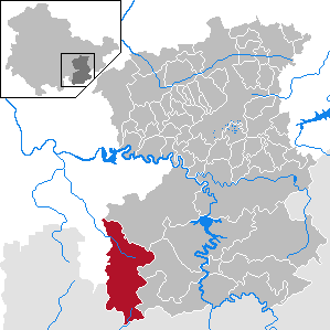
Remptendorf
- municipality of Germany
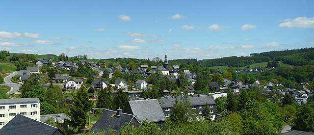
Hiking in Remptendorf
Remptendorf is a small village located in the Thuringia region of Germany, surrounded by beautiful landscapes that are perfect for hiking. If you're looking to explore this area, here are some points to consider:...
- Country:
- Postal Code: 07368
- Local Dialing Code: 036652; 036651; 036643; 036640
- Licence Plate Code: SOK
- Coordinates: 50° 32' 0" N, 11° 39' 0" E
- GPS tracks (wikiloc): [Link]
- AboveSeaLevel: 490 м m
- Area: 97.32 sq km
- Population: 3419
- Web site: [Link]
Wurzbach
- municipality of Germany
Hiking in Wurzbach
Wurzbach, located in the Thuringian Forest region of Germany, offers a variety of hiking opportunities that cater to all levels of outdoor enthusiasts. Here are some key highlights about hiking in Wurzbach:...
- Country:
- Postal Code: 07343
- Local Dialing Code: 036652
- Licence Plate Code: SOK
- Coordinates: 50° 27' 50" N, 11° 32' 12" E
- GPS tracks (wikiloc): [Link]
- AboveSeaLevel: 525 м m
- Area: 72.31 sq km
- Population: 3159
- Web site: [Link]

Krölpa
- municipality of Germany
Hiking in Krölpa
Krölpa is a beautiful area in Germany that offers a variety of hiking opportunities, characterized by its stunning landscapes and rich natural beauty. It's especially popular among those who love to explore forested areas, hills, and rivers....
- Country:
- Postal Code: 07387
- Local Dialing Code: 03647
- Licence Plate Code: SOK
- Coordinates: 50° 40' 39" N, 11° 32' 19" E
- GPS tracks (wikiloc): [Link]
- AboveSeaLevel: 250 м m
- Area: 42.23 sq km
- Population: 2587
- Web site: [Link]

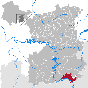
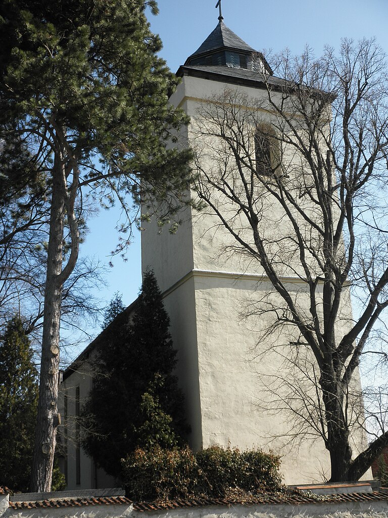
Hirschberg
- place in Thuringia, Germany
Hiking in Hirschberg
Hirschberg, located in the Thuringia region of Germany, is a beautiful destination for hiking enthusiasts. This area is characterized by its scenic landscapes, lush forests, and rolling hills, making it perfect for both casual strolls and more challenging hikes....
- Country:
- Postal Code: 07927
- Local Dialing Code: 036644
- Licence Plate Code: SOK
- Coordinates: 50° 24' 21" N, 11° 49' 12" E
- GPS tracks (wikiloc): [Link]
- AboveSeaLevel: 454 м m
- Area: 24.12 sq km
- Population: 2121
- Web site: [Link]

Tanna
- municipality of Germany
Hiking in Tanna
Tanna, located in the state of Thuringia, Germany, is a small town surrounded by beautiful countryside, making it a lovely spot for hiking and enjoying nature. Here are some highlights for hiking in and around Tanna:...
- Country:
- Postal Code: 07922
- Local Dialing Code: 036646
- Licence Plate Code: SOK
- Coordinates: 50° 29' 40" N, 11° 51' 40" E
- GPS tracks (wikiloc): [Link]
- AboveSeaLevel: 542 м m
- Area: 87.18 sq km
- Population: 3612
- Web site: [Link]
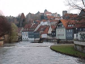
Saale-Rennsteig
- municipal association in Thuringia, Germany
Hiking in Saale-Rennsteig
The Saale-Rennsteig region, located in central Germany, is a wonderful destination for hiking enthusiasts. It offers a blend of scenic beauty, diverse landscapes, and rich cultural history. Here’s an overview of what you can expect when hiking in the Saale-Rennsteig area:...
- Country:
- Coordinates: 50° 24' 6" N, 11° 41' 55" E
- GPS tracks (wikiloc): [Link]
Oppurg
- municipal association in Thuringia, Germany
Hiking in Oppurg
Oppurg, located in the German state of Thuringia, offers a variety of hiking opportunities that showcase the natural beauty and diverse landscapes of the region. The area is characterized by rolling hills, dense forests, and picturesque valleys, making it an appealing destination for hikers of all skill levels....
- Country:
- Coordinates: 50° 42' 0" N, 11° 39' 0" E
- GPS tracks (wikiloc): [Link]
Seenplatte
- municipal association in Thuringia, Germany
Hiking in Seenplatte
Seenplatte, often referred to as the "Lake Plate," is a beautiful region in Switzerland characterized by its stunning lakes, lush landscapes, and diverse hiking trails. It’s a popular destination for outdoor enthusiasts looking to explore the natural beauty of the Swiss countryside....
- Country:
- Coordinates: 50° 39' 0" N, 11° 47' 0" E
- GPS tracks (wikiloc): [Link]

Ranis-Ziegenrück
- municipal association in Thuringia, Germany
Hiking in Ranis-Ziegenrück
Ranis and Ziegenrück, located in the Thuringia region of Germany, are beautiful areas that offer a variety of hiking opportunities. The landscape is characterized by rolling hills, dense forests, and scenic views, making it an excellent destination for outdoor enthusiasts....
Shares border with regions:

Hof
- district in Bavaria, Germany
Hiking in Hof
Hof is a district located in Bavaria, Germany, known for its scenic landscapes, charming towns, and outdoor recreational opportunities. The region offers various hiking trails that cater to different skill levels, making it a great destination for both beginners and experienced hikers....
- Country:
- Capital: Hof
- Licence Plate Code: SAN; REH; NAI; MÜB; HO
- Coordinates: 50° 15' 0" N, 11° 49' 48" E
- GPS tracks (wikiloc): [Link]
- AboveSeaLevel: 581 м m
- Area: 893.00 sq km
- Population: 105628
- Web site: [Link]
Kronach
- district in Bavaria, Germany
Hiking in Kronach
Kronach, located in Bavaria, Germany, is an excellent destination for hiking enthusiasts. The district is characterized by its beautiful landscapes, rich history, and diverse trails suitable for all levels of hikers. Here are some highlights regarding hiking in Kronach:...
- Country:
- Capital: Kronach
- Licence Plate Code: SAN; KC
- Coordinates: 50° 19' 48" N, 11° 22' 12" E
- GPS tracks (wikiloc): [Link]
- AboveSeaLevel: 412 м m
- Area: 651.00 sq km
- Population: 75353
- Web site: [Link]