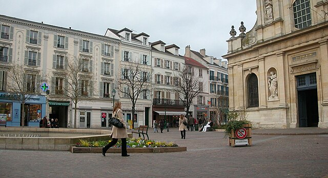
Croissy-sur-Seine (Croissy-sur-Seine)

- commune in Yvelines, France
- Country:

- Postal Code: 78290
- Coordinates: 48° 52' 40" N, 2° 8' 32" E


- GPS tracks (wikiloc): [Link]
- Area: 3.44 sq km
- Population: 10046
- Web site: https://www.croissy.com/
- Wikipedia en: wiki(en)
- Wikipedia: wiki(fr)
- Wikidata storage: Wikidata: Q491391
- Wikipedia Commons Category: [Link]
- Freebase ID: [/m/03x0jf]
- Freebase ID: [/m/03x0jf]
- GeoNames ID: Alt: [6443950]
- GeoNames ID: Alt: [6443950]
- SIREN number: [217801901]
- SIREN number: [217801901]
- BnF ID: [15275941x]
- BnF ID: [15275941x]
- VIAF ID: Alt: [123135512]
- VIAF ID: Alt: [123135512]
- GND ID: Alt: [4302566-3]
- GND ID: Alt: [4302566-3]
- Library of Congress authority ID: Alt: [n82117003]
- Library of Congress authority ID: Alt: [n82117003]
- MusicBrainz area ID: [e27b879d-d4fc-4138-ae9e-2f79fef46f50]
- MusicBrainz area ID: [e27b879d-d4fc-4138-ae9e-2f79fef46f50]
- WOEID: [587990]
- WOEID: [587990]
- Twitter username: Alt: [VilleCroissy]
- Twitter username: Alt: [VilleCroissy]
- INSEE municipality code: 78190
- INSEE municipality code: 78190
Shares border with regions:


Le Port-Marly
- commune in Yvelines, France
- Country:
- Postal Code: 78560
- Coordinates: 48° 52' 45" N, 2° 6' 35" E
- GPS tracks (wikiloc): [Link]
- Area: 1.44 sq km
- Population: 5453
- Web site: [Link]

Rueil-Malmaison
- commune in Hauts-de-Seine, France
- Country:
- Postal Code: 92500
- Coordinates: 48° 52' 40" N, 2° 11' 18" E
- GPS tracks (wikiloc): [Link]
- Area: 14.7 sq km
- Population: 78794
- Web site: [Link]

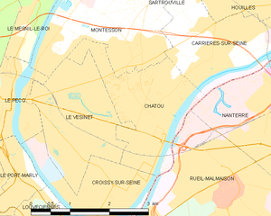
Chatou
- commune in Yvelines, France
- Country:
- Postal Code: 78400
- Coordinates: 48° 53' 26" N, 2° 9' 25" E
- GPS tracks (wikiloc): [Link]
- Area: 5.08 sq km
- Population: 31058
- Web site: [Link]


Le Pecq
- commune in Yvelines, France
- Country:
- Postal Code: 78230
- Coordinates: 48° 53' 48" N, 2° 6' 22" E
- GPS tracks (wikiloc): [Link]
- Area: 2.84 sq km
- Population: 16131
- Web site: [Link]


Bougival
- commune in Yvelines, France
- Country:
- Postal Code: 78380
- Coordinates: 48° 51' 54" N, 2° 8' 22" E
- GPS tracks (wikiloc): [Link]
- Area: 2.76 sq km
- Population: 8798
- Web site: [Link]


Le Vésinet
- commune in Yvelines, France
- Country:
- Postal Code: 78110
- Coordinates: 48° 53' 38" N, 2° 7' 56" E
- GPS tracks (wikiloc): [Link]
- Area: 5 sq km
- Population: 15884
- Web site: [Link]

Louveciennes
- commune in Yvelines, France
- Country:
- Postal Code: 78431
- Coordinates: 48° 51' 37" N, 2° 6' 59" E
- GPS tracks (wikiloc): [Link]
- Area: 5.37 sq km
- Population: 7143
- Web site: [Link]