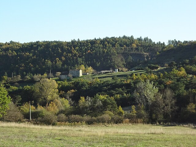
Cruis (Cruis)
- commune in Alpes-de-Haute-Provence, France
Cruis, a picturesque village located in the Provence-Alpes-Côte d'Azur region of France, offers a charming landscape for hiking enthusiasts. The area boasts rolling hills, olive groves, and scenic views characteristic of southern France. Here are some highlights regarding hiking in and around Cruis:
Trails and Scenery
-
Diverse Terrain: Hiking trails in Cruis often include varied terrain, from gentle valleys to more rugged hills, allowing for hikes suitable for different levels of experience.
-
Cultural Route: Some trails pass by historical sites and traditional Provencal architecture, giving hikers a glimpse of local culture alongside natural beauty.
-
Nearby Natural Parks: Cruis is close to the Luberon Regional Park and the Verdon Gorge, where more challenging hikes can be found. These areas offer stunning landscapes, including cliffs, rivers, and unique rock formations.
Best Times to Hike
- Spring and Fall: These seasons provide mild weather and blooming flora, making them ideal for hiking. Summer can be hot, so early morning hikes are recommended during this time.
Preparation Tips
- Footwear: Sturdy hiking boots are recommended, especially for more rugged trails.
- Hydration: Always bring enough water, particularly on warmer days. Some trails may have limited access to natural water sources.
- Navigation: While many popular trails are marked, having a map or GPS device can be helpful.
Local Amenities
- Visitor Centers: Check out local tourist information centers for maps and advice on guided hikes.
- Accommodations: Cruis and surrounding villages offer a range of accommodations, from hotels to charming bed-and-breakfasts, making it a great base for hiking excursions.
Community Events
- Look out for local hiking events or guided tours that might be taking place during your visit, which can provide a deeper insight into the area's natural and cultural history.
Whether you're looking for a leisurely stroll through the olive groves or seeking a more challenging trek in the nearby mountains, Cruis and its surroundings offer something for every hiking enthusiast. Always ensure to follow local guidelines and respect nature during your hikes.
- Country:

- Postal Code: 04230
- Coordinates: 44° 3' 45" N, 5° 50' 9" E


- GPS tracks (wikiloc): [Link]
- Area: 36.47 sq km
- Population: 645
- Wikipedia en: wiki(en)
- Wikipedia: wiki(fr)
- Wikidata storage: Wikidata: Q865554
- Wikipedia Commons Category: [Link]
- Freebase ID: [/m/03m7wg7]
- Freebase ID: [/m/03m7wg7]
- GeoNames ID: Alt: [3022225]
- GeoNames ID: Alt: [3022225]
- SIREN number: [210400651]
- SIREN number: [210400651]
- INSEE municipality code: 04065
- INSEE municipality code: 04065
Shares border with regions:

Saint-Étienne-les-Orgues
- commune in Alpes-de-Haute-Provence, France
 Hiking in Saint-Étienne-les-Orgues
Saint-Étienne-les-Orgues is a picturesque village located in the Alpes-de-Haute-Provence region of southern France. It lies in a beautiful natural setting, surrounded by diverse landscapes, which makes it a great destination for hiking enthusiasts. Here are some key points about hiking in this area:...
- Country:

- Postal Code: 04230
- Coordinates: 44° 2' 46" N, 5° 46' 49" E


- GPS tracks (wikiloc): [Link]
- Area: 48.42 sq km
- Population: 1249
- Web site: [Link]

Valbelle
- commune in Alpes-de-Haute-Provence, France
Valbelle, located in France, is known for its natural beauty and scenic hiking trails. While it may not be one of the most famous hiking destinations, it offers a variety of experiences for hikers of all levels....
- Country:

- Postal Code: 04200
- Coordinates: 44° 8' 52" N, 5° 52' 54" E


- GPS tracks (wikiloc): [Link]
- AboveSeaLevel: 580 м m
- Area: 32.99 sq km
- Population: 271

Mallefougasse-Augès
- commune in Alpes-de-Haute-Provence, France
Mallefougasse-Augès is a charming village located in the Provence-Alpes-Côte d'Azur region of southeastern France. It's situated near the Luberon Regional Natural Park, which offers excellent opportunities for hiking, thanks to its diverse landscapes, picturesque villages, and rich flora and fauna....
- Country:

- Postal Code: 04230
- Coordinates: 44° 3' 58" N, 5° 53' 52" E


- GPS tracks (wikiloc): [Link]
- AboveSeaLevel: 700 м m
- Area: 19.71 sq km
- Population: 326

Montlaux
- commune in Alpes-de-Haute-Provence, France
Montlaux is a charming destination for hiking enthusiasts, located in the Provence-Alpes-Côte d'Azur region of France. Nestled in the picturesque Verdon region, it offers a variety of trails that cater to different levels of hikers, from beginners to experienced trekkers....
- Country:

- Postal Code: 04230
- Coordinates: 44° 2' 49" N, 5° 50' 40" E


- GPS tracks (wikiloc): [Link]
- AboveSeaLevel: 550 м m
- Area: 19.75 sq km
- Population: 143

Noyers-sur-Jabron
- commune in Alpes-de-Haute-Provence, France
Noyers-sur-Jabron is a charming village located in the Provence-Alpes-Côte d'Azur region of southeastern France, known for its picturesque landscapes, historical architecture, and natural beauty. Hiking in this area offers a variety of trails that cater to different skill levels, making it a great destination for both novice and experienced hikers....
- Country:

- Postal Code: 04200
- Coordinates: 44° 10' 8" N, 5° 49' 41" E


- GPS tracks (wikiloc): [Link]
- Area: 56.58 sq km
- Population: 510