Saint-Étienne-les-Orgues (Saint-Étienne-les-Orgues)
- commune in Alpes-de-Haute-Provence, France
 Hiking in Saint-Étienne-les-Orgues
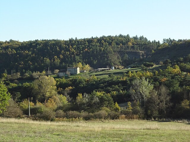
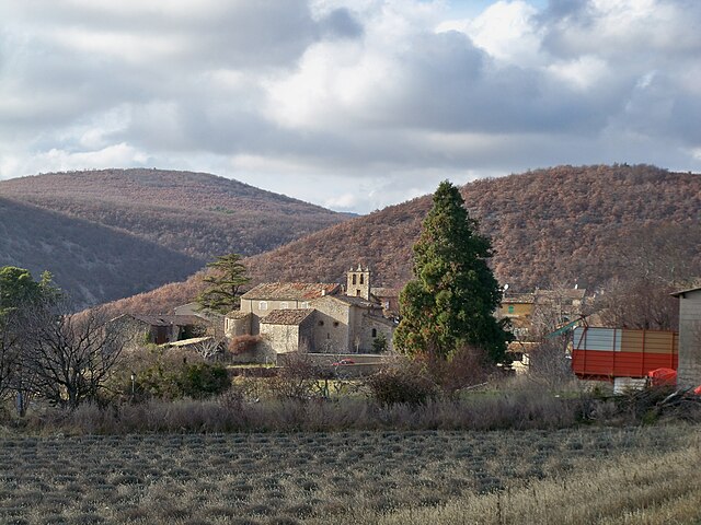
Saint-Étienne-les-Orgues is a picturesque village located in the Alpes-de-Haute-Provence region of southern France. It lies in a beautiful natural setting, surrounded by diverse landscapes, which makes it a great destination for hiking enthusiasts. Here are some key points about hiking in this area:
Scenic Trails
- Variety of Hiking Paths: The region offers a variety of trails suitable for all levels of hikers, from beginners to experienced trekkers. You'll find routes that take you through forests, along rivers, and up to panoramic viewpoints.
- Natural Landscapes: The hikes often feature stunning views of the surrounding mountains, valleys, and colorful wildflowers, especially in the spring and summer months.
Points of Interest
- Luberon National Park: Close to Saint-Étienne-les-Orgues, the Luberon National Park offers extensive trails with breathtaking vistas and opportunities to explore local flora and fauna.
- Historical Sites: Along your hikes, you may encounter historical landmarks, churches, and remnants of ancient villages that add cultural depth to your outdoor experience.
Tips for Hiking
- Prepare for Varying Terrain: Be ready for a mix of terrains, including rocky paths and steep inclines. Good hiking boots are essential.
- Check Local Conditions: Weather in the region can change quickly, so it’s wise to check forecasts and local advice before setting out.
- Stay Hydrated: Bring plenty of water, especially during the warmer months, as some trails may not have water sources.
- Map and Navigation: While many trails are well-marked, carrying a map or using a GPS app is recommended for safety and to enhance your exploration.
Local Resources
- Guided Hikes: If you're unsure about navigating the trails or want to learn more about the local ecology, consider joining a guided hike. Local guides can provide insights into the area’s history and natural features.
- Visitor Information: The local tourism office can offer maps, brochures, and advice on the best hiking options tailored to your skill level and interests.
Accessibility
- Family-Friendly Options: There are also family-friendly trails that are manageable for children and offer educational opportunities about the local environment.
Whether you are looking for a peaceful stroll or a challenging adventure, hiking in Saint-Étienne-les-Orgues can be a rewarding experience filled with natural beauty and cultural richness. Enjoy your hiking adventure!
- Country:

- Postal Code: 04230
- Coordinates: 44° 2' 46" N, 5° 46' 49" E


- GPS tracks (wikiloc): [Link]
- Area: 48.42 sq km
- Population: 1249
- Web site: http://www.saint-etienne-les-orgues.fr
- Wikipedia en: wiki(en)
- Wikipedia: wiki(fr)
- Wikidata storage: Wikidata: Q1016716
- Wikipedia Commons Category: [Link]
- Freebase ID: [/m/03m7xcg]
- Freebase ID: [/m/03m7xcg]
- GeoNames ID: Alt: [2980220]
- GeoNames ID: Alt: [2980220]
- SIREN number: [210401782]
- SIREN number: [210401782]
- VIAF ID: Alt: [141170675]
- VIAF ID: Alt: [141170675]
- Library of Congress authority ID: Alt: [nr95038685]
- Library of Congress authority ID: Alt: [nr95038685]
- WOEID: [623937]
- WOEID: [623937]
- INSEE municipality code: 04178
- INSEE municipality code: 04178
Shares border with regions:

Saint-Vincent-sur-Jabron
- commune in Alpes-de-Haute-Provence, France
 Hiking in Saint-Vincent-sur-Jabron
Saint-Vincent-sur-Jabron is a charming village situated in the Provence-Alpes-Côte d'Azur region of France. The area is known for its stunning natural scenery, including rolling hills, vineyards, and the nearby Jabron River, making it a great destination for hiking enthusiasts....
- Country:

- Postal Code: 04200
- Coordinates: 44° 10' 15" N, 5° 44' 31" E


- GPS tracks (wikiloc): [Link]
- Area: 30.2 sq km
- Population: 199

Revest-Saint-Martin
- commune in Alpes-de-Haute-Provence, France
Revest-Saint-Martin, located in the Provence-Alpes-Côte d'Azur region of southeastern France, offers beautiful hiking opportunities amid stunning natural landscapes. The area is characterized by its diverse topography, including hills, forests, and panoramic views of the surrounding mountains and valleys....
- Country:

- Postal Code: 04230
- Coordinates: 44° 0' 41" N, 5° 49' 36" E


- GPS tracks (wikiloc): [Link]
- Area: 7.56 sq km
- Population: 69

Ongles
- commune in Alpes-de-Haute-Provence, France
Ongles, located in the Alpes-de-Haute-Provence region of France, offers a unique hiking experience characterized by stunning landscapes, charming rustic villages, and a rich natural environment. Whether you're an experienced hiker or a beginner, you'll find various trails that cater to different skill levels....
- Country:

- Postal Code: 04230
- Coordinates: 44° 1' 40" N, 5° 44' 1" E


- GPS tracks (wikiloc): [Link]
- Area: 31.46 sq km
- Population: 363

Montlaux
- commune in Alpes-de-Haute-Provence, France
Montlaux is a charming destination for hiking enthusiasts, located in the Provence-Alpes-Côte d'Azur region of France. Nestled in the picturesque Verdon region, it offers a variety of trails that cater to different levels of hikers, from beginners to experienced trekkers....
- Country:

- Postal Code: 04230
- Coordinates: 44° 2' 49" N, 5° 50' 40" E


- GPS tracks (wikiloc): [Link]
- AboveSeaLevel: 550 м m
- Area: 19.75 sq km
- Population: 143

Cruis
- commune in Alpes-de-Haute-Provence, France
Cruis, a picturesque village located in the Provence-Alpes-Côte d'Azur region of France, offers a charming landscape for hiking enthusiasts. The area boasts rolling hills, olive groves, and scenic views characteristic of southern France. Here are some highlights regarding hiking in and around Cruis:...
- Country:

- Postal Code: 04230
- Coordinates: 44° 3' 45" N, 5° 50' 9" E


- GPS tracks (wikiloc): [Link]
- Area: 36.47 sq km
- Population: 645

Fontienne
- commune in Alpes-de-Haute-Provence, France
Fontienne is not a widely known hiking destination, so it's possible that you're referring to a specific area or a local trail that has not gained significant recognition outside its immediate region. Here are some general guidelines and tips for hiking in lesser-known areas that may apply to hiking in Fontienne or similar locations:...
- Country:

- Postal Code: 04230
- Coordinates: 44° 0' 32" N, 5° 47' 36" E


- GPS tracks (wikiloc): [Link]
- Area: 8.18 sq km
- Population: 129

Lardiers
- commune in Alpes-de-Haute-Provence, France
Lardiers is a small village located in the Alpes-de-Haute-Provence region of France. It's known for its picturesque scenery and offers a variety of hiking opportunities that cater to different skill levels. Here are some key points to consider when hiking in and around Lardiers:...
- Country:

- Postal Code: 04230
- Coordinates: 44° 3' 25" N, 5° 42' 44" E


- GPS tracks (wikiloc): [Link]
- Area: 30.08 sq km
- Population: 112

Noyers-sur-Jabron
- commune in Alpes-de-Haute-Provence, France
Noyers-sur-Jabron is a charming village located in the Provence-Alpes-Côte d'Azur region of southeastern France, known for its picturesque landscapes, historical architecture, and natural beauty. Hiking in this area offers a variety of trails that cater to different skill levels, making it a great destination for both novice and experienced hikers....
- Country:

- Postal Code: 04200
- Coordinates: 44° 10' 8" N, 5° 49' 41" E


- GPS tracks (wikiloc): [Link]
- Area: 56.58 sq km
- Population: 510