Cuveglio (Cuveglio)
.svg)
- Italian comune
 Hiking in Cuveglio
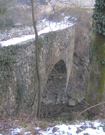
Cuveglio is a charming town located in the Lombardy region of Italy, near the larger city of Varese and the scenic Lake Maggiore. The area surrounding Cuveglio boasts beautiful landscapes, including hills, forests, and pathways perfect for hiking enthusiasts. Here are some key points about hiking in Cuveglio:
Trail Options
- Local Trails: Cuveglio has a variety of local trails that range in difficulty. You can find easier paths for family hikes as well as more challenging routes for seasoned hikers.
- Monte Bsa: This mountain offers trails with stunning views of the surrounding valleys and lakes. It's a popular spot for hikers seeking panoramic vistas.
- Connecting Paths: Cuveglio is well connected to a network of hiking trails that lead to nearby towns and natural sites, allowing for longer hikes that can explore more of the region.
Natural Features
- Forests: Many routes take you through lush woodlands, providing a sense of tranquility and the chance to see local wildlife.
- Rivers and Streams: Hikes often feature beautiful waterways, with opportunities for rest and reflection.
- Scenic Views: The elevation provides ample opportunities to enjoy breathtaking views of the surrounding countryside, especially during clear days.
Practical Considerations
- Seasonal Weather: Spring and early autumn are ideal for hiking, with mild temperatures and beautiful foliage. Summers can be warm, while winters might require snow gear if you venture into higher elevations.
- Recommended Gear: Wear sturdy hiking boots, bring plenty of water, and dress in layers to adjust to changing temperatures. A map or GPS device can be helpful for navigation.
- Local Advice: It might be beneficial to check in with local hiking groups or information centers for trail conditions and recommendations.
Additional Activities
Besides hiking, Cuveglio and its surrounding area offer opportunities for cycling, exploring small local villages, and enjoying Italian cuisine in local restaurants.
Overall, Cuveglio is a wonderful destination for hikers looking to experience the natural beauty of northern Italy. Whether you're a beginner or an experienced hiker, you'll find trails that suit your skill level and provide an immersive experience in nature.
- Country:

- Postal Code: 21030
- Local Dialing Code: 0332
- Licence Plate Code: VA
- Coordinates: 45° 54' 21" N, 8° 44' 3" E


- GPS tracks (wikiloc): [Link]
- AboveSeaLevel: 294 м m
- Area: 7.53 sq km
- Population: 3375
- Web site: http://www.comune.cuveglio.va.it
- Wikipedia en: wiki(en)
- Wikipedia: wiki(it)
- Wikidata storage: Wikidata: Q39467
- Wikipedia Commons Category: [Link]
- Freebase ID: [/m/0ghytb]
- GeoNames ID: Alt: [6543087]
- VIAF ID: Alt: [239183182]
- OSM relation ID: [46464]
- UN/LOCODE: [ITCUV]
- ISTAT ID: 012062
- Italian cadastre code: D238
Shares border with regions:
Castello Cabiaglio
- Italian comune
Hiking in Castello Cabiaglio
Castello Cabiaglio, located in the province of Varese in Lombardy, Italy, is a charming destination for hiking enthusiasts. Nestled in the picturesque hills of the Prealps, it offers a variety of trails, stunning landscapes, and opportunities to immerse yourself in nature....
- Country:
- Postal Code: 21030
- Local Dialing Code: 0332
- Licence Plate Code: VA
- Coordinates: 45° 53' 38" N, 8° 45' 25" E
- GPS tracks (wikiloc): [Link]
- AboveSeaLevel: 514 м m
- Area: 6.98 sq km
- Population: 562
- Web site: [Link]
Cuvio
- Italian comune
Hiking in Cuvio
Cuvio is a small town located in the province of Varese in northern Italy, surrounded by beautiful landscapes and natural beauty, making it a great place for hiking enthusiasts. The area is characterized by rolling hills, forests, and stunning views of the surrounding region, including the nearby Lake Maggiore and the foothills of the Alps....
- Country:
- Postal Code: 21030
- Local Dialing Code: 0332
- Licence Plate Code: VA
- Coordinates: 45° 54' 0" N, 8° 44' 0" E
- GPS tracks (wikiloc): [Link]
- AboveSeaLevel: 309 м m
- Area: 5.96 sq km
- Population: 1650
- Web site: [Link]


Casalzuigno
- Italian comune
Hiking in Casalzuigno
Casalzuigno, located in the province of Varese in the Lombardy region of Italy, offers a variety of hiking opportunities that showcase its beautiful natural landscape, rich history, and scenic views. Here are some highlights for hiking enthusiasts in the area:...
- Country:
- Postal Code: 21030
- Local Dialing Code: 0332
- Licence Plate Code: VA
- Coordinates: 45° 54' 0" N, 8° 42' 0" E
- GPS tracks (wikiloc): [Link]
- AboveSeaLevel: 350 м m
- Area: 7.32 sq km
- Population: 1353
- Web site: [Link]

Rancio Valcuvia
- Italian comune
Hiking in Rancio Valcuvia
Rancio Valcuvia is a charming area located in the province of Varese in Lombardy, Italy, surrounded by stunning natural landscapes. The region is characterized by its hills, valleys, and the nearby presence of the Prealps, making it an excellent destination for hiking enthusiasts....
- Country:
- Postal Code: 21030
- Local Dialing Code: 0332
- Licence Plate Code: VA
- Coordinates: 45° 54' 0" N, 8° 46' 0" E
- GPS tracks (wikiloc): [Link]
- AboveSeaLevel: 296 м m
- Area: 4.45 sq km
- Population: 937
- Web site: [Link]
Duno
- Italian comune
Hiking in Duno
Duno is a beautiful area located in the Lombardy region of northern Italy, known for its scenic landscapes, lush greenery, and serene lakes. It offers several hiking options suitable for various skill levels. Here’s what you need to know about hiking in Duno:...
- Country:
- Postal Code: 21030
- Local Dialing Code: 0332
- Licence Plate Code: VA
- Coordinates: 45° 55' 0" N, 8° 44' 0" E
- GPS tracks (wikiloc): [Link]
- AboveSeaLevel: 530 м m
- Area: 2.49 sq km
- Population: 125
- Web site: [Link]
Cassano Valcuvia
- Italian comune
Hiking in Cassano Valcuvia
Cassano Valcuvia is a charming town located in the province of Varese in the Lombardy region of Italy. Nestled in the foothills of the Alps, it offers a variety of hiking opportunities that are perfect for outdoor enthusiasts of all skill levels. Here’s what you can expect when hiking in Cassano Valcuvia:...
- Country:
- Postal Code: 21030
- Local Dialing Code: 0332
- Licence Plate Code: VA
- Coordinates: 45° 56' 0" N, 8° 46' 0" E
- GPS tracks (wikiloc): [Link]
- AboveSeaLevel: 296 м m
- Area: 3.95 sq km
- Population: 675
- Web site: [Link]