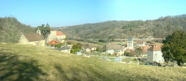
Dégagnac (Dégagnac)

- commune in Lot, France
- Country:

- Postal Code: 46340
- Coordinates: 44° 39' 54" N, 1° 18' 57" E


- GPS tracks (wikiloc): [Link]
- Area: 37.9 sq km
- Population: 647
- Wikipedia en: wiki(en)
- Wikipedia: wiki(fr)
- Wikidata storage: Wikidata: Q1379684
- Wikipedia Commons Category: [Link]
- Freebase ID: [/m/03nwlcc]
- GeoNames ID: Alt: [6449246]
- SIREN number: [214600876]
- BnF ID: [152608281]
- INSEE municipality code: 46087
Shares border with regions:


Rampoux
- commune in Lot, France
- Country:
- Postal Code: 46340
- Coordinates: 44° 38' 30" N, 1° 18' 36" E
- GPS tracks (wikiloc): [Link]
- Area: 5.83 sq km
- Population: 96
Gindou
- commune in Lot, France
- Country:
- Postal Code: 46250
- Coordinates: 44° 37' 53" N, 1° 15' 0" E
- GPS tracks (wikiloc): [Link]
- Area: 15.65 sq km
- Population: 313


Concorès
- commune in Lot, France
- Country:
- Postal Code: 46310
- Coordinates: 44° 39' 32" N, 1° 23' 42" E
- GPS tracks (wikiloc): [Link]
- Area: 19 sq km
- Population: 321

Peyrilles
- commune in Lot, France
- Country:
- Postal Code: 46310
- Coordinates: 44° 37' 11" N, 1° 24' 52" E
- GPS tracks (wikiloc): [Link]
- AboveSeaLevel: 259 м m
- Area: 28.41 sq km
- Population: 386


Lavercantière
- commune in Lot, France
- Country:
- Postal Code: 46340
- Coordinates: 44° 38' 15" N, 1° 19' 8" E
- GPS tracks (wikiloc): [Link]
- Area: 14.99 sq km
- Population: 237
- Web site: [Link]


Léobard
- commune in Lot, France
- Country:
- Postal Code: 46300
- Coordinates: 44° 43' 20" N, 1° 18' 36" E
- GPS tracks (wikiloc): [Link]
- Area: 10.3 sq km
- Population: 217


Gourdon
- commune in Lot, France
- Country:
- Postal Code: 46300
- Coordinates: 44° 44' 14" N, 1° 22' 58" E
- GPS tracks (wikiloc): [Link]
- AboveSeaLevel: 263 м m
- Area: 45.56 sq km
- Population: 4321
- Web site: [Link]


Salviac
- commune in Lot, France
- Country:
- Postal Code: 46340
- Coordinates: 44° 40' 52" N, 1° 15' 53" E
- GPS tracks (wikiloc): [Link]
- Area: 29.61 sq km
- Population: 1217
- Web site: [Link]