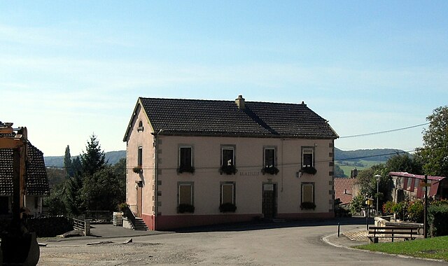
Désandans (Désandans)

- commune in Doubs, France
 Hiking in Désandans
Désandans is a small commune located in the Doubs department in the Bourgogne-Franche-Comté region of eastern France. While it may not be as widely known as some larger hiking destinations, there are still opportunities for outdoor enthusiasts to explore the scenic beauty of the area.
Hiking Opportunities:
-
Natural Scenery: The region offers lush countryside with rolling hills, forests, and farmland, making it ideal for peaceful hikes away from urban sprawl. The diverse landscape is perfect for experiencing nature.
-
Local Trails: While specific hiking trails in Désandans might not be well-documented, you can find numerous paths and tracks in and around the village. Exploring local maps can lead you to beautiful walks.
-
Nearby Nature Reserves: Consider venturing out to nearby natural parks or reserves in the Doubs region. The Parc Naturel Régional du Haut-Jura and other nearby areas offer well-maintained trails and stunning natural environments.
-
Cultural Exploration: Hiking in this area may also allow you to explore local culture and history. Look for trails that lead to historical sites or viewpoints.
Preparation Tips:
- Maps: Make sure to have a local map or guidebook, as some trails may not be clearly marked.
- Weather: Check the weather conditions before heading out, as the terrain can vary greatly depending on recent rainfall and seasonal changes.
- Gear: Wear appropriate footwear and clothing for hiking. Consider bringing a backpack with water, snacks, and a first-aid kit.
- Respect Nature: Always follow Leave No Trace principles to preserve the beauty of the natural environment.
Additional Activities:
After a day of hiking, you might enjoy visiting local restaurants or farms in Désandans to sample regional cuisine. Engage with the local community and learn about their lifestyle, which often includes agriculture and traditional crafts.
Hiking in and around Désandans can provide a tranquil escape into nature, so take your time to enjoy the environment and the beauty of rural France!
- Country:

- Postal Code: 25750
- Coordinates: 47° 31' 59" N, 6° 40' 38" E


- GPS tracks (wikiloc): [Link]
- Area: 5.47 sq km
- Population: 720
- Wikipedia en: wiki(en)
- Wikipedia: wiki(fr)
- Wikidata storage: Wikidata: Q905109
- Wikipedia Commons Category: [Link]
- Freebase ID: [/m/03mgvrv]
- Freebase ID: [/m/03mgvrv]
- GeoNames ID: Alt: [6612383]
- GeoNames ID: Alt: [6612383]
- SIREN number: [212501985]
- SIREN number: [212501985]
- BnF ID: [15252424t]
- BnF ID: [15252424t]
- MusicBrainz area ID: [91c75816-5ec7-4cd9-9131-297e63dab19f]
- MusicBrainz area ID: [91c75816-5ec7-4cd9-9131-297e63dab19f]
- INSEE municipality code: 25198
- INSEE municipality code: 25198
Shares border with regions:


Le Vernoy
- commune in Doubs, France
Hiking in Le Vernoy
Le Vernoy is a lesser-known hiking area located in the beautiful surroundings of the French Alps. While specific trails may vary, the region generally offers a variety of hiking opportunities suitable for different skill levels, from beginners to experienced hikers. Here are some key aspects to consider if you plan to hike in Le Vernoy:...
- Country:
- Postal Code: 25750
- Coordinates: 47° 33' 35" N, 6° 40' 32" E
- GPS tracks (wikiloc): [Link]
- Area: 3.3 sq km
- Population: 171

Chavanne
- commune in Haute-Saône, France
Hiking in Chavanne
Chavanne, located in the Swiss Alps, is a beautiful destination for hiking enthusiasts. The area is known for its stunning natural scenery, diverse trails, and breathtaking panoramic views. Here are some key points to consider if you're planning a hiking trip to Chavanne:...
- Country:
- Postal Code: 70400
- Coordinates: 47° 33' 28" N, 6° 39' 29" E
- GPS tracks (wikiloc): [Link]
- AboveSeaLevel: 420 м m
- Area: 2.32 sq km
- Population: 234

Semondans
- commune in Doubs, France
Hiking in Semondans
Semondans is a small commune in the Doubs department in the Bourgogne-Franche-Comté region of eastern France. While it may not be as widely known for hiking as some larger national parks or mountainous regions, there are still opportunities for outdoor activities in the surrounding area....
- Country:
- Postal Code: 25750
- Coordinates: 47° 32' 34" N, 6° 41' 35" E
- GPS tracks (wikiloc): [Link]
- Area: 2.77 sq km
- Population: 298


Villers-sur-Saulnot
- commune in Haute-Saône, France
Hiking in Villers-sur-Saulnot
Villers-sur-Saulnot is a charming commune located in the Haute-Saône department in the Bourgogne-Franche-Comté region of eastern France. It offers a peaceful environment ideal for hiking enthusiasts. Here are some highlights regarding hiking in and around Villers-sur-Saulnot:...
- Country:
- Postal Code: 70400
- Coordinates: 47° 32' 58" N, 6° 38' 50" E
- GPS tracks (wikiloc): [Link]
- Area: 2.37 sq km
- Population: 136