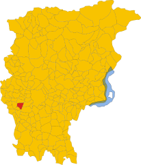
Dalmine (Dalmine)
.svg)
- Italian comune
 Hiking in Dalmine
Dalmine, located in the Lombardy region of Italy, is primarily an urban area, but it offers access to several nearby natural attractions and hiking opportunities. While Dalmine itself may not have extensive trails directly within the city, there are several options in the surrounding regions.
Here are some key points regarding hiking near Dalmine:
-
Nearby Natural Parks: The Parco Regionale della Valle del Lambro and Parco dei Colli di Bergamo are within reach. These parks feature a variety of trails that let hikers enjoy scenic views, diverse flora and fauna, and the tranquility of nature.
-
Bergamo Hills: Just a short drive away, the hills around Bergamo provide numerous hiking trails that vary in difficulty. The paths often lead to beautiful viewpoints overlooking the city and surrounding landscape.
-
Monte Canto: This is a popular hiking destination near Dalmine. The trails offer a moderate hiking experience and picturesque views of the surrounding countryside, making it a great day trip option.
-
Hiking Recommendations: Ensure you carry sufficient water and snacks, wear appropriate footwear, and check local maps or guides for trail conditions. Always inform someone of your hiking plans if you're venturing into less populated areas.
-
Local Hiking Clubs: Consider connecting with local hiking groups or clubs, as they often organize group hikes, which can be a great way to explore the area while meeting new people.
-
Best Time to Hike: Spring and fall are ideal seasons for hiking in Lombardy due to mild weather and beautiful scenery. Summer can get hot, and winter may present challenges due to snow in higher elevations.
While Dalmine may not have extensive hiking options directly within its borders, it serves as a convenient starting point for exploring the beautiful hiking opportunities that the surrounding regions offer.
- Country:

- Postal Code: 24044
- Local Dialing Code: 035
- Licence Plate Code: BG
- Coordinates: 45° 39' 0" N, 9° 36' 0" E


- GPS tracks (wikiloc): [Link]
- AboveSeaLevel: 201 м m
- Area: 11.81 sq km
- Population: 23495
- Web site: http://www.comune.dalmine.bg.it/
- Wikipedia en: wiki(en)
- Wikipedia: wiki(it)
- Wikidata storage: Wikidata: Q101028
- Wikipedia Commons Gallery: [Link]
- Wikipedia Commons Category: [Link]
- Freebase ID: [/m/0gj9_n]
- GeoNames ID: Alt: [6536541]
- VIAF ID: Alt: [239666129]
- OSM relation ID: [45584]
- archINFORM location ID: [16415]
- Quora topic ID: [Dalmine]
- UN/LOCODE: [ITDME]
- ISTAT ID: 016091
- Italian cadastre code: D245
Shares border with regions:


Filago
- Italian comune
Hiking in Filago
Filago, located in the Lombardy region of Italy, offers a serene experience for hikers looking to explore the picturesque landscapes of Northern Italy. While it may not be as widely known as some other hiking destinations, it is surrounded by beautiful natural areas and charming villages that enhance the hiking experience....
- Country:
- Postal Code: 24040
- Local Dialing Code: 035
- Licence Plate Code: BG
- Coordinates: 45° 38' 0" N, 9° 33' 0" E
- GPS tracks (wikiloc): [Link]
- AboveSeaLevel: 190 м m
- Area: 5.42 sq km
- Population: 3182
- Web site: [Link]


Lallio
- Italian comune
Hiking in Lallio
Lallio is a small town in Italy, located in the Lombardy region, near Bergamo. While it might not be known for extensive hiking trails directly in its vicinity, it serves as a good base for exploring nearby natural areas. The Bergamasque Alps and other surrounding regions offer numerous hiking opportunities, including picturesque trails, diverse landscapes, and stunning views....
- Country:
- Postal Code: 24040
- Local Dialing Code: 035
- Licence Plate Code: BG
- Coordinates: 45° 39' 58" N, 9° 37' 53" E
- GPS tracks (wikiloc): [Link]
- AboveSeaLevel: 216 м m
- Area: 2.16 sq km
- Population: 4112
- Web site: [Link]


Levate
- Italian comune
Hiking in Levate
Levate, located in the province of Bergamo in Northern Italy, offers beautiful landscapes and diverse hiking opportunities. The area is characterized by picturesque rolling hills, charming villages, and lush nature, making it an excellent place for outdoor enthusiasts....
- Country:
- Postal Code: 24040
- Local Dialing Code: 035
- Licence Plate Code: BG
- Coordinates: 45° 38' 0" N, 9° 37' 0" E
- GPS tracks (wikiloc): [Link]
- AboveSeaLevel: 185 м m
- Area: 5.53 sq km
- Population: 3780
- Web site: [Link]


Osio Sopra
- Italian comune
Hiking in Osio Sopra
Osio Sopra is a small town in the Lombardy region of Italy, located near Bergamo. While Osio Sopra is primarily an urban area, there are opportunities for hiking and outdoor activities in the surrounding regions. Here are some insights for hiking enthusiasts:...
- Country:
- Postal Code: 24040
- Local Dialing Code: 035
- Licence Plate Code: BG
- Coordinates: 45° 38' 0" N, 9° 35' 0" E
- GPS tracks (wikiloc): [Link]
- AboveSeaLevel: 192 м m
- Area: 5.18 sq km
- Population: 5273
- Web site: [Link]


Stezzano
- Italian comune
Hiking in Stezzano
Stezzano is a small town located in the Lombardy region of Italy, near Bergamo. While it may not be as widely recognized for hiking compared to more mountainous areas, there are several outdoor opportunities and nearby areas that you can explore....
- Country:
- Postal Code: 24040
- Local Dialing Code: 035
- Licence Plate Code: BG
- Coordinates: 45° 35' 0" N, 9° 40' 0" E
- GPS tracks (wikiloc): [Link]
- AboveSeaLevel: 211 м m
- Area: 9.37 sq km
- Population: 13112
- Web site: [Link]


Treviolo
- Italian comune
Hiking in Treviolo
Treviolo is a charming municipality located in the province of Bergamo, Italy. It offers a mix of scenic landscapes, historical sites, and opportunities for outdoor activities, making it a lovely destination for hiking enthusiasts. Here are some key points to consider when hiking in Treviolo:...
- Country:
- Postal Code: 24048
- Local Dialing Code: 035
- Licence Plate Code: BG
- Coordinates: 45° 40' 22" N, 9° 36' 56" E
- GPS tracks (wikiloc): [Link]
- AboveSeaLevel: 225 м m
- Area: 8.49 sq km
- Population: 10870
- Web site: [Link]

Bonate Sotto
- Italian comune
Hiking in Bonate Sotto
Bonate Sotto is a charming town located in the Lombardy region of Italy, situated just a few kilometers northeast of Bergamo. While it may not be as well-known as some other hiking destinations, it offers some beautiful landscapes and trails that can be enjoyed by outdoor enthusiasts....
- Country:
- Postal Code: 24040
- Local Dialing Code: 035
- Licence Plate Code: BG
- Coordinates: 45° 40' 0" N, 9° 33' 41" E
- GPS tracks (wikiloc): [Link]
- AboveSeaLevel: 215 м m
- Area: 6.47 sq km
- Population: 6704
- Web site: [Link]