Dame-Marie-les-Bois (Dame-Marie-les-Bois)

- commune in Indre-et-Loire, France
- Country:

- Postal Code: 37110
- Coordinates: 47° 32' 26" N, 1° 1' 55" E


- GPS tracks (wikiloc): [Link]
- Area: 8.91 sq km
- Population: 351
- Web site: http://www.damemarielesbois.fr
- Wikipedia en: wiki(en)
- Wikipedia: wiki(fr)
- Wikidata storage: Wikidata: Q1135917
- Wikipedia Commons Category: [Link]
- Freebase ID: [/m/03nvdps]
- GeoNames ID: Alt: [6448704]
- SIREN number: [213700958]
- BnF ID: [15257646w]
- INSEE municipality code: 37095
Shares border with regions:


Cangey
- commune in Indre-et-Loire, France
- Country:
- Postal Code: 37530
- Coordinates: 47° 28' 4" N, 1° 3' 37" E
- GPS tracks (wikiloc): [Link]
- Area: 22.98 sq km
- Population: 1068
- Web site: [Link]
Saint-Étienne-des-Guérets
- commune in Loir-et-Cher, France
- Country:
- Postal Code: 41190
- Coordinates: 47° 35' 57" N, 1° 3' 51" E
- GPS tracks (wikiloc): [Link]
- Area: 11.72 sq km
- Population: 95

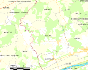
Mesland
- commune in Loir-et-Cher, France
- Country:
- Postal Code: 41150
- Coordinates: 47° 30' 35" N, 1° 7' 21" E
- GPS tracks (wikiloc): [Link]
- Area: 26.38 sq km
- Population: 570
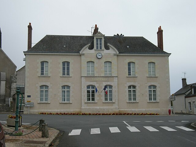

Santenay
- commune in Loir-et-Cher, France
- Country:
- Postal Code: 41190
- Coordinates: 47° 34' 0" N, 1° 6' 59" E
- GPS tracks (wikiloc): [Link]
- Area: 30.28 sq km
- Population: 297


Saint-Nicolas-des-Motets
- commune in Indre-et-Loire, France
- Country:
- Postal Code: 37110
- Coordinates: 47° 35' 8" N, 1° 2' 14" E
- GPS tracks (wikiloc): [Link]
- Area: 12.77 sq km
- Population: 270

Morand
- commune in Indre-et-Loire, France
- Country:
- Postal Code: 37110
- Coordinates: 47° 33' 45" N, 1° 0' 36" E
- GPS tracks (wikiloc): [Link]
- Area: 14.62 sq km
- Population: 358
- Web site: [Link]

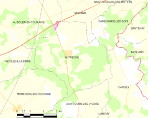
Autrèche
- commune in Indre-et-Loire, France
- Country:
- Postal Code: 37110
- Coordinates: 47° 31' 29" N, 0° 59' 46" E
- GPS tracks (wikiloc): [Link]
- Area: 20.72 sq km
- Population: 426
- Web site: [Link]