Delebio (Delebio)
.svg)
- Italian comune
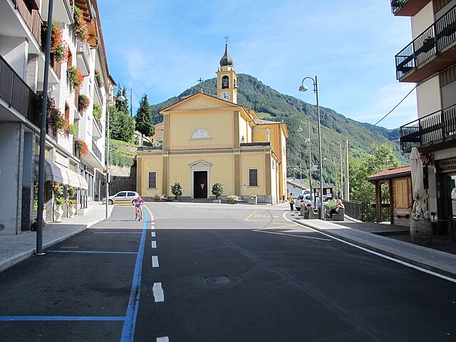
 Hiking in Delebio
Delebio, located in the province of Sondrio in northern Italy, is a charming town that serves as a gateway to the scenic trails of the Valtellina valley and the surrounding Alpine region. The area is known for its stunning landscapes, including mountains, forests, and rivers, which make it an attractive destination for hikers of all levels.
Hiking Trails
-
Sentiero del Viandante: This famous hiking path runs along the eastern shore of Lake Como, providing breathtaking views of the lake and surrounding mountains. While it’s not directly in Delebio, it's easily accessible from the town and offers various stages that can be enjoyed as day hikes.
-
Monte Foppa: A popular trail that leads to the summit of Monte Foppa. This hike offers panoramic views of the Valtellina valley and can be tackled by hikers with a good fitness level.
-
Val Masino: A bit further afield, this area features numerous trails that cater to both beginners and experienced hikers. You can explore beautiful alpine meadows, waterfalls, and rocky terrains.
Tips for Hiking in Delebio
- Prepare for Weather: Mountain weather can change rapidly, so it's advisable to bring appropriate clothing and gear. Layering is key.
- Hydration and Snacks: Always carry enough water and snacks to keep your energy up during the hike.
- Trail Maps and Markings: Familiarize yourself with the trail maps and ensure that you understand the route markings. It's easy to get lost in the vast wilderness.
- Respect Nature: Follow Leave No Trace principles to preserve the natural beauty of the area.
Best Time to Hike
The ideal time for hiking in the Delebio area is during the late spring (May to June) and early autumn (September to October) when the weather is generally mild, and the trails are less crowded.
Local Resources
- Consider checking in with local hiking clubs or visitor centers for guided hikes or tips for specific trails.
- Local accommodation options range from guesthouses to hotels, making it easy to extend your stay for multiple hikes.
Overall, hiking in Delebio offers a fantastic opportunity to immerse yourself in the beauty of the Italian Alps while enjoying well-maintained trails and stunning scenery.
- Country:

- Postal Code: 23014
- Local Dialing Code: 0342
- Licence Plate Code: SO
- Coordinates: 46° 8' 0" N, 9° 28' 0" E


- GPS tracks (wikiloc): [Link]
- AboveSeaLevel: 218 м m
- Area: 22.44 sq km
- Population: 3255
- Web site: http://www.comune.delebio.so.it
- Wikipedia en: wiki(en)
- Wikipedia: wiki(it)
- Wikidata storage: Wikidata: Q39354
- Wikipedia Commons Category: [Link]
- Freebase ID: [/m/0gj2_r]
- GeoNames ID: Alt: [6539472]
- VIAF ID: Alt: [236590361]
- OSM relation ID: [46848]
- WOEID: [714981]
- UN/LOCODE: [ITDBO]
- ISTAT ID: 014026
- Italian cadastre code: D266
- LombardiaBeniCulturali toponym ID: 10000041
Shares border with regions:
Andalo Valtellino
- Italian comune
Hiking in Andalo Valtellino
Andalo Valtellino is a beautiful destination for hiking enthusiasts, located in the Valtellina region of northern Italy. The area is characterized by stunning mountain scenery, lush forests, and a rich variety of flora and fauna. Here are some key points to consider when planning a hiking trip in Andalo Valtellino:...
- Country:
- Postal Code: 23014
- Local Dialing Code: 0342
- Licence Plate Code: SO
- Coordinates: 46° 7' 0" N, 9° 28' 0" E
- GPS tracks (wikiloc): [Link]
- AboveSeaLevel: 229 м m
- Area: 6.78 sq km
- Population: 580
- Web site: [Link]
Piantedo
- Italian comune
Hiking in Piantedo
Piantedo is a small town located in the province of Sondrio, in the Lombardy region of northern Italy. It's surrounded by beautiful landscapes, including the stunning Alps, making it an excellent destination for hiking enthusiasts. Here are some highlights about hiking in and around Piantedo:...
- Country:
- Postal Code: 23010
- Local Dialing Code: 0342
- Licence Plate Code: SO
- Coordinates: 46° 8' 0" N, 9° 25' 0" E
- GPS tracks (wikiloc): [Link]
- AboveSeaLevel: 215 м m
- Area: 6.8 sq km
- Population: 1384
- Web site: [Link]
Dubino
- Italian comune
Hiking in Dubino
Dubino is a charming village in the province of Sondrio, located in the Lombardy region of northern Italy. Its picturesque setting, surrounded by mountains and lush landscapes, offers various hiking opportunities that cater to different skill levels. Here are some aspects to consider if you're planning to hike in the Dubino area:...
- Country:
- Postal Code: 23015
- Local Dialing Code: 0342
- Licence Plate Code: SO
- Coordinates: 46° 9' 0" N, 9° 27' 0" E
- GPS tracks (wikiloc): [Link]
- AboveSeaLevel: 223 м m
- Area: 13.24 sq km
- Population: 3715
- Web site: [Link]


Rogolo
- Italian comune
Hiking in Rogolo
Hiking in Rogolo, a mountain located in the Lombardy region of northern Italy, offers stunning views and a range of trails suitable for different hiking abilities. The area is known for its beautiful landscapes, rich flora and fauna, and the nearby valleys and peaks of the Orobie Alps....
- Country:
- Postal Code: 23010
- Local Dialing Code: 0342
- Licence Plate Code: SO
- Coordinates: 46° 8' 8" N, 9° 29' 14" E
- GPS tracks (wikiloc): [Link]
- AboveSeaLevel: 216 м m
- Area: 12.83 sq km
- Population: 553
- Web site: [Link]


Pagnona
- Italian comune
Hiking in Pagnona
Pagnona, located in the region of Lombardy in Italy, is surrounded by stunning landscapes that make it a charming destination for hiking enthusiasts. The area is characterized by its mountainous terrain, lush green valleys, and picturesque villages, offering a range of hiking trails suitable for different skill levels....
- Country:
- Postal Code: 23833
- Local Dialing Code: 0341
- Licence Plate Code: LC
- Coordinates: 46° 3' 36" N, 9° 24' 7" E
- GPS tracks (wikiloc): [Link]
- AboveSeaLevel: 790 м m
- Area: 9.2 sq km
- Population: 364
- Web site: [Link]

Premana
- Italian comune
Hiking in Premana
Premana is a charming town located in the province of Lecco, in the Lombardy region of northern Italy. It's situated in the heart of the Alps, making it an ideal destination for hiking enthusiasts. The surrounding landscape is characterized by breathtaking mountains, lush valleys, and pristine nature, offering a variety of hiking trails suited for all levels of hikers....
- Country:
- Postal Code: 23834
- Local Dialing Code: 0341
- Licence Plate Code: LC
- Coordinates: 46° 3' 7" N, 9° 25' 23" E
- GPS tracks (wikiloc): [Link]
- AboveSeaLevel: 1000 м m
- Area: 33.64 sq km
- Population: 2262
- Web site: [Link]


Colico
- Italian comune
Hiking in Colico
Colico, located on the eastern shore of Lake Como in Italy's Lombardy region, offers a wonderful mix of beautiful scenery and hiking opportunities. The region is characterized by its stunning lake views, surrounding mountains, and charming villages....
- Country:
- Postal Code: 23823
- Local Dialing Code: 0341
- Licence Plate Code: LC
- Coordinates: 46° 8' 0" N, 9° 22' 0" E
- GPS tracks (wikiloc): [Link]
- AboveSeaLevel: 218 м m
- Area: 35.30 sq km
- Population: 7853
- Web site: [Link]