Province of Sondrio (provincia di Sondrio)

- province of Italy
 Hiking in Province of Sondrio
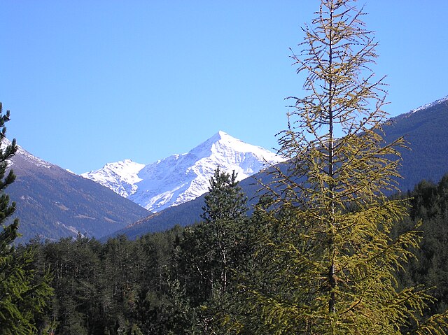
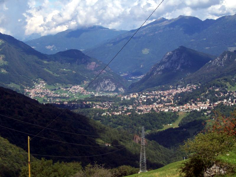
The Province of Sondrio, located in northern Italy's Lombardy region, is a stunning destination for hiking enthusiasts. Known for its diverse landscapes, which include the impressive Alps, lush valleys, and picturesque villages, Sondrio offers a wide range of hiking trails suitable for all levels of experience.
Key Highlights:
-
Stunning Landscapes: The area is characterized by dramatic mountain scenery, including iconic peaks like Pizzo Bernina and the Valtellina Valley. You can also find charming landscapes filled with vineyards, forests, and meadows.
-
National Parks: The province is home to several protected areas, including the Stelvio National Park, which offers numerous trails. The park's high-altitude hikes provide breathtaking views and opportunities to see wildlife, such as ibex and marmots.
-
Mountain Passes: The Forcola di Livigno and Bocca di Braulio are popular mountain passes that provide incredible panoramas and access to several hiking routes.
-
Cultural Experience: Alongside natural beauty, hikers can explore quaint towns and villages like Tirano, Sondrio, and Bormio, which offer rich history, local cuisine, and cultural attractions.
-
Wine and Food Trails: The Valtellina region is famous for its wines (particularly the Sforzato) and local dishes. Many hiking routes can be paired with stops at local vineyards and restaurants for a taste of the region's culinary heritage.
Recommended Hiking Trails:
-
Sentiero Valtellina: This long-distance trail follows the Adda River and offers a mix of scenic views and cultural experiences as it leads through various villages and vineyards.
-
Bormio 2000 to Cima Lago di Cancano: A moderate hike that offers beautiful views of the surrounding mountains and lakes.
-
Val di Mello: Known for its dramatic rock formations and lush forests, this area is perfect for hiking and bouldering.
-
Pizzo Ferrè: A more challenging hike offering panoramic views that stretch across the Alps and beyond. Ideal for experienced hikers.
Tips for Hiking in Sondrio:
- Weather: Always check the weather forecast before heading out as conditions can change rapidly in the mountains.
- Gear: Wear appropriate hiking boots and bring layers of clothing to adapt to changing temperatures. A good backpack, water, snacks, and a map or GPS device are essential.
- Permits and Regulations: Be aware of any regulations specific to the areas you plan to hike, especially in national parks.
- Local Guidance: Consider hiring a local guide for off-the-beaten-path trails or to enhance your experience with knowledge about the region.
Overall, the Province of Sondrio presents a perfect blend of natural beauty and cultural richness, making it a fantastic destination for hikers of all skill levels.
- Country:

- Capital: Sondrio
- Postal Code: 23100, 23010-23038
- Licence Plate Code: SO
- Coordinates: 46° 21' 37" N, 9° 56' 38" E


- GPS tracks (wikiloc): [Link]
- Area: 3211.9 sq km
- Web site: http://www.provincia.so.it
- Wikipedia en: wiki(en)
- Wikipedia: wiki(it)
- Wikidata storage: Wikidata: Q16282
- Wikipedia Commons Gallery: [Link]
- Wikipedia Commons Category: [Link]
- Freebase ID: [/m/052ff5]
- GeoNames ID: Alt: [3166396]
- VIAF ID: Alt: [140721049]
- GND ID: Alt: [4362422-4]
- archINFORM location ID: [6481]
- Library of Congress authority ID: Alt: [n80128347]
- PACTOLS thesaurus ID: [pcrt50vD6kEl7Z]
- MusicBrainz area ID: [6a09bd81-aa2f-4d0b-87ea-85bfde90f634]
- NUTS code: [ITC44]
- BabelNet ID: [00655800n]
- ISTAT ID: 014
- ISO 3166-2 code: IT-SO
Includes regions:


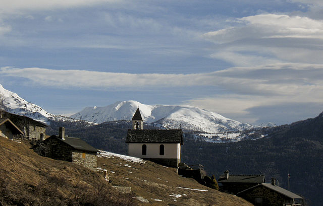
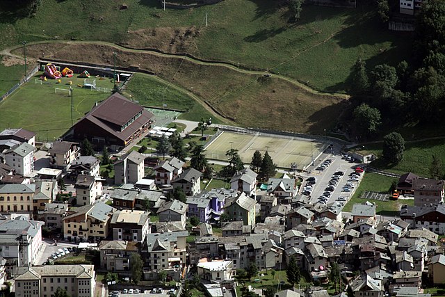
Montagna in Valtellina
- Italian comune
Hiking in Montagna in Valtellina
Montagna in Valtellina, located in the Sondrio province of Lombardy, Italy, is an excellent destination for hiking enthusiasts. This area is part of the Valtellina Valley, which is known for its stunning landscapes, charming villages, and rich cultural heritage....
- Country:
- Postal Code: 23020
- Local Dialing Code: 0342
- Licence Plate Code: SO
- Coordinates: 46° 11' 0" N, 9° 54' 0" E
- GPS tracks (wikiloc): [Link]
- AboveSeaLevel: 567 м m
- Area: 44.97 sq km
- Population: 3041
- Web site: [Link]

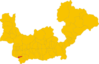
Pedesina
- Italian comune
Hiking in Pedesina
Pedesina is a small and picturesque village located in the Valtellina region of northern Italy, nestled in the Alps. It offers stunning natural beauty and a variety of hiking opportunities for outdoor enthusiasts. Here are some highlights for hiking in and around Pedesina:...
- Country:
- Postal Code: 23010
- Local Dialing Code: 0342
- Licence Plate Code: SO
- Coordinates: 46° 5' 0" N, 9° 33' 0" E
- GPS tracks (wikiloc): [Link]
- AboveSeaLevel: 1032 м m
- Area: 6.3 sq km
- Population: 41
- Web site: [Link]
Postalesio
- Italian comune
Hiking in Postalesio
Postalesio is a charming destination for hikers, located in the Valtellina valley in northern Italy. It's surrounded by the stunning Alps, and offers a range of hiking trails that cater to different skill levels, from gentle walks to more challenging routes....
- Country:
- Postal Code: 23010
- Local Dialing Code: 0342
- Licence Plate Code: SO
- Coordinates: 46° 10' 0" N, 9° 47' 0" E
- GPS tracks (wikiloc): [Link]
- AboveSeaLevel: 516 м m
- Area: 10.58 sq km
- Population: 666
- Web site: [Link]
Andalo Valtellino
- Italian comune
Hiking in Andalo Valtellino
Andalo Valtellino is a beautiful destination for hiking enthusiasts, located in the Valtellina region of northern Italy. The area is characterized by stunning mountain scenery, lush forests, and a rich variety of flora and fauna. Here are some key points to consider when planning a hiking trip in Andalo Valtellino:...
- Country:
- Postal Code: 23014
- Local Dialing Code: 0342
- Licence Plate Code: SO
- Coordinates: 46° 7' 0" N, 9° 28' 0" E
- GPS tracks (wikiloc): [Link]
- AboveSeaLevel: 229 м m
- Area: 6.78 sq km
- Population: 580
- Web site: [Link]
Mazzo di Valtellina
- Italian comune
Hiking in Mazzo di Valtellina
Mazzo di Valtellina, located in the Valtellina valley in the Lombardy region of northern Italy, offers a stunning backdrop for hiking enthusiasts. The region is known for its majestic alpine scenery, rich biodiversity, and well-marked trails that cater to hikers of all skill levels. Here’s a guide to hiking in this beautiful area:...
- Country:
- Postal Code: 23030
- Local Dialing Code: 0342
- Licence Plate Code: SO
- Coordinates: 46° 15' 0" N, 10° 15' 0" E
- GPS tracks (wikiloc): [Link]
- AboveSeaLevel: 552 м m
- Area: 15.32 sq km
- Population: 999
- Web site: [Link]
Piantedo
- Italian comune
Hiking in Piantedo
Piantedo is a small town located in the province of Sondrio, in the Lombardy region of northern Italy. It's surrounded by beautiful landscapes, including the stunning Alps, making it an excellent destination for hiking enthusiasts. Here are some highlights about hiking in and around Piantedo:...
- Country:
- Postal Code: 23010
- Local Dialing Code: 0342
- Licence Plate Code: SO
- Coordinates: 46° 8' 0" N, 9° 25' 0" E
- GPS tracks (wikiloc): [Link]
- AboveSeaLevel: 215 м m
- Area: 6.8 sq km
- Population: 1384
- Web site: [Link]


Colorina
- Italian comune
Hiking in Colorina
It seems there might be a slight typing error in your question regarding "Colorina." If you meant Colorado, there are numerous amazing hiking opportunities in the state. Here are some highlights:...
- Country:
- Postal Code: 23010
- Local Dialing Code: 0342
- Licence Plate Code: SO
- Coordinates: 46° 9' 0" N, 9° 44' 0" E
- GPS tracks (wikiloc): [Link]
- AboveSeaLevel: 385 м m
- Area: 17.84 sq km
- Population: 1423
- Web site: [Link]


Castello dell'Acqua
- Italian comune
Hiking in Castello dell'Acqua
Castello dell'Acqua, located in the province of Sondrio in Lombardy, Italy, offers stunning hiking opportunities with breathtaking views of the surrounding Alps. Nestled in the heart of the Valtellina valley, it’s a great spot for those seeking both scenic beauty and outdoor adventure....
- Country:
- Postal Code: 23030
- Local Dialing Code: 0342
- Licence Plate Code: SO
- Coordinates: 46° 9' 0" N, 10° 1' 0" E
- GPS tracks (wikiloc): [Link]
- AboveSeaLevel: 664 м m
- Area: 14.07 sq km
- Population: 629
- Web site: [Link]
Cedrasco
- Italian comune
Hiking in Cedrasco
Cedrasco is a small municipality located in the Valtellina valley in the Lombardy region of Italy. It is surrounded by stunning natural scenery, making it a great destination for hiking enthusiasts. Here are some highlights about hiking in and around Cedrasco:...
- Country:
- Postal Code: 23010
- Local Dialing Code: 0342
- Licence Plate Code: SO
- Coordinates: 46° 9' 0" N, 9° 46' 0" E
- GPS tracks (wikiloc): [Link]
- AboveSeaLevel: 287 м m
- Area: 14.42 sq km
- Population: 442
- Web site: [Link]
Tartano
- Italian comune
Hiking in Tartano
Tartano is a mountain area located in the Italian Alps, specifically in the Lombardy region. It offers a range of hiking opportunities for both novice and experienced hikers. The region is known for its breathtaking landscapes, including lush forests, alpine meadows, and stunning panoramic views....
- Country:
- Postal Code: 23010
- Local Dialing Code: 0342
- Licence Plate Code: SO
- Coordinates: 46° 7' 0" N, 9° 41' 0" E
- GPS tracks (wikiloc): [Link]
- AboveSeaLevel: 1210 м m
- Area: 47.27 sq km
- Population: 205
- Web site: [Link]
Sernio
- Italian comune
Hiking in Sernio
Sernio, located in the Italian region of Lombardy, is a charming destination for hiking enthusiasts. While it may not be as well-known as larger national parks, it offers a variety of trails that can cater to different skill levels, from leisurely walks to more challenging hikes....
- Country:
- Postal Code: 23030
- Local Dialing Code: 0342
- Licence Plate Code: SO
- Coordinates: 46° 13' 0" N, 10° 12' 0" E
- GPS tracks (wikiloc): [Link]
- AboveSeaLevel: 632 м m
- Area: 9.52 sq km
- Population: 474
- Web site: [Link]

Torre di Santa Maria
- Italian comune
Hiking in Torre di Santa Maria
Torre di Santa Maria, located in the beautiful region of Lombardy in northern Italy, is an excellent destination for hiking enthusiasts. Nestled in the Valtellina valley, it is surrounded by stunning landscapes, including mountains, valleys, and lush forests....
- Country:
- Postal Code: 23020
- Local Dialing Code: 0342
- Licence Plate Code: SO
- Coordinates: 46° 14' 0" N, 9° 51' 0" E
- GPS tracks (wikiloc): [Link]
- AboveSeaLevel: 795 м m
- Area: 44.24 sq km
- Population: 752
- Web site: [Link]
Verceia
- Italian comune
Hiking in Verceia
Verceia is a picturesque village located in the Lombardy region of Italy, nestled within the stunning landscape of the Valtellina Valley near the northern shores of Lake Como. The area around Verceia offers numerous hiking opportunities, showcasing beautiful views, diverse terrain, and a chance to explore the rich natural and cultural heritage of the region....
- Country:
- Postal Code: 23020
- Local Dialing Code: 0343
- Licence Plate Code: SO
- Coordinates: 46° 12' 0" N, 9° 27' 0" E
- GPS tracks (wikiloc): [Link]
- AboveSeaLevel: 205 м m
- Area: 11.38 sq km
- Population: 1107
- Web site: [Link]

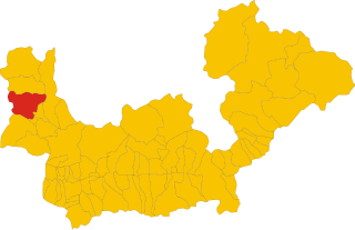
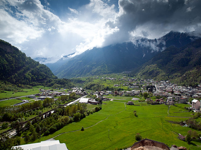
Campodolcino
- Italian comune
Hiking in Campodolcino
Campodolcino is a picturesque village located in the province of Sondrio in the Lombardy region of Italy, nestled in the heart of the Italian Alps. This area is not only known for its stunning landscapes but also for the variety of hiking opportunities it offers, catering to all levels of outdoor enthusiasts....
- Country:
- Postal Code: 23021
- Local Dialing Code: 0343
- Licence Plate Code: SO
- Coordinates: 46° 24' 18" N, 9° 21' 11" E
- GPS tracks (wikiloc): [Link]
- AboveSeaLevel: 1071 м m
- Area: 48.49 sq km
- Population: 931
- Web site: [Link]

San Giacomo Filippo
- Italian comune
Hiking in San Giacomo Filippo
San Giacomo Filippo, located in the Sondrio province of Lombardy, Italy, offers a variety of hiking opportunities amidst stunning landscapes of the Valtellina Valley. The region is characterized by its mountainous terrain, charming villages, lush forests, and impressive views of the surrounding Alps....
- Country:
- Postal Code: 23020
- Local Dialing Code: 0343
- Licence Plate Code: SO
- Coordinates: 46° 20' 0" N, 9° 22' 0" E
- GPS tracks (wikiloc): [Link]
- AboveSeaLevel: 679 м m
- Area: 61.85 sq km
- Population: 349
- Web site: [Link]
Ponte in Valtellina
- Italian comune
Hiking in Ponte in Valtellina
Ponte in Valtellina is a picturesque town located in the Valtellina Valley in northern Italy, known for its stunning alpine scenery and a variety of outdoor activities, including hiking. Here are some key points about hiking in and around Ponte in Valtellina:...
- Country:
- Postal Code: 23026
- Local Dialing Code: 0342
- Licence Plate Code: SO
- Coordinates: 46° 11' 0" N, 9° 59' 0" E
- GPS tracks (wikiloc): [Link]
- AboveSeaLevel: 500 м m
- Area: 67.73 sq km
- Population: 2294
- Web site: [Link]
Lanzada
- Italian comune
Hiking in Lanzada
Lanzada, located on the beautiful Galician coast in Spain, is known for its stunning beaches, picturesque landscapes, and vibrant natural surroundings, making it a great destination for hiking enthusiasts. Here’s an overview of what to expect when hiking in the Lanzada area:...
- Country:
- Postal Code: 23020
- Local Dialing Code: 0342
- Licence Plate Code: SO
- Coordinates: 46° 16' 0" N, 9° 52' 0" E
- GPS tracks (wikiloc): [Link]
- AboveSeaLevel: 1000 м m
- Area: 117.17 sq km
- Population: 1335
- Web site: [Link]
Delebio
- Italian comune
Hiking in Delebio
Delebio, located in the province of Sondrio in northern Italy, is a charming town that serves as a gateway to the scenic trails of the Valtellina valley and the surrounding Alpine region. The area is known for its stunning landscapes, including mountains, forests, and rivers, which make it an attractive destination for hikers of all levels....
- Country:
- Postal Code: 23014
- Local Dialing Code: 0342
- Licence Plate Code: SO
- Coordinates: 46° 8' 0" N, 9° 28' 0" E
- GPS tracks (wikiloc): [Link]
- AboveSeaLevel: 218 м m
- Area: 22.44 sq km
- Population: 3255
- Web site: [Link]
Buglio in Monte
- Italian comune
Hiking in Buglio in Monte
Buglio in Monte is a picturesque village located in the Lombardy region of Italy, in the province of Sondrio. The area is known for its stunning natural landscapes, making it an excellent destination for hiking enthusiasts....
- Country:
- Postal Code: 23010
- Local Dialing Code: 0342
- Licence Plate Code: SO
- Coordinates: 46° 11' 0" N, 9° 41' 0" E
- GPS tracks (wikiloc): [Link]
- AboveSeaLevel: 577 м m
- Area: 27.71 sq km
- Population: 2012
- Web site: [Link]


Gordona
- Italian comune
Hiking in Gordona
Gordona, located in the Italian region of Lombardy, is a picturesque area that offers beautiful hiking opportunities surrounded by nature. Situated in the province of Sondrio, not far from the Alps, Gordona is known for its stunning landscapes, lush forests, and charming villages....
- Country:
- Postal Code: 23020
- Local Dialing Code: 0343
- Licence Plate Code: SO
- Coordinates: 46° 17' 0" N, 9° 22' 0" E
- GPS tracks (wikiloc): [Link]
- AboveSeaLevel: 283 м m
- Area: 62.79 sq km
- Population: 1970
- Web site: [Link]

Valfurva
- Italian comune
Hiking in Valfurva
Valfurva, located in the Lombardy region of northern Italy, is a beautiful destination for hiking enthusiasts, offering stunning alpine scenery and a variety of trails suitable for different skill levels. The area is part of the Stelvio National Park, which is known for its diverse landscapes, including mountains, forests, and meadows....
- Country:
- Postal Code: 23030
- Local Dialing Code: 0342
- Licence Plate Code: SO
- Coordinates: 46° 27' 0" N, 10° 25' 0" E
- GPS tracks (wikiloc): [Link]
- AboveSeaLevel: 1800 м m
- Area: 215.02 sq km
- Population: 2581
- Web site: [Link]


Traona
- Italian comune
Hiking in Traona
Traona is a charming village located in the Valtellina Valley of northern Italy, and it offers some beautiful hiking opportunities that cater to various skill levels. Here are some highlights about hiking in and around Traona:...
- Country:
- Postal Code: 23019
- Local Dialing Code: 0342
- Licence Plate Code: SO
- Coordinates: 46° 9' 0" N, 9° 31' 0" E
- GPS tracks (wikiloc): [Link]
- AboveSeaLevel: 252 м m
- Area: 6.37 sq km
- Population: 2782
- Web site: [Link]


Berbenno di Valtellina
- Italian comune
Hiking in Berbenno di Valtellina
Berbenno di Valtellina, located in the Valtellina Valley of Northern Italy, is a beautiful area that offers a variety of hiking opportunities. Surrounded by the stunning Alps and characterized by its charming villages, verdant landscapes, and rich cultural heritage, it is an ideal destination for hikers of all levels....
- Country:
- Postal Code: 23010
- Local Dialing Code: 0342
- Licence Plate Code: SO
- Coordinates: 46° 10' 0" N, 9° 45' 0" E
- GPS tracks (wikiloc): [Link]
- AboveSeaLevel: 370 м m
- Area: 35.6 sq km
- Population: 4151
- Web site: [Link]


Villa di Chiavenna
- Italian comune
Hiking in Villa di Chiavenna
Villa di Chiavenna, located in the province of Sondrio in Lombardy, Italy, is a charming destination for hikers and outdoor enthusiasts. Nestled in the heart of the Alps, this area offers stunning landscapes, diverse terrains, and a variety of trails suitable for different skill levels....
- Country:
- Postal Code: 23029
- Local Dialing Code: 0343
- Licence Plate Code: SO
- Coordinates: 46° 20' 0" N, 9° 29' 0" E
- GPS tracks (wikiloc): [Link]
- AboveSeaLevel: 633 м m
- Area: 32.52 sq km
- Population: 990
- Web site: [Link]
Piuro
- Italian comune
Hiking in Piuro
Piuro is a picturesque village located in the Lombardy region of northern Italy, nestled in the Seriana Valley and close to the border with Switzerland. The area is known for its stunning natural beauty, making it a great destination for hiking enthusiasts. Here are some highlights about hiking in Piuro:...
- Country:
- Postal Code: 23020
- Local Dialing Code: 0343
- Licence Plate Code: SO
- Coordinates: 46° 19' 51" N, 9° 25' 18" E
- GPS tracks (wikiloc): [Link]
- AboveSeaLevel: 382 м m
- Area: 84.25 sq km
- Population: 1932
- Web site: [Link]
Mello
- Italian comune
Hiking in Mello
Mello, located in the Lombardy region of Italy, is a beautiful destination for hiking enthusiasts. Nestled in the heart of the Sondrio province and surrounded by the lush nature of the Val Mello Valley, it offers a variety of trails that cater to different skill levels, ranging from easy walks to more challenging hikes....
- Country:
- Postal Code: 23010
- Local Dialing Code: 0342
- Licence Plate Code: SO
- Coordinates: 46° 9' 18" N, 9° 32' 50" E
- GPS tracks (wikiloc): [Link]
- AboveSeaLevel: 681 м m
- Area: 11.43 sq km
- Population: 959
- Web site: [Link]


Villa di Tirano
- Italian comune
Hiking in Villa di Tirano
Villa di Tirano, located in the Valtellina region of northern Italy, is a beautiful area for hiking enthusiasts. Nestled in the Alps, this small town offers access to stunning landscapes, rich history, and diverse trails suitable for various skill levels....
- Country:
- Postal Code: 23030
- Local Dialing Code: 0342
- Licence Plate Code: SO
- Coordinates: 46° 12' 0" N, 10° 8' 0" E
- GPS tracks (wikiloc): [Link]
- AboveSeaLevel: 406 м m
- Area: 24.74 sq km
- Population: 2978
- Web site: [Link]
Mese
- Italian comune
Hiking in Mese
Mese, located in the province of Sondrio in the Lombardy region of Northern Italy, is a fantastic area for hiking enthusiasts. Nestled in the heart of the Valtellina Valley and surrounded by the stunning backdrop of the Alps, Mese offers a variety of hiking trails suitable for different skill levels....
- Country:
- Postal Code: 23020
- Local Dialing Code: 0343
- Licence Plate Code: SO
- Coordinates: 46° 18' 0" N, 9° 23' 0" E
- GPS tracks (wikiloc): [Link]
- AboveSeaLevel: 274 м m
- Area: 4.15 sq km
- Population: 1814
- Web site: [Link]


Dazio
- Italian comune
Hiking in Dazio
Dazio, a picturesque area located in the northern part of Italy, particularly in the Valtellina valley, offers a variety of hiking opportunities that cater to different skill levels and interests. Here are some key points about hiking in Dazio:...
- Country:
- Postal Code: 23010
- Local Dialing Code: 0342
- Licence Plate Code: SO
- Coordinates: 46° 9' 41" N, 9° 36' 2" E
- GPS tracks (wikiloc): [Link]
- AboveSeaLevel: 568 м m
- Area: 3.73 sq km
- Population: 442
- Web site: [Link]


Teglio
- Italian comune
Hiking in Teglio
Teglio, a charming town located in the Valtellina valley of northern Italy, is surrounded by stunning alpine landscapes, making it a fantastic destination for hiking enthusiasts. The area is known for its rich natural beauty, with a diverse range of trails suitable for various skill levels, from leisurely strolls to challenging hikes....
- Country:
- Postal Code: 23036
- Local Dialing Code: 0342
- Licence Plate Code: SO
- Coordinates: 46° 10' 0" N, 10° 4' 0" E
- GPS tracks (wikiloc): [Link]
- AboveSeaLevel: 851 м m
- Area: 115.32 sq km
- Population: 4534
- Web site: [Link]

Vervio
- Italian comune
Hiking in Vervio
Vervio is a charming village located in the Valtellina region of northern Italy, which offers beautiful hiking opportunities amidst stunning alpine scenery. Here are some key points about hiking in and around Vervio:...
- Country:
- Postal Code: 23030
- Local Dialing Code: 0342
- Licence Plate Code: SO
- Coordinates: 46° 15' 0" N, 10° 14' 0" E
- GPS tracks (wikiloc): [Link]
- AboveSeaLevel: 549 м m
- Area: 12.41 sq km
- Population: 209
- Web site: [Link]


Tovo di Sant'Agata
- Italian comune
Hiking in Tovo di Sant'Agata
Tovo di Sant'Agata is a charming village located in the province of Savona, in the Liguria region of Italy. This area is known for its beautiful landscapes, lush Mediterranean vegetation, and diverse hiking opportunities. Here’s what you might want to know about hiking in and around Tovo di Sant'Agata:...
- Country:
- Postal Code: 23030
- Local Dialing Code: 0342
- Licence Plate Code: SO
- Coordinates: 46° 15' 0" N, 10° 15' 0" E
- GPS tracks (wikiloc): [Link]
- AboveSeaLevel: 531 м m
- Area: 11.15 sq km
- Population: 631
- Web site: [Link]


Lovero
- Italian comune
Hiking in Lovero
Lovero is a charming village located in the Valtellina region of northern Italy, offering stunning landscapes and a variety of hiking opportunities. The area is known for its beautiful mountains, lush greenery, and picturesque views that attract outdoor enthusiasts....
- Country:
- Postal Code: 23030
- Local Dialing Code: 0342
- Licence Plate Code: SO
- Coordinates: 46° 14' 0" N, 10° 14' 0" E
- GPS tracks (wikiloc): [Link]
- AboveSeaLevel: 515 м m
- Area: 13.46 sq km
- Population: 657
- Web site: [Link]
Faedo Valtellino
- Italian comune
Hiking in Faedo Valtellino
Faedo Valtellino is a picturesque area located in the Lombardy region of northern Italy, known for its stunning landscapes, charming villages, and proximity to the Alps. Hiking in this region offers a variety of trails that cater to different skill levels, making it a great destination for both casual walkers and experienced hikers....
- Country:
- Postal Code: 23020
- Local Dialing Code: 0342
- Licence Plate Code: SO
- Coordinates: 46° 9' 0" N, 9° 54' 0" E
- GPS tracks (wikiloc): [Link]
- AboveSeaLevel: 557 м m
- Area: 4.8 sq km
- Population: 556
- Web site: [Link]


Bianzone
- human settlement in Italy
Hiking in Bianzone
Bianzone, a charming village located in the Valtellina valley of Italy, offers some stunning hiking opportunities surrounded by the beautiful landscape of the Italian Alps. Here are some details about hiking in Bianzone:...
- Country:
- Postal Code: 23030
- Local Dialing Code: 0342
- Licence Plate Code: SO
- Coordinates: 46° 11' 0" N, 10° 6' 0" E
- GPS tracks (wikiloc): [Link]
- AboveSeaLevel: 444 м m
- Area: 17.11 sq km
- Population: 1326
- Web site: [Link]
Albosaggia
- Italian comune
Hiking in Albosaggia
Albosaggia, located in the Lombardy region of Italy, offers beautiful hiking opportunities with stunning views of the surrounding mountains and valleys. Here are some highlights and tips for hiking in this picturesque area:...
- Country:
- Postal Code: 23010
- Local Dialing Code: 0342
- Licence Plate Code: SO
- Coordinates: 46° 9' 0" N, 9° 51' 0" E
- GPS tracks (wikiloc): [Link]
- AboveSeaLevel: 490 м m
- Area: 34.35 sq km
- Population: 3020
- Web site: [Link]
Rasura
- Italian comune
Hiking in Rasura
Rasura is a lesser-known but beautiful hiking destination located in the Lombardy region of northern Italy. It offers a unique combination of stunning landscapes, rich history, and cultural experiences. Here’s an overview of what you can expect when hiking in Rasura:...
- Country:
- Postal Code: 23010
- Local Dialing Code: 0342
- Licence Plate Code: SO
- Coordinates: 46° 6' 0" N, 9° 33' 0" E
- GPS tracks (wikiloc): [Link]
- AboveSeaLevel: 762 м m
- Area: 6 sq km
- Population: 291
- Web site: [Link]
Ardenno
- Italian comune
Hiking in Ardenno
Ardenno, located in the Valtellina region of northern Italy, offers a beautiful setting for hiking enthusiasts. The area is known for its stunning landscapes, rich flora and fauna, and traditional alpine villages. Here are some key points to consider when hiking in Ardenno:...
- Country:
- Postal Code: 23011
- Local Dialing Code: 0342
- Licence Plate Code: SO
- Coordinates: 46° 10' 0" N, 9° 39' 0" E
- GPS tracks (wikiloc): [Link]
- AboveSeaLevel: 266 м m
- Area: 17.14 sq km
- Population: 3270
- Web site: [Link]

Chiuro
- Italian comune
Hiking in Chiuro
Chiuro, located in the Valtellina region of northern Italy, is surrounded by stunning landscapes that make it a great destination for hiking enthusiasts. Here’s what you can expect when hiking in and around Chiuro:...
- Country:
- Postal Code: 23030
- Local Dialing Code: 0342
- Licence Plate Code: SO
- Coordinates: 46° 10' 0" N, 9° 59' 0" E
- GPS tracks (wikiloc): [Link]
- AboveSeaLevel: 390 м m
- Area: 51.76 sq km
- Population: 2552
- Web site: [Link]

Morbegno
- Italian comune
Hiking in Morbegno
Morbegno is a charming town in the Valtellina region of northern Italy, nestled among the Alps. It offers a variety of hiking opportunities, suitable for different skill levels, from gentle walks to more challenging treks....
- Country:
- Postal Code: 23017
- Local Dialing Code: 0342
- Licence Plate Code: SO
- Coordinates: 46° 8' 0" N, 9° 34' 0" E
- GPS tracks (wikiloc): [Link]
- AboveSeaLevel: 242 м m
- Area: 14.82 sq km
- Population: 12407
- Web site: [Link]


Valdidentro
- Italian comune
Hiking in Valdidentro
Valdidentro is a beautiful valley located in the Lombardy region of northern Italy, within the larger Valtellina area. It's an excellent spot for hiking enthusiasts, offering a variety of trails that cater to different experience levels, stunning scenery, and opportunities to explore the rich natural and cultural heritage of the region....
- Country:
- Postal Code: 23038
- Local Dialing Code: 0342
- Licence Plate Code: SO
- Coordinates: 46° 29' 0" N, 10° 18' 0" E
- GPS tracks (wikiloc): [Link]
- AboveSeaLevel: 1345 м m
- Area: 226.73 sq km
- Population: 4131
- Web site: [Link]
Gerola Alta
- Italian comune
Hiking in Gerola Alta
Gerola Alta is a beautiful destination for hiking enthusiasts, located in the Lombardy region of Italy, specifically in the province of Sondrio. Known for its stunning mountain scenery, this area offers a variety of trails that cater to different skill levels, making it suitable for both novice and experienced hikers....
- Country:
- Postal Code: 23010
- Local Dialing Code: 0342
- Licence Plate Code: SO
- Coordinates: 46° 4' 0" N, 9° 34' 0" E
- GPS tracks (wikiloc): [Link]
- AboveSeaLevel: 1050 м m
- Area: 37.43 sq km
- Population: 174
- Web site: [Link]


Chiavenna
- Italian comune
Hiking in Chiavenna
Chiavenna, located in the Lombardy region of northern Italy, is an excellent destination for hiking due to its stunning natural landscapes and rich cultural history. Nestled at the entrance of the Val Bregaglia and near the borders of Switzerland, this charming town serves as a base for numerous hiking trails that cater to various skill levels....
- Country:
- Postal Code: 23022
- Local Dialing Code: 0343
- Licence Plate Code: SO
- Coordinates: 46° 19' 0" N, 9° 24' 0" E
- GPS tracks (wikiloc): [Link]
- AboveSeaLevel: 333 м m
- Area: 10.77 sq km
- Population: 7313
- Web site: [Link]

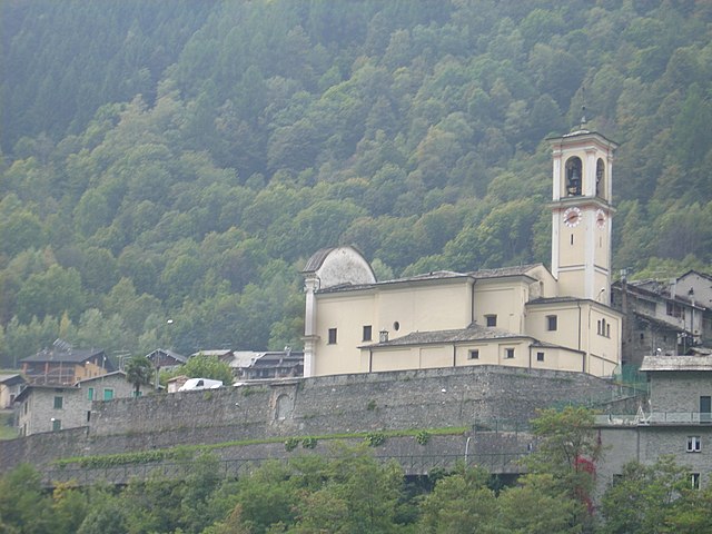
Sondalo
- Italian comune
Hiking in Sondalo
Sondalo is a charming town located in the Valtellina Valley in northern Italy, surrounded by stunning natural landscapes that make it an excellent destination for hiking enthusiasts. The area is characterized by its dramatic mountains, lush forests, and rich biodiversity....
- Country:
- Postal Code: 23035
- Local Dialing Code: 0342
- Licence Plate Code: SO
- Coordinates: 46° 20' 0" N, 10° 20' 0" E
- GPS tracks (wikiloc): [Link]
- AboveSeaLevel: 900 м m
- Area: 95.45 sq km
- Population: 4114
- Web site: [Link]
Novate Mezzola
- Italian comune
Hiking in Novate Mezzola
Novate Mezzola is a picturesque village located in the province of Sondrio, in the Lombardy region of northern Italy, near the beautiful Lake Mezzola. The surrounding area offers a range of hiking opportunities that cater to various skill levels, all set against the stunning backdrop of the Italian Alps....
- Country:
- Postal Code: 23025
- Local Dialing Code: 0343
- Licence Plate Code: SO
- Coordinates: 46° 13' 0" N, 9° 27' 0" E
- GPS tracks (wikiloc): [Link]
- AboveSeaLevel: 212 м m
- Area: 99.75 sq km
- Population: 1895
- Web site: [Link]
Valdisotto
- Italian comune
Hiking in Valdisotto
Valdisotto is a beautiful destination located in the Valtellina region of Lombardy, Italy, known for its stunning landscapes, rich natural heritage, and excellent hiking opportunities. Nestled in the Alps, Valdisotto offers a range of trails that cater to hikers of all skill levels, from easy walks to challenging alpine routes....
- Country:
- Postal Code: 23030
- Local Dialing Code: 0342
- Licence Plate Code: SO
- Coordinates: 46° 25' 0" N, 10° 21' 0" E
- GPS tracks (wikiloc): [Link]
- AboveSeaLevel: 1141 м m
- Area: 89.57 sq km
- Population: 3601
- Web site: [Link]


Chiesa in Valmalenco
- Italian comune
Hiking in Chiesa in Valmalenco
Chiesa in Valmalenco is a beautiful destination for hiking, located in the Italian Alps within the Lombardy region. It is characterized by stunning landscapes, rich biodiversity, and a variety of trails suitable for hikers of all levels. Here’s an overview of what you can expect when hiking in Chiesa in Valmalenco:...
- Country:
- Postal Code: 23023
- Local Dialing Code: 0342
- Licence Plate Code: SO
- Coordinates: 46° 16' 0" N, 9° 51' 0" E
- GPS tracks (wikiloc): [Link]
- AboveSeaLevel: 800 м m
- Area: 107.6 sq km
- Population: 2482
- Web site: [Link]

Caspoggio
- Italian comune
Hiking in Caspoggio
Caspoggio is a charming village located in the Valtellina valley in the Lombardy region of northern Italy, known for its stunning natural landscapes and outdoor recreational opportunities. Hiking in and around Caspoggio provides breathtaking views, diverse trails, and the chance to explore the rich flora and fauna of the area....
- Country:
- Postal Code: 23020
- Local Dialing Code: 0342
- Licence Plate Code: SO
- Coordinates: 46° 16' 0" N, 9° 52' 0" E
- GPS tracks (wikiloc): [Link]
- AboveSeaLevel: 1098 м m
- Area: 7.31 sq km
- Population: 1377
- Web site: [Link]
Mantello
- Italian comune
Hiking in Mantello
Mantello is a beautiful village located in the Valtellina region of Northern Italy, nestled in the Alps. The surrounding area offers a variety of hiking opportunities for all levels of adventurers....
- Country:
- Postal Code: 23016
- Local Dialing Code: 0342
- Licence Plate Code: SO
- Coordinates: 46° 9' 0" N, 9° 29' 0" E
- GPS tracks (wikiloc): [Link]
- AboveSeaLevel: 211 м m
- Area: 3.78 sq km
- Population: 765
- Web site: [Link]
Samolaco
- Italian comune
Hiking in Samolaco
Samolaco is a charming village located in the province of Sondrio in the Lombardy region of northern Italy. It offers a variety of hiking opportunities that showcase the stunning landscapes of the Valtellina Valley and surrounding areas....
- Country:
- Postal Code: 23027
- Local Dialing Code: 0343
- Licence Plate Code: SO
- Coordinates: 46° 16' 0" N, 9° 23' 0" E
- GPS tracks (wikiloc): [Link]
- AboveSeaLevel: 236 м m
- Area: 45.8 sq km
- Population: 2893
- Web site: [Link]


Bormio
- Italian comune
Hiking in Bormio
Bormio is a beautiful town located in the Italian Alps, specifically within the Lombardy region. It's well known for its stunning landscapes, rich history, and access to a variety of outdoor activities, including hiking. Here’s an overview of what to expect when hiking in Bormio:...
- Country:
- Postal Code: 23032
- Local Dialing Code: 0342
- Licence Plate Code: SO
- Coordinates: 46° 28' 0" N, 10° 22' 0" E
- GPS tracks (wikiloc): [Link]
- AboveSeaLevel: 1225 м m
- Area: 41.44 sq km
- Population: 4194
- Web site: [Link]


Grosio
- Italian comune
Hiking in Grosio
Grosio, located in the Valtellina valley of northern Italy, is a wonderful destination for hiking enthusiasts. Surrounded by the stunning Rhaetian Alps, the area offers a variety of trails that cater to different skill levels, from casual walkers to experienced hikers....
- Country:
- Postal Code: 23033
- Local Dialing Code: 0342
- Licence Plate Code: SO
- Coordinates: 46° 18' 0" N, 10° 17' 0" E
- GPS tracks (wikiloc): [Link]
- AboveSeaLevel: 656 м m
- Area: 126.92 sq km
- Population: 4431
- Web site: [Link]
Dubino
- Italian comune
Hiking in Dubino
Dubino is a charming village in the province of Sondrio, located in the Lombardy region of northern Italy. Its picturesque setting, surrounded by mountains and lush landscapes, offers various hiking opportunities that cater to different skill levels. Here are some aspects to consider if you're planning to hike in the Dubino area:...
- Country:
- Postal Code: 23015
- Local Dialing Code: 0342
- Licence Plate Code: SO
- Coordinates: 46° 9' 0" N, 9° 27' 0" E
- GPS tracks (wikiloc): [Link]
- AboveSeaLevel: 223 м m
- Area: 13.24 sq km
- Population: 3715
- Web site: [Link]
Forcola
- Italian comune
Hiking in Forcola
Forcola, located in the beautiful Lombardy region of Italy, is a scenic destination for hiking enthusiasts. Here are some highlights and details about hiking in the Forcola area:...
- Country:
- Postal Code: 23010
- Local Dialing Code: 0342
- Licence Plate Code: SO
- Coordinates: 46° 9' 0" N, 9° 40' 0" E
- GPS tracks (wikiloc): [Link]
- AboveSeaLevel: 289 м m
- Area: 15.9 sq km
- Population: 796
- Web site: [Link]
Spriana
- Italian comune
Hiking in Spriana
Spriana, a charming village in the Lombardy region of Italy, is set against the stunning backdrop of the Italian Alps. It offers a variety of hiking opportunities suitable for all skill levels, with scenic trails that showcase the natural beauty of the area....
- Country:
- Postal Code: 23020
- Local Dialing Code: 0342
- Licence Plate Code: SO
- Coordinates: 46° 13' 0" N, 9° 52' 0" E
- GPS tracks (wikiloc): [Link]
- AboveSeaLevel: 754 м m
- Area: 7.69 sq km
- Population: 87
- Web site: [Link]
Fusine
- Italian comune
Hiking in Fusine
Fusine, located in the Julian Alps of northeastern Italy, is a stunning destination for hiking enthusiasts. The area is known for its picturesque landscapes, crystal-clear alpine lakes, and diverse flora and fauna. Here are some highlights and tips for hiking in Fusine:...
- Country:
- Postal Code: 23010
- Local Dialing Code: 0342
- Licence Plate Code: SO
- Coordinates: 46° 8' 58" N, 9° 44' 59" E
- GPS tracks (wikiloc): [Link]
- AboveSeaLevel: 285 м m
- Area: 37 sq km
- Population: 575
- Web site: [Link]


Cercino
- Italian comune
Hiking in Cercino
Cercino, located in the mountainous region of northern Italy, offers a variety of hiking opportunities for outdoor enthusiasts. The area is characterized by its stunning landscapes, including lush forests, hills, and mountains, making it a great destination for both novice and experienced hikers....
- Country:
- Postal Code: 23016
- Local Dialing Code: 0342
- Licence Plate Code: SO
- Coordinates: 46° 9' 0" N, 9° 30' 0" E
- GPS tracks (wikiloc): [Link]
- AboveSeaLevel: 487 м m
- Area: 5.69 sq km
- Population: 760
- Web site: [Link]


Castione Andevenno
- Italian comune
Hiking in Castione Andevenno
Castione Andevenno is a charming village located in the Valtellina valley in the Lombardy region of Italy. It offers several hiking opportunities that appeal to various skill levels, providing breathtaking views of the surrounding mountains and countryside....
- Country:
- Postal Code: 23012
- Local Dialing Code: 0342
- Licence Plate Code: SO
- Coordinates: 46° 10' 0" N, 9° 48' 0" E
- GPS tracks (wikiloc): [Link]
- AboveSeaLevel: 468 м m
- Area: 17.03 sq km
- Population: 1575
- Web site: [Link]


Tirano
- Italian comune
Hiking in Tirano
Tirano, located in the Valtellina region of northern Italy, is a charming town surrounded by stunning Alpine scenery, making it a fantastic base for hiking enthusiasts. The area offers diverse trails that cater to various skill levels, from leisurely walks to challenging hikes....
- Country:
- Postal Code: 23037
- Local Dialing Code: 0342
- Licence Plate Code: SO
- Coordinates: 46° 12' 59" N, 10° 10' 8" E
- GPS tracks (wikiloc): [Link]
- AboveSeaLevel: 441 м m
- Area: 32.37 sq km
- Population: 9050
- Web site: [Link]


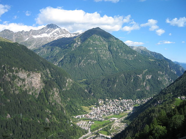
Livigno
- Italian comune
Hiking in Livigno
Livigno, located in the Italian Alps near the Swiss border, is a fantastic destination for hiking enthusiasts. This charming alpine resort is surrounded by stunning scenery, with lush valleys, high peaks, and pristine landscapes....
- Country:
- Postal Code: 23030
- Local Dialing Code: 0342
- Licence Plate Code: SO
- Coordinates: 46° 32' 0" N, 10° 8' 0" E
- GPS tracks (wikiloc): [Link]
- AboveSeaLevel: 1816 м m
- Area: 227.3 sq km
- Population: 6550
- Web site: [Link]
Talamona
- Italian comune
Hiking in Talamona
Talamona, located in the Sondrio province of Lombardy, Italy, is surrounded by stunning landscapes and mountains, making it an excellent destination for hiking enthusiasts....
- Country:
- Postal Code: 23018
- Local Dialing Code: 0342
- Licence Plate Code: SO
- Coordinates: 46° 8' 0" N, 9° 37' 0" E
- GPS tracks (wikiloc): [Link]
- AboveSeaLevel: 285 м m
- Area: 21.05 sq km
- Population: 4671
- Web site: [Link]
Grosotto
- Italian comune
Hiking in Grosotto
Grosotto, located in the Valtellina valley of northern Italy, is a fantastic destination for hiking enthusiasts. Surrounded by stunning landscapes, this area offers a variety of trails that cater to all levels of hikers, from beginners to experienced mountaineers....
- Country:
- Postal Code: 23034
- Local Dialing Code: 0342
- Licence Plate Code: SO
- Coordinates: 46° 17' 0" N, 10° 16' 0" E
- GPS tracks (wikiloc): [Link]
- AboveSeaLevel: 610 м m
- Area: 53.12 sq km
- Population: 1624
- Web site: [Link]
Val Masino
- Italian comune
Hiking in Val Masino
Val Masino, located in the Valtellina region of northern Italy, is a stunning destination for hiking enthusiasts. Known for its dramatic landscapes, granite cliffs, lush forests, and clear rivers, Val Masino offers a variety of hiking trails suitable for different skill levels, from leisurely walks to challenging treks....
- Country:
- Postal Code: 23010
- Local Dialing Code: 0342
- Licence Plate Code: SO
- Coordinates: 46° 13' 0" N, 9° 38' 0" E
- GPS tracks (wikiloc): [Link]
- AboveSeaLevel: 787 м m
- Area: 116.71 sq km
- Population: 891
- Web site: [Link]
Caiolo
- Italian comune
Hiking in Caiolo
Caiolo is a charming village located in the Valtellina valley in northern Italy, known for its beautiful landscapes and rich outdoor activities, including hiking. Here are some highlights and tips for hiking in and around Caiolo:...
- Country:
- Postal Code: 23010
- Local Dialing Code: 0342
- Licence Plate Code: SO
- Coordinates: 46° 9' 0" N, 9° 48' 0" E
- GPS tracks (wikiloc): [Link]
- AboveSeaLevel: 335 м m
- Area: 32.97 sq km
- Population: 1085
- Web site: [Link]


Madesimo
- Italian comune
Hiking in Madesimo
Madesimo, located in the Lombardy region of Italy, is a popular destination for hiking, especially during the summer months when the snow melts and reveals stunning landscapes. Nestled in the Alps, Madesimo offers a variety of trails suitable for hikers of all ages and skill levels. Here are some key highlights of hiking in the area:...
- Country:
- Postal Code: 23024
- Local Dialing Code: 0343
- Licence Plate Code: SO
- Coordinates: 46° 26' 0" N, 9° 21' 0" E
- GPS tracks (wikiloc): [Link]
- AboveSeaLevel: 1399 м m
- Area: 85.66 sq km
- Population: 517
- Web site: [Link]
Bema
- Italian comune
Hiking in Bema
Bema, located in the Lombardy region of Italy, is a beautiful destination for hiking enthusiasts. Nestled in the mountainous area of the Valtellina valley, it offers stunning views, diverse landscapes, and rich flora and fauna. Here are some highlights and tips for hiking in Bema:...
- Country:
- Postal Code: 23010
- Local Dialing Code: 0342
- Licence Plate Code: SO
- Coordinates: 46° 7' 0" N, 9° 34' 0" E
- GPS tracks (wikiloc): [Link]
- AboveSeaLevel: 800 м m
- Area: 19.22 sq km
- Population: 116
- Web site: [Link]


Albaredo per San Marco
- Italian comune
Hiking in Albaredo per San Marco
Albaredo per San Marco is a charming village located in the province of Sondrio, in the Lombardy region of northern Italy. Nestled within the stunning landscapes of the Valtellina Valley and the surrounding Orobie Alps, it offers a range of beautiful hiking opportunities suitable for various skill levels....
- Country:
- Postal Code: 23010
- Local Dialing Code: 0342
- Licence Plate Code: SO
- Coordinates: 46° 6' 11" N, 9° 35' 26" E
- GPS tracks (wikiloc): [Link]
- AboveSeaLevel: 950 м m
- Area: 18.96 sq km
- Population: 300
- Web site: [Link]


Rogolo
- Italian comune
Hiking in Rogolo
Hiking in Rogolo, a mountain located in the Lombardy region of northern Italy, offers stunning views and a range of trails suitable for different hiking abilities. The area is known for its beautiful landscapes, rich flora and fauna, and the nearby valleys and peaks of the Orobie Alps....
- Country:
- Postal Code: 23010
- Local Dialing Code: 0342
- Licence Plate Code: SO
- Coordinates: 46° 8' 8" N, 9° 29' 14" E
- GPS tracks (wikiloc): [Link]
- AboveSeaLevel: 216 м m
- Area: 12.83 sq km
- Population: 553
- Web site: [Link]


Civo
- Italian comune
Hiking in Civo
Civo, a charming destination in Italy, offers a range of hiking opportunities that showcase the stunning natural beauty of the region. Located in the Lombardy area near Lake Como, Civo is often less crowded than more popular hiking destinations, making it an excellent choice for those seeking tranquility in nature....
- Country:
- Postal Code: 23010
- Local Dialing Code: 0342
- Licence Plate Code: SO
- Coordinates: 46° 9' 0" N, 9° 34' 0" E
- GPS tracks (wikiloc): [Link]
- AboveSeaLevel: 719 м m
- Area: 25.14 sq km
- Population: 1115
- Web site: [Link]
Prata Camportaccio
- Italian comune
Hiking in Prata Camportaccio
Prata Camportaccio is a picturesque village located in the Valtellina region of northern Italy, surrounded by the stunning landscapes of the Italian Alps. Hiking in this area offers a unique blend of natural beauty, cultural heritage, and a variety of trails suitable for different skill levels....
- Country:
- Postal Code: 23020
- Local Dialing Code: 0343
- Licence Plate Code: SO
- Coordinates: 46° 19' 0" N, 9° 24' 0" E
- GPS tracks (wikiloc): [Link]
- AboveSeaLevel: 352 м m
- Area: 27.94 sq km
- Population: 2950
- Web site: [Link]


Poggiridenti
- Italian comune
Hiking in Poggiridenti
Poggiridenti, a charming village located in the province of Sondrio in the Italian region of Lombardy, offers a unique hiking experience surrounded by the beautiful landscapes of the Valtellina valley and the foothills of the Alps. Here are some highlights and tips for hiking in and around Poggiridenti:...
- Country:
- Postal Code: 23020
- Local Dialing Code: 0342
- Licence Plate Code: SO
- Coordinates: 46° 10' 0" N, 9° 55' 0" E
- GPS tracks (wikiloc): [Link]
- AboveSeaLevel: 564 м m
- Area: 2.9 sq km
- Population: 1906
- Web site: [Link]
Piateda
- Italian comune
Hiking in Piateda
Piateda is a charming village located in the Lombardy region of northern Italy, nestled in the picturesque Valtellina Valley. For hiking enthusiasts, the area offers a variety of trails that cater to different skill levels, allowing you to immerse yourself in stunning Alpine landscapes, lush forests, and panoramic views of the surrounding mountains....
- Country:
- Postal Code: 23020
- Local Dialing Code: 0342
- Licence Plate Code: SO
- Coordinates: 46° 9' 35" N, 9° 56' 6" E
- GPS tracks (wikiloc): [Link]
- AboveSeaLevel: 304 м m
- Area: 70.8 sq km
- Population: 2158
- Web site: [Link]

Aprica
- Italian comune
Hiking in Aprica
Aprica, located in the Valtellina region of northern Italy, is a fantastic destination for hiking enthusiasts. Surrounded by the stunning landscapes of the Rhaetian Alps, Aprica offers a variety of trails suitable for all skill levels, from casual walkers to experienced trekkers. Here are some highlights of hiking in this beautiful area:...
- Country:
- Postal Code: 23031
- Local Dialing Code: 0342
- Licence Plate Code: SO
- Coordinates: 46° 9' 0" N, 10° 8' 0" E
- GPS tracks (wikiloc): [Link]
- AboveSeaLevel: 1180 м m
- Area: 20.37 sq km
- Population: 1580
- Web site: [Link]
Cosio Valtellino
- Italian comune
Hiking in Cosio Valtellino
Cosio Valtellino, located in the province of Sondrio in the Valtellina region of northern Italy, is a hidden gem for hikers and nature enthusiasts. This area offers a variety of trails that cater to different skill levels, showcasing stunning landscapes, rich flora and fauna, and traditional alpine culture....
- Country:
- Postal Code: 23013
- Local Dialing Code: 0342
- Licence Plate Code: SO
- Coordinates: 46° 8' 0" N, 9° 32' 0" E
- GPS tracks (wikiloc): [Link]
- AboveSeaLevel: 231 м m
- Area: 23.99 sq km
- Population: 5512
- Web site: [Link]


Tresivio
- Italian comune
Hiking in Tresivio
Tresivio is a charming town located in the Valtellina valley in northern Italy, surrounded by stunning alpine landscapes. It is a fantastic destination for hiking enthusiasts, offering a variety of trails suitable for different skill levels. Here are some highlights and tips for hiking in and around Tresivio:...
- Country:
- Postal Code: 23020
- Local Dialing Code: 0342
- Licence Plate Code: SO
- Coordinates: 46° 10' 0" N, 9° 57' 0" E
- GPS tracks (wikiloc): [Link]
- AboveSeaLevel: 520 м m
- Area: 15.01 sq km
- Population: 1998
- Web site: [Link]
Cino
- Italian comune
Hiking in Cino
Cino is a picturesque area located in the Lombardy region of Italy, nestled in the Valtellina valley. Known for its stunning landscapes, rich biodiversity, and charming villages, it provides various opportunities for hiking and outdoor activities....
- Country:
- Postal Code: 23010
- Local Dialing Code: 0342
- Licence Plate Code: SO
- Coordinates: 46° 9' 0" N, 9° 29' 0" E
- GPS tracks (wikiloc): [Link]
- AboveSeaLevel: 504 м m
- Area: 5.07 sq km
- Population: 336
- Web site: [Link]
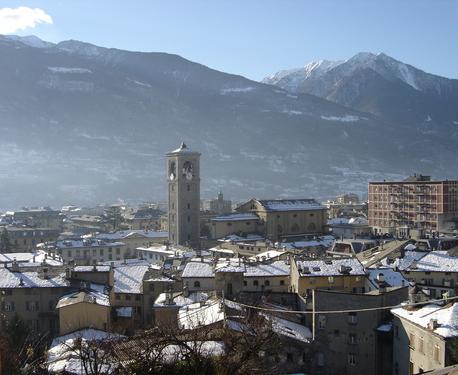

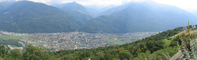
Sondrio
- Italian city in Valtellina
Hiking in Sondrio
Sondrio, located in the Lombardy region of northern Italy, offers a variety of stunning hiking opportunities, particularly in the surrounding Valtellina Valley and the adjacent Stelvio National Park. Here are some highlights and essential information for hiking in the Sondrio area:...
- Country:
- Postal Code: 23100
- Local Dialing Code: 0342
- Licence Plate Code: SO
- Coordinates: 46° 10' 11" N, 9° 52' 12" E
- GPS tracks (wikiloc): [Link]
- AboveSeaLevel: 360 м m
- Area: 20.88 sq km
- Population: 21642
- Web site: [Link]
Shares border with regions:
Graubünden
- canton of Switzerland
Hiking in Graubünden
The Canton of Grisons, or Graubünden, is a breathtaking region in Switzerland known for its stunning landscapes, diverse hiking trails, and rich cultural heritage. Here are some highlights of hiking in this beautiful area:...
- Country:

- Capital: Chur
- Licence Plate Code: GR
- Coordinates: 46° 45' 0" N, 9° 30' 0" E
- GPS tracks (wikiloc): [Link]
- AboveSeaLevel: 585 м m
- Area: 7105.39 sq km
- Web site: [Link]


South Tyrol
- autonomous province of Italy
Hiking in South Tyrol
South Tyrol, located in northern Italy, is a paradise for hikers and outdoor enthusiasts. This stunning region is characterized by its dramatic landscapes, which include the towering peaks of the Dolomites, lush valleys, and picturesque alpine meadows. Here are some key points about hiking in South Tyrol:...
- Country:
- Capital: Bolzano
- Postal Code: 39010–39059; 39100
- Local Dialing Code: 0471; 0463; 0474; 0473; 0472
- Licence Plate Code: BZ
- Coordinates: 46° 30' 0" N, 11° 20' 0" E
- GPS tracks (wikiloc): [Link]
- Area: 7400.43 sq km
- Population: 550432
- Web site: [Link]

Province of Bergamo
- province of Italy
Hiking in Province of Bergamo
Hiking in the Province of Bergamo, located in the Lombardy region of Italy, offers a stunning array of trails and scenic beauty. This area is characterized by its diverse landscapes, ranging from the picturesque plains to the dramatic peaks of the Lombardy Alps. Here’s a guide to hiking in this beautiful province:...
- Country:
- Capital: Bergamo
- Postal Code: 24121-24129 (Bergamo), 23806, 24000-24100, (provincia)
- Licence Plate Code: BG
- Coordinates: 45° 41' 42" N, 9° 40' 12" E
- GPS tracks (wikiloc): [Link]
- AboveSeaLevel: 249 м m
- Area: 2722.86 sq km
- Population: 1109933
- Web site: [Link]

Province of Brescia
- province of Italy
Hiking in Province of Brescia
The Province of Brescia, located in the Lombardy region of northern Italy, offers a diverse landscape that is a hiker's paradise. Its mix of mountains, lakes, and valleys provides numerous trails suitable for hikers of all skill levels. Here are some highlights and tips for hiking in this picturesque province:...
- Country:
- Capital: Brescia
- Postal Code: 25010–25089; 25121–25136
- Local Dialing Code: 0365; 035; 0364; 030
- Licence Plate Code: BS
- Coordinates: 45° 32' 20" N, 10° 13' 10" E
- GPS tracks (wikiloc): [Link]
- Area: 4784.36 sq km
- Web site: [Link]


Province of Como
- province of Italy
Hiking in Province of Como
The Province of Como, located in the northern part of Italy, is a spectacular destination for hiking, thanks to its stunning landscapes, rich cultural history, and pristine natural areas. The region is home to Lake Como, which is surrounded by mountains and hills, providing a diverse range of hiking trails for all levels of hikers....
- Country:
- Capital: Como
- Postal Code: 22100
- Local Dialing Code: 004191; 0331; 02; 0344; 031
- Licence Plate Code: CO
- Coordinates: 45° 49' 0" N, 9° 5' 0" E
- GPS tracks (wikiloc): [Link]
- Area: 1288.07 sq km
- Web site: [Link]

Province of Lecco
- province of Italy
Hiking in Province of Lecco
The Province of Lecco, located in the Lombardy region of Italy, offers stunning landscapes and diverse hiking opportunities, making it a popular destination for outdoor enthusiasts. Here are some highlights and considerations for hiking in this beautiful region:...
- Country:
- Capital: Lecco
- Postal Code: 23801–23900
- Local Dialing Code: 039; 035; 0341; 031
- Licence Plate Code: LC
- Coordinates: 45° 51' 0" N, 9° 24' 0" E
- GPS tracks (wikiloc): [Link]
- Area: 816.17 sq km
- Web site: [Link]
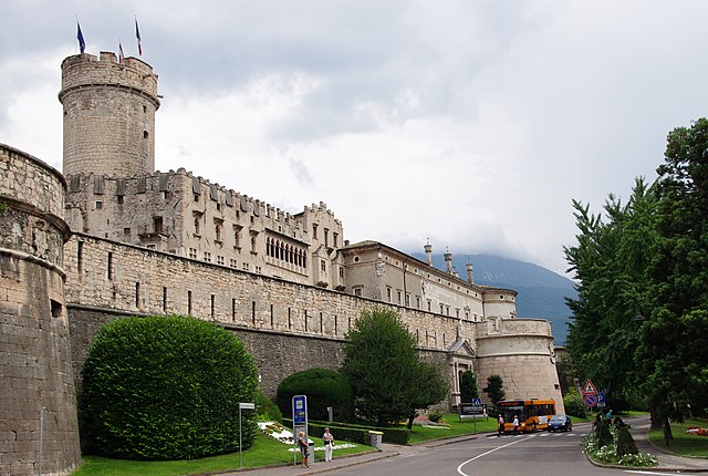
Trentino
- autonomous province of Italy
Hiking in Trentino
Hiking in Trentino, a region in northern Italy, offers a stunning array of landscapes, from the majestic Dolomites to picturesque valleys, dense forests, and serene lakes. Here are some highlights and essentials for hiking in this beautiful region:...
- Country:
- Capital: Trento
- Postal Code: 38010-38023-38089; 38121–38123
- Local Dialing Code: 0465; 0464; 0463; 0462; 0461; 0439
- Licence Plate Code: TN
- Coordinates: 46° 26' 44" N, 11° 10' 23" E
- GPS tracks (wikiloc): [Link]
- Area: 6207 sq km
- Population: 447359
- Web site: [Link]