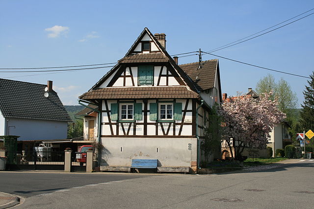
Dieffenbach-lès-Wœrth (Dieffenbach-lès-Wœrth)
- commune in Bas-Rhin, France
- Country:

- Postal Code: 67360
- Coordinates: 48° 55' 58" N, 7° 46' 43" E


- GPS tracks (wikiloc): [Link]
- Area: 3.61 sq km
- Population: 354
- Wikipedia en: wiki(en)
- Wikipedia: wiki(fr)
- Wikidata storage: Wikidata: Q22789
- Wikipedia Commons Category: [Link]
- Freebase ID: [/m/03m9788]
- Freebase ID: [/m/03m9788]
- Freebase ID: [/m/03m9788]
- GeoNames ID: Alt: [6614937]
- GeoNames ID: Alt: [6614937]
- GeoNames ID: Alt: [6614937]
- SIREN number: [216700930]
- SIREN number: [216700930]
- SIREN number: [216700930]
- VIAF ID: Alt: [160551760]
- VIAF ID: Alt: [160551760]
- VIAF ID: Alt: [160551760]
- Library of Congress authority ID: Alt: [n2010080328]
- Library of Congress authority ID: Alt: [n2010080328]
- Library of Congress authority ID: Alt: [n2010080328]
- INSEE municipality code: 67093
- INSEE municipality code: 67093
- INSEE municipality code: 67093
Shares border with regions:


Merkwiller-Pechelbronn
- commune in Bas-Rhin, France
- Country:

- Postal Code: 67250
- Coordinates: 48° 56' 21" N, 7° 49' 32" E


- GPS tracks (wikiloc): [Link]
- Area: 3.76 sq km
- Population: 919
- Web site: [Link]


Gunstett
- commune in Bas-Rhin, France
- Country:

- Postal Code: 67360
- Coordinates: 48° 54' 54" N, 7° 45' 50" E


- GPS tracks (wikiloc): [Link]
- Area: 6.3 sq km
- Population: 660
- Web site: [Link]
Oberdorf-Spachbach
- commune in Bas-Rhin, France
- Country:

- Postal Code: 67360
- Coordinates: 48° 55' 29" N, 7° 45' 27" E


- GPS tracks (wikiloc): [Link]
- Area: 2.36 sq km
- Population: 366


Surbourg
- commune in Bas-Rhin, France
- Country:

- Postal Code: 67250
- Coordinates: 48° 54' 32" N, 7° 50' 52" E


- GPS tracks (wikiloc): [Link]
- Area: 10.46 sq km
- Population: 1667


Preuschdorf
- commune in Bas-Rhin, France
- Country:

- Postal Code: 67250
- Coordinates: 48° 56' 43" N, 7° 47' 54" E


- GPS tracks (wikiloc): [Link]
- Area: 7.57 sq km
- Population: 920


Gœrsdorf
- commune in Bas-Rhin, France
- Country:

- Postal Code: 67360
- Coordinates: 48° 57' 6" N, 7° 46' 8" E


- GPS tracks (wikiloc): [Link]
- Area: 13.14 sq km
- Population: 1087
