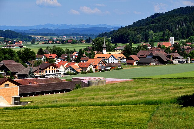
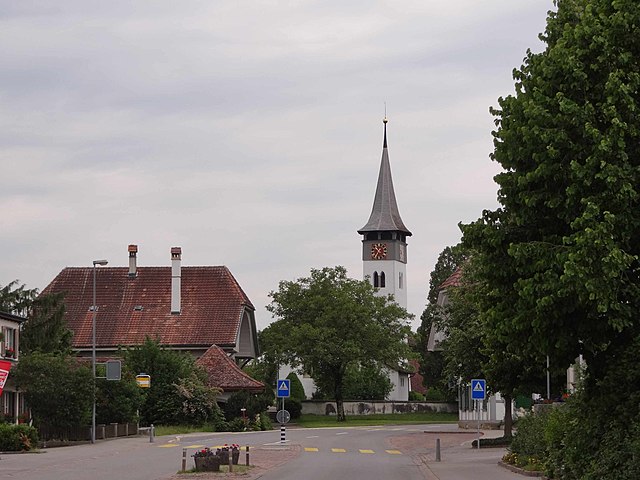
Diemerswil (Diemerswil)

- municipality in Switzerland
 Hiking in Diemerswil
Diemerswil, a charming village located in the canton of Bern, Switzerland, offers a peaceful outdoor experience for hikers of all levels. The area is characterized by beautiful landscapes, rolling hills, and scenic views of the surrounding Alpine foothills.
Hiking Routes
-
Diemerswil to Wabern: This moderate trail takes you through lush fields and forests. The route provides picturesque views of the nearby lakes and the Alps, especially on clear days.
-
Biel Lake Loop: A bit further out but accessible, this trail encircles Lake Biel and can be started from Diemerswil. It's an excellent option for those looking for a longer hike with stunning water views.
-
Local Nature Trails: There are also several shorter trails directly in and around Diemerswil that feature interpretive signs about local flora and fauna. These are perfect for families or those looking for a leisurely stroll.
Tips for Hiking in Diemerswil
- Best Time to Visit: The best months for hiking here are between late spring and early autumn (May to October). The landscapes are lush, and the weather is usually mild.
- Gear: Ensure you have appropriate hiking gear, including sturdy shoes, a hat, and sunscreen, as some trails can expose you to the sun.
- Maps and Resources: Carry an up-to-date Swiss hiking map or use a reliable navigation app, as some trails may not be well-marked.
- Local Amenities: Diemerswil has a few small shops and eateries, but it's best to pack your own snacks and water for the trail.
Accessibility
Diemerswil is easily accessible by public transportation from Bern, with local buses connecting to nearby towns and trailheads. The village itself is small and does not have extensive services, so plan accordingly.
Overall, hiking in Diemerswil offers a delightful experience for nature lovers looking to explore the serene beauty of the Bernese countryside. Whether you are a seasoned hiker or a beginner, you'll find something to enjoy in this tranquil setting.
- Country:

- Postal Code: 3053
- Local Dialing Code: 031
- Licence Plate Code: BE
- Coordinates: 47° 1' 9" N, 7° 25' 41" E


- GPS tracks (wikiloc): [Link]
- AboveSeaLevel: 600 м m
- Area: 2.86 sq km
- Population: 202
- Web site: http://www.diemerswil.ch
- Wikipedia en: wiki(en)
- Wikipedia: wiki(de)
- Wikidata storage: Wikidata: Q70266
- Wikipedia Commons Category: [Link]
- Freebase ID: [/m/0frsw1]
- GeoNames ID: Alt: [7285644]
- VIAF ID: Alt: [244305873]
- OSM relation ID: [1682419]
- HDS ID: [297]
- Swiss municipality code: [0536]
Shares border with regions:

Schüpfen
- municipality in Switzerland
Hiking in Schüpfen
Schüpfen, located in the Canton of Bern in Switzerland, offers a variety of hiking opportunities in a picturesque setting. Although it is a small municipality, its surroundings feature beautiful landscapes, rolling hills, and scenic views typical of the Swiss countryside....
- Country:
- Postal Code: 3054
- Local Dialing Code: 031
- Licence Plate Code: BE
- Coordinates: 47° 2' 9" N, 7° 22' 29" E
- GPS tracks (wikiloc): [Link]
- AboveSeaLevel: 540 м m
- Area: 19.83 sq km
- Population: 3752
- Web site: [Link]

Münchenbuchsee
- municipality in Switzerland
Hiking in Münchenbuchsee
Münchenbuchsee is a charming municipality located in the Canton of Bern, Switzerland. It offers a variety of hiking opportunities that allow you to explore beautiful landscapes, serene lakes, and picturesque countryside....
- Country:
- Postal Code: 3053
- Local Dialing Code: 031
- Licence Plate Code: BE
- Coordinates: 47° 1' 5" N, 7° 26' 55" E
- GPS tracks (wikiloc): [Link]
- AboveSeaLevel: 563 м m
- Area: 8.9 sq km
- Population: 10079
- Web site: [Link]
Kirchlindach
- municipality in Switzerland
Hiking in Kirchlindach
Kirchlindach is a charming municipality located near Bern, Switzerland, known for its beautiful natural landscapes and hiking opportunities. Here are some key points to consider if you're planning a hike in the Kirchlindach area:...
- Country:
- Postal Code: 3038
- Local Dialing Code: 031
- Licence Plate Code: BE
- Coordinates: 46° 59' 54" N, 7° 24' 57" E
- GPS tracks (wikiloc): [Link]
- AboveSeaLevel: 586 м m
- Area: 11.9 sq km
- Population: 3004
- Web site: [Link]