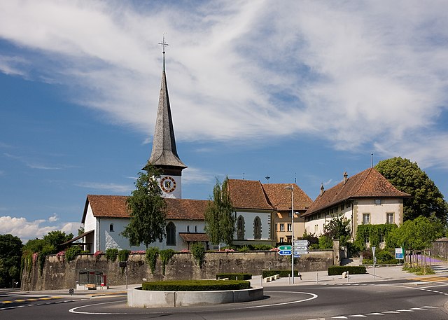
Bern-Mittelland administrative district (Verwaltungskreis Bern-Mittelland)

- administrative district of the canton of Bern, Switzerland (Verwaltungskreis)
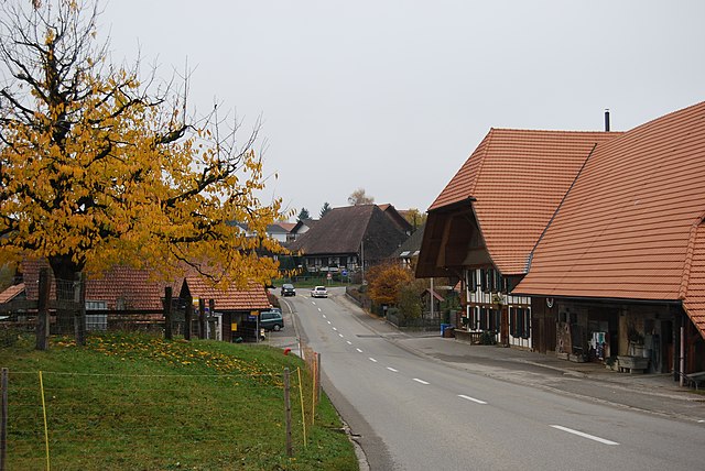
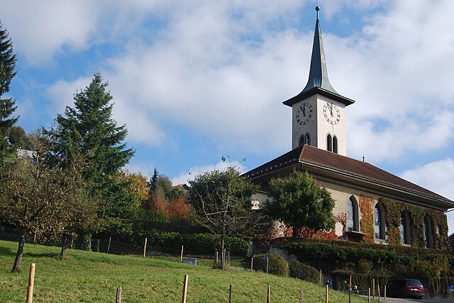
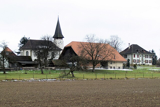
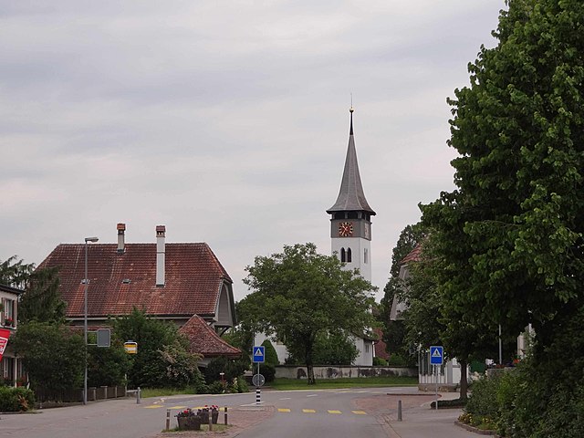
 Hiking in Bern-Mittelland administrative district
Bern-Mittelland is a beautiful administrative district in the canton of Bern, Switzerland, that offers a diverse range of hiking opportunities for all levels of hikers. Here are some highlights and tips for hiking in this scenic area:
Key Features of Bern-Mittelland:
-
Diverse Landscapes: The district boasts a variety of landscapes, including rolling hills, lush meadows, dense forests, and picturesque lakes. The scenery varies from the foothills of the Alps to charming rural areas.
-
Well-Marked Trails: Hiking trails in Bern-Mittelland are usually well-marked and maintained. You can find a variety of trails ranging from easy walks suitable for families to more challenging hikes for experienced trekkers.
-
Scenic Lakes: The area is home to several beautiful lakes like Lake Thun and Lake Biel, offering stunning views and opportunities for lakeside walking and picnicking.
-
Cultural Highlights: Many hikes pass through quaint villages, historical sites, and cultural landmarks. It's an excellent way to experience the local Swiss culture, including charming churches and traditional farmhouses.
-
Nature Reserves: There are several nature reserves in the region, which provide opportunities to observe local wildlife and enjoy the natural flora.
Popular Hiking Regions:
-
Gurten: A local mountain offering panoramic views of Bern and a variety of trails. You can hike up or take the funicular for a quicker ascent.
-
Höheweg: This is an ideal hiking trail for families, offering gentle slopes and beautiful meadows.
-
Elfenau Park: A lovely park in Bern with walking paths, great for leisurely strolls surrounded by nature.
-
Emmental: Just a bit further out, this region is famous for its rolling hills and stunning landscapes. It features several well-marked hiking paths.
Tips for Hiking in Bern-Mittelland:
-
Check Weather Conditions: Weather in Switzerland can change rapidly, so check the forecast before heading out and be prepared for varying conditions.
-
Dress Appropriately: Wear sturdy hiking shoes and dress in layers to accommodate changes in temperature and activity levels.
-
Stay Hydrated: Bring enough water, especially on longer hikes, as facilities may be sparse on certain trails.
-
Respect Nature: Follow Leave No Trace principles by staying on marked trails, taking your trash with you, and not disturbing wildlife.
-
Local Resources: Consult local hiking maps or guides, often available in tourist information centers, which provide detailed descriptions and updates about trail conditions.
With its blend of natural beauty, cultural experiences, and well-maintained trails, Bern-Mittelland is an excellent destination for both casual walkers and serious hikers. Happy trails!
- Country:

- Capital: Ostermundigen
- Licence Plate Code: BE
- Coordinates: 46° 57' 17" N, 7° 23' 42" E


- GPS tracks (wikiloc): [Link]
- AboveSeaLevel: 518 м m
- Area: 947 sq km
- Wikipedia en: wiki(en)
- Wikipedia: wiki(de)
- Wikidata storage: Wikidata: Q666217
- Wikipedia Commons Category: [Link]
- Freebase ID: [/m/0bhbwt9]
- GeoNames ID: Alt: [8260142]
- archINFORM location ID: [42765]
Includes regions:

Fraubrunnen
- municipality in the Bern-Mittelland administrative district, Switzerland
Hiking in Fraubrunnen
Fraubrunnen is a municipality located in the Canton of Bern in Switzerland, known for its picturesque landscapes and serene natural surroundings, making it a great destination for hiking enthusiasts. Here are some aspects to consider when planning a hike in Fraubrunnen:...
- Country:
- Postal Code: 3306, 3308, 3309, 3312, 3313, 3314, 3317, 3317
- Local Dialing Code: 031
- Licence Plate Code: BE
- Coordinates: 47° 5' 20" N, 7° 31' 50" E
- GPS tracks (wikiloc): [Link]
- AboveSeaLevel: 489 м m
- Area: 7.69 sq km
- Population: 5037
- Web site: [Link]

Jegenstorf
- municipality in the Bern-Mittelland administrative district, Switzerland
Hiking in Jegenstorf
Jegenstorf, located in Switzerland, offers a charming setting for hiking enthusiasts. Nestled near the picturesque Emmental region, this area is characterized by rolling hills, lush green landscapes, and scenic views, making it a great destination for outdoor activities....
- Country:
- Postal Code: 3303
- Local Dialing Code: 031
- Licence Plate Code: BE
- Coordinates: 47° 3' 8" N, 7° 30' 13" E
- GPS tracks (wikiloc): [Link]
- AboveSeaLevel: 538 м m
- Area: 8.9 sq km
- Population: 5697
- Web site: [Link]
Köniz
- municipality in Switzerland
Hiking in Köniz
Köniz, located just outside the city of Bern, Switzerland, offers a range of hiking opportunities that cater to various skill levels. The scenic landscape of the area features rolling hills, lush forests, and stunning views of the surrounding mountains and the Aare River....
- Country:
- Postal Code: 3084, 3095, 3097, 3098, 3144, 3145, 3147, 3172, 3173, 3174
- Local Dialing Code: 031
- Licence Plate Code: BE
- Coordinates: 46° 54' 16" N, 7° 23' 52" E
- GPS tracks (wikiloc): [Link]
- AboveSeaLevel: 651 м m
- Area: 51.1 sq km
- Population: 41507
- Web site: [Link]

Guggisberg
- municipality in Switzerland
Hiking in Guggisberg
Guggisberg, located in the Bernese Oberland region of Switzerland, is a picturesque area known for its stunning landscape and outdoor activities, making it a popular destination for hikers. Here are some key points about hiking in Guggisberg:...
- Country:
- Postal Code: 3158
- Local Dialing Code: 031
- Licence Plate Code: BE
- Coordinates: 46° 45' 59" N, 7° 19' 59" E
- GPS tracks (wikiloc): [Link]
- AboveSeaLevel: 1320 м m
- Area: 45.9 sq km
- Population: 1539
- Web site: [Link]

Rüschegg
- municipality in Switzerland
Hiking in Rüschegg
Rüschegg is a picturesque area located in the Bernese Oberland region of Switzerland, known for its stunning landscapes, rich flora and fauna, and a variety of hiking trails suitable for different skill levels. Here are some key points to consider when hiking in Rüschegg:...
- Country:
- Postal Code: 3153, 3154
- Local Dialing Code: 031
- Licence Plate Code: BE
- Coordinates: 46° 44' 44" N, 7° 24' 21" E
- GPS tracks (wikiloc): [Link]
- AboveSeaLevel: 1313 м m
- Area: 57.40 sq km
- Population: 1630
- Web site: [Link]

Riggisberg
- municipality in Switzerland
Hiking in Riggisberg
Riggisberg, located in the Bernese Oberland region of Switzerland, offers beautiful hiking opportunities with stunning views of the Swiss Alps and the surrounding countryside. Here are some highlights about hiking in Riggisberg:...
- Country:
- Postal Code: 3132
- Local Dialing Code: 031
- Licence Plate Code: BE
- Coordinates: 46° 48' 34" N, 7° 28' 41" E
- GPS tracks (wikiloc): [Link]
- AboveSeaLevel: 762 м m
- Area: 29.9 sq km
- Population: 2491
- Web site: [Link]

Biglen
- municipality in Switzerland
Hiking in Biglen
Biglen, located in the Canton of Bern, Switzerland, offers beautiful landscapes and a variety of hiking opportunities for both beginners and experienced hikers. The area is known for its rolling hills, lush forests, and scenic views of the surrounding mountains. Here are some key points to consider when planning a hiking trip in Biglen:...
- Country:
- Postal Code: 3507
- Local Dialing Code: 031
- Licence Plate Code: BE
- Coordinates: 46° 55' 40" N, 7° 37' 36" E
- GPS tracks (wikiloc): [Link]
- AboveSeaLevel: 732 м m
- Area: 3.59 sq km
- Population: 1814
- Web site: [Link]

Oberbalm
- municipality in Switzerland
Hiking in Oberbalm
Oberbalm is a beautiful area located in Switzerland, known for its stunning landscapes and outdoor activities, including hiking. Nestled near the city of Bern, Oberbalm offers impressive views of the surrounding mountains and countryside, making it a great destination for hikers of all levels....
- Country:
- Postal Code: 3096
- Local Dialing Code: 031
- Licence Plate Code: BE
- Coordinates: 46° 51' 56" N, 7° 24' 33" E
- GPS tracks (wikiloc): [Link]
- AboveSeaLevel: 776 м m
- Area: 12.40 sq km
- Population: 869
- Web site: [Link]
Ferenbalm
- municipality in Switzerland
Hiking in Ferenbalm
Ferenbalm, a charming area located near Bern in Switzerland, offers a variety of hiking opportunities that showcase its picturesque landscapes and serene environment. The region is known for its beautiful trails, which cater to different skill levels, making it a great destination for both novice and experienced hikers....
- Country:
- Postal Code: 3206
- Local Dialing Code: 031
- Licence Plate Code: BE
- Coordinates: 46° 56' 55" N, 7° 12' 41" E
- GPS tracks (wikiloc): [Link]
- AboveSeaLevel: 513 м m
- Area: 9.2 sq km
- Population: 1241
- Web site: [Link]

Kirchdorf
- municipality in the canton of Bern, Switzerland
Hiking in Kirchdorf
Kirchdorf, located in the canton of Bern, Switzerland, is a charming area that offers beautiful landscapes for hiking enthusiasts. The region surrounding Kirchdorf is characterized by rolling hills, lush forests, and stunning panoramic views of the Alps, making it a great destination for hikers of all levels....
- Country:
- Postal Code: 3116
- Local Dialing Code: 031
- Licence Plate Code: BE
- Coordinates: 46° 49' 2" N, 7° 32' 44" E
- GPS tracks (wikiloc): [Link]
- AboveSeaLevel: 601 м m
- Area: 6.1 sq km
- Population: 977
- Web site: [Link]

Kirchenthurnen
- municipality in Switzerland
Hiking in Kirchenthurnen
Kirchenthurnen, located in the Bernese region of Switzerland, offers various hiking opportunities amidst beautiful landscapes, meandering streams, and picturesque views of the surrounding mountains. Here are some aspects you might consider when hiking in this area:...
- Country:
- Postal Code: 3128
- Local Dialing Code: 031
- Licence Plate Code: BE
- Coordinates: 46° 49' 23" N, 7° 30' 6" E
- GPS tracks (wikiloc): [Link]
- AboveSeaLevel: 612 м m
- Area: 1.3 sq km
- Population: 273
- Web site: [Link]

Wichtrach
- municipality in Switzerland
Hiking in Wichtrach
Wichtrach is a charming village located in Switzerlands' Aargau region, surrounded by beautiful landscapes that can offer some pleasant hiking opportunities. While it may not be as well-known as some other hiking destinations in Switzerland, hiking in and around Wichtrach can provide a wonderful experience for nature lovers and outdoor enthusiasts....
- Country:
- Postal Code: 3114
- Local Dialing Code: 031
- Licence Plate Code: BE
- Coordinates: 46° 50' 43" N, 7° 34' 46" E
- GPS tracks (wikiloc): [Link]
- AboveSeaLevel: 551 м m
- Area: 11.6 sq km
- Population: 4318
- Web site: [Link]

Münchenwiler
- municipality in Switzerland
Hiking in Münchenwiler
Münchenwiler is a picturesque municipality located in the canton of Fribourg, Switzerland. It offers an excellent environment for hiking enthusiasts, with its beautiful landscapes, rolling hills, and proximity to natural reserves. Here are some highlights and tips for hiking in Münchenwiler:...
- Country:
- Postal Code: 1797
- Local Dialing Code: 026
- Licence Plate Code: BE
- Coordinates: 46° 54' 47" N, 7° 7' 31" E
- GPS tracks (wikiloc): [Link]
- AboveSeaLevel: 499 м m
- Area: 2.5 sq km
- Population: 514
- Web site: [Link]

Neuenegg
- municipality in Switzerland
Hiking in Neuenegg
Neuenegg, located in the Canton of Bern in Switzerland, offers a variety of hiking opportunities that cater to different skill levels and preferences. Here are some highlights and tips for hiking in this beautiful area:...
- Country:
- Postal Code: 3176
- Local Dialing Code: 031
- Licence Plate Code: BE
- Coordinates: 46° 54' 0" N, 7° 17' 59" E
- GPS tracks (wikiloc): [Link]
- AboveSeaLevel: 525 м m
- Area: 22.0 sq km
- Population: 5543
- Web site: [Link]
Brenzikofen
- municipality in Switzerland
Hiking in Brenzikofen
Brenzikofen, located in Switzerland, offers a variety of hiking opportunities that cater to different skill levels. The surrounding region is known for its stunning landscapes, picturesque views, and well-marked trails....
- Country:
- Postal Code: 3671
- Local Dialing Code: 031
- Licence Plate Code: BE
- Coordinates: 46° 48' 53" N, 7° 36' 59" E
- GPS tracks (wikiloc): [Link]
- AboveSeaLevel: 598 м m
- Area: 2.2 sq km
- Population: 488
- Web site: [Link]

Niedermuhlern
- municipality in Switzerland
Hiking in Niedermuhlern
Niedermühlen is a picturesque area in Switzerland known for its beautiful landscapes and hiking opportunities. Nestled in the Emmental region, it offers diverse trails that cater to various skill levels, making it suitable for both beginners and experienced hikers....
- Country:
- Postal Code: 3087
- Local Dialing Code: 031
- Licence Plate Code: BE
- Coordinates: 46° 51' 41" N, 7° 27' 56" E
- GPS tracks (wikiloc): [Link]
- AboveSeaLevel: 829 м m
- Area: 7.25 sq km
- Population: 499
- Web site: [Link]
Noflen
- municipality in the canton of Bern, Switzerland
Hiking in Noflen
Noflen is a picturesque area located in Switzerland, not far from the more well-known destination of Thun in the Bernese Oberland region. While Noflen itself may not be as crowded with tourists as other Swiss hiking areas, it offers stunning views and a more tranquil experience for those looking to immerse themselves in nature....
- Country:
- Postal Code: 3116
- Local Dialing Code: 031
- Licence Plate Code: BE
- Coordinates: 46° 48' 26" N, 7° 32' 32" E
- GPS tracks (wikiloc): [Link]
- AboveSeaLevel: 630 м m
- Area: 2.72 sq km
- Population: 300

Gelterfingen
- municipality in Switzerland
Hiking in Gelterfingen
Gelterfingen is a charming municipality located in the canton of Thurgau in Switzerland. While it may not be as well-known as some of the major hiking regions in the country, it offers some lovely opportunities for hiking enthusiasts to explore the picturesque Swiss countryside....
- Country:
- Postal Code: 3126
- Local Dialing Code: 031
- Licence Plate Code: BE
- Coordinates: 46° 50' 38" N, 7° 30' 57" E
- GPS tracks (wikiloc): [Link]
- AboveSeaLevel: 618 м m
- Area: 3.5 sq km
- Population: 303
- Web site: [Link]

Clavaleyres
- municipality in Switzerland
Hiking in Clavaleyres
Clavaleyres is a picturesque area located in the Canton of Fribourg in Switzerland, known for its stunning natural landscapes and hiking opportunities. The region features a mix of rolling hills, forests, and scenic views of the surrounding mountains, making it a lovely destination for hikers of all levels....
- Country:
- Postal Code: 1595
- Local Dialing Code: 026
- Licence Plate Code: BE
- Coordinates: 46° 53' 52" N, 7° 5' 31" E
- GPS tracks (wikiloc): [Link]
- AboveSeaLevel: 460 м m
- Area: 1.0 sq km
- Population: 46
- Web site: [Link]

Konolfingen
- municipality in the canton of Bern, Switzerland
Hiking in Konolfingen
Konolfingen is a charming municipality located in the Canton of Bern, Switzerland, known for its beautiful landscapes and opportunities for hiking. The area offers a mix of trails that cater to various skill levels, making it a great destination for both beginner and experienced hikers....
- Country:
- Postal Code: 3510
- Local Dialing Code: 031
- Licence Plate Code: BE
- Coordinates: 46° 53' 0" N, 7° 37' 0" E
- GPS tracks (wikiloc): [Link]
- AboveSeaLevel: 658 м m
- Area: 12.8 sq km
- Population: 4732
- Web site: [Link]

Bleiken bei Oberdiessbach
- former municipality of Switzerland
Hiking in Bleiken bei Oberdiessbach
Bleiken bei Oberdiessbach is a charming village in Bavaria, Germany, surrounded by beautiful landscapes that are perfect for hiking enthusiasts. The region offers a variety of trails that cater to different skill levels, allowing both beginners and experienced hikers to enjoy the natural beauty....
- Country:
- Postal Code: 3674
- Local Dialing Code: 031
- Licence Plate Code: BE
- Coordinates: 46° 48' 47" N, 7° 38' 25" E
- GPS tracks (wikiloc): [Link]
- AboveSeaLevel: 874 м m
- Area: 3.42 sq km
- Web site: [Link]

Mühlethurnen
- municipality in Switzerland
Hiking in Mühlethurnen
Mühlethurnen, located in the Canton of Bern in Switzerland, offers beautiful hiking opportunities amidst stunning scenery. The region is characterized by gentle hills, lush green landscapes, and panoramic views of the Alps, making it an ideal spot for both leisurely walks and more challenging hikes....
- Country:
- Postal Code: 3127
- Local Dialing Code: 031
- Licence Plate Code: BE
- Coordinates: 46° 48' 58" N, 7° 30' 37" E
- GPS tracks (wikiloc): [Link]
- AboveSeaLevel: 565 м m
- Area: 2.9 sq km
- Population: 1378
- Web site: [Link]
Kiesen
- municipality in Switzerland
Hiking in Kiesen
Kiesen, located in the canton of Bern, Switzerland, is a picturesque village that serves as a great starting point for various hiking adventures. The region is characterized by its stunning natural landscapes, including lush forests, rolling hills, and panoramic views of the Bernese Alps....
- Country:
- Postal Code: 3629
- Local Dialing Code: 031
- Licence Plate Code: BE
- Coordinates: 46° 48' 45" N, 7° 34' 48" E
- GPS tracks (wikiloc): [Link]
- AboveSeaLevel: 540 м m
- Area: 4.7 sq km
- Population: 989
- Web site: [Link]

Rüeggisberg
- municipality in Switzerland
Hiking in Rüeggisberg
Rüeggisberg, located in the Bernese Oberland region of Switzerland, offers a superb hiking experience with its picturesque landscapes, rolling hills, and stunning views of the Alps. Here are some highlights and tips for hiking in Rüeggisberg:...
- Country:
- Postal Code: 3088, 3089, 3155
- Local Dialing Code: 031
- Licence Plate Code: BE
- Coordinates: 46° 49' 18" N, 7° 26' 22" E
- GPS tracks (wikiloc): [Link]
- AboveSeaLevel: 775 м m
- Area: 37.76 sq km
- Population: 1789
- Web site: [Link]
Jaberg
- municipality in Switzerland
Hiking in Jaberg
Jaberg, a small municipality in the Canton of Bern, Switzerland, offers beautiful hiking opportunities amidst picturesque landscapes and scenic views of the Swiss Alps. Here are some highlights of hiking in Jaberg:...
- Country:
- Postal Code: 3629
- Local Dialing Code: 031
- Licence Plate Code: BE
- Coordinates: 46° 49' 10" N, 7° 33' 57" E
- GPS tracks (wikiloc): [Link]
- AboveSeaLevel: 569 м m
- Area: 1.32 sq km
- Population: 269
- Web site: [Link]
Lohnstorf
- municipality in Switzerland
Hiking in Lohnstorf
Lohnstorf, located in Switzerland, is surrounded by picturesque landscapes and provides several opportunities for hiking enthusiasts. While Lohnstorf itself may be a small village, its proximity to the beautiful regions of the Swiss Alps and nearby nature reserves makes it an excellent base for hiking adventures....
- Country:
- Postal Code: 3127
- Local Dialing Code: 031
- Licence Plate Code: BE
- Coordinates: 46° 48' 24" N, 7° 30' 47" E
- GPS tracks (wikiloc): [Link]
- AboveSeaLevel: 554 м m
- Area: 1.8 sq km
- Population: 225
- Web site: [Link]

Kaufdorf
- municipality in Switzerland
Hiking in Kaufdorf
Kaufdorf, a small municipality in Switzerland, is surrounded by beautiful nature and offers various hiking opportunities suitable for different skill levels. The area is characterized by rolling hills, picturesque landscapes, and scenic views of the nearby Alps....
- Country:
- Postal Code: 3126
- Local Dialing Code: 031
- Licence Plate Code: BE
- Coordinates: 46° 49' 59" N, 7° 28' 59" E
- GPS tracks (wikiloc): [Link]
- AboveSeaLevel: 560 м m
- Area: 2.1 sq km
- Population: 1085
- Web site: [Link]

Rümligen
- municipality in Switzerland
Hiking in Rümligen
Rümligen is a small municipality in the canton of Bern, Switzerland, known for its beautiful natural landscapes and access to hiking trails. The area is characterized by rolling hills, forests, and scenic views of the surrounding Bernese Alps, making it a great destination for hikers of all levels....
- Country:
- Postal Code: 3128
- Local Dialing Code: 031
- Licence Plate Code: BE
- Coordinates: 46° 49' 51" N, 7° 29' 54" E
- GPS tracks (wikiloc): [Link]
- AboveSeaLevel: 606 м m
- Area: 4.65 sq km
- Population: 440
- Web site: [Link]
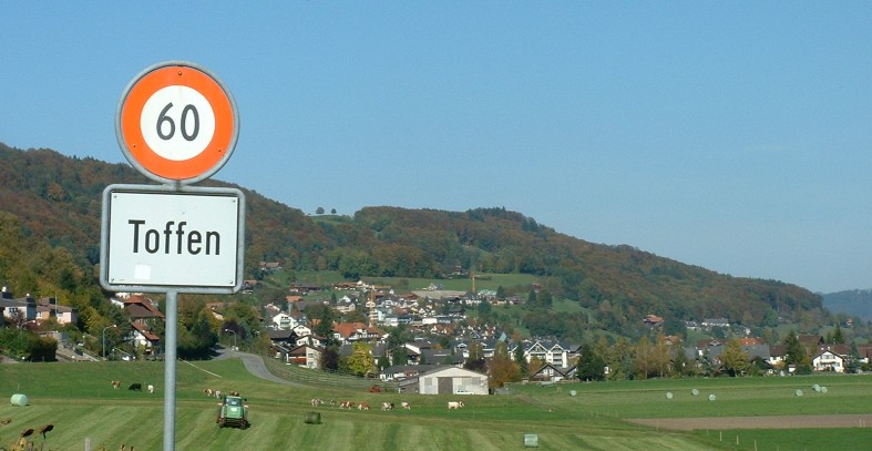
Toffen
- municipality in Switzerland
Hiking in Toffen
Toffen, located in the Canton of Bern in Switzerland, is a charming village surrounded by stunning natural scenery, making it an excellent place for hiking enthusiasts. The region offers a variety of trails suitable for all levels of hikers, from leisurely walks to more challenging routes....
- Country:
- Postal Code: 3125
- Local Dialing Code: 031
- Licence Plate Code: BE
- Coordinates: 46° 51' 32" N, 7° 29' 33" E
- GPS tracks (wikiloc): [Link]
- AboveSeaLevel: 530 м m
- Area: 4.88 sq km
- Population: 2557
- Web site: [Link]
Vechigen
- municipality in Switzerland
Hiking in Vechigen
Vechigen is a charming municipality located in the canton of Bern, Switzerland. It offers a variety of hiking opportunities that allow outdoor enthusiasts to enjoy the stunning landscapes and natural beauty of the region. Here are a few highlights about hiking in Vechigen:...
- Country:
- Postal Code: 3067, 3068
- Local Dialing Code: 031
- Licence Plate Code: BE
- Coordinates: 46° 57' 47" N, 7° 34' 7" E
- GPS tracks (wikiloc): [Link]
- AboveSeaLevel: 733 м m
- Area: 25.0 sq km
- Population: 5242
- Web site: [Link]
Mühledorf
- municipality in the canton of Bern, Switzerland
Hiking in Mühledorf
Mühledorf is a charming village located in the Bern region of Switzerland, surrounded by beautiful landscapes and natural wonders, making it an excellent location for hiking enthusiasts. Here are some key aspects of hiking in and around Mühledorf:...
- Country:
- Postal Code: 3116
- Local Dialing Code: 031
- Licence Plate Code: BE
- Coordinates: 46° 49' 44" N, 7° 32' 19" E
- GPS tracks (wikiloc): [Link]
- AboveSeaLevel: 564 м m
- Area: 2.3 sq km
- Population: 261
- Web site: [Link]
Wileroltigen
- municipality in Switzerland
Hiking in Wileroltigen
Wileroltigen is a quaint village located in the Bern-Mittelland region of Switzerland, known for its beautiful landscapes and proximity to the picturesque Swiss countryside. Hiking in and around Wileroltigen offers a range of trails suitable for various skill levels, providing a wonderful opportunity to immerse yourself in nature....
- Country:
- Postal Code: 3207
- Local Dialing Code: 031
- Licence Plate Code: BE
- Coordinates: 46° 58' 20" N, 7° 14' 19" E
- GPS tracks (wikiloc): [Link]
- AboveSeaLevel: 530 м m
- Area: 4.15 sq km
- Population: 357
- Web site: [Link]

Zäziwil
- municipality in Switzerland
Hiking in Zäziwil
Zäziwil is a charming village located in the canton of Bern, Switzerland. It's a great spot for hiking enthusiasts, offering a variety of trails that cater to different skill levels. Here are some highlights for hiking in and around Zäziwil:...
- Country:
- Postal Code: 3532
- Local Dialing Code: 031
- Licence Plate Code: BE
- Coordinates: 46° 53' 44" N, 7° 40' 3" E
- GPS tracks (wikiloc): [Link]
- AboveSeaLevel: 714 м m
- Area: 5.42 sq km
- Population: 1628
- Web site: [Link]
Zuzwil
- municipality in the canton of Bern, Switzerland
Hiking in Zuzwil
Zuzwil, located in the Bern region of Switzerland, is a charming area that offers various hiking opportunities, often featuring breathtaking vistas of the Bernese Alps and surrounding countryside. While Zuzwil itself is a small municipality, it serves as a great base for accessing several scenic trails and discovering the natural beauty of the region....
- Country:
- Postal Code: 3303
- Local Dialing Code: 031
- Licence Plate Code: BE
- Coordinates: 47° 2' 59" N, 7° 28' 2" E
- GPS tracks (wikiloc): [Link]
- AboveSeaLevel: 572 м m
- Area: 3.46 sq km
- Population: 572
- Web site: [Link]

Gerzensee
- municipality in the canton of Bern, Switzerland
Hiking in Gerzensee
Gerzensee is a picturesque area located in the Bernese region of Switzerland, offering beautiful landscapes and serene hiking opportunities. The region is known for its stunning lake and surrounding mountains, making it an ideal destination for both casual and experienced hikers....
- Country:
- Postal Code: 3115
- Local Dialing Code: 031
- Licence Plate Code: BE
- Coordinates: 46° 50' 0" N, 7° 33' 0" E
- GPS tracks (wikiloc): [Link]
- AboveSeaLevel: 646 м m
- Area: 7.8 sq km
- Population: 1194
- Web site: [Link]

Gurbrü
- municipality in Switzerland
Hiking in Gurbrü
Gurbrü is a lesser-known yet charming area in Switzerland that offers a variety of hiking trails suitable for different skill levels. Nestled in the beautiful landscapes of the Bernese Oberland, it is surrounded by stunning views of mountains, forests, and meadows, making it an ideal spot for nature lovers....
- Country:
- Postal Code: 3208
- Local Dialing Code: 031
- Licence Plate Code: BE
- Coordinates: 46° 57' 0" N, 7° 12' 0" E
- GPS tracks (wikiloc): [Link]
- AboveSeaLevel: 490 м m
- Area: 1.8 sq km
- Population: 246
- Web site: [Link]

Kriechenwil
- municipality in Switzerland
Hiking in Kriechenwil
Kriechenwil is a charming village in the canton of Bern, Switzerland. Though it's not as widely known as some of the country's larger tourist destinations, it offers beautiful landscapes and a peaceful hiking experience suitable for all skill levels....
- Country:
- Postal Code: 3179
- Local Dialing Code: 031
- Licence Plate Code: BE
- Coordinates: 46° 54' 40" N, 7° 12' 57" E
- GPS tracks (wikiloc): [Link]
- AboveSeaLevel: 522 м m
- Area: 4.85 sq km
- Population: 420
- Web site: [Link]

Laupen
- municipality in Switzerland
Hiking in Laupen
Laupen, located in the canton of Bern, Switzerland, is a charming town surrounded by beautiful landscapes, making it a great location for hiking enthusiasts. Here are some highlights and tips for hiking in the area:...
- Country:
- Postal Code: 3177
- Local Dialing Code: 031
- Licence Plate Code: BE
- Coordinates: 46° 54' 0" N, 7° 13' 59" E
- GPS tracks (wikiloc): [Link]
- AboveSeaLevel: 489 м m
- Area: 4.12 sq km
- Population: 3093
- Web site: [Link]

Wald
- municipality in the canton of Bern, Switzerland
Hiking in Wald
Wald, located in the Bernese Oberland region of Switzerland, offers a variety of picturesque hiking opportunities amidst stunning natural landscapes. Here are some highlights to consider when hiking in this area:...
- Country:
- Postal Code: 3086
- Local Dialing Code: 031
- Licence Plate Code: BE
- Coordinates: 46° 52' 57" N, 7° 28' 18" E
- GPS tracks (wikiloc): [Link]
- AboveSeaLevel: 840 м m
- Area: 13.3 sq km
- Population: 1171
- Web site: [Link]

Mühleberg
- municipality in Switzerland
Hiking in Mühleberg
Mühleberg is a picturesque municipality located near the city of Bern in Switzerland, and it offers several opportunities for hiking enthusiasts. The area is characterized by its scenic views, lush green landscapes, and the gentle slopes of the surrounding hills. Here are some highlights to consider when planning a hike in Mühleberg:...
- Country:
- Postal Code: 3203
- Local Dialing Code: 031
- Licence Plate Code: BE
- Coordinates: 46° 56' 48" N, 7° 16' 19" E
- GPS tracks (wikiloc): [Link]
- AboveSeaLevel: 639 м m
- Area: 26.3 sq km
- Population: 2974
- Web site: [Link]

Urtenen-Schönbühl
- municipality in Switzerland
Hiking in Urtenen-Schönbühl
Urtenen-Schönbühl is a charming municipality located in the canton of Bern, Switzerland. It's situated near the city of Biel and offers a beautiful mix of nature, culture, and accessibility, making it an excellent starting point for hiking enthusiasts. Here’s what you can expect when hiking in and around Urtenen-Schönbühl:...
- Country:
- Postal Code: 3322
- Local Dialing Code: 031
- Licence Plate Code: BE
- Coordinates: 47° 2' 0" N, 7° 30' 0" E
- GPS tracks (wikiloc): [Link]
- AboveSeaLevel: 525 м m
- Area: 7.18 sq km
- Population: 6222
- Web site: [Link]

Meikirch
- municipality in Switzerland
Hiking in Meikirch
Meikirch, located in the Canton of Bern, Switzerland, offers a lovely setting for hiking enthusiasts. Surrounded by picturesque landscapes, rolling hills, and scenic views, it serves as a great starting point for various hiking trails....
- Country:
- Postal Code: 3042, 3045, 3046
- Local Dialing Code: 031
- Licence Plate Code: BE
- Coordinates: 47° 0' 35" N, 7° 21' 55" E
- GPS tracks (wikiloc): [Link]
- AboveSeaLevel: 654 м m
- Area: 10.30 sq km
- Population: 2499
- Web site: [Link]
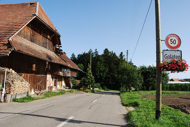
Golaten
- village in the municipality of Kallnach in the canton of Bern, Switzerland
Hiking in Golaten
Golaten is a picturesque area located in Switzerland, known for its natural beauty and excellent hiking opportunities. Situated near the scenic Lake Geneva and surrounded by the Swiss Alps, it offers a variety of trails for hikers of all skill levels....
- Country:
- Postal Code: 3207
- Local Dialing Code: 031
- Licence Plate Code: BE
- Coordinates: 46° 59' 0" N, 7° 14' 0" E
- GPS tracks (wikiloc): [Link]
- AboveSeaLevel: 519 м m
- Area: 2.8 sq km
- Population: 305
- Web site: [Link]
Zauggenried
- former municipality of Switzerland
Hiking in Zauggenried
Zauggenried is a small and picturesque area located in the Emmental region of Switzerland. While it may not be one of the most famous hiking destinations, it offers a variety of opportunities to explore the natural beauty of the Swiss countryside....
- Country:
- Postal Code: 3309
- Local Dialing Code: 031
- Licence Plate Code: BE
- Coordinates: 47° 4' 22" N, 7° 32' 26" E
- GPS tracks (wikiloc): [Link]
- AboveSeaLevel: 500 м m
- Area: 3.67 sq km
- Web site: [Link]

Allmendingen bei Bern
- municipality in Switzerland
Hiking in Allmendingen bei Bern
Allmendingen bei Bern is a scenic location in Switzerland that offers beautiful hiking opportunities. Nestled in the Bernese region, it provides a great mix of natural landscapes, rolling hills, and views of the surrounding mountains....
- Country:
- Postal Code: 3112
- Local Dialing Code: 031
- Licence Plate Code: BE
- Coordinates: 46° 55' 0" N, 7° 31' 0" E
- GPS tracks (wikiloc): [Link]
- AboveSeaLevel: 589 м m
- Area: 3.8 sq km
- Population: 579
- Web site: [Link]

Walkringen
- municipality in Switzerland
Hiking in Walkringen
Walkringen is a charming village located in the Canton of Bern, Switzerland. It offers a variety of beautiful hiking trails that cater to different skill levels and preferences. Here are some highlights about hiking in and around Walkringen:...
- Country:
- Postal Code: 3512
- Local Dialing Code: 031
- Licence Plate Code: BE
- Coordinates: 46° 57' 38" N, 7° 37' 39" E
- GPS tracks (wikiloc): [Link]
- AboveSeaLevel: 809 м m
- Area: 17.19 sq km
- Population: 1782
- Web site: [Link]

Schlosswil
- former municipality in Switzerland
Hiking in Schlosswil
Schlosswil, located in the canton of Bern, Switzerland, offers picturesque scenery and a variety of trails suitable for hikers of all levels. Nestled near the foothills of the Swiss Alps, this area combines beautiful landscapes with charming villages and lush greenery....
- Country:
- Postal Code: 3082
- Local Dialing Code: 031
- Licence Plate Code: BE
- Coordinates: 46° 54' 30" N, 7° 36' 46" E
- GPS tracks (wikiloc): [Link]
- AboveSeaLevel: 743 м m
- Area: 3.45 sq km
- Population: 630
- Web site: [Link]

Oberthal
- municipality in the canton of Bern, Switzerland
Hiking in Oberthal
Oberthal, located in the scenic region of Switzerland, offers a great variety of hiking opportunities for both beginners and experienced hikers. Nestled in the foothills of the Alps, this area is known for its breathtaking landscapes, lush valleys, and panoramic mountain views....
- Country:
- Postal Code: 3531
- Local Dialing Code: 031
- Licence Plate Code: BE
- Coordinates: 46° 54' 59" N, 7° 39' 59" E
- GPS tracks (wikiloc): [Link]
- AboveSeaLevel: 822 м m
- Area: 10.54 sq km
- Population: 731
- Web site: [Link]

Moosseedorf
- municipality in Switzerland
Hiking in Moosseedorf
Moosseedorf is a charming village located in the Canton of Bern, Switzerland. With its picturesque landscapes and scenic trails, it can be an excellent starting point for hiking enthusiasts looking to explore the beautiful Swiss countryside....
- Country:
- Postal Code: 3302
- Local Dialing Code: 031
- Licence Plate Code: BE
- Coordinates: 47° 1' 1" N, 7° 29' 2" E
- GPS tracks (wikiloc): [Link]
- AboveSeaLevel: 530 м m
- Area: 6.3 sq km
- Population: 4114
- Web site: [Link]

Büren zum Hof
- former municipality of Switzerland
Hiking in Büren zum Hof
Büren zum Hof is a beautiful area located in Switzerland that offers various hiking opportunities, characterized by picturesque landscapes, charming villages, and scenic views of the surrounding countryside and mountains. Here are some things to consider when planning a hiking trip in this area:...
- Country:
- Postal Code: 3313
- Local Dialing Code: 031
- Licence Plate Code: BE
- Coordinates: 47° 5' 44" N, 7° 30' 49" E
- GPS tracks (wikiloc): [Link]
- AboveSeaLevel: 510 м m
- Area: 3.5 sq km
- Web site: [Link]
Arni
- municipality in the canton of Bern, Switzerland
Hiking in Arni
Hiking around Arni in the Bern region of Switzerland offers a wonderful experience, showcasing the beauty of the Swiss landscape. Arni is nestled in the lush hills and mountains, making it an ideal starting point for various hiking trails. Here are some highlights and tips for hiking in the area:...
- Country:
- Postal Code: 3508
- Local Dialing Code: 031
- Licence Plate Code: BE
- Coordinates: 46° 56' 7" N, 7° 39' 28" E
- GPS tracks (wikiloc): [Link]
- AboveSeaLevel: 865 м m
- Area: 10.43 sq km
- Population: 935
- Web site: [Link]

Mülchi
- former municipality of Switzerland
Hiking in Mülchi
Mülchi is a picturesque area located in Switzerland, often celebrated for its beautiful landscapes and excellent hiking opportunities. The region offers a variety of trails suitable for different skill levels, making it a great destination for both novice and experienced hikers....
- Country:
- Postal Code: 3317
- Local Dialing Code: 031
- Licence Plate Code: BE
- Coordinates: 47° 6' 8" N, 7° 28' 42" E
- GPS tracks (wikiloc): [Link]
- AboveSeaLevel: 476 м m
- Area: 3.8 sq km
- Web site: [Link]

Oberdiessbach
- municipality in Switzerland
Hiking in Oberdiessbach
Oberdiessbach is a charming village located in Bavaria, Germany, surrounded by stunning landscapes that are perfect for hiking enthusiasts. The region is characterized by its beautiful forests, meadows, and scenic views of the surrounding mountains, making it an ideal destination for outdoor activities....
- Country:
- Postal Code: 3672
- Local Dialing Code: 031
- Licence Plate Code: BE
- Coordinates: 46° 50' 22" N, 7° 37' 9" E
- GPS tracks (wikiloc): [Link]
- AboveSeaLevel: 613 м m
- Area: 8.2 sq km
- Population: 3523
- Web site: [Link]
Münchringen
- former municipality of Switzerland
Hiking in Münchringen
Münchringen, a small village in Germany, offers a unique blend of nature and culture for hikers. Located in the picturesque region of Baden-Württemberg, the area is characterized by rolling hills, dense forests, and beautiful rural landscapes. Here are some insights into hiking in Münchringen:...
- Country:
- Postal Code: 3303
- Local Dialing Code: 031
- Licence Plate Code: BE
- Coordinates: 47° 2' 39" N, 7° 31' 18" E
- GPS tracks (wikiloc): [Link]
- AboveSeaLevel: 522 м m
- Area: 2.4 sq km
- Population: 596
- Web site: [Link]
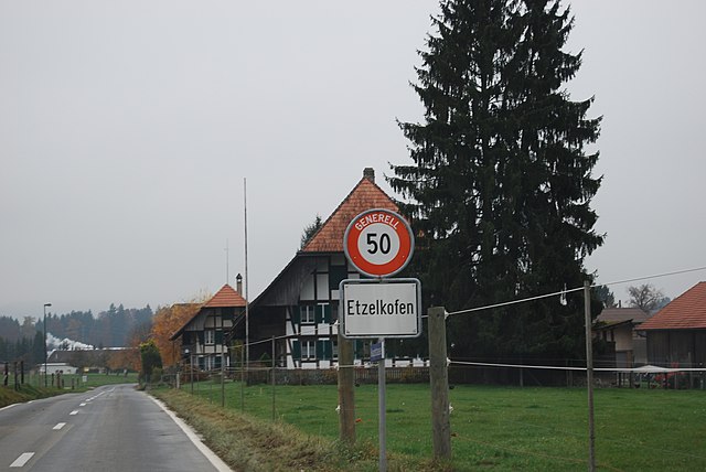
Etzelkofen
- former municipality of Switzerland
Hiking in Etzelkofen
Etzelkofen is a picturesque area in Switzerland that offers beautiful hiking opportunities, characterized by stunning landscapes, lush greenery, and panoramic views of the surrounding mountains. Here’s a guide to hiking in Etzelkofen and what you can expect:...
- Country:
- Postal Code: 3306
- Local Dialing Code: 031
- Licence Plate Code: BE
- Coordinates: 47° 5' 2" N, 7° 28' 44" E
- GPS tracks (wikiloc): [Link]
- AboveSeaLevel: 529 м m
- Area: 2.8 sq km
- Web site: [Link]
Linden
- municipality in the canton of Bern, Switzerland
Hiking in Linden
Linden, Switzerland, is a small area that might not have well-known hiking trails directly associated with its name, but it offers access to beautiful landscapes typical of the Swiss countryside. Here are some aspects you'll appreciate when hiking in and around Linden:...
- Country:
- Postal Code: 3673
- Local Dialing Code: 031
- Licence Plate Code: BE
- Coordinates: 46° 50' 54" N, 7° 41' 13" E
- GPS tracks (wikiloc): [Link]
- AboveSeaLevel: 905 м m
- Area: 13.3 sq km
- Population: 1281
- Web site: [Link]
Grosshöchstetten
- municipality in Switzerland
Hiking in Grosshöchstetten
Grosshöchstetten, located in the Swiss canton of Bern, offers a variety of hiking opportunities for outdoor enthusiasts. Nestled between the picturesque landscape of the Emmental region and the rolling hills of the Bernese Oberland, this area is characterized by stunning views, lush green fields, and charming Swiss villages....
- Country:
- Postal Code: 3506
- Local Dialing Code: 031
- Licence Plate Code: BE
- Coordinates: 46° 53' 59" N, 7° 38' 0" E
- GPS tracks (wikiloc): [Link]
- AboveSeaLevel: 765 м m
- Area: 3.4 sq km
- Population: 3555
- Web site: [Link]

Wohlen bei Bern
- municipality in Switzerland
Hiking in Wohlen bei Bern
Wohlen bei Bern is a picturesque municipality in the Bern-Mittelland region of Switzerland, offering various beautiful trails and natural surroundings for hiking enthusiasts. Here are some key points to know about hiking in and around Wohlen bei Bern:...
- Country:
- Postal Code: 3032, 3033, 3034, 3043, 3044, 3049
- Local Dialing Code: 031
- Licence Plate Code: BE
- Coordinates: 46° 58' 58" N, 7° 20' 37" E
- GPS tracks (wikiloc): [Link]
- AboveSeaLevel: 613 м m
- Area: 36.3 sq km
- Population: 9215
- Web site: [Link]

Freimettigen
- municipality in Switzerland
Hiking in Freimettigen
Freimettigen is a picturesque and tranquil area in the region of Bern, Switzerland. While it may not be as widely recognized as some of the more prominent hiking destinations in the Swiss Alps, it offers beautiful landscapes and a chance to experience the serene natural environment....
- Country:
- Postal Code: 3510
- Local Dialing Code: 031
- Licence Plate Code: BE
- Coordinates: 46° 51' 48" N, 7° 37' 57" E
- GPS tracks (wikiloc): [Link]
- AboveSeaLevel: 723 м m
- Area: 2.95 sq km
- Population: 473
- Web site: [Link]
Mirchel
- municipality in Switzerland
Hiking in Mirchel
Mirchel is a scenic area in Switzerland that offers beautiful hiking opportunities, particularly characterized by its lush landscapes, rolling hills, and panoramic views of the surrounding countryside. Located in the Bernese Oberland, it is a great destination for both novice and experienced hikers....
- Country:
- Postal Code: 3532
- Local Dialing Code: 031
- Licence Plate Code: BE
- Coordinates: 46° 53' 30" N, 7° 39' 1" E
- GPS tracks (wikiloc): [Link]
- AboveSeaLevel: 665 м m
- Area: 2.4 sq km
- Population: 630
- Web site: [Link]
Herbligen
- municipality in Switzerland
Hiking in Herbligen
Herbligen is a small municipality located in the canton of Bern, Switzerland, surrounded by beautiful landscapes and proximity to the Bernese Alps. While it may not be as famous as other hiking destinations in Switzerland, it offers great opportunities for those looking to immerse themselves in nature and enjoy less crowded trails....
- Country:
- Postal Code: 3671
- Local Dialing Code: 031
- Licence Plate Code: BE
- Coordinates: 46° 49' 38" N, 7° 36' 40" E
- GPS tracks (wikiloc): [Link]
- AboveSeaLevel: 580 м m
- Area: 2.7 sq km
- Population: 600
- Web site: [Link]
Wiggiswil
- municipality in Switzerland
Hiking in Wiggiswil
Wiggiswil is a scenic area that offers various hiking opportunities, especially for those who enjoy exploring the natural beauty of the Swiss landscape. Nestled in the heart of Switzerland, Wiggiswil provides access to trails that can cater to different skill levels, making it suitable for both beginners and experienced hikers....
- Country:
- Postal Code: 3053
- Local Dialing Code: 031
- Licence Plate Code: BE
- Coordinates: 47° 1' 53" N, 7° 28' 16" E
- GPS tracks (wikiloc): [Link]
- AboveSeaLevel: 563 м m
- Area: 1.43 sq km
- Population: 102
Niederhünigen
- municipality in Switzerland
Hiking in Niederhünigen
Niederhünigen is a charming area located in Switzerland, known for its picturesque landscapes and peaceful hiking trails. Hiking in this region provides an opportunity to explore the natural beauty of the Swiss countryside, with rolling hills, forests, and stunning views of the Alps....
- Country:
- Postal Code: 3504
- Local Dialing Code: 031
- Licence Plate Code: BE
- Coordinates: 46° 52' 38" N, 7° 38' 11" E
- GPS tracks (wikiloc): [Link]
- AboveSeaLevel: 692 м m
- Area: 5.4 sq km
- Population: 614
- Web site: [Link]
Oppligen
- municipality in Switzerland
Hiking in Oppligen
Oppligen is a small village situated in Norway, known for its beautiful landscapes and access to various hiking trails. Nestled in the Region of Buskerud, it offers a tranquil experience for hikers looking to connect with nature....
- Country:
- Postal Code: 3629
- Local Dialing Code: 031
- Licence Plate Code: BE
- Coordinates: 46° 49' 2" N, 7° 35' 48" E
- GPS tracks (wikiloc): [Link]
- AboveSeaLevel: 561 м m
- Area: 3.41 sq km
- Population: 644
- Web site: [Link]
Häutligen
- municipality in Switzerland
Hiking in Häutligen
Häutligen is a scenic area located in the Swiss canton of Bern, known for its beautiful landscapes and diverse hiking opportunities. Here are some details that can help you enjoy hiking in Häutligen:...
- Country:
- Postal Code: 3510
- Local Dialing Code: 031
- Licence Plate Code: BE
- Coordinates: 46° 51' 26" N, 7° 36' 19" E
- GPS tracks (wikiloc): [Link]
- AboveSeaLevel: 760 м m
- Area: 3.0 sq km
- Population: 253
- Web site: [Link]
Grafenried
- municipality in the canton of Bern, Switzerland
Hiking in Grafenried
Grafenried is a charming village located in the Emmental region of Switzerland, known for its picturesque landscapes and outdoor activities. Here are some key points to consider when hiking in and around Grafenried:...
- Country:
- Postal Code: 3308
- Local Dialing Code: 031
- Licence Plate Code: BE
- Coordinates: 47° 4' 44" N, 7° 30' 49" E
- GPS tracks (wikiloc): [Link]
- AboveSeaLevel: 520 м m
- Area: 4.71 sq km
- Web site: [Link]

Iffwil
- municipality in Switzerland
Hiking in Iffwil
Iffwil is a charming village located in the Canton of Berne in Switzerland, surrounded by stunning natural landscapes that are perfect for hiking enthusiasts. The region offers a variety of trails that cater to different skill levels, making it a fantastic destination for both novice hikers and experienced trekkers....
- Country:
- Postal Code: 3305
- Local Dialing Code: 031
- Licence Plate Code: BE
- Coordinates: 47° 3' 54" N, 7° 28' 37" E
- GPS tracks (wikiloc): [Link]
- AboveSeaLevel: 567 м m
- Area: 5.06 sq km
- Population: 444
- Web site: [Link]
Oberhünigen
- municipality in Switzerland
Hiking in Oberhünigen
Oberhünigen, located in the picturesque region of Switzerland, offers a serene and beautiful environment for hiking enthusiasts. Nestled in nature, it is surrounded by stunning landscapes that include rolling hills, lush forests, and clear Swiss waterways....
- Country:
- Postal Code: 3504
- Local Dialing Code: 031
- Licence Plate Code: BE
- Coordinates: 46° 52' 46" N, 7° 39' 30" E
- GPS tracks (wikiloc): [Link]
- AboveSeaLevel: 852 м m
- Area: 6.02 sq km
- Population: 308
- Web site: [Link]
Landiswil
- municipality in Switzerland
Hiking in Landiswil
Landiswil is a picturesque municipality located in the Bernese Oberland region of Switzerland. This area is known for its stunning landscapes, rolling hills, and access to the Alps, making it an attractive destination for hikers. Here are some highlights and tips for hiking in Landiswil:...
- Country:
- Postal Code: 3434
- Local Dialing Code: 031
- Licence Plate Code: BE
- Coordinates: 46° 57' 19" N, 7° 40' 46" E
- GPS tracks (wikiloc): [Link]
- AboveSeaLevel: 796 м m
- Area: 10.3 sq km
- Population: 628
- Web site: [Link]

Limpach
- municipality in the canton of Bern, Switzerland
Hiking in Limpach
Limpach, a small village in Switzerland, is surrounded by beautiful landscapes perfect for hiking enthusiasts. While the village itself may not be widely known, it is located in proximity to several trails and nature reserves that offer stunning views and varied terrain. Here are some key points for hiking in and around Limpach:...
- Country:
- Postal Code: 3317
- Local Dialing Code: 031
- Licence Plate Code: BE
- Coordinates: 47° 6' 30" N, 7° 29' 38" E
- GPS tracks (wikiloc): [Link]
- AboveSeaLevel: 473 м m
- Area: 4.4 sq km
- Web site: [Link]

Rubigen
- municipality in Switzerland
Hiking in Rubigen
Rubigen is a charming municipality located in the canton of Bern, Switzerland. While it may not be as widely recognized as some of the more mountainous regions in the country, it offers beautiful landscapes and a range of hiking opportunities suitable for various skill levels....
- Country:
- Postal Code: 3113
- Local Dialing Code: 031
- Licence Plate Code: BE
- Coordinates: 46° 53' 59" N, 7° 32' 42" E
- GPS tracks (wikiloc): [Link]
- AboveSeaLevel: 549 м m
- Area: 6.93 sq km
- Population: 2924
- Web site: [Link]

Schalunen
- former municipality of Switzerland
Hiking in Schalunen
Schalunen is a lovely area for hiking, characterized by its beautiful landscapes, varied terrain, and opportunities to connect with nature. While specific trails and details may differ, here are some general tips and insights for hiking in Schalunen or any similar region:...
- Country:
- Postal Code: 3314
- Local Dialing Code: 031
- Licence Plate Code: BE
- Coordinates: 47° 6' 33" N, 7° 31' 34" E
- GPS tracks (wikiloc): [Link]
- AboveSeaLevel: 500 м m
- Area: 1.4 sq km

Deisswil bei Münchenbuchsee
- municipality in Switzerland
Hiking in Deisswil bei Münchenbuchsee
Deisswil bei Münchenbuchsee is a charming area located near Bern, Switzerland, that offers a range of hiking opportunities amidst picturesque landscapes. Here are some highlights and tips for hiking in this region:...
- Country:
- Postal Code: 3053
- Local Dialing Code: 031
- Licence Plate Code: BE
- Coordinates: 47° 2' 3" N, 7° 27' 21" E
- GPS tracks (wikiloc): [Link]
- AboveSeaLevel: 530 м m
- Area: 2.16 sq km
- Population: 74
- Web site: [Link]

Mattstetten
- municipality in Switzerland
Hiking in Mattstetten
Mattstetten is a charming municipality located in the Canton of Bern, Switzerland, known for its picturesque landscapes and outdoor activities. Hiking in this area offers a wonderful blend of natural beauty and tranquil surroundings....
- Country:
- Postal Code: 3322
- Local Dialing Code: 031
- Licence Plate Code: BE
- Coordinates: 47° 1' 24" N, 7° 31' 14" E
- GPS tracks (wikiloc): [Link]
- AboveSeaLevel: 530 м m
- Area: 3.8 sq km
- Population: 573
- Web site: [Link]

Tägertschi
- former municipality of Switzerland in Bern
Hiking in Tägertschi
Tägertschi, located in the Canton of Bern, Switzerland, offers beautiful hiking opportunities amidst stunning natural landscapes. Known for its scenic vistas, rolling hills, and lush forests, the area is ideal for both casual walkers and more experienced hikers....
- Country:
- Postal Code: 3111
- Local Dialing Code: 031
- Licence Plate Code: BE
- Coordinates: 46° 52' 21" N, 7° 35' 14" E
- GPS tracks (wikiloc): [Link]
- AboveSeaLevel: 621 м m
- Area: 3.64 sq km
- Web site: [Link]

Scheunen
- former municipality of Switzerland
Hiking in Scheunen
Scheunen is known for its beautiful landscapes and various hiking trails that cater to different skill levels. When hiking in this region, you can expect scenic views of nature, lush forests, and possibly some wildlife sightings, depending on the season....
- Country:
- Postal Code: 3305
- Local Dialing Code: 031
- Licence Plate Code: BE
- Coordinates: 47° 4' 5" N, 7° 27' 25" E
- GPS tracks (wikiloc): [Link]
- AboveSeaLevel: 575 м m
- Area: 2.2 sq km

Bremgarten bei Bern
- municipality in Switzerland
Hiking in Bremgarten bei Bern
Bremgarten bei Bern is a picturesque area located near the capital of Switzerland. It offers a delightful environment for hiking enthusiasts with its scenic views, lush greenery, and cultural landmarks. Here are some highlights about hiking in this region:...
- Country:
- Postal Code: 3047
- Local Dialing Code: 031
- Licence Plate Code: BE
- Coordinates: 46° 58' 31" N, 7° 26' 15" E
- GPS tracks (wikiloc): [Link]
- AboveSeaLevel: 548 м m
- Area: 1.9 sq km
- Population: 4420
- Web site: [Link]

Kehrsatz
- municipality in Switzerland
Hiking in Kehrsatz
Kehrsatz is a charming village located near the capital of Bern in Switzerland, nestled in the foothills of the Alps. It offers a range of hiking opportunities, making it a great destination for both beginners and experienced hikers. Here are some key points about hiking in Kehrsatz:...
- Country:
- Postal Code: 3122
- Local Dialing Code: 031
- Licence Plate Code: BE
- Coordinates: 46° 54' 44" N, 7° 28' 18" E
- GPS tracks (wikiloc): [Link]
- AboveSeaLevel: 565 м m
- Area: 4.44 sq km
- Population: 4263
- Web site: [Link]
Bäriswil
- municipality in Switzerland
Hiking in Bäriswil
Bäriswil, located in the Bern region of Switzerland, is a charming place that offers several opportunities for hiking enthusiasts. The area is characterized by stunning landscapes, rolling hills, and picturesque views of the Swiss countryside....
- Country:
- Postal Code: 3323
- Local Dialing Code: 031
- Licence Plate Code: BE
- Coordinates: 47° 1' 1" N, 7° 31' 55" E
- GPS tracks (wikiloc): [Link]
- AboveSeaLevel: 569 м m
- Area: 2.8 sq km
- Population: 1065
- Web site: [Link]

Münchenbuchsee
- municipality in Switzerland
Hiking in Münchenbuchsee
Münchenbuchsee is a charming municipality located in the Canton of Bern, Switzerland. It offers a variety of hiking opportunities that allow you to explore beautiful landscapes, serene lakes, and picturesque countryside....
- Country:
- Postal Code: 3053
- Local Dialing Code: 031
- Licence Plate Code: BE
- Coordinates: 47° 1' 5" N, 7° 26' 55" E
- GPS tracks (wikiloc): [Link]
- AboveSeaLevel: 563 м m
- Area: 8.9 sq km
- Population: 10079
- Web site: [Link]

Bolligen
- municipality in Switzerland
Hiking in Bolligen
Bolligen, located near Bern in Switzerland, offers a range of beautiful hiking opportunities amidst picturesque landscapes and charming surroundings. Here’s what you need to know about hiking in Bolligen:...
- Country:
- Postal Code: 3065
- Local Dialing Code: 031
- Licence Plate Code: BE
- Coordinates: 46° 58' 59" N, 7° 30' 49" E
- GPS tracks (wikiloc): [Link]
- AboveSeaLevel: 818 м m
- Area: 16.57 sq km
- Population: 6260
- Web site: [Link]

Bowil
- municipality in Switzerland
Hiking in Bowil
Bowil is a small village in the Bernese Oberland region of Switzerland, situated at an altitude that provides stunning views of the surrounding landscapes. While it may not be as widely known as some other hiking destinations in Switzerland, it offers a variety of trails suitable for different skill levels, making it a hidden gem for outdoor enthusiasts....
- Country:
- Postal Code: 3533
- Local Dialing Code: 031
- Licence Plate Code: BE
- Coordinates: 46° 53' 21" N, 7° 42' 4" E
- GPS tracks (wikiloc): [Link]
- AboveSeaLevel: 801 м m
- Area: 2.7 sq km
- Population: 1360
- Web site: [Link]

Zollikofen
- municipality in Switzerland
Hiking in Zollikofen
Zollikofen is a picturesque municipality located just outside of Bern, Switzerland. It offers an excellent environment for hiking enthusiasts, with trails that provide beautiful views of the surrounding landscape, including the Alps and the Aare River....
- Country:
- Postal Code: 3052
- Local Dialing Code: 031
- Licence Plate Code: BE
- Coordinates: 46° 59' 39" N, 7° 27' 9" E
- GPS tracks (wikiloc): [Link]
- AboveSeaLevel: 562 м m
- Area: 5.4 sq km
- Population: 10314
- Web site: [Link]

Belp
- municipality in Switzerland
Hiking in Belp
Belp, a charming municipality located just outside of Bern, Switzerland, offers a variety of hiking opportunities for outdoor enthusiasts. The region is known for its picturesque landscapes, featuring rolling hills, lush forests, and stunning views of the Alps....
- Country:
- Local Dialing Code: 031
- Licence Plate Code: BE
- Coordinates: 46° 53' 29" N, 7° 29' 50" E
- GPS tracks (wikiloc): [Link]
- AboveSeaLevel: 521 м m
- Area: 23.3 sq km
- Population: 11439
- Web site: [Link]

Frauenkappelen
- municipality in Switzerland
Hiking in Frauenkappelen
Frauenkappelen, located in the Bern region of Switzerland, is a picturesque area that offers several opportunities for hiking enthusiasts. Nestled near the city of Bern, it provides a beautiful backdrop of nature combined with accessible trails suitable for various skill levels....
- Country:
- Postal Code: 3202
- Local Dialing Code: 031
- Licence Plate Code: BE
- Coordinates: 46° 57' 19" N, 7° 20' 0" E
- GPS tracks (wikiloc): [Link]
- AboveSeaLevel: 605 м m
- Area: 9.3 sq km
- Population: 1235
- Web site: [Link]
Ostermundigen
- municipality in Switzerland
Hiking in Ostermundigen
Ostermundigen, located near Bern, Switzerland, offers a variety of hiking opportunities that cater to different skill levels and preferences. Here are some highlights and tips for hiking in this beautiful area:...
- Country:
- Postal Code: 3072
- Local Dialing Code: 031
- Licence Plate Code: BE
- Coordinates: 46° 57' 21" N, 7° 29' 44" E
- GPS tracks (wikiloc): [Link]
- AboveSeaLevel: 570 м m
- Area: 5.96 sq km
- Population: 17546
- Web site: [Link]
Kirchlindach
- municipality in Switzerland
Hiking in Kirchlindach
Kirchlindach is a charming municipality located near Bern, Switzerland, known for its beautiful natural landscapes and hiking opportunities. Here are some key points to consider if you're planning a hike in the Kirchlindach area:...
- Country:
- Postal Code: 3038
- Local Dialing Code: 031
- Licence Plate Code: BE
- Coordinates: 46° 59' 54" N, 7° 24' 57" E
- GPS tracks (wikiloc): [Link]
- AboveSeaLevel: 586 м m
- Area: 11.9 sq km
- Population: 3004
- Web site: [Link]
Ittigen
- municipality in Switzerland
Hiking in Ittigen
Ittigen is a municipality located near Bern, Switzerland, and it offers a variety of opportunities for hiking enthusiasts. While Ittigen itself is more of an urban area, its proximity to the Bernese Alps and natural landscapes provides excellent access to numerous trails. Here are some aspects you might consider when hiking in and around Ittigen:...
- Country:
- Postal Code: 3063
- Local Dialing Code: 031
- Licence Plate Code: BE
- Coordinates: 46° 58' 50" N, 7° 28' 28" E
- GPS tracks (wikiloc): [Link]
- AboveSeaLevel: 552 м m
- Area: 4.2 sq km
- Population: 11335
- Web site: [Link]

Worb
- municipality in Switzerland
Hiking in Worb
Worb, located in the canton of Bern in Switzerland, is a charming town that offers several hiking opportunities in the surrounding region. The area is characterized by its picturesque countryside, rolling hills, and scenic views of the Bernese Alps....
- Country:
- Postal Code: 3075, 3076, 3077, 3078
- Local Dialing Code: 031
- Licence Plate Code: BE
- Coordinates: 46° 55' 38" N, 7° 34' 15" E
- GPS tracks (wikiloc): [Link]
- AboveSeaLevel: 615 м m
- Area: 21.084 sq km
- Population: 11394
- Web site: [Link]

Muri bei Bern
- municipality in Switzerland
Hiking in Muri bei Bern
Muri bei Bern is a charming municipality located near the capital city of Bern in Switzerland. It offers beautiful landscapes, picturesque rural settings, and numerous hiking trails that cater to different skill levels. Here's what you can expect when hiking in this region:...
- Country:
- Postal Code: 3074
- Local Dialing Code: 031
- Licence Plate Code: BE
- Coordinates: 46° 55' 55" N, 7° 29' 14" E
- GPS tracks (wikiloc): [Link]
- AboveSeaLevel: 558 м m
- Area: 7.6 sq km
- Population: 13058
- Web site: [Link]

Münsingen
- municipality in the canton of Bern, Switzerland
Hiking in Münsingen
Münsingen, located in the Swabian Jura region of Baden-Württemberg, Germany, offers beautiful landscapes and a variety of hiking trails suitable for different skill levels. Here are some highlights about hiking in and around Münsingen:...
- Country:
- Postal Code: 3110
- Local Dialing Code: 031
- Licence Plate Code: BE
- Coordinates: 46° 51' 59" N, 7° 34' 0" E
- GPS tracks (wikiloc): [Link]
- AboveSeaLevel: 540 м m
- Area: 15.75 sq km
- Population: 12001
- Web site: [Link]
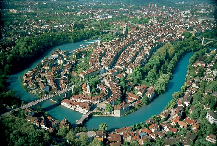
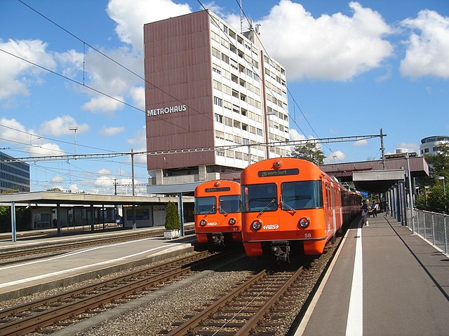
Bern
- capital of Switzerland
Hiking in Bern
Hiking in Bern, the capital of Switzerland, offers a wonderful variety of landscapes, trails, and experiences for outdoor enthusiasts. The region surrounding Bern is characterized by its picturesque countryside, rolling hills, and proximity to the imposing Bernese Alps. Here are some highlights to consider when hiking in and around Bern:...
- Country:
- Postal Code: 3000
- Local Dialing Code: 031
- Licence Plate Code: BE
- Coordinates: 46° 56' 53" N, 7° 26' 51" E
- GPS tracks (wikiloc): [Link]
- AboveSeaLevel: 542 м m
- Area: 51.62 sq km
- Population: 133798
- Web site: [Link]
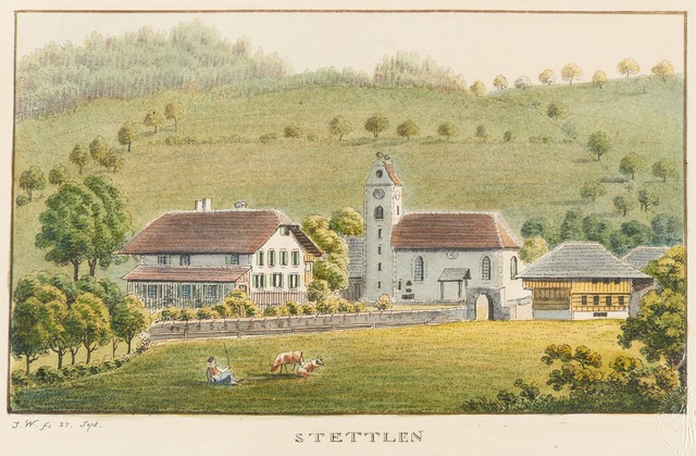
Stettlen
- municipality in Switzerland
Hiking in Stettlen
Stettlen is a charming municipality located near Bern, Switzerland, offering a variety of opportunities for outdoor activities, including hiking. Although the area may not be as widely known as some of Switzerland's larger hiking destinations, it features pleasant trails and beautiful scenery....
- Country:
- Postal Code: 3066
- Local Dialing Code: 031
- Licence Plate Code: BE
- Coordinates: 46° 57' 24" N, 7° 31' 20" E
- GPS tracks (wikiloc): [Link]
- AboveSeaLevel: 549 м m
- Area: 3.5 sq km
- Population: 3105
- Web site: [Link]
Diemerswil
- municipality in Switzerland
Hiking in Diemerswil
Diemerswil, a charming village located in the canton of Bern, Switzerland, offers a peaceful outdoor experience for hikers of all levels. The area is characterized by beautiful landscapes, rolling hills, and scenic views of the surrounding Alpine foothills....
- Country:
- Postal Code: 3053
- Local Dialing Code: 031
- Licence Plate Code: BE
- Coordinates: 47° 1' 9" N, 7° 25' 41" E
- GPS tracks (wikiloc): [Link]
- AboveSeaLevel: 600 м m
- Area: 2.86 sq km
- Population: 202
- Web site: [Link]

Schwarzenburg
- municipality in the canton of Bern, Switzerland
Hiking in Schwarzenburg
Schwarzenburg is a charming village located in the canton of Bern, Switzerland, surrounded by stunning natural landscapes that make it an excellent destination for hiking enthusiasts. The region is characterized by rolling hills, lush forests, and breathtaking views of the surrounding mountains....
- Country:
- Postal Code: 3183; 3157; 3152; 3150; 3148
- Licence Plate Code: BE
- Coordinates: 46° 49' 0" N, 7° 20' 0" E
- GPS tracks (wikiloc): [Link]
- AboveSeaLevel: 792 м m
- Area: 44.88 sq km
- Population: 6827
- Web site: [Link]