Dionay (Dionay)
- former commune in Isère, France
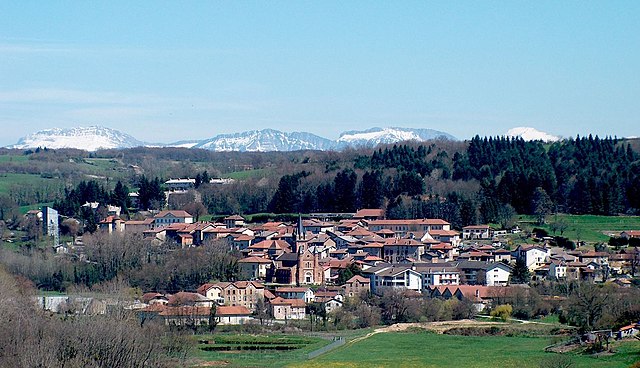
Dionay, located in the Auvergne-Rhône-Alpes region of France, is a picturesque area that offers beautiful hiking opportunities, particularly for those who enjoy nature, mountainous landscapes, and the tranquility of the countryside.
Hiking Highlights in Dionay:
-
Scenic Trails: Dionay has several well-marked trails that traverse through forests, meadows, and hills, providing stunning views of the surrounding mountains and valleys. The paths vary in difficulty, catering to both beginner and experienced hikers.
-
Flora and Fauna: The region is rich in biodiversity. While hiking, you may encounter various plant species, wildlife, and even local fauna unique to the area, so keep your eyes peeled!
-
Cultural Landmarks: Along the hiking trails, you can find charming villages and historical sites, offering a glimpse into the local culture and history. It's a great opportunity to learn about the area while enjoying your hike.
-
Seasonal Considerations: The best time to hike in Dionay is during late spring through early autumn (May to October) when the weather is typically mild and the scenery is vibrant. Always check local weather conditions before heading out.
-
Access and Amenities: Dionay is accessible by car from larger towns, and there are often facilities like parking spots and picnic areas near trailheads. It’s wise to carry sufficient water, snacks, and a basic first aid kit.
-
Guided Tours: If you're unfamiliar with the area or prefer a structured experience, consider joining a guided hiking tour. Local guides can provide insights into the trails, flora, fauna, and history of Dionay.
-
Safety Tips: Always inform someone about your hiking plans, wear appropriate footwear, and be vigilant about the trail conditions, especially after rain or during colder months when paths can be slippery.
Suggested Trails:
- Le Sentier de la Petite Vigne: A lovely loop trail ideal for families, offering beautiful views of local vineyards.
- Les Crêtes de Dionay: For a more challenging hike, this trail offers panoramic viewpoints and a chance to spot local wildlife.
Remember to respect nature and follow local regulations while hiking. Enjoy your adventure in the enchanting landscapes of Dionay!
- Country:

- Postal Code: 38160
- Coordinates: 45° 12' 11" N, 5° 13' 11" E


- GPS tracks (wikiloc): [Link]
- Area: 14.01 sq km
- Population: 117
- Web site: http://www.dionay.fr
- Wikipedia en: wiki(en)
- Wikipedia: wiki(fr)
- Wikidata storage: Wikidata: Q1002949
- Wikipedia Commons Category: [Link]
- Freebase ID: [/m/03nvhpp]
- GeoNames ID: Alt: [6433186]
- BnF ID: [15257967p]
- INSEE municipality code: 38145
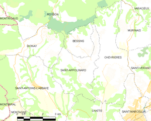
Shares border with regions:


Bessins
- commune in Isère, France
Bessins, a small village in the scenic region of the French Alps, offers a variety of hiking opportunities for outdoor enthusiasts. While it might not be as widely known as some larger hiking destinations, the area around Bessins is rich in natural beauty, with breathtaking alpine landscapes, lush forests, and clear mountain streams....
- Country:

- Postal Code: 38160
- Coordinates: 45° 12' 9" N, 5° 15' 53" E


- GPS tracks (wikiloc): [Link]
- Area: 4.65 sq km
- Population: 123
- Web site: [Link]


Montrigaud
- commune in Drôme, France
Montrigaud is a charming commune located in the Isère department in the Auvergne-Rhône-Alpes region of southeastern France. This area offers various hiking opportunities, particularly for those looking to enjoy scenic views and natural landscapes....
- Country:

- Postal Code: 26350
- Coordinates: 45° 13' 8" N, 5° 7' 52" E


- GPS tracks (wikiloc): [Link]
- Area: 28.73 sq km
- Population: 482


Saint-Appolinard
- commune in Isère, France
Saint-Appolinard is a charming commune located in the Isère department in the Auvergne-Rhône-Alpes region of southeastern France. Known for its picturesque landscapes, it offers a variety of hiking opportunities suitable for different skill levels. Here are some highlights and tips for hiking in the area:...
- Country:

- Postal Code: 38160
- Coordinates: 45° 11' 20" N, 5° 15' 45" E


- GPS tracks (wikiloc): [Link]
- AboveSeaLevel: 380 м m
- Area: 10.76 sq km
- Population: 400
- Web site: [Link]


Saint-Bonnet-de-Valclérieux
- commune in Drôme, France
 Hiking in Saint-Bonnet-de-Valclérieux
Saint-Bonnet-de-Valclérieux is a charming village located in the Auvergne-Rhône-Alpes region of France, nestled in the picturesque countryside. The area is known for its natural beauty and offers a range of hiking opportunities, making it a great destination for outdoor enthusiasts....
- Country:

- Postal Code: 26350
- Coordinates: 45° 11' 43" N, 5° 8' 35" E


- GPS tracks (wikiloc): [Link]
- Area: 8.29 sq km
- Population: 217


Roybon
- commune in Isère, France
Roybon, located in the Auvergne-Rhône-Alpes region of France, offers several hiking opportunities for outdoor enthusiasts. The area is characterized by its beautiful landscapes, ranging from forests to rolling hills, making it ideal for both novice and experienced hikers....
- Country:

- Postal Code: 38940
- Coordinates: 45° 15' 31" N, 5° 14' 39" E


- GPS tracks (wikiloc): [Link]
- Area: 67.31 sq km
- Population: 1229
- Web site: [Link]


Saint-Antoine-l'Abbaye
- former commune in Isère, France
 Hiking in Saint-Antoine-l'Abbaye
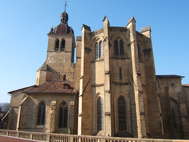
Saint-Antoine-l'Abbaye, located in the Isère department of France, offers some wonderful hiking opportunities set against a backdrop of historical architecture and picturesque landscapes. The region is known for its medieval abbey, which adds cultural significance to your outdoor adventures....
- Country:

- Postal Code: 38160
- Coordinates: 45° 10' 30" N, 5° 13' 0" E


- GPS tracks (wikiloc): [Link]
- Area: 22.21 sq km
- Population: 1053
- Web site: [Link]
