Saint-Appolinard (Saint-Appolinard)
- commune in Isère, France
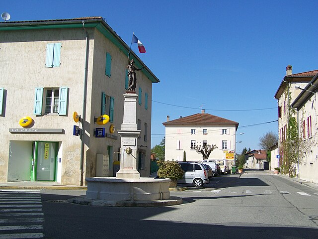
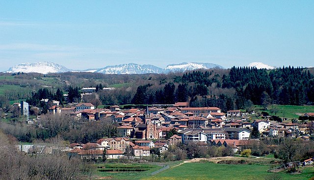
Saint-Appolinard is a charming commune located in the Isère department in the Auvergne-Rhône-Alpes region of southeastern France. Known for its picturesque landscapes, it offers a variety of hiking opportunities suitable for different skill levels. Here are some highlights and tips for hiking in the area:
Scenic Trails
-
Local Trails: Saint-Appolinard, being surrounded by beautiful countryside, has several local trails that can be explored. These trails often lead through vineyards, forests, and offer stunning views of the surrounding mountains.
-
The Pilat Regional Natural Park: Just a short drive away, this park features a network of well-marked hiking trails, ranging from easy walks to more challenging treks. The park is known for its diverse flora and fauna, as well as panoramic views from the higher elevations.
-
Mont Pilat: This mountain is a popular destination for hikers. Trails range from simple loops to more strenuous hikes that take you to higher altitudes, where you can enjoy magnificent views of the Rhône Valley and the Alps on clear days.
Hiking Tips
-
Choose Your Trail: Depending on your fitness level and experience, select trails that suit your abilities. Ensure to check trail markers and maps, as they can vary in difficulty and length.
-
Weather Preparedness: The weather can change rapidly in the mountains. It's essential to check the forecast before heading out and dress in layers to adjust to varying temperatures.
-
Hydration and Nutrition: Carry enough water and snacks to keep your energy levels up during your hike.
-
Wildlife Awareness: Respect the local wildlife and stay on marked paths. Be cautious and avoid disturbing animals you may encounter along your hike.
-
Leave No Trace: Follow Leave No Trace principles to preserve the natural beauty of the area.
Accessibility
Saint-Appolinard is accessible by road, and there’s good connectivity to larger towns nearby. Consider starting your hike early in the day to make the most of the daylight hours and avoid the warmer parts of the day, especially in summer.
Conclusion
Whether you are looking for a peaceful walk through nature or a more vigorous hike with challenging terrain, Saint-Appolinard and its surroundings have something to offer for everyone. Enjoy the stunning views and the tranquility of the French countryside!
- Country:

- Postal Code: 38160
- Coordinates: 45° 11' 20" N, 5° 15' 45" E


- GPS tracks (wikiloc): [Link]
- AboveSeaLevel: 380 м m
- Area: 10.76 sq km
- Population: 400
- Web site: http://www.saint-appolinard.fr
- Wikipedia en: wiki(en)
- Wikipedia: wiki(fr)
- Wikidata storage: Wikidata: Q1068165
- Wikipedia Commons Category: [Link]
- Freebase ID: [/m/03nvj43]
- SIREN number: [213803604]
- BnF ID: [15258171z]
- INSEE municipality code: 38360
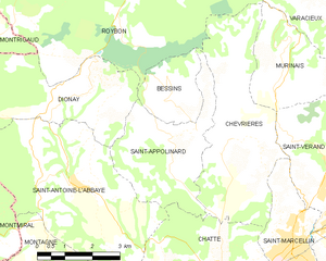
Shares border with regions:


Dionay
- former commune in Isère, France
Dionay, located in the Auvergne-Rhône-Alpes region of France, is a picturesque area that offers beautiful hiking opportunities, particularly for those who enjoy nature, mountainous landscapes, and the tranquility of the countryside....
- Country:

- Postal Code: 38160
- Coordinates: 45° 12' 11" N, 5° 13' 11" E


- GPS tracks (wikiloc): [Link]
- Area: 14.01 sq km
- Population: 117
- Web site: [Link]


Chevrières
- commune in Isère, France
Chevrières is a small village in the Isère department of the Auvergne-Rhône-Alpes region in southeastern France. While it may not be as well-known as some larger hiking destinations, it is surrounded by beautiful landscapes and offers opportunities for outdoor activities, including hiking....
- Country:

- Postal Code: 38160
- Coordinates: 45° 11' 15" N, 5° 17' 25" E


- GPS tracks (wikiloc): [Link]
- Area: 16.62 sq km
- Population: 710
- Web site: [Link]


Bessins
- commune in Isère, France
Bessins, a small village in the scenic region of the French Alps, offers a variety of hiking opportunities for outdoor enthusiasts. While it might not be as widely known as some larger hiking destinations, the area around Bessins is rich in natural beauty, with breathtaking alpine landscapes, lush forests, and clear mountain streams....
- Country:

- Postal Code: 38160
- Coordinates: 45° 12' 9" N, 5° 15' 53" E


- GPS tracks (wikiloc): [Link]
- Area: 4.65 sq km
- Population: 123
- Web site: [Link]


Chatte
- commune in Isère, France
It seems like you might be referring to a location that could be spelled differently or may not be widely recognized as a hiking destination. If you meant "Chattahoochee" or other known areas, please clarify. However, if you are referring to a lesser-known area, here's a general guide on how to approach hiking in any location:...
- Country:

- Postal Code: 38160
- Coordinates: 45° 8' 37" N, 5° 16' 59" E


- GPS tracks (wikiloc): [Link]
- Area: 22.81 sq km
- Population: 2496
- Web site: [Link]


Roybon
- commune in Isère, France
Roybon, located in the Auvergne-Rhône-Alpes region of France, offers several hiking opportunities for outdoor enthusiasts. The area is characterized by its beautiful landscapes, ranging from forests to rolling hills, making it ideal for both novice and experienced hikers....
- Country:

- Postal Code: 38940
- Coordinates: 45° 15' 31" N, 5° 14' 39" E


- GPS tracks (wikiloc): [Link]
- Area: 67.31 sq km
- Population: 1229
- Web site: [Link]


Saint-Antoine-l'Abbaye
- former commune in Isère, France
 Hiking in Saint-Antoine-l'Abbaye
Saint-Antoine-l'Abbaye, located in the Isère department of France, offers some wonderful hiking opportunities set against a backdrop of historical architecture and picturesque landscapes. The region is known for its medieval abbey, which adds cultural significance to your outdoor adventures....
- Country:

- Postal Code: 38160
- Coordinates: 45° 10' 30" N, 5° 13' 0" E


- GPS tracks (wikiloc): [Link]
- Area: 22.21 sq km
- Population: 1053
- Web site: [Link]
