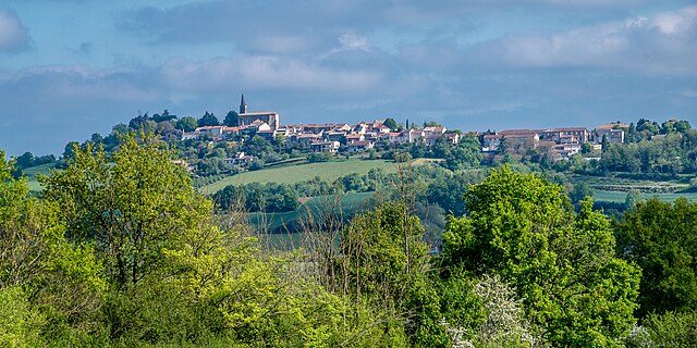
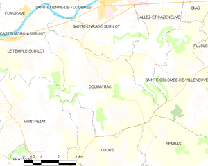
Dolmayrac (Dolmayrac)
- commune in Lot-et-Garonne, France
- Country:

- Postal Code: 47110
- Coordinates: 44° 21' 44" N, 0° 35' 22" E


- GPS tracks (wikiloc): [Link]
- Area: 19.4 sq km
- Population: 710
- Wikipedia en: wiki(en)
- Wikipedia: wiki(fr)
- Wikidata storage: Wikidata: Q24561
- Wikipedia Commons Category: [Link]
- Freebase ID: [/m/03qm197]
- GeoNames ID: Alt: [6449317]
- SIREN number: [214700817]
- BnF ID: [15261162h]
- INSEE municipality code: 47081
Shares border with regions:
Allez-et-Cazeneuve
- commune in Lot-et-Garonne, France
- Country:

- Postal Code: 47110
- Coordinates: 44° 23' 17" N, 0° 37' 47" E


- GPS tracks (wikiloc): [Link]
- Area: 10.69 sq km
- Population: 590


Le Temple-sur-Lot
- commune in Lot-et-Garonne, France
- Country:

- Postal Code: 47110
- Coordinates: 44° 22' 47" N, 0° 31' 29" E


- GPS tracks (wikiloc): [Link]
- Area: 16.91 sq km
- Population: 1004
- Web site: [Link]


Sainte-Livrade-sur-Lot
- commune in Lot-et-Garonne, France
- Country:

- Postal Code: 47110
- Coordinates: 44° 23' 53" N, 0° 35' 22" E


- GPS tracks (wikiloc): [Link]
- Area: 30.94 sq km
- Population: 6298
- Web site: [Link]
Cours
- commune in Lot-et-Garonne, France
- Country:

- Postal Code: 47360
- Coordinates: 44° 19' 20" N, 0° 35' 20" E


- GPS tracks (wikiloc): [Link]
- Area: 11.43 sq km
- Population: 202


Montpezat
- commune in Lot-et-Garonne, France
- Country:

- Postal Code: 47360
- Coordinates: 44° 20' 48" N, 0° 31' 26" E


- GPS tracks (wikiloc): [Link]
- Area: 24.19 sq km
- Population: 579
Sembas
- commune in Lot-et-Garonne, France
- Country:

- Postal Code: 47360
- Coordinates: 44° 19' 48" N, 0° 38' 48" E


- GPS tracks (wikiloc): [Link]
- Area: 12.51 sq km
- Population: 138


Sainte-Colombe-de-Villeneuve
- commune in Lot-et-Garonne, France
- Country:

- Postal Code: 47300
- Coordinates: 44° 21' 34" N, 0° 39' 33" E


- GPS tracks (wikiloc): [Link]
- Area: 18.92 sq km
- Population: 496
