Sainte-Livrade-sur-Lot (Sainte-Livrade-sur-Lot)

- commune in Lot-et-Garonne, France
- Country:

- Postal Code: 47110
- Coordinates: 44° 23' 53" N, 0° 35' 22" E


- GPS tracks (wikiloc): [Link]
- Area: 30.94 sq km
- Population: 6298
- Web site: http://www.ville-ste-livrade47.fr
- Wikipedia en: wiki(en)
- Wikipedia: wiki(fr)
- Wikidata storage: Wikidata: Q217288
- Wikipedia Commons Category: [Link]
- Freebase ID: [/m/03qm2pl]
- GeoNames ID: Alt: [2980519]
- SIREN number: [214702524]
- BnF ID: [15261333g]
- VIAF ID: Alt: [150507493]
- GND ID: Alt: [7696194-1]
- Library of Congress authority ID: Alt: [no2010072449]
- PACTOLS thesaurus ID: [pcrtWngIKDsuNK]
- INSEE municipality code: 47252
Shares border with regions:
Allez-et-Cazeneuve
- commune in Lot-et-Garonne, France
- Country:
- Postal Code: 47110
- Coordinates: 44° 23' 17" N, 0° 37' 47" E
- GPS tracks (wikiloc): [Link]
- Area: 10.69 sq km
- Population: 590


Le Temple-sur-Lot
- commune in Lot-et-Garonne, France
- Country:
- Postal Code: 47110
- Coordinates: 44° 22' 47" N, 0° 31' 29" E
- GPS tracks (wikiloc): [Link]
- Area: 16.91 sq km
- Population: 1004
- Web site: [Link]
Pinel-Hauterive
- commune in Lot-et-Garonne, France
- Country:
- Postal Code: 47380
- Coordinates: 44° 26' 20" N, 0° 34' 3" E
- GPS tracks (wikiloc): [Link]
- Area: 21.77 sq km
- Population: 565

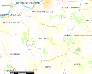
Dolmayrac
- commune in Lot-et-Garonne, France
- Country:
- Postal Code: 47110
- Coordinates: 44° 21' 44" N, 0° 35' 22" E
- GPS tracks (wikiloc): [Link]
- Area: 19.4 sq km
- Population: 710


Casseneuil
- commune in Lot-et-Garonne, France
- Country:
- Postal Code: 47440
- Coordinates: 44° 26' 34" N, 0° 37' 16" E
- GPS tracks (wikiloc): [Link]
- Area: 18.09 sq km
- Population: 2360
- Web site: [Link]
Saint-Étienne-de-Fougères
- commune in Lot-et-Garonne, France
- Country:
- Postal Code: 47380
- Coordinates: 44° 25' 7" N, 0° 33' 18" E
- GPS tracks (wikiloc): [Link]
- Area: 9.9 sq km
- Population: 831

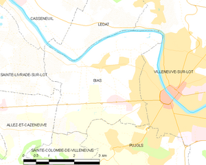
Bias
- commune in Lot-et-Garonne, France
- Country:
- Postal Code: 47300
- Coordinates: 44° 24' 58" N, 0° 40' 9" E
- GPS tracks (wikiloc): [Link]
- Area: 12.29 sq km
- Population: 3062
- Web site: [Link]