Dommartin-la-Chaussée (Dommartin-la-Chaussée)

- commune in Meurthe-et-Moselle, France
- Country:

- Postal Code: 54470
- Coordinates: 49° 0' 41" N, 5° 51' 44" E


- GPS tracks (wikiloc): [Link]
- AboveSeaLevel: 240 м m
- Area: 2.71 sq km
- Population: 36
- Wikipedia en: wiki(en)
- Wikipedia: wiki(fr)
- Wikidata storage: Wikidata: Q230121
- Wikipedia Commons Category: [Link]
- Freebase ID: [/m/03qdgp3]
- Freebase ID: [/m/03qdgp3]
- GeoNames ID: Alt: [6617047]
- GeoNames ID: Alt: [6617047]
- SIREN number: [215401662]
- SIREN number: [215401662]
- BnF ID: [15264235m]
- BnF ID: [15264235m]
- INSEE municipality code: 54166
- INSEE municipality code: 54166
Shares border with regions:


Hagéville
- commune in Meurthe-et-Moselle, France
- Country:
- Postal Code: 54470
- Coordinates: 49° 1' 55" N, 5° 51' 41" E
- GPS tracks (wikiloc): [Link]
- Area: 8.94 sq km
- Population: 114


Dampvitoux
- commune in Meurthe-et-Moselle, France
- Country:
- Postal Code: 54470
- Coordinates: 49° 0' 47" N, 5° 50' 34" E
- GPS tracks (wikiloc): [Link]
- Area: 9.19 sq km
- Population: 60

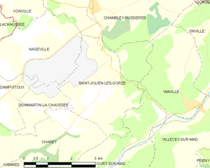
Saint-Julien-lès-Gorze
- commune in Meurthe-et-Moselle, France
- Country:
- Postal Code: 54470
- Coordinates: 49° 0' 52" N, 5° 54' 2" E
- GPS tracks (wikiloc): [Link]
- Area: 10.38 sq km
- Population: 164


Charey
- commune in Meurthe-et-Moselle, France
- Country:
- Postal Code: 54470
- Coordinates: 49° 0' 6" N, 5° 52' 48" E
- GPS tracks (wikiloc): [Link]
- Area: 9.31 sq km
- Population: 75