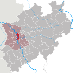
Duisburg (Duisburg)
- city in North Rhine-Westphalia, Germany
Duisburg, located in the western part of Germany in the Ruhr area, is known more for its industrial heritage than for traditional hiking trails. However, there are still opportunities to enjoy nature and go hiking in and around the city. Here are some highlights for hiking in Duisburg:
1.
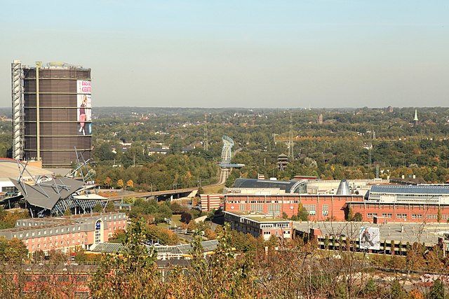
- Description: This former industrial site has been transformed into a public park that combines nature with historical industrial structures. You can explore pathways, trails, and lookout points, all while enjoying the unique blend of green spaces and remnants of the industrial past.
- Highlights: Climbing the old gas holder for a panoramic view, exploring the extensive gardens and wetlands, and visiting the various installations and sculptures.
2.
- Description: This lake is surrounded by a pleasant park area and offers trails for walking and hiking. The serene environment makes it a great spot for nature enthusiasts.
- Activities: You can walk around the lake, enjoy picnicking, bird-watching, or simply relax by the water.
3.
- Description: This park along the banks of the Rhine River has paths for walking and jogging, providing scenic views of the river and the surrounding landscape.
- Features: It’s a great place for leisurely hikes, and you can enjoy the riverside atmosphere.
4.
- Destinations: There are multiple nature reserves in the surrounding areas of Duisburg that offer hiking trails:
- Meiderich Nature Reserve: Features diverse flora and fauna with well-marked trails.
- Bergheider See: A beautiful lake area surrounded by hiking options.
5.
- Ruhr Valley Trail: Within a short drive, you can access parts of the Ruhr Valley, which has numerous hiking trails that provide insight into the natural and industrial heritage of the region.
- Hiking in the Regional Park: The nearby Niederrhein area offers a variety of hiking routes across heathlands, moors, and wooded areas.
Tips for Hiking in Duisburg:
- Accessibility: Public transport can help you reach many starting points for hikes or parks.
- Seasons: Spring and autumn are particularly pleasant times for hiking due to moderate weather and scenic views.
- Gear: Wear comfortable hiking shoes and bring water, especially if you’re planning longer hikes.
- Safety: Always check the weather ahead of time and dress appropriately for the conditions.
In conclusion, while Duisburg may not be the most well-known hiking destination, it offers some nice local parks and trails that can be enjoyed by those looking for a quick escape into nature. Consider expanding your search to the surrounding Ruhr area for more extensive hiking experiences.
- Country:

- Postal Code: 47051; 47001; 47279; 4100
- Local Dialing Code: 02065; 0203; 02151; 02841; 02066
- Licence Plate Code: DU
- Coordinates: 51° 25' 56" N, 6° 45' 40" E


- GPS tracks (wikiloc): [Link]
- AboveSeaLevel: 33 м m
- Area: 232.80 sq km
- Population: 499845
- Web site: https://www.duisburg.de/
- Wikipedia en: wiki(en)
- Wikipedia: wiki(de)
- Wikidata storage: Wikidata: Q2100
- Wikipedia Commons Category: [Link]
- Wikipedia Commons Maps Category: [Link]
- Freebase ID: [/m/0ps1q]
- GeoNames ID: Alt: [2934691]
- BnF ID: [11974263q]
- VIAF ID: Alt: [312835853]
- OSM relation ID: [62456]
- GND ID: Alt: [4013284-5]
- archINFORM location ID: [367]
- Library of Congress authority ID: Alt: [n89667772]
- PACTOLS thesaurus ID: [pcrtAJqbSS5yDY]
- MusicBrainz area ID: [71730bfd-9d1e-4b8a-a0d6-007150cdacea]
- WOEID: [645877]
- Quora topic ID: [Duisburg-Germany]
- Encyclopædia Britannica Online ID: [place/Duisburg]
- EMLO location ID: [e9704e4a-cb6a-445d-9a55-01c349d81174]
- Facebook Places ID: [107747869254581]
- Great Russian Encyclopedia Online ID: [1969957]
- DMOZ ID: Alt: [Regional/Europe/Germany/States/North_Rhine-Westphalia/Localities/Duisburg/]
- NUTS code: [DEA12]
- YSO ID: [110080]
- Nomisma ID: [duisburg]
- Klexikon article ID: [Duisburg]
- Global Anabaptist Mennonite Encyclopedia Online ID: [Duisburg (Nordrhein-Westfalen, Germany)]
- Store norske leksikon ID: [Duisburg]
- German municipality key: 05112000
- German district key: 05112
Includes regions:


Duisburg-Mitte
- human settlement in Germany
Duisburg-Mitte, located in the heart of Duisburg, Germany, offers a unique blend of urban exploration and nature. While it's not traditionally seen as a hiking destination, you can still enjoy some outdoor activities and walks in and around the area. Here are some highlights:...
- Country:

- Local Dialing Code: 0203
- Coordinates: 51° 25' 59" N, 6° 46' 7" E


- GPS tracks (wikiloc): [Link]

Walsum
- quarter of Duisburg, Germany
Duisburg-Walsum is a district located in the northern part of Duisburg, Germany, and while it's primarily known for its industrial background, it also offers some interesting opportunities for hiking and enjoying nature....
- Country:

- Licence Plate Code: DU
- Coordinates: 51° 31' 58" N, 6° 42' 31" E


- GPS tracks (wikiloc): [Link]
- Web site: [Link]


Rheinhausen
- district in Duisburg, Germany
Rheinhausen is a small locality located in the district of Emmendingen in Baden-Württemberg, Germany. Nestled near the Rhine River, it offers a variety of outdoor activities, including hiking. The region is known for its beautiful landscapes, including vineyards, rolling hills, and forested areas....
- Country:

- Licence Plate Code: DU
- Coordinates: 51° 24' 26" N, 6° 42' 43" E


- GPS tracks (wikiloc): [Link]
- Population: 77209
- Web site: [Link]


Hamborn
- city district of Duisburg, Germany
Hamborn is a district in the city of Duisburg, located in North Rhine-Westphalia, Germany. While the area is primarily urban and industrial, it does offer some opportunities for hiking and outdoor activities, particularly in nearby parks and natural reserves....
- Country:

- Licence Plate Code: DU
- Coordinates: 51° 29' 51" N, 6° 46' 40" E


- GPS tracks (wikiloc): [Link]
- Web site: [Link]


Meiderich/Beeck
- human settlement in Germany
Duisburg-Meiderich-Beeck, located in the Ruhr area of Germany, offers some interesting opportunities for hiking, though it might not be as recognized for outdoor activities as other regions. Here's a brief overview:...
- Country:

- Coordinates: 51° 27' 59" N, 6° 46' 1" E


- GPS tracks (wikiloc): [Link]


Homberg/Ruhrort/Baerl (Stadtbezirk)
- human settlement in Germany
 Hiking in Homberg/Ruhrort/Baerl (Stadtbezirk)
Duisburg-Homberg, Ruhrort, and Baerl are located in North Rhine-Westphalia, Germany, and while they may not be as famous for hiking as some other regions in Germany, they do offer opportunities for walking and outdoor activities....
- Country:

- Licence Plate Code: DU
- Coordinates: 51° 27' 59" N, 6° 40' 58" E


- GPS tracks (wikiloc): [Link]
- Web site: [Link]
Duisburg-Süd
- city district of Duisburg, Germany
Duisburg-Süd, part of the larger Duisburg area in North Rhine-Westphalia, Germany, offers a variety of hiking opportunities in a mix of natural and urban settings. While the landscape is more industrial than rural, there are still plenty of options for outdoor enthusiasts....
- Country:

- Licence Plate Code: DU
- Coordinates: 51° 22' 31" N, 6° 45' 35" E


- GPS tracks (wikiloc): [Link]
- Web site: [Link]
Shares border with regions:


Düsseldorf
- capital city of the German federated state of North Rhine-Westphalia
Düsseldorf, known for its vibrant arts scene and beautiful riverside promenades, also offers opportunities for hiking in and around the city. While it may not be as known for rugged mountainous trails like other regions of Germany, there are still several picturesque routes and parks to explore....
- Country:

- Postal Code: 40629; 40627; 40625; 40599; 40597; 40595; 40593; 40591; 40589; 40549; 40547; 40545; 40489; 40479; 40477; 40476; 40474; 40472; 40470; 40468; 40239; 40237; 40235; 40233; 40231; 40229; 40227; 40225; 40223; 40221; 40219; 40217; 40215; 40213; 40212; 40211; 40210
- Local Dialing Code: 0211; 0203; 02104
- Licence Plate Code: D
- Coordinates: 51° 13' 44" N, 6° 48' 36" E


- GPS tracks (wikiloc): [Link]
- AboveSeaLevel: 38 м m
- Area: 217.41 sq km
- Population: 613230
- Web site: [Link]

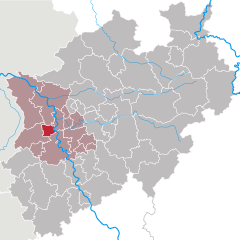
Krefeld
- city in North Rhine-Westphalia, Germany
Krefeld, located in North Rhine-Westphalia, Germany, is not traditionally known as a hiking destination, but it does offer some pleasant walking trails and green spaces for outdoor enthusiasts. Here’s an overview of hiking opportunities in and around Krefeld:...
- Country:

- Postal Code: 47701
- Local Dialing Code: 02151
- Licence Plate Code: KR
- Coordinates: 51° 20' 0" N, 6° 34' 0" E


- GPS tracks (wikiloc): [Link]
- AboveSeaLevel: 38 м m
- Area: 137.77 sq km
- Population: 226812
- Web site: [Link]

Oberhausen
- city in North Rhine-Westphalia, Germany
Oberhausen, located in the Ruhr area of Germany, is not typically known for its natural hiking trails, as it is an industrial city. However, there are several options in and around the city for those looking to explore the outdoors....
- Country:

- Postal Code: 46001–46149
- Local Dialing Code: 0208
- Licence Plate Code: OB
- Coordinates: 51° 33' 0" N, 6° 51' 0" E


- GPS tracks (wikiloc): [Link]
- AboveSeaLevel: 25 м m
- Area: 77.09 sq km
- Population: 211382
- Web site: [Link]
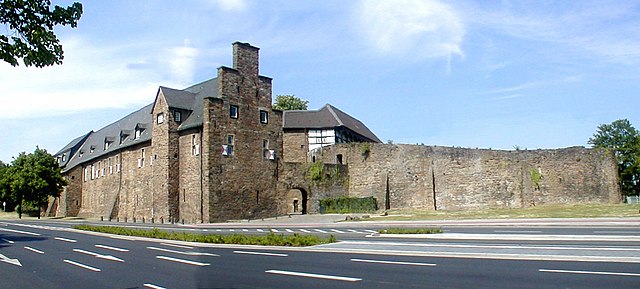

Mülheim an der Ruhr
- city in North Rhine-Westphalia, Germany
Mülheim an der Ruhr, a city located in the Ruhr area of Germany, offers some interesting hiking opportunities for outdoor enthusiasts. While it may not be as renowned for hiking as some mountainous regions of Germany, it has several beautiful parks, forests, and paths that make for pleasant experiences. Here are a few highlights for hiking in and around Mülheim:...
- Country:

- Postal Code: 45401–45481
- Local Dialing Code: 0208
- Licence Plate Code: MH
- Coordinates: 51° 25' 42" N, 6° 52' 44" E


- GPS tracks (wikiloc): [Link]
- AboveSeaLevel: 153 м m
- Area: 91.28 sq km
- Population: 170936
- Web site: [Link]


Wesel
- district in North Rhine-Westphalia, Germany
Wesel is a beautiful district located in North Rhine-Westphalia, Germany, and offers some lovely hiking opportunities. The area is characterized by a mix of natural landscapes, including rivers, forests, and scenic countryside, making it ideal for hiking enthusiasts. Here are some highlights and tips for hiking in the Wesel district:...
- Country:

- Licence Plate Code: WES
- Coordinates: 51° 40' 12" N, 6° 40' 12" E


- GPS tracks (wikiloc): [Link]
- AboveSeaLevel: 17 м m
- Area: 1042.47 sq km
- Web site: [Link]
Rhein-Kreis Neuss
- district in North Rhine-Westphalia, Germany
Rhein-Kreis Neuss, located in North Rhine-Westphalia, Germany, offers a variety of hiking opportunities that showcase its natural beauty and cultural heritage. The region is characterized by scenic landscapes, rolling hills, forests, and rivers, making it an ideal destination for hikers of all levels. Here are some key features and trails you might consider:...
- Country:

- Licence Plate Code: NE
- Coordinates: 51° 9' 55" N, 6° 39' 14" E


- GPS tracks (wikiloc): [Link]
- AboveSeaLevel: 48 м m
- Area: 576.52 sq km
- Web site: [Link]


Mettmann
- district in North Rhine-Westphalia, Germany
Mettmann, located in North Rhine-Westphalia, Germany, offers a variety of hiking opportunities that cater to different skill levels and preferences. The region features picturesque landscapes, including forests, hills, and scenic views, making it ideal for outdoor activities....
- Country:

- Licence Plate Code: ME
- Coordinates: 51° 15' 0" N, 7° 0' 0" E


- GPS tracks (wikiloc): [Link]
- AboveSeaLevel: 143 м m
- Web site: [Link]

