Wesel (Kreis Wesel)
- district in North Rhine-Westphalia, Germany
Wesel is a beautiful district located in North Rhine-Westphalia, Germany, and offers some lovely hiking opportunities. The area is characterized by a mix of natural landscapes, including rivers, forests, and scenic countryside, making it ideal for hiking enthusiasts. Here are some highlights and tips for hiking in the Wesel district:
Natural Parks and Trails
-
Lower Rhine Region: The Wesel district is part of the scenic Lower Rhine region, which features flatland suitable for various hiking trails. The picturesque countryside is dotted with fields, meadows, and typical German villages.
-
Riverside Trails: The Rhine and Lippe rivers offer beautiful trails alongside their banks. You can enjoy walks with stunning views, especially around the confluence of the Rhine and Lippe.
-
Hiking Routes: Numerous well-signposted trails are available, varying in length and difficulty. Popular trails often pass through local nature reserves such as the Dinslaken Nature Reserve, which is home to diverse flora and fauna.
Popular Hiking Paths
-
Xantener Allee: A scenic path that takes you through beautiful landscapes and leads you to the historic town of Xanten, known for its Roman history and archaeological sites.
-
The Lippe Path: This trail follows the Lippe River and provides a serene hiking experience. It’s perfect for those who enjoy a quieter environment connected to nature.
Tips for Hiking in Wesel
-
Maps and Guides: It’s always a good idea to have a detailed map or guidebook with you. Local tourist information centers can provide useful resources.
-
Weather: Check the weather forecast before heading out, as it can change quickly. Dress in layers and wear appropriate footwear, especially if hiking in forested or muddy areas.
-
Safety: Stay on marked trails and be mindful of your surroundings. If you're hiking in more isolated areas, consider bringing a companion.
-
Respect Nature: As with all hiking areas, it's important to leave no trace and respect wildlife and plants.
Local Amenities
Wesel and its surrounding areas offer various amenities like restaurants, cafes, and accommodation options, making it easy to plan a multi-day hiking trip or simply enjoy a day hike with a meal afterward.
Overall, hiking in Wesel can be a delightful experience for both casual walkers and serious hikers. Take your time to enjoy the natural beauty and cultural heritage of the region!
- Country:

- Licence Plate Code: WES
- Coordinates: 51° 40' 12" N, 6° 40' 12" E


- GPS tracks (wikiloc): [Link]
- AboveSeaLevel: 17 м m
- Area: 1042.47 sq km
- Web site: http://www.kreis-wesel.de/
- Wikipedia en: wiki(en)
- Wikipedia: wiki(de)
- Wikidata storage: Wikidata: Q6245
- Wikipedia Commons Gallery: [Link]
- Wikipedia Commons Category: [Link]
- Wikipedia Commons Maps Category: [Link]
- Freebase ID: [/m/01c4zt]
- GeoNames ID: Alt: [2810674]
- VIAF ID: Alt: [312809611]
- OSM relation ID: [58745]
- GND ID: Alt: [4065698-6]
- archINFORM location ID: [2665]
- Library of Congress authority ID: Alt: [n83029524]
- TGN ID: [7084377]
- ISNI: Alt: [0000 0004 0488 5512]
- National Library of Israel ID: [000998568]
- NUTS code: [DEA1F]
- Ringgold ID: [272842]
- BabelNet ID: [01250072n]
- GNS Unique Feature ID: -1886401
- German district key: 05170
Shares border with regions:


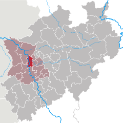
Duisburg
- city in North Rhine-Westphalia, Germany
Duisburg, located in the western part of Germany in the Ruhr area, is known more for its industrial heritage than for traditional hiking trails. However, there are still opportunities to enjoy nature and go hiking in and around the city. Here are some highlights for hiking in Duisburg:...
- Country:

- Postal Code: 47051; 47001; 47279; 4100
- Local Dialing Code: 02065; 0203; 02151; 02841; 02066
- Licence Plate Code: DU
- Coordinates: 51° 25' 56" N, 6° 45' 40" E


- GPS tracks (wikiloc): [Link]
- AboveSeaLevel: 33 м m
- Area: 232.80 sq km
- Population: 499845
- Web site: [Link]


Krefeld
- city in North Rhine-Westphalia, Germany
Krefeld, located in North Rhine-Westphalia, Germany, is not traditionally known as a hiking destination, but it does offer some pleasant walking trails and green spaces for outdoor enthusiasts. Here’s an overview of hiking opportunities in and around Krefeld:...
- Country:

- Postal Code: 47701
- Local Dialing Code: 02151
- Licence Plate Code: KR
- Coordinates: 51° 20' 0" N, 6° 34' 0" E


- GPS tracks (wikiloc): [Link]
- AboveSeaLevel: 38 м m
- Area: 137.77 sq km
- Population: 226812
- Web site: [Link]


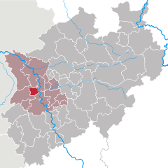
Oberhausen
- city in North Rhine-Westphalia, Germany
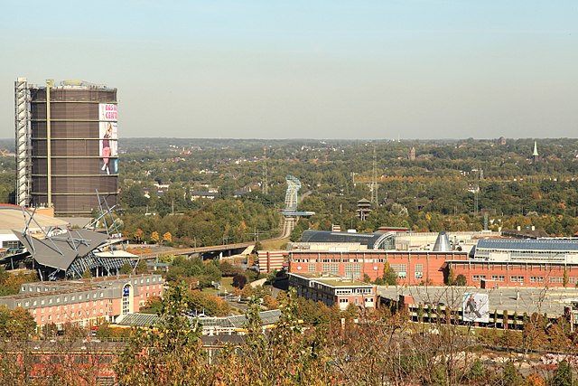
Oberhausen, located in the Ruhr area of Germany, is not typically known for its natural hiking trails, as it is an industrial city. However, there are several options in and around the city for those looking to explore the outdoors....
- Country:

- Postal Code: 46001–46149
- Local Dialing Code: 0208
- Licence Plate Code: OB
- Coordinates: 51° 33' 0" N, 6° 51' 0" E


- GPS tracks (wikiloc): [Link]
- AboveSeaLevel: 25 м m
- Area: 77.09 sq km
- Population: 211382
- Web site: [Link]


Bottrop
- town in North Rhine-Westphalia, Germany
Bottrop, a city in North Rhine-Westphalia, Germany, is not primarily known for extensive hiking trails compared to more renowned natural areas. However, there are still some opportunities for hiking and enjoying the outdoors in and around Bottrop....
- Country:

- Postal Code: 46236
- Local Dialing Code: 02045; 02041
- Licence Plate Code: BOT
- Coordinates: 51° 31' 29" N, 6° 55' 22" E


- GPS tracks (wikiloc): [Link]
- AboveSeaLevel: 55 м m
- Area: 100.61 sq km
- Population: 117409
- Web site: [Link]
Borken
- German district of North Rhine-Westphalia
Borken is a district located in North Rhine-Westphalia, Germany, and it offers a variety of hiking opportunities for outdoor enthusiasts. The region is characterized by its diverse landscapes, which include forests, meadows, rivers, and a mix of natural and agricultural areas....
- Country:

- Licence Plate Code: BOR
- Coordinates: 51° 55' 0" N, 6° 55' 0" E


- GPS tracks (wikiloc): [Link]
- AboveSeaLevel: 65 м m
- Area: 1420.98 sq km
- Web site: [Link]


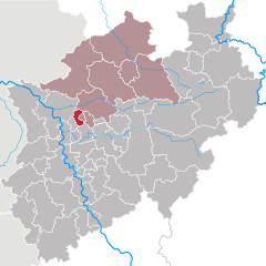
Recklinghausen
- German district of North Rhine-Westphalia
Recklinghausen, located in the state of North Rhine-Westphalia in Germany, offers a variety of hiking opportunities, primarily in the form of trails that showcase the region's natural beauty and cultural heritage. Here are some aspects to consider when planning a hike in and around Recklinghausen:...
- Country:

- Licence Plate Code: RE
- Coordinates: 51° 40' 12" N, 7° 10' 12" E


- GPS tracks (wikiloc): [Link]
- AboveSeaLevel: 52 м m
- Web site: [Link]
Kleve
- district in North Rhine-Westphalia, Germany
Kleve, a district in North Rhine-Westphalia, Germany, offers some beautiful hiking opportunities, blending natural landscapes with historical and cultural sites. The region is characterized by its lush forests, rolling hills, and the scenic Lower Rhine area....
- Country:

- Licence Plate Code: GEL; KLE
- Coordinates: 51° 40' 0" N, 6° 15' 0" E


- GPS tracks (wikiloc): [Link]
- AboveSeaLevel: 18 м m
- Web site: [Link]


Viersen
- district in North Rhine-Westphalia, Germany
Viersen, located in North Rhine-Westphalia, Germany, is a charming district that offers a variety of outdoor activities, including hiking. The area is characterized by its scenic landscapes, lush forests, and well-maintained trails, making it a great destination for both novice and experienced hikers....
- Country:

- Licence Plate Code: VIE
- Coordinates: 51° 16' 12" N, 6° 24' 0" E


- GPS tracks (wikiloc): [Link]
- AboveSeaLevel: 92 м m
- Web site: [Link]

