
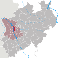
Oberhausen (Oberhausen)


- city in North Rhine-Westphalia, Germany
 Hiking in Oberhausen
Oberhausen, located in the Ruhr area of Germany, is not typically known for its natural hiking trails, as it is an industrial city. However, there are several options in and around the city for those looking to explore the outdoors.
-
Duisburg-Nord Landscape Park: Just a short distance from Oberhausen, this park was created on the site of a former ironworks. It features industrial ruins, gardens, and walking trails. The blend of nature and industrial history offers a unique hiking experience.
-
Landschaftspark Duisburg-Nord: Similar to the previous point, this park offers a variety of walking trails amidst preserved industrial architecture. You can also explore the green spaces and art installations, which makes for a memorable day hike.
-
The Emscherweg: This long-distance trail runs along the Emscher River and passes near Oberhausen. It provides hikers with a chance to experience both nature and the reclamation of industrial lands, making it suitable for longer excursions.
-
Ruhrgebiet Trails: The Ruhr area has a network of hiking routes that connect various parks and nature reserves. You can find well-marked paths that lead you through diverse landscapes, from rivers to forests.
-
Walsum Forest: Located on the outskirts of Oberhausen, this area offers trails for walking and simple hikes amidst natural woodland.
-
Nearby Nature Reserves: You can explore locations such as the "Naturschutzgebiet Dender Tal" or other regional parks that might offer more relaxed and undisturbed environments for hiking.
When hiking in or around Oberhausen, it’s important to wear appropriate footwear and bring sufficient supplies like water and snacks, especially if you plan to venture onto longer trails. Always check the weather and trail conditions prior to your hike to ensure a safe experience!
- Country:

- Postal Code: 46001–46149
- Local Dialing Code: 0208
- Licence Plate Code: OB
- Coordinates: 51° 33' 0" N, 6° 51' 0" E


- GPS tracks (wikiloc): [Link]
- AboveSeaLevel: 25 м m
- Area: 77.09 sq km
- Population: 211382
- Web site: https://www.oberhausen.de/
- Wikipedia en: wiki(en)
- Wikipedia: wiki(de)
- Wikidata storage: Wikidata: Q2838
- Wikipedia Commons Gallery: [Link]
- Wikipedia Commons Category: [Link]
- Wikipedia Commons Maps Category: [Link]
- Freebase ID: [/m/018khw]
- GeoNames ID: Alt: [2860410]
- VIAF ID: Alt: [137207010]
- OSM relation ID: [62734]
- GND ID: Alt: [4042927-1]
- archINFORM location ID: [375]
- Library of Congress authority ID: Alt: [n80107058]
- MusicBrainz area ID: [eb1ff5ca-ce4f-44ee-b915-21976abc9ddf]
- National Library of Israel ID: [000980833]
- NUTS code: [DEA17]
- Klexikon article ID: [Oberhausen]
- German municipality key: 05119000
- German district key: 05119
Shares border with regions:


Essen
- city in North Rhine-Westphalia, Germany
Hiking in Essen
Essen, located in the Ruhr area of Germany, is surrounded by a mix of industrial heritage and natural landscapes, offering some unique hiking opportunities. While it's a city that has undergone significant transformations, nature enthusiasts can find various trails and parks that provide a nice escape from urban life. Here are some highlights for hiking in and around Essen:...
- Country:
- Postal Code: 45001; 45359
- Local Dialing Code: 02054; 0201
- Licence Plate Code: E
- Coordinates: 51° 27' 3" N, 7° 0' 47" E
- GPS tracks (wikiloc): [Link]
- AboveSeaLevel: 116 м m
- Area: 210.34 sq km
- Population: 590194
- Web site: [Link]

Duisburg
- city in North Rhine-Westphalia, Germany
Hiking in Duisburg
Duisburg, located in the western part of Germany in the Ruhr area, is known more for its industrial heritage than for traditional hiking trails. However, there are still opportunities to enjoy nature and go hiking in and around the city. Here are some highlights for hiking in Duisburg:...
- Country:
- Postal Code: 47051; 47001; 47279; 4100
- Local Dialing Code: 02065; 0203; 02151; 02841; 02066
- Licence Plate Code: DU
- Coordinates: 51° 25' 56" N, 6° 45' 40" E
- GPS tracks (wikiloc): [Link]
- AboveSeaLevel: 33 м m
- Area: 232.80 sq km
- Population: 499845
- Web site: [Link]

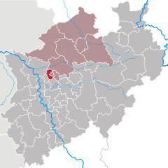
Mülheim an der Ruhr
- city in North Rhine-Westphalia, Germany
Hiking in Mülheim an der Ruhr
Mülheim an der Ruhr, a city located in the Ruhr area of Germany, offers some interesting hiking opportunities for outdoor enthusiasts. While it may not be as renowned for hiking as some mountainous regions of Germany, it has several beautiful parks, forests, and paths that make for pleasant experiences. Here are a few highlights for hiking in and around Mülheim:...
- Country:
- Postal Code: 45401–45481
- Local Dialing Code: 0208
- Licence Plate Code: MH
- Coordinates: 51° 25' 42" N, 6° 52' 44" E
- GPS tracks (wikiloc): [Link]
- AboveSeaLevel: 153 м m
- Area: 91.28 sq km
- Population: 170936
- Web site: [Link]

Bottrop
- town in North Rhine-Westphalia, Germany
Hiking in Bottrop
Bottrop, a city in North Rhine-Westphalia, Germany, is not primarily known for extensive hiking trails compared to more renowned natural areas. However, there are still some opportunities for hiking and enjoying the outdoors in and around Bottrop....
- Country:
- Postal Code: 46236
- Local Dialing Code: 02045; 02041
- Licence Plate Code: BOT
- Coordinates: 51° 31' 29" N, 6° 55' 22" E
- GPS tracks (wikiloc): [Link]
- AboveSeaLevel: 55 м m
- Area: 100.61 sq km
- Population: 117409
- Web site: [Link]


Wesel
- district in North Rhine-Westphalia, Germany
Hiking in Wesel
Wesel is a beautiful district located in North Rhine-Westphalia, Germany, and offers some lovely hiking opportunities. The area is characterized by a mix of natural landscapes, including rivers, forests, and scenic countryside, making it ideal for hiking enthusiasts. Here are some highlights and tips for hiking in the Wesel district:...
- Country:
- Licence Plate Code: WES
- Coordinates: 51° 40' 12" N, 6° 40' 12" E
- GPS tracks (wikiloc): [Link]
- AboveSeaLevel: 17 м m
- Area: 1042.47 sq km
- Web site: [Link]