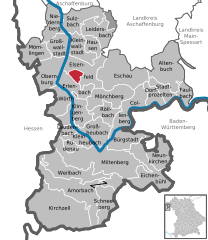
Elsenfeld (Elsenfeld)
- human settlement in Germany
Elsenfeld is a charming town located in the Bavarian region of Germany, surrounded by picturesque landscapes, making it a great destination for hiking enthusiasts. Here are some highlights about hiking in and around Elsenfeld:
Trail Options:
-
Local Trails: The area around Elsenfeld features various marked trails that cater to different hiking levels. You can explore forest paths, meandering village routes, and scenic viewpoints.
-
Spessart Trail: The nearby Spessart Forest offers some more challenging hikes. This vast forest area is known for its lush greenery, diverse wildlife, and stunning panoramic views.
-
Historical Routes: Some trails in the region may take you through historical sites, showcasing local culture and heritage. Look for paths that lead to old churches, castles, and other landmarks.
Best Season:
- Spring and Fall are ideal for hiking in Elsenfeld, thanks to mild temperatures and beautiful natural scenery — the spring flowers and fall foliage create stunning landscapes.
Preparation:
- Gear Up: Ensure you have proper hiking boots, weather-appropriate clothing, and a backpack with essentials like water, snacks, a first aid kit, and a map or GPS device.
- Local Guides: Consider joining local guided hikes if you prefer a structured experience or want to learn more about the area’s ecology and history.
Safety Tips:
- Always check the weather before heading out.
- Inform someone about your hiking plans.
- Carry a fully charged phone in case of emergencies.
Nearby Attractions:
- If you have time, explore nearby towns or natural sites, including the scenic rivers or vineyards in the region.
Overall, hiking in Elsenfeld can be a rewarding experience, offering a blend of natural beauty and cultural exploration. Enjoy your adventure!
- Country:

- Postal Code: 63820
- Local Dialing Code: 06022
- Licence Plate Code: MIL
- Coordinates: 49° 51' 0" N, 9° 10' 0" E


- GPS tracks (wikiloc): [Link]
- AboveSeaLevel: 123 м m
- Area: 24.37 sq km
- Population: 9015
- Web site: http://www.elsenfeld.de/
- Wikipedia en: wiki(en)
- Wikipedia: wiki(de)
- Wikidata storage: Wikidata: Q502996
- Wikipedia Commons Category: [Link]
- Freebase ID: [/m/02q4p1y]
- GeoNames ID: Alt: [2930747]
- VIAF ID: Alt: [239429636]
- OSM relation ID: [394529]
- GND ID: Alt: [4014506-2]
- archINFORM location ID: [13166]
- Bavarikon ID: [ODB_A00000395]
- German municipality key: 09676121
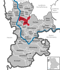
Shares border with regions:


Forstwald
- unincorporated area in Germany
Gemeindefreies Gebiet Forstwald is a nature area located in Germany, known for its beautiful landscapes and tranquil environment, making it an appealing spot for hiking enthusiasts. Here are some key details to consider for your hiking adventure there:...
- Country:

- Coordinates: 49° 49' 40" N, 9° 10' 45" E


- GPS tracks (wikiloc): [Link]


Erlenbach am Main
- human settlement in Germany
Erlenbach am Main is a charming small town in Bavaria, Germany, situated along the banks of the Main River. It's surrounded by picturesque landscapes, making it a lovely destination for hiking enthusiasts. Here are some highlights and tips for hiking in and around Erlenbach am Main:...
- Country:

- Postal Code: 63906
- Local Dialing Code: 09372
- Licence Plate Code: MIL
- Coordinates: 49° 48' 14" N, 9° 9' 50" E


- GPS tracks (wikiloc): [Link]
- AboveSeaLevel: 129 м m
- Area: 16.33 sq km
- Population: 9959
- Web site: [Link]

