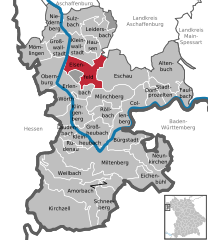
Forstwald (Forstwald)

- unincorporated area in Germany
 Hiking in Forstwald
Gemeindefreies Gebiet Forstwald is a nature area located in Germany, known for its beautiful landscapes and tranquil environment, making it an appealing spot for hiking enthusiasts. Here are some key details to consider for your hiking adventure there:
Trails and Routes
- Diverse Terrain: The area features a range of trails varying in difficulty levels, from easy paths suitable for families and casual walkers to more challenging routes for experienced hikers.
- Scenic Views: Expect to enjoy picturesque views of the forest, wildlife, and possibly nearby lakes or rivers, which can provide a refreshing setting for your hike.
Wildlife and Flora
- Biodiversity: Forstwald is home to a variety of flora and fauna. Keep an eye out for local wildlife, including birds, deer, and various plant species. Spring and summer are particularly vibrant times to experience the area’s biodiversity.
- Photography Opportunities: Bring your camera to capture the natural beauty of the surroundings, especially during the golden hours of early morning or late afternoon.
Preparation
- Footwear and Gear: Wear sturdy hiking boots and consider weather-appropriate clothing. A backpack with water, snacks, and a first aid kit is essential.
- Navigation: Familiarize yourself with the trail maps ahead of time. While the trails should be marked, having a navigation app or a physical map can be helpful.
Safety Tips
- Stay Hydrated: Carry enough water, especially during warmer months, as hiking can be physically taxing.
- Inform Someone: Let someone know your hiking plans and expected return time, especially if you plan to hike alone.
Best Times to Visit
- Seasonal Considerations: Each season offers a unique experience in Forstwald. Spring is great for blooming flowers, summer for lush greenery, autumn for vibrant foliage, and winter for serene, snowy landscapes.
Local Regulations
- Nature Conservation: Respect local guidelines regarding wildlife and plant conservation. Stay on marked trails to minimize your impact on the environment.
Hiking in Gemeindefreies Gebiet Forstwald can be a fulfilling and refreshing experience, so enjoy the natural beauty and take your time exploring the great outdoors!
- Country:

- Coordinates: 49° 49' 40" N, 9° 10' 45" E


- GPS tracks (wikiloc): [Link]
- Wikidata storage: Wikidata: Q1090964
- Wikipedia Commons Category: [Link]
- VIAF ID: Alt: [236624822]
- OSM relation ID: [394528]
Shares border with regions:


Erlenbach am Main
- human settlement in Germany
Hiking in Erlenbach am Main
Erlenbach am Main is a charming small town in Bavaria, Germany, situated along the banks of the Main River. It's surrounded by picturesque landscapes, making it a lovely destination for hiking enthusiasts. Here are some highlights and tips for hiking in and around Erlenbach am Main:...
- Country:
- Postal Code: 63906
- Local Dialing Code: 09372
- Licence Plate Code: MIL
- Coordinates: 49° 48' 14" N, 9° 9' 50" E
- GPS tracks (wikiloc): [Link]
- AboveSeaLevel: 129 м m
- Area: 16.33 sq km
- Population: 9959
- Web site: [Link]

Elsenfeld
- human settlement in Germany
Hiking in Elsenfeld
Elsenfeld is a charming town located in the Bavarian region of Germany, surrounded by picturesque landscapes, making it a great destination for hiking enthusiasts. Here are some highlights about hiking in and around Elsenfeld:...
- Country:
- Postal Code: 63820
- Local Dialing Code: 06022
- Licence Plate Code: MIL
- Coordinates: 49° 51' 0" N, 9° 10' 0" E
- GPS tracks (wikiloc): [Link]
- AboveSeaLevel: 123 м m
- Area: 24.37 sq km
- Population: 9015
- Web site: [Link]