Embreville (Embreville)

- commune in Somme, France
- Country:

- Postal Code: 80570
- Coordinates: 50° 1' 49" N, 1° 32' 35" E


- GPS tracks (wikiloc): [Link]
- Area: 5.33 sq km
- Population: 566
- Web site: http://www.mairie-embreville.fr/mairie-embreville
- Wikipedia en: wiki(en)
- Wikipedia: wiki(fr)
- Wikidata storage: Wikidata: Q120791
- Wikipedia Commons Category: [Link]
- Freebase ID: [/m/03npt2q]
- GeoNames ID: Alt: [6444402]
- SIREN number: [218002541]
- BnF ID: [15276747p]
- VIAF ID: Alt: [242662135]
- INSEE municipality code: 80265
Shares border with regions:


Buigny-lès-Gamaches
- commune in Somme, France
- Country:
- Postal Code: 80220
- Coordinates: 50° 1' 28" N, 1° 33' 59" E
- GPS tracks (wikiloc): [Link]
- Area: 4.77 sq km
- Population: 413


Beauchamps
- commune in Somme, France
- Country:
- Postal Code: 80770
- Coordinates: 50° 1' 4" N, 1° 30' 31" E
- GPS tracks (wikiloc): [Link]
- Area: 7.22 sq km
- Population: 1006
- Web site: [Link]


Fressenneville
- commune in Somme, France
- Country:
- Postal Code: 80390
- Coordinates: 50° 4' 4" N, 1° 34' 37" E
- GPS tracks (wikiloc): [Link]
- Area: 8.66 sq km
- Population: 2230


Gamaches
- commune in Somme, France
- Country:
- Postal Code: 80220
- Coordinates: 49° 59' 12" N, 1° 33' 26" E
- GPS tracks (wikiloc): [Link]
- Area: 9.92 sq km
- Population: 2643
- Web site: [Link]


Aigneville
- commune in Somme, France
- Country:
- Postal Code: 80210
- Coordinates: 50° 2' 7" N, 1° 36' 59" E
- GPS tracks (wikiloc): [Link]
- Area: 10.76 sq km
- Population: 878
- Web site: [Link]

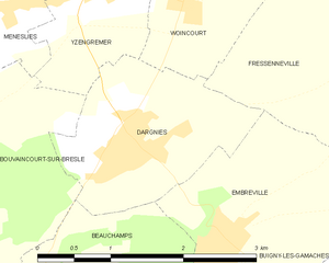
Dargnies
- commune in Somme, France
- Country:
- Postal Code: 80570
- Coordinates: 50° 2' 30" N, 1° 31' 32" E
- GPS tracks (wikiloc): [Link]
- Area: 3.67 sq km
- Population: 1281
- Web site: [Link]