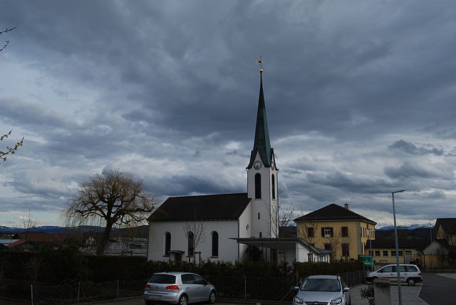
Erlen (Erlen)

- municipality in Switzerland
 Hiking in Erlen
Erlen is a small municipality in the canton of Thurgau, Switzerland, known for its picturesque landscapes and access to various outdoor activities, including hiking. While Erlen itself may not be a major hiking destination, it is well-positioned for enjoying the surrounding natural beauty.
Hiking Trails
-
Local Trails: You can find several walking and hiking trails around Erlen that meander through lush fields, forests, and alongside rivers. These trails vary in difficulty, accommodating both beginners and more experienced hikers.
-
Thurgau Region: The Thurgau canton has an extensive network of well-marked trails. You can explore scenic routes that take you through vineyards, charming villages, and alongside the country's lakes. Some notable nearby hiking areas include:
- Lake Constance: Trails along the lakeshore offer stunning views and opportunities for birdwatching.
- Klöntalersee: Although a bit farther away, this area features beautiful trails with varying levels of difficulty.
-
The Swiss National Park: A bit further afield, heading into the Alps or visiting regions like nearby Appenzell can provide exceptional hiking experiences, with breathtaking views and diverse landscapes.
Tips for Hiking in Erlen
- Trail Maps: Ensure you have a good trail map or a hiking app. The official Thurgau tourism website often provides downloadable maps and details.
- Weather Preparedness: Weather can change quickly in the Swiss countryside, so dress in layers and check forecasts.
- Local Amenities: Be aware that small towns like Erlen may have limited services, so plan to carry enough water and snacks.
- Respect Nature: Stay on marked trails and be mindful of the local fauna and flora.
Accessibility
The trails around Erlen are generally accessible, but some may have regional variations in terrain. Make sure you choose a route that suits your fitness level.
Conclusion
Hiking in and around Erlen can be a delightful experience for nature lovers and outdoor enthusiasts. By exploring the trails available, you can appreciate the stunning landscapes that this charming region has to offer.
- Country:

- Postal Code: 8586
- Local Dialing Code: 071
- Licence Plate Code: TG
- Coordinates: 47° 33' 4" N, 9° 14' 10" E


- GPS tracks (wikiloc): [Link]
- AboveSeaLevel: 445 м m
- Area: 12.2 sq km
- Population: 3687
- Web site: http://www.erlen.ch
- Wikipedia en: wiki(en)
- Wikipedia: wiki(de)
- Wikidata storage: Wikidata: Q65439
- Wikipedia Commons Category: [Link]
- Freebase ID: [/m/0g30q_]
- GeoNames ID: Alt: [7285751]
- VIAF ID: Alt: [249323527]
- OSM relation ID: [1684516]
- archINFORM location ID: [6418]
- HDS ID: [1869]
- Swiss municipality code: [4476]
Shares border with regions:
Zihlschlacht-Sitterdorf
- municipality in Switzerland
Hiking in Zihlschlacht-Sitterdorf
Zihlschlacht-Sitterdorf is a picturesque area located in the canton of Thurgau in Switzerland, known for its stunning landscapes and diverse hiking opportunities. Here’s a general overview of what you can expect when hiking in this beautiful region:...
- Country:
- Postal Code: 8588
- Local Dialing Code: 071
- Licence Plate Code: TG
- Coordinates: 47° 31' 0" N, 9° 15' 59" E
- GPS tracks (wikiloc): [Link]
- AboveSeaLevel: 527 м m
- Area: 12.2 sq km
- Population: 2367
- Web site: [Link]

Birwinken
- municipality in Switzerland
Hiking in Birwinken
Birwinken is a charming area in Switzerland that offers a variety of hiking opportunities. Nestled in the scenic landscapes, it is an excellent place for outdoor enthusiasts to explore nature. Here are some highlights and tips for hiking in Birwinken:...
- Country:
- Postal Code: 8585
- Local Dialing Code: 071
- Licence Plate Code: TG
- Coordinates: 47° 35' 0" N, 9° 12' 0" E
- GPS tracks (wikiloc): [Link]
- AboveSeaLevel: 550 м m
- Area: 12.3 sq km
- Population: 1352
- Web site: [Link]

Hohentannen
- municipality in Switzerland
Hiking in Hohentannen
Hohentannen is a lesser-known hiking destination that offers stunning views and a variety of trails suited for different skill levels. It's often less crowded than more popular hiking spots, making it an ideal place for those looking to enjoy nature in a more secluded environment....
- Country:
- Postal Code: 9216
- Local Dialing Code: 071
- Licence Plate Code: TG
- Coordinates: 47° 30' 0" N, 9° 12' 59" E
- GPS tracks (wikiloc): [Link]
- AboveSeaLevel: 570 м m
- Area: 8.0 sq km
- Population: 602
- Web site: [Link]


Langrickenbach
- municipality in Switzerland
Hiking in Langrickenbach
Langrickenbach is a picturesque village located in the region of Thurgau in Switzerland. It's surrounded by beautiful landscapes, making it a great destination for hiking enthusiasts. The area offers a variety of trails that cater to different skill levels, from easy walks suitable for families to more challenging routes for experienced hikers....
- Country:
- Postal Code: 8585
- Local Dialing Code: 071
- Licence Plate Code: TG
- Coordinates: 47° 35' 41" N, 9° 14' 27" E
- GPS tracks (wikiloc): [Link]
- AboveSeaLevel: 534 м m
- Area: 10.9 sq km
- Population: 1313
- Web site: [Link]

Sommeri
- municipality in Switzerland
Hiking in Sommeri
Sommeri is a picturesque area located in the canton of Thurgau in Switzerland, known for its beautiful landscapes, rolling hills, and serene lakeside views, particularly along Lake Constance. Hiking in Sommeri offers a variety of trails suitable for different skill levels, making it an excellent destination for both beginners and experienced hikers....
- Country:
- Postal Code: 8580
- Local Dialing Code: 071
- Licence Plate Code: TG
- Coordinates: 47° 33' 59" N, 9° 17' 0" E
- GPS tracks (wikiloc): [Link]
- AboveSeaLevel: 465 м m
- Area: 4.2 sq km
- Population: 565
- Web site: [Link]

Amriswil
- municipality in Switzerland
Hiking in Amriswil
Amriswil, located in the canton of Thurgau in Switzerland, offers beautiful landscapes and a variety of hiking opportunities. The region is characterized by rolling hills, picturesque countryside, and proximity to Lake Constance, making it an excellent destination for outdoor enthusiasts. Here are some highlights for hiking in and around Amriswil:...
- Country:
- Postal Code: 8580
- Local Dialing Code: 071
- Licence Plate Code: TG
- Coordinates: 47° 32' 59" N, 9° 18' 0" E
- GPS tracks (wikiloc): [Link]
- AboveSeaLevel: 437 м m
- Area: 19.1 sq km
- Population: 13462
- Web site: [Link]