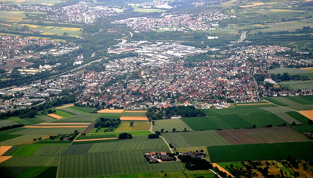
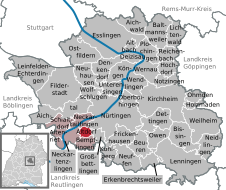
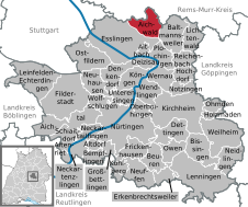
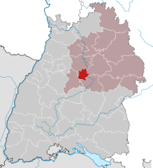
Esslingen (Landkreis Esslingen)

- district in Baden-Württemberg, Germany
 Hiking in Esslingen
Esslingen district, located in the state of Baden-Württemberg, Germany, offers a variety of hiking opportunities that showcase both its natural beauty and historical sites. Here are some highlights for hiking in the Esslingen region:
Scenic Trails
-
Neckar Valley Trails: The trails along the Neckar River provide beautiful views of the river, vineyards, and surrounding hills. You can enjoy a mix of flat paths and hilly terrain.
-
Filder Plateau: The Filder region has several well-marked trails that offer picturesque views of the landscape and are mostly suited for casual hikers. This area is known for its agricultural fields and charming villages.
-
Swabian Jura (Schwäbische Jura): Just a bit further afield, the Swabian Jura offers more rugged hiking experiences, including its famous escarpments, caves, and stunning viewpoints.
Highlights and Points of Interest
-
Burg Teck: A historic castle overlooking the area, which is accessible via hiking trails. The view from the top is stunning, especially on clear days.
-
Vineyards: The Esslingen district is known for its wine production, particularly for producing high-quality wines. Many trails go through vineyards where you can taste and learn about local wines.
-
Nature Reserves: There's a wealth of protected areas, such as the Wernauer Bucht and the Kesselberg, which offer opportunities for bird watching and enjoying diverse flora and fauna.
Tips for Hiking in Esslingen
-
Equipment: Good footwear is essential, especially when exploring hilly terrains or rocky areas. Depending on the season, pack weather-appropriate clothing.
-
Trail Maps: Make sure to have a map or use a hiking app to keep track of trails. The region is well-marked, but it always helps to have a navigation tool on hand.
-
Hydration and Snacks: Always carry enough water and some snacks, especially on longer hikes.
-
Public Transport: The Esslingen district is well connected by public transport, making it easier to reach trailheads without needing a car.
Whether you are a beginner or an experienced hiker, Esslingen district's diverse landscape offers something for everyone. Enjoy the views and immerse yourself in the beautiful natural surroundings!
- Country:

- Capital: Esslingen am Neckar
- Licence Plate Code: ES
- Coordinates: 48° 41' 24" N, 9° 19' 12" E


- GPS tracks (wikiloc): [Link]
- AboveSeaLevel: 263 м m
- Area: 641.48 sq km
- Population: 524127
- Web site: http://www.landkreis-esslingen.de/
- Wikipedia en: wiki(en)
- Wikipedia: wiki(de)
- Wikidata storage: Wikidata: Q8533
- Wikipedia Commons Category: [Link]
- Freebase ID: [/m/01k24_]
- GeoNames ID: Alt: [2928748]
- VIAF ID: Alt: [150128564]
- OSM relation ID: [2812851]
- GND ID: Alt: [4015576-6]
- archINFORM location ID: [2406]
- Library of Congress authority ID: Alt: [n82250157]
- TGN ID: [7188440]
- ISNI: Alt: [0000 0004 0629 4660]
- NUTS code: [DE113]
- Ringgold ID: [60858]
- German district key: 08116
Includes regions:

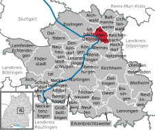
Nürtingen
- town in Baden-Württemberg, Germany
Hiking in Nürtingen
Nürtingen, located in Baden-Württemberg, Germany, is surrounded by beautiful landscapes and scenic trails, making it a great destination for hiking enthusiasts. The region is characterized by rolling hills, vineyards, and the picturesque Esslingen River, which contribute to its natural beauty....
- Country:
- Postal Code: 72622
- Local Dialing Code: 07022
- Coordinates: 48° 37' 36" N, 9° 20' 7" E
- GPS tracks (wikiloc): [Link]
- AboveSeaLevel: 291 м m
- Area: 46.9 sq km
- Population: 39960
- Web site: [Link]
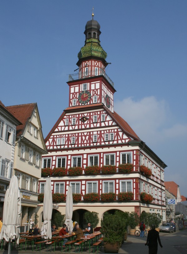

Kirchheim unter Teck
- town in Baden-Württemberg, Germany
Hiking in Kirchheim unter Teck
Kirchheim unter Teck is a charming town located in the state of Baden-Württemberg, Germany, surrounded by beautiful natural landscapes, making it a fantastic destination for hiking enthusiasts. Here are some highlights to consider when hiking in this area:...
- Country:
- Postal Code: 73230
- Local Dialing Code: 07021
- Licence Plate Code: ES
- Coordinates: 48° 38' 54" N, 9° 27' 4" E
- GPS tracks (wikiloc): [Link]
- AboveSeaLevel: 311 м m
- Area: 40.47 sq km
- Population: 39396
- Web site: [Link]


Leinfelden-Echterdingen
- town in the district of Esslingen, Baden-Württemberg, Germany
Hiking in Leinfelden-Echterdingen
Leinfelden-Echterdingen, located in Germany's Baden-Württemberg region, offers pleasant hiking opportunities, particularly due to its proximity to the lush landscapes of the Swabian Jura and various nature reserves. Here are some highlights and tips for hiking in and around the area:...
- Country:
- Postal Code: 70771
- Local Dialing Code: 0711
- Licence Plate Code: ES
- Coordinates: 48° 41' 34" N, 9° 8' 34" E
- GPS tracks (wikiloc): [Link]
- AboveSeaLevel: 432 м m
- Area: 29.89 sq km
- Population: 38266
- Web site: [Link]

Ostfildern
- town in Baden-Württemberg, Germany
Hiking in Ostfildern
Ostfildern, located in the state of Baden-Württemberg, Germany, is a great destination for hiking enthusiasts. While it is primarily a suburban area, it is surrounded by beautiful natural landscapes that offer various hiking opportunities....
- Country:
- Postal Code: 73760
- Local Dialing Code: 07158; 0711
- Licence Plate Code: ES
- Coordinates: 48° 43' 22" N, 9° 15' 47" E
- GPS tracks (wikiloc): [Link]
- AboveSeaLevel: 348 м m
- Area: 22.81 sq km
- Population: 37785
- Web site: [Link]

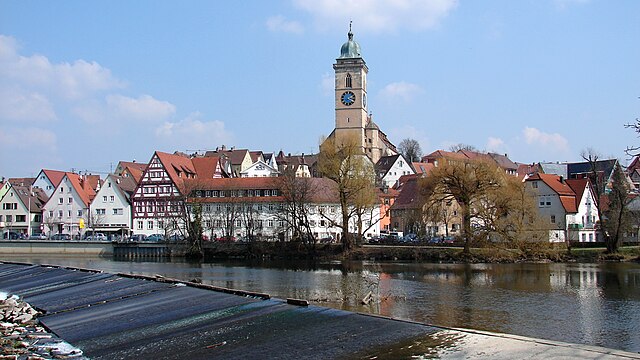
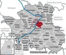
Esslingen am Neckar
- city in the Stuttgart Region of Baden-Württemberg, Germany
Hiking in Esslingen am Neckar
Esslingen am Neckar is a beautiful town in Baden-Württemberg, Germany, that offers a variety of hiking opportunities for outdoor enthusiasts. Nestled in the Neckar valley and surrounded by picturesque hills, the region provides diverse landscapes for hikers of all skill levels....
- Country:
- Postal Code: 73728–73734
- Local Dialing Code: 0711
- Licence Plate Code: ES
- Coordinates: 48° 44' 26" N, 9° 18' 39" E
- GPS tracks (wikiloc): [Link]
- AboveSeaLevel: 241 м m
- Area: 46.42 sq km
- Population: 90378
- Web site: [Link]
Filderstadt
- town in the district of Esslingen, Baden-Württemberg, Germany
Hiking in Filderstadt
Filderstadt is located in the state of Baden-Württemberg, Germany, near Stuttgart. It offers a mix of urban areas and surrounding natural landscapes, making it a great place for hiking enthusiasts. Here are some details about hiking in Filderstadt:...
- Country:
- Postal Code: 70794
- Local Dialing Code: 07158; 0711
- Licence Plate Code: ES
- Coordinates: 48° 40' 0" N, 9° 13' 0" E
- GPS tracks (wikiloc): [Link]
- AboveSeaLevel: 371 м m
- Area: 38.55 sq km
- Population: 44721
- Web site: [Link]


Baltmannsweiler
- municipality in Germany
Hiking in Baltmannsweiler
Baltmannsweiler, located in the Esslingen district of Baden-Württemberg, Germany, is surrounded by beautiful landscapes that are ideal for hiking enthusiasts. The region features diverse terrains ranging from scenic forests to rolling hills, offering various trails for different skill levels....
- Country:
- Postal Code: 73666
- Local Dialing Code: 07153
- Licence Plate Code: ES
- Coordinates: 48° 44' 33" N, 9° 26' 59" E
- GPS tracks (wikiloc): [Link]
- AboveSeaLevel: 456 м m
- Area: 18.55 sq km
- Population: 5621
- Web site: [Link]


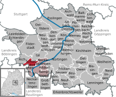
Bempflingen
- municipality in Germany
Hiking in Bempflingen
Bempflingen is a small town located in Baden-Württemberg, Germany, and it's surrounded by the beautiful landscapes of the Swabian Jura and the scenic countryside. Hiking in and around Bempflingen can provide a great immersive experience in nature, catering to various skill levels from gentle walks to more challenging hikes....
- Country:
- Postal Code: 72658
- Local Dialing Code: 07123
- Licence Plate Code: ES
- Coordinates: 48° 34' 18" N, 9° 16' 6" E
- GPS tracks (wikiloc): [Link]
- AboveSeaLevel: 316 м m
- Area: 6.27 sq km
- Population: 3403
- Web site: [Link]


Frickenhausen
- municipality in Germany
Hiking in Frickenhausen
Frickenhausen is a charming small town located in the district of Esslingen in Baden-Württemberg, Germany. Surrounded by picturesque landscapes, it offers a variety of hiking opportunities suitable for different skill levels....
- Country:
- Postal Code: 72636
- Local Dialing Code: 07123; 07025; 07022
- Licence Plate Code: ES
- Coordinates: 48° 35' 34" N, 9° 21' 40" E
- GPS tracks (wikiloc): [Link]
- AboveSeaLevel: 323 м m
- Area: 11.35 sq km
- Population: 8729
- Web site: [Link]


Erkenbrechtsweiler
- municipality in Germany
Hiking in Erkenbrechtsweiler
Erkenbrechtsweiler, located in Baden-Württemberg, Germany, is a beautiful area for hiking enthusiasts. It's part of the Swabian Jura, known for its picturesque landscapes, limestone hills, and dense forests. Here are some highlights about hiking in Erkenbrechtsweiler:...
- Country:
- Postal Code: 73268
- Local Dialing Code: 07026
- Licence Plate Code: ES
- Coordinates: 48° 33' 24" N, 9° 25' 56" E
- GPS tracks (wikiloc): [Link]
- AboveSeaLevel: 702 м m
- Area: 6.93 sq km
- Population: 2109
- Web site: [Link]


Bissingen an der Teck
- municipality in Germany
Hiking in Bissingen an der Teck
Bissingen an der Teck, located in the state of Baden-Württemberg, Germany, is an excellent spot for hiking enthusiasts. Situated near the Swabian Jura, the area offers diverse landscapes, scenic vistas, and well-marked trails suitable for various skill levels....
- Country:
- Postal Code: 73266
- Local Dialing Code: 07023
- Licence Plate Code: ES
- Coordinates: 48° 35' 58" N, 9° 29' 33" E
- GPS tracks (wikiloc): [Link]
- AboveSeaLevel: 415 м m
- Area: 17.06 sq km
- Population: 3470
- Web site: [Link]


Wolfschlugen
- municipality in Germany
Hiking in Wolfschlugen
Wolfschlugen is a small town located in the state of Baden-Württemberg, Germany, and it serves as a great starting point for various hiking adventures in the region. Here are some details about hiking around Wolfschlugen:...
- Country:
- Postal Code: 72649
- Local Dialing Code: 07022
- Licence Plate Code: ES
- Coordinates: 48° 39' 0" N, 9° 17' 0" E
- GPS tracks (wikiloc): [Link]
- AboveSeaLevel: 371 м m
- Area: 7.11 sq km
- Population: 6289
- Web site: [Link]

Altbach
- municipality in Germany
Hiking in Altbach
Altbach is a small town located in the state of Baden-Württemberg, Germany, and it offers some lovely options for hiking enthusiasts. Situated near the Neckar River and surrounded by scenic landscapes, Altbach allows hikers to explore both natural beauty and local history....
- Country:
- Postal Code: 73776
- Local Dialing Code: 07153
- Licence Plate Code: ES
- Coordinates: 48° 43' 22" N, 9° 22' 51" E
- GPS tracks (wikiloc): [Link]
- AboveSeaLevel: 248 м m
- Area: 3.35 sq km
- Population: 5974
- Web site: [Link]

Deizisau
- municipality in Germany
Hiking in Deizisau
Deizisau, a picturesque town in the Esslingen district of Baden-Württemberg, Germany, offers a great backdrop for hiking enthusiasts. Nestled along the banks of the Neckar River, it boasts scenic landscapes, woodlands, and trails that appeal to both novice and experienced hikers....
- Country:
- Postal Code: 73779
- Local Dialing Code: 07153
- Licence Plate Code: ES
- Coordinates: 48° 42' 44" N, 9° 23' 10" E
- GPS tracks (wikiloc): [Link]
- AboveSeaLevel: 251 м m
- Area: 5.17 sq km
- Population: 6720
- Web site: [Link]


Oberboihingen
- municipality in Germany
Hiking in Oberboihingen
Oberboihingen is a small town located in the state of Baden-Württemberg, Germany, near the Neckar River. It offers a variety of hiking opportunities that are suitable for different skill levels. Here are some key points to consider when hiking in and around Oberboihingen:...
- Country:
- Postal Code: 72644
- Local Dialing Code: 07022
- Licence Plate Code: ES
- Coordinates: 48° 39' 0" N, 9° 22' 0" E
- GPS tracks (wikiloc): [Link]
- AboveSeaLevel: 271 м m
- Area: 6.31 sq km
- Population: 5601
- Web site: [Link]


Neuhausen auf den Fildern
- municipality in Germany
Hiking in Neuhausen auf den Fildern
Neuhausen auf den Fildern is a beautiful town located in the state of Baden-Württemberg, Germany, known for its scenic landscapes and accessibility to outdoor activities, including hiking. The area provides various trails and paths that cater to different skill levels, making it an attractive destination for both novice hikers and seasoned adventurers....
- Country:
- Postal Code: 73765
- Local Dialing Code: 07158
- Licence Plate Code: ES
- Coordinates: 48° 41' 4" N, 9° 16' 28" E
- GPS tracks (wikiloc): [Link]
- AboveSeaLevel: 321 м m
- Area: 12.46 sq km
- Population: 11583
- Web site: [Link]


Lichtenwald
- municipality in Germany
Hiking in Lichtenwald
Lichtenwald, located in the state of Baden-Württemberg, Germany, is a beautiful area for hiking enthusiasts. Nestled near the forested regions of the Swabian Jura, it offers a variety of trails that cater to different skill levels, making it a great destination for both casual walkers and seasoned hikers....
- Country:
- Postal Code: 73669
- Local Dialing Code: 07153
- Licence Plate Code: ES
- Coordinates: 48° 45' 8" N, 9° 28' 58" E
- GPS tracks (wikiloc): [Link]
- AboveSeaLevel: 467 м m
- Area: 10.81 sq km
- Population: 2678
- Web site: [Link]


Notzingen
- municipality in Germany
Hiking in Notzingen
Notzingen, a charming village located in the Baden-Württemberg region of Germany, offers several opportunities for hiking enthusiasts. Here are some highlights and tips for hiking in and around Notzingen:...
- Country:
- Postal Code: 73274
- Local Dialing Code: 07021
- Licence Plate Code: ES
- Coordinates: 48° 40' 15" N, 9° 27' 26" E
- GPS tracks (wikiloc): [Link]
- AboveSeaLevel: 314 м m
- Area: 7.7 sq km
- Population: 3574
- Web site: [Link]

Köngen
- municipality in Germany
Hiking in Köngen
Köngen, located in the state of Baden-Württemberg, Germany, is a charming town situated near the Neckar River and surrounded by scenic landscapes. While it may not be one of the most famous hiking destinations, it offers some lovely trails and outdoor experiences, particularly for those who appreciate a blend of nature and local history....
- Country:
- Postal Code: 73257
- Local Dialing Code: 07024
- Licence Plate Code: ES
- Coordinates: 48° 41' 0" N, 9° 22' 0" E
- GPS tracks (wikiloc): [Link]
- AboveSeaLevel: 281 м m
- Area: 12.52 sq km
- Population: 9632
- Web site: [Link]


Neidlingen
- municipality in Germany
Hiking in Neidlingen
Neidlingen is a charming village located in the Swabian Alps region of Germany, and it offers some beautiful hiking opportunities for outdoor enthusiasts. Here are some key points to consider if you're planning a hike in Neidlingen:...
- Country:
- Postal Code: 73272
- Local Dialing Code: 07023
- Licence Plate Code: ES
- Coordinates: 48° 34' 45" N, 9° 33' 54" E
- GPS tracks (wikiloc): [Link]
- AboveSeaLevel: 456 м m
- Area: 12.62 sq km
- Population: 1819
- Web site: [Link]


Holzmaden
- municipality in Germany
Hiking in Holzmaden
Holzmaden is a small town located in Baden-Württemberg, Germany, and it's well known for its rich geological history, particularly its fossil finds from the Jurassic period. The surrounding areas offer some great opportunities for hiking, with a combination of scenic views, interesting geological formations, and charming countryside....
- Country:
- Postal Code: 73271
- Local Dialing Code: 07023
- Licence Plate Code: ES
- Coordinates: 48° 38' 1" N, 9° 31' 2" E
- GPS tracks (wikiloc): [Link]
- AboveSeaLevel: 356 м m
- Area: 3.1 sq km
- Population: 2264
- Web site: [Link]


Neckartenzlingen
- municipality in Germany
Hiking in Neckartenzlingen
Neckartenzlingen is a charming village located in the Baden-Württemberg region of Germany, surrounded by beautiful landscapes that are perfect for hiking enthusiasts. Here are some highlights and tips for hiking in and around Neckartenzlingen:...
- Country:
- Postal Code: 72654
- Local Dialing Code: 07127
- Licence Plate Code: ES
- Coordinates: 48° 35' 21" N, 9° 14' 46" E
- GPS tracks (wikiloc): [Link]
- AboveSeaLevel: 292 м m
- Area: 9.03 sq km
- Population: 6549
- Web site: [Link]


Weilheim an der Teck
- town in Germany
Hiking in Weilheim an der Teck
Weilheim an der Teck is a charming town located in the Swabian Jura region of southern Germany, known for its picturesque landscapes and rich cultural heritage. Hiking in and around Weilheim offers a variety of trails suitable for all levels of hikers, ranging from leisurely walks to challenging treks....
- Country:
- Postal Code: 73235
- Local Dialing Code: 07023
- Coordinates: 48° 36' 54" N, 9° 32' 19" E
- GPS tracks (wikiloc): [Link]
- AboveSeaLevel: 385 м m
- Area: 26.51 sq km
- Population: 10305
- Web site: [Link]


Lenningen
- municipality in Germany
Hiking in Lenningen
Lenningen, located in the Swabian Jura region of Baden-Württemberg, Germany, offers a variety of hiking opportunities that showcase the area's natural beauty and cultural heritage. Here are some highlights for hiking in Lenningen:...
- Country:
- Postal Code: 73252
- Local Dialing Code: 07026
- Licence Plate Code: ES
- Coordinates: 48° 33' 0" N, 9° 28' 19" E
- GPS tracks (wikiloc): [Link]
- AboveSeaLevel: 449 м m
- Area: 41.44 sq km
- Population: 7942
- Web site: [Link]
Ohmden
- municipality in Germany
Hiking in Ohmden
Ohmden is a picturesque village located in the Swabian region of Germany, near the scenic landscapes of the Swabian Jura. This region is known for its diverse hiking trails, beautiful nature, and charming villages. Here are some highlights for hiking in Ohmden:...
- Country:
- Postal Code: 73275
- Local Dialing Code: 07023
- Licence Plate Code: ES
- Coordinates: 48° 38' 44" N, 9° 31' 35" E
- GPS tracks (wikiloc): [Link]
- AboveSeaLevel: 363 м m
- Area: 5.55 sq km
- Population: 1713
- Web site: [Link]


Beuren
- municipality in Esslingen, Baden-Wuerttemberg, Germany
Hiking in Beuren
Beuren, located in the Esslingen district of Baden-Württemberg, Germany, offers a delightful hiking experience with picturesque landscapes and scenic views. This area is characterized by its beautiful rolling hills, vineyards, and dense forests, making it an ideal destination for outdoor enthusiasts....
- Country:
- Postal Code: 72660
- Local Dialing Code: 07022; 07025
- Licence Plate Code: ES
- Coordinates: 48° 34' 9" N, 9° 24' 10" E
- GPS tracks (wikiloc): [Link]
- AboveSeaLevel: 435 м m
- Area: 11.69 sq km
- Population: 3585
- Web site: [Link]

Unterensingen
- municipality in Germany
Hiking in Unterensingen
Unterensingen is a small town located in the Baden-Württemberg region of Germany, not too far from Stuttgart. While it may not be widely recognized as a major hiking destination, it offers some charming local trails and the potential for enjoyable outdoor experiences....
- Country:
- Postal Code: 72669
- Local Dialing Code: 07022
- Licence Plate Code: ES
- Coordinates: 48° 39' 16" N, 9° 21' 29" E
- GPS tracks (wikiloc): [Link]
- AboveSeaLevel: 288 м m
- Area: 7.56 sq km
- Population: 4916
- Web site: [Link]


Denkendorf
- municipality in Germany
Hiking in Denkendorf
Denkendorf, located in the state of Baden-Württemberg, Germany, is a charming area that offers several opportunities for hiking enthusiasts. While the town itself may not be as widely known for hiking as some of the larger mountainous regions in Germany, it is surrounded by beautiful natural landscapes that can make for enjoyable hikes....
- Country:
- Postal Code: 73770
- Local Dialing Code: 0711
- Licence Plate Code: ES
- Coordinates: 48° 41' 45" N, 9° 19' 3" E
- GPS tracks (wikiloc): [Link]
- AboveSeaLevel: 303 м m
- Area: 13.06 sq km
- Population: 10588
- Web site: [Link]


Owen
- municipality in Germany
Hiking in Owen
Owen, Germany, located in the scenic Swabian Jura region of Baden-Württemberg, offers some wonderful hiking opportunities surrounded by beautiful landscapes. Here’s what you should know about hiking in and around Owen:...
- Country:
- Postal Code: 73277
- Local Dialing Code: 07021
- Licence Plate Code: ES
- Coordinates: 48° 35' 18" N, 9° 27' 5" E
- GPS tracks (wikiloc): [Link]
- AboveSeaLevel: 391 м m
- Area: 9.7 sq km
- Population: 3404
- Web site: [Link]

Altenriet
- municipality in Germany
Hiking in Altenriet
Altenriet, a charming village located in Baden-Württemberg, Germany, is surrounded by beautiful landscapes, making it an excellent destination for hiking enthusiasts. The region is characterized by its rolling hills, forests, and scenic countryside, offering a variety of hiking trails suitable for different skill levels....
- Country:
- Postal Code: 72657
- Local Dialing Code: 07127
- Licence Plate Code: ES
- Coordinates: 48° 35' 29" N, 9° 13' 19" E
- GPS tracks (wikiloc): [Link]
- AboveSeaLevel: 407 м m
- Area: 3.35 sq km
- Population: 1918
- Web site: [Link]

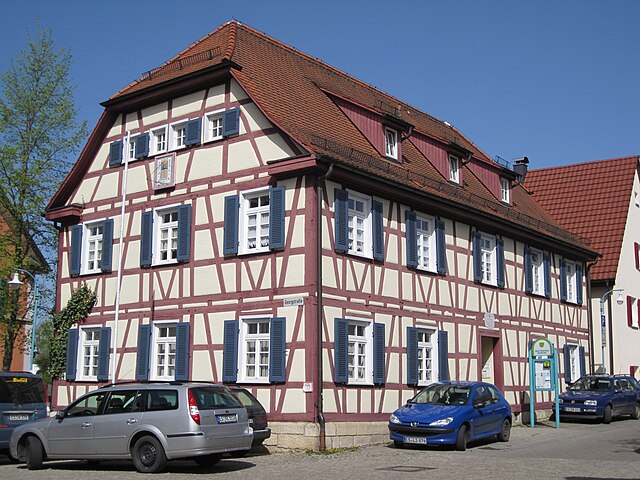
Altdorf
- municipality in the district of Esslingen, Baden-Württemberg, Germany
Hiking in Altdorf
Altdorf, located in the Esslingen district of Germany, offers a variety of hiking opportunities that cater to different experience levels. The region is characterized by beautiful landscapes, including forests, hills, and scenic views, making it ideal for outdoor enthusiasts....
- Country:
- Postal Code: 72655
- Local Dialing Code: 07127
- Licence Plate Code: ES
- Coordinates: 48° 35' 39" N, 9° 16' 15" E
- GPS tracks (wikiloc): [Link]
- AboveSeaLevel: 355 м m
- Area: 3.25 sq km
- Population: 1685
- Web site: [Link]
Hochdorf
- municipality in Germany
Hiking in Hochdorf
Hochdorf, located in the Esslingen district of Baden-Württemberg, Germany, offers some beautiful hiking opportunities, primarily due to its picturesque landscapes, vineyards, and forested areas. Here’s a summary of what to expect when hiking in the Hochdorf area:...
- Country:
- Postal Code: 73269
- Local Dialing Code: 07153
- Licence Plate Code: ES
- Coordinates: 48° 41' 43" N, 9° 28' 10" E
- GPS tracks (wikiloc): [Link]
- AboveSeaLevel: 292 м m
- Area: 7.75 sq km
- Population: 4620
- Web site: [Link]

Aichwald
- municipality in Germany
Hiking in Aichwald
Aichwald, located in the state of Baden-Württemberg, Germany, is a scenic area that offers a variety of hiking opportunities for both beginners and experienced hikers. The region is characterized by its lush forests, rolling hills, and picturesque landscapes. Here are some highlights of hiking in Aichwald:...
- Country:
- Postal Code: 73773
- Local Dialing Code: 0711
- Licence Plate Code: ES
- Coordinates: 48° 45' 29" N, 9° 22' 49" E
- GPS tracks (wikiloc): [Link]
- AboveSeaLevel: 425 м m
- Area: 14.68 sq km
- Population: 7537
- Web site: [Link]


Neckartailfingen
- municipality in Germany
Hiking in Neckartailfingen
Neckartailfingen is a picturesque village located in the Baden-Württemberg region of Germany, near the Neckar River. The area is known for its beautiful landscapes, charming rural atmosphere, and scenic hiking trails that appeal to both casual walkers and experienced hikers....
- Country:
- Postal Code: 72666
- Local Dialing Code: 07127
- Licence Plate Code: ES
- Coordinates: 48° 36' 42" N, 9° 15' 49" E
- GPS tracks (wikiloc): [Link]
- AboveSeaLevel: 285 м m
- Area: 8.26 sq km
- Population: 3684
- Web site: [Link]


Kohlberg
- municipality in Germany
Hiking in Kohlberg
Kohlberg, located in Baden-Württemberg, is a charming little village that serves as a great starting point for various hiking adventures in the surrounding area. The region is known for its diverse landscapes, including lush forests, rolling hills, and scenic viewpoints that make for enjoyable hiking experiences....
- Country:
- Postal Code: 72664
- Local Dialing Code: 07025
- Licence Plate Code: ES
- Coordinates: 48° 33' 28" N, 9° 20' 8" E
- GPS tracks (wikiloc): [Link]
- AboveSeaLevel: 476 м m
- Area: 4.38 sq km
- Population: 2320
- Web site: [Link]


Dettingen unter Teck
- municipality in Germany
Hiking in Dettingen unter Teck
Dettingen unter Teck is a charming town located in the Swabian region of Germany, surrounded by beautiful natural landscapes that make it an excellent destination for hiking enthusiasts. Here are some highlights of hiking in and around Dettingen unter Teck:...
- Country:
- Postal Code: 73265
- Local Dialing Code: 07021
- Licence Plate Code: ES
- Coordinates: 48° 37' 0" N, 9° 27' 0" E
- GPS tracks (wikiloc): [Link]
- AboveSeaLevel: 352 м m
- Area: 15.13 sq km
- Population: 5888
- Web site: [Link]

Wendlingen am Neckar
- municipality in Germany
Hiking in Wendlingen am Neckar
Wendlingen am Neckar is a charming town in Baden-Württemberg, Germany, situated near the scenic Swabian Jura and the Neckar River. The area is known for its beautiful landscapes, which offer various hiking opportunities for all levels of hikers....
- Country:
- Postal Code: 73240
- Local Dialing Code: 07024
- Licence Plate Code: ES
- Coordinates: 48° 40' 29" N, 9° 22' 54" E
- GPS tracks (wikiloc): [Link]
- AboveSeaLevel: 294 м m
- Area: 12.15 sq km
- Population: 16247
- Web site: [Link]

Plochingen
- municipality in Germany
Hiking in Plochingen
Plochingen is a charming town in the Baden-Württemberg region of Germany, situated near the Neckar River. It's well-known for its historical background and beautiful surroundings, making it a great destination for hiking enthusiasts. Here are some highlights about hiking in and around Plochingen:...
- Country:
- Postal Code: 73207
- Local Dialing Code: 07153
- Licence Plate Code: ES
- Coordinates: 48° 42' 42" N, 9° 24' 59" E
- GPS tracks (wikiloc): [Link]
- AboveSeaLevel: 276 м m
- Area: 10.65 sq km
- Population: 13997
- Web site: [Link]


Wernau
- municipality in Germany
Hiking in Wernau
Wernau, located in the state of Baden-Württemberg, Germany, is a charming town with access to beautiful natural landscapes, making it a great place for hiking enthusiasts. Here are a few highlights and tips for hiking in and around Wernau:...
- Country:
- Postal Code: 73249
- Local Dialing Code: 07153
- Licence Plate Code: ES
- Coordinates: 48° 41' 19" N, 9° 25' 20" E
- GPS tracks (wikiloc): [Link]
- AboveSeaLevel: 255 м m
- Area: 10.9 sq km
- Population: 12376
- Web site: [Link]


Neuffen
- municipality in Germany
Hiking in Neuffen
Neuffen is a charming town located in the Swabian Jura region of Germany, known for its beautiful landscapes, historic sites, and excellent hiking opportunities. The area offers a variety of trails suitable for different skill levels, making it a great destination for both casual walkers and experienced hikers....
- Country:
- Postal Code: 72637–72639
- Local Dialing Code: 07025
- Licence Plate Code: ES
- Coordinates: 48° 33' 16" N, 9° 22' 32" E
- GPS tracks (wikiloc): [Link]
- AboveSeaLevel: 408 м m
- Area: 17.45 sq km
- Population: 6343
- Web site: [Link]


Aichtal
- municipality in Germany
Hiking in Aichtal
Aichtal, located in the state of Baden-Württemberg in Germany, is a beautiful area for hiking, featuring a mix of gentle hills, forests, and scenic views. Here are some highlights and tips for hiking in Aichtal:...
- Country:
- Postal Code: 72631
- Local Dialing Code: 07127
- Licence Plate Code: ES
- Coordinates: 48° 37' 22" N, 9° 14' 14" E
- GPS tracks (wikiloc): [Link]
- AboveSeaLevel: 311 м m
- Area: 23.64 sq km
- Population: 10124
- Web site: [Link]


Reichenbach an der Fils
- municipality in Germany
Hiking in Reichenbach an der Fils
Reichenbach an der Fils, located in the state of Baden-Württemberg, Germany, offers a beautiful setting for hiking enthusiasts. The area is characterized by its picturesque landscapes, lush forests, and the meandering Fils River, providing a variety of hiking options suitable for different skill levels....
- Country:
- Postal Code: 73262
- Local Dialing Code: 07153
- Licence Plate Code: ES
- Coordinates: 48° 42' 29" N, 9° 27' 12" E
- GPS tracks (wikiloc): [Link]
- AboveSeaLevel: 262 м m
- Area: 7.43 sq km
- Population: 8436
- Web site: [Link]

Schlaitdorf
- municipality in Germany
Hiking in Schlaitdorf
Schlaitdorf, a quaint village located in Baden-Württemberg, Germany, offers some beautiful natural landscapes for hiking enthusiasts. The surrounding region is characterized by rolling hills, forests, and picturesque views, making it a lovely spot for outdoor activities....
- Country:
- Postal Code: 72667
- Local Dialing Code: 07127
- Licence Plate Code: ES
- Coordinates: 48° 36' 16" N, 9° 13' 22" E
- GPS tracks (wikiloc): [Link]
- AboveSeaLevel: 398 м m
- Area: 7.31 sq km
- Population: 1876
- Web site: [Link]


Großbettlingen
- municipality in Germany
Hiking in Großbettlingen
Großbettlingen, located in the Baden-Württemberg region of Germany, is surrounded by beautiful landscapes perfect for hiking enthusiasts. The area features a mix of rolling hills, forests, and vineyards, providing various trails for different skill levels....
- Country:
- Postal Code: 72663
- Local Dialing Code: 07022
- Licence Plate Code: ES
- Coordinates: 48° 35' 25" N, 9° 18' 32" E
- GPS tracks (wikiloc): [Link]
- AboveSeaLevel: 362 м m
- Area: 4.23 sq km
- Population: 4445
- Web site: [Link]
Shares border with regions:

Stuttgart
- capital city of German federated state Baden-Württemberg
Hiking in Stuttgart
Hiking in Stuttgart offers a fantastic blend of urban and natural experiences. The city is surrounded by beautiful landscapes, vineyards, and wooded hills, making it an excellent base for outdoor enthusiasts. Here are some highlights and popular hiking areas around Stuttgart:...
- Country:
- Postal Code: 70619; 70599; 70597; 70569; 70567; 70565; 70563; 70499; 70469; 70376; 70439; 70437; 70435; 70378; 70374; 70372; 70329; 70327; 70199; 70197; 70195; 70193; 70192; 70191; 70190; 70188; 70186; 70184; 70182; 70180; 70178; 70176; 70174; 70173
- Local Dialing Code: 711
- Licence Plate Code: S
- Coordinates: 48° 46' 34" N, 9° 10' 39" E
- GPS tracks (wikiloc): [Link]
- AboveSeaLevel: 247 м m
- Area: 207.33 sq km
- Population: 632743
- Web site: [Link]