Fay-aux-Loges (Fay-aux-Loges)

- commune in Loiret, France
- Country:

- Postal Code: 45450
- Coordinates: 47° 55' 44" N, 2° 8' 22" E


- GPS tracks (wikiloc): [Link]
- Area: 26.48 sq km
- Population: 3691
- Web site: http://www.mairie-fayauxloges.fr
- Wikipedia en: wiki(en)
- Wikipedia: wiki(fr)
- Wikidata storage: Wikidata: Q570653
- Wikipedia Commons Category: [Link]
- Freebase ID: [/m/03nwg06]
- GeoNames ID: Alt: [6434598]
- SIREN number: [214501421]
- BnF ID: [152605344]
- VIAF ID: Alt: [247380634]
- PACTOLS thesaurus ID: [pcrtQ6PSQSEeDB]
- INSEE municipality code: 45142
Shares border with regions:

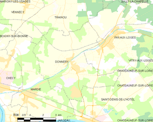
Donnery
- commune in Loiret, France
- Country:
- Postal Code: 45450
- Coordinates: 47° 54' 47" N, 2° 6' 15" E
- GPS tracks (wikiloc): [Link]
- Area: 21.77 sq km
- Population: 2741
- Web site: [Link]


Traînou
- commune in Loiret, France
- Country:
- Postal Code: 45470
- Coordinates: 47° 58' 23" N, 2° 6' 18" E
- GPS tracks (wikiloc): [Link]
- Area: 33.68 sq km
- Population: 3243
- Web site: [Link]


Sully-la-Chapelle
- commune in Loiret, France
- Country:
- Postal Code: 45450
- Coordinates: 47° 58' 33" N, 2° 10' 56" E
- GPS tracks (wikiloc): [Link]
- Area: 26.17 sq km
- Population: 412


Saint-Denis-de-l'Hôtel
- commune in Loiret, France
- Country:
- Postal Code: 45550
- Coordinates: 47° 52' 25" N, 2° 7' 48" E
- GPS tracks (wikiloc): [Link]
- Area: 25.45 sq km
- Population: 2928
- Web site: [Link]


Vitry-aux-Loges
- commune in Loiret, France
- Country:
- Postal Code: 45530
- Coordinates: 47° 56' 24" N, 2° 15' 58" E
- GPS tracks (wikiloc): [Link]
- Area: 44.06 sq km
- Population: 2058
- Web site: [Link]