Sully-la-Chapelle (Sully-la-Chapelle)

- commune in Loiret, France
- Country:

- Postal Code: 45450
- Coordinates: 47° 58' 33" N, 2° 10' 56" E


- GPS tracks (wikiloc): [Link]
- Area: 26.17 sq km
- Population: 412
- Wikipedia en: wiki(en)
- Wikipedia: wiki(fr)
- Wikidata storage: Wikidata: Q1381961
- Wikipedia Commons Category: [Link]
- Freebase ID: [/m/03nwhgf]
- GeoNames ID: Alt: [6434737]
- SIREN number: [214503146]
- BnF ID: [15260706f]
- INSEE municipality code: 45314
Shares border with regions:


Chilleurs-aux-Bois
- commune in Loiret, France
- Country:
- Postal Code: 45170
- Coordinates: 48° 4' 20" N, 2° 8' 5" E
- GPS tracks (wikiloc): [Link]
- Area: 52.22 sq km
- Population: 2016
- Web site: [Link]


Traînou
- commune in Loiret, France
- Country:
- Postal Code: 45470
- Coordinates: 47° 58' 23" N, 2° 6' 18" E
- GPS tracks (wikiloc): [Link]
- Area: 33.68 sq km
- Population: 3243
- Web site: [Link]


Ingrannes
- commune in Loiret, France
- Country:
- Postal Code: 45450
- Coordinates: 47° 59' 28" N, 2° 12' 48" E
- GPS tracks (wikiloc): [Link]
- Area: 38.98 sq km
- Population: 519

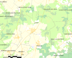
Loury
- commune in Loiret, France
- Country:
- Postal Code: 45470
- Coordinates: 48° 0' 5" N, 2° 5' 6" E
- GPS tracks (wikiloc): [Link]
- Area: 34.36 sq km
- Population: 2516
- Web site: [Link]


Vitry-aux-Loges
- commune in Loiret, France
- Country:
- Postal Code: 45530
- Coordinates: 47° 56' 24" N, 2° 15' 58" E
- GPS tracks (wikiloc): [Link]
- Area: 44.06 sq km
- Population: 2058
- Web site: [Link]

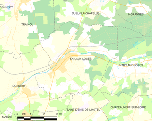
Fay-aux-Loges
- commune in Loiret, France
- Country:
- Postal Code: 45450
- Coordinates: 47° 55' 44" N, 2° 8' 22" E
- GPS tracks (wikiloc): [Link]
- Area: 26.48 sq km
- Population: 3691
- Web site: [Link]