Festes-et-Saint-André (Festes-et-Saint-André)

- commune in Aude, France
- Country:

- Postal Code: 11300
- Coordinates: 42° 58' 26" N, 2° 8' 44" E


- GPS tracks (wikiloc): [Link]
- Area: 18.07 sq km
- Population: 208
- Wikipedia en: wiki(en)
- Wikipedia: wiki(fr)
- Wikidata storage: Wikidata: Q1087052
- Wikipedia Commons Category: [Link]
- Freebase ID: [/m/03m8yt2]
- GeoNames ID: Alt: [6426672]
- SIREN number: [211101423]
- BnF ID: [15246679d]
- INSEE municipality code: 11142
Shares border with regions:
Saint-Benoît
- commune in Aude, France
- Country:
- Postal Code: 11230
- Coordinates: 43° 1' 4" N, 2° 3' 43" E
- GPS tracks (wikiloc): [Link]
- Area: 21.31 sq km
- Population: 103
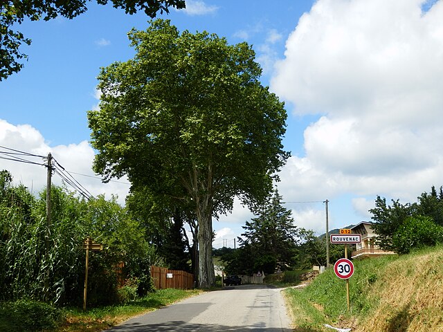

Rouvenac
- commune in Aude, France
- Country:
- Postal Code: 11260
- Coordinates: 42° 56' 16" N, 2° 8' 45" E
- GPS tracks (wikiloc): [Link]
- Area: 12.23 sq km
- Population: 218
Bourigeole
- commune in Aude, France
- Country:
- Postal Code: 11300
- Coordinates: 42° 59' 17" N, 2° 8' 1" E
- GPS tracks (wikiloc): [Link]
- Area: 9.08 sq km
- Population: 51
Montjardin
- commune in Aude, France
- Country:
- Postal Code: 11230
- Coordinates: 42° 58' 58" N, 2° 1' 39" E
- GPS tracks (wikiloc): [Link]
- Area: 14.11 sq km
- Population: 89


Saint-Jean-de-Paracol
- commune in Aude, France
- Country:
- Postal Code: 11260
- Coordinates: 42° 56' 9" N, 2° 6' 50" E
- GPS tracks (wikiloc): [Link]
- Area: 7.08 sq km
- Population: 117
Bouriège
- commune in Aude, France
- Country:
- Postal Code: 11300
- Coordinates: 42° 59' 9" N, 2° 9' 59" E
- GPS tracks (wikiloc): [Link]
- Area: 10.65 sq km
- Population: 118
Villefort
- commune in Aude, France
- Country:
- Postal Code: 11230
- Coordinates: 42° 57' 13" N, 2° 1' 57" E
- GPS tracks (wikiloc): [Link]
- Area: 12.67 sq km
- Population: 92

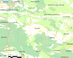
Puivert
- commune in Aude, France
- Country:
- Postal Code: 11230
- Coordinates: 42° 55' 14" N, 2° 2' 49" E
- GPS tracks (wikiloc): [Link]
- Area: 41.29 sq km
- Population: 522


La Serpent
- commune in Aude, France
- Country:
- Postal Code: 11190
- Coordinates: 42° 58' 2" N, 2° 10' 57" E
- GPS tracks (wikiloc): [Link]
- Area: 9.59 sq km
- Population: 87