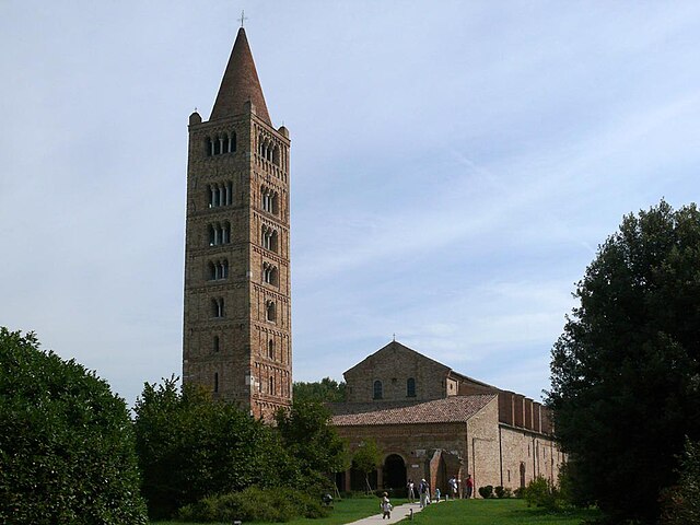
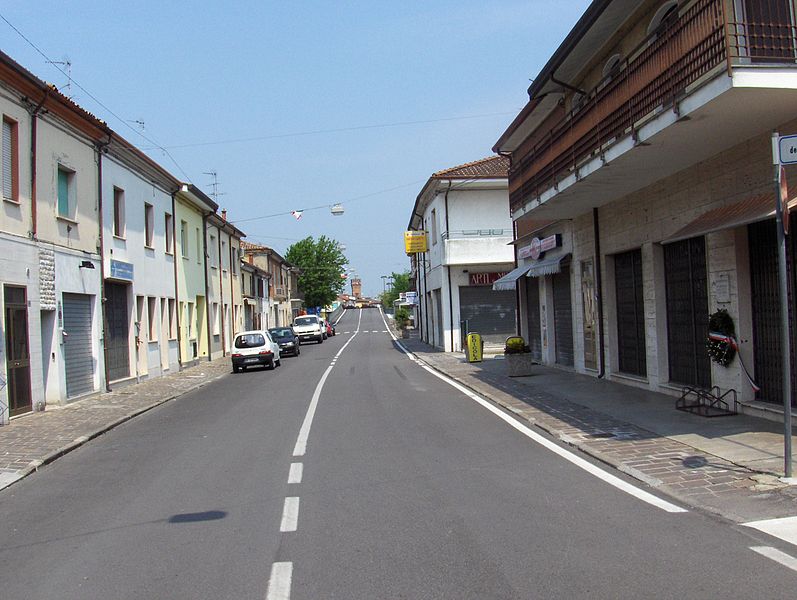
Fiscaglia (Fiscaglia)
.svg)
- Italian comune
 Hiking in Fiscaglia
Fiscaglia is a charming area located in the Emilia-Romagna region of Italy, known for its picturesque landscapes and charming villages. The area is characterized by gentle hills, vast agricultural fields, and a network of canals. Although Fiscaglia itself might not be a well-known hiking destination, it offers several opportunities for outdoor activities, including hiking, biking, and exploring the natural surroundings.
Hiking in Fiscaglia
-
Scenic Trails: While specific marked trails may be limited, you can explore the countryside by following tracks and unpaved roads. These paths often lead through beautiful farmland, along waterways, and offer views of local flora and fauna.
-
Natural Parks: Nearby natural parks and reserves, such as the Po Delta Regional Park, provide fantastic opportunities for hiking. This park features wetlands, river landscapes, and a rich variety of wildlife, including numerous bird species.
-
Cultural Exploration: A hiking trip in Fiscaglia also allows you to experience local culture. You can plan routes that take you through small villages, where you can enjoy local cuisine, learn about the region's history, and interact with residents.
-
Planning Your Hike: Depending on your skill level and interests, you can plan short walks or longer hiking routes. It’s advisable to check local maps or consult with local tourist information for guidance on paths.
-
Best Time to Visit: Spring and fall are ideal for hiking, as the weather is mild and the countryside is particularly beautiful during these seasons.
-
Safety Precautions: As always, when hiking, it’s important to wear appropriate footwear, carry enough water, and let someone know your intended route and return time.
If you're in the region and are looking for a peaceful hiking experience away from the more crowded tourist areas, Fiscaglia and its surroundings can offer a delightful adventure in nature.
- Country:

- Postal Code: 44027
- Local Dialing Code: 0533
- Licence Plate Code: FE
- Coordinates: 44° 46' 15" N, 11° 56' 5" E


- GPS tracks (wikiloc): [Link]
- AboveSeaLevel: 3 м m
- Area: 116.18 sq km
- Population: 8898
- Web site: http://www.comune.fiscaglia.fe.it
- Wikipedia en: wiki(en)
- Wikipedia: wiki(it)
- Wikidata storage: Wikidata: Q15527957
- Wikipedia Commons Category: [Link]
- GeoNames ID: Alt: [8658902]
- ISTAT ID: 038027
- Italian cadastre code: M323
Shares border with regions:

Codigoro
- Italian comune
Hiking in Codigoro
Codigoro is a small town located in the province of Ferrara in the Emilia-Romagna region of northern Italy. While it may not be as well-known as some other Italian hiking destinations, it offers some unique landscapes and opportunities for exploration, particularly for those interested in nature and rural environments....
- Country:
- Postal Code: 44021
- Local Dialing Code: 0533
- Licence Plate Code: FE
- Coordinates: 44° 50' 0" N, 12° 7' 0" E
- GPS tracks (wikiloc): [Link]
- AboveSeaLevel: 4 м m
- Area: 170.01 sq km
- Population: 11740
- Web site: [Link]


Jolanda di Savoia
- Italian comune
Hiking in Jolanda di Savoia
Jolanda di Savoia is a small municipality located in the Emilia-Romagna region of Italy, known for its picturesque landscapes and agricultural surroundings. While it may not be as widely recognized for hiking as some of the more mountainous regions of Italy, there are still opportunities for outdoor enthusiasts in and around the area....
- Country:
- Postal Code: 44037
- Local Dialing Code: 0532
- Licence Plate Code: FE
- Coordinates: 44° 53' 0" N, 11° 59' 0" E
- GPS tracks (wikiloc): [Link]
- AboveSeaLevel: 1 м m
- Area: 108.03 sq km
- Population: 2838
- Web site: [Link]

Lagosanto
- Italian comune
Hiking in Lagosanto
Lagosanto is a charming destination in the Emilia-Romagna region of Italy, situated near the Po River Delta. While it may not be as famous as some other hiking destinations in Italy, it offers unique opportunities for outdoor enthusiasts who appreciate nature, wildlife, and serene landscapes. Here are some key points to consider when hiking in and around Lagosanto:...
- Country:
- Postal Code: 44023
- Local Dialing Code: 0533
- Licence Plate Code: FE
- Coordinates: 44° 46' 0" N, 12° 8' 0" E
- GPS tracks (wikiloc): [Link]
- AboveSeaLevel: 2 м m
- Area: 34.44 sq km
- Population: 4844
- Web site: [Link]
Ostellato
- Italian comune
Hiking in Ostellato
Ostellato, located in the Emilia-Romagna region of Italy, offers a unique hiking experience due to its picturesque landscapes and tranquil environment. While the area isn't known for high mountains or rugged terrain, it features flat countryside, rice paddies, and wetlands, making it ideal for leisurely hikes and nature walks....
- Country:
- Postal Code: 44020
- Local Dialing Code: 0533
- Licence Plate Code: FE
- Coordinates: 44° 45' 0" N, 11° 56' 0" E
- GPS tracks (wikiloc): [Link]
- AboveSeaLevel: 2 м m
- Area: 173.34 sq km
- Population: 6030
- Web site: [Link]