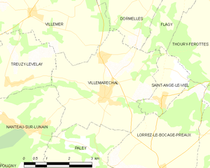
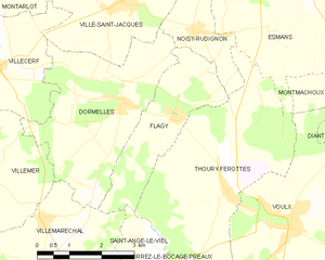
Flagy (Flagy)
- commune in Seine-et-Marne, France
- Country:

- Postal Code: 77940
- Coordinates: 48° 18' 45" N, 2° 55' 17" E


- GPS tracks (wikiloc): [Link]
- Area: 7.21 sq km
- Population: 644
- Web site: http://www.flagy.fr
- Wikipedia en: wiki(en)
- Wikipedia: wiki(fr)
- Wikidata storage: Wikidata: Q630515
- Wikipedia Commons Category: [Link]
- Freebase ID: [/m/02qh2cj]
- Freebase ID: [/m/02qh2cj]
- GeoNames ID: Alt: [6443658]
- GeoNames ID: Alt: [6443658]
- SIREN number: [217701846]
- SIREN number: [217701846]
- BnF ID: [152755247]
- BnF ID: [152755247]
- VIAF ID: Alt: [250796784]
- VIAF ID: Alt: [250796784]
- Library of Congress authority ID: Alt: [no2011144042]
- Library of Congress authority ID: Alt: [no2011144042]
- MusicBrainz area ID: [9eae04aa-ef9e-42eb-bcf9-82df8faf5c8c]
- MusicBrainz area ID: [9eae04aa-ef9e-42eb-bcf9-82df8faf5c8c]
- INSEE municipality code: 77184
- INSEE municipality code: 77184
Shares border with regions:


Villemaréchal
- commune in Seine-et-Marne, France
- Country:

- Postal Code: 77710
- Coordinates: 48° 16' 3" N, 2° 52' 6" E


- GPS tracks (wikiloc): [Link]
- Area: 14.23 sq km
- Population: 862
- Web site: [Link]


Noisy-Rudignon
- commune in Seine-et-Marne, France
- Country:

- Postal Code: 77940
- Coordinates: 48° 20' 9" N, 2° 55' 48" E


- GPS tracks (wikiloc): [Link]
- Area: 4.16 sq km
- Population: 621
- Web site: [Link]


Thoury-Férottes
- commune in Seine-et-Marne, France
- Country:

- Postal Code: 77940
- Coordinates: 48° 17' 29" N, 2° 56' 32" E


- GPS tracks (wikiloc): [Link]
- Area: 16.49 sq km
- Population: 677
- Web site: [Link]


Saint-Ange-le-Viel
- commune in Seine-et-Marne, France
- Country:

- Postal Code: 77710
- Coordinates: 48° 15' 56" N, 2° 54' 4" E


- GPS tracks (wikiloc): [Link]
- AboveSeaLevel: 119 м m
- Area: 3.23 sq km
- Population: 234


Dormelles
- commune in Seine-et-Marne, France
- Country:

- Postal Code: 77130
- Coordinates: 48° 18' 57" N, 2° 54' 3" E


- GPS tracks (wikiloc): [Link]
- Area: 13.02 sq km
- Population: 808
- Web site: [Link]
