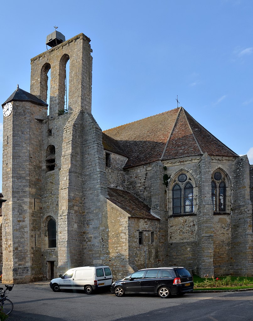
Thoury-Férottes (Thoury-Férottes)

- commune in Seine-et-Marne, France
- Country:

- Postal Code: 77940
- Coordinates: 48° 17' 29" N, 2° 56' 32" E


- GPS tracks (wikiloc): [Link]
- Area: 16.49 sq km
- Population: 677
- Web site: http://www.thoury-ferrottes.fr/
- Wikipedia en: wiki(en)
- Wikipedia: wiki(fr)
- Wikidata storage: Wikidata: Q271165
- Wikipedia Commons Category: [Link]
- Freebase ID: [/m/02rqpp8]
- Freebase ID: [/m/02rqpp8]
- GeoNames ID: Alt: [6443872]
- GeoNames ID: Alt: [6443872]
- SIREN number: [217704659]
- SIREN number: [217704659]
- BnF ID: [15275804f]
- BnF ID: [15275804f]
- INSEE municipality code: 77465
- INSEE municipality code: 77465
Shares border with regions:


Chevry-en-Sereine
- commune in Seine-et-Marne, France
- Country:
- Postal Code: 77710
- Coordinates: 48° 15' 13" N, 2° 56' 35" E
- GPS tracks (wikiloc): [Link]
- Area: 22.81 sq km
- Population: 517
- Web site: [Link]


Voulx
- commune in Seine-et-Marne, France
- Country:
- Postal Code: 77940
- Coordinates: 48° 16' 51" N, 2° 58' 6" E
- GPS tracks (wikiloc): [Link]
- Area: 12.6 sq km
- Population: 1761
- Web site: [Link]


Lorrez-le-Bocage-Préaux
- commune in Seine-et-Marne, France
- Country:
- Postal Code: 77710
- Coordinates: 48° 14' 13" N, 2° 54' 3" E
- GPS tracks (wikiloc): [Link]
- Area: 19.9 sq km
- Population: 1291
- Web site: [Link]


Noisy-Rudignon
- commune in Seine-et-Marne, France
- Country:
- Postal Code: 77940
- Coordinates: 48° 20' 9" N, 2° 55' 48" E
- GPS tracks (wikiloc): [Link]
- Area: 4.16 sq km
- Population: 621
- Web site: [Link]


Saint-Ange-le-Viel
- commune in Seine-et-Marne, France
- Country:
- Postal Code: 77710
- Coordinates: 48° 15' 56" N, 2° 54' 4" E
- GPS tracks (wikiloc): [Link]
- AboveSeaLevel: 119 м m
- Area: 3.23 sq km
- Population: 234


Esmans
- commune in Seine-et-Marne, France
- Country:
- Postal Code: 77940
- Coordinates: 48° 20' 53" N, 2° 58' 35" E
- GPS tracks (wikiloc): [Link]
- Area: 17.83 sq km
- Population: 899
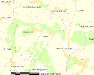
Flagy
- commune in Seine-et-Marne, France
- Country:
- Postal Code: 77940
- Coordinates: 48° 18' 45" N, 2° 55' 17" E
- GPS tracks (wikiloc): [Link]
- Area: 7.21 sq km
- Population: 644
- Web site: [Link]