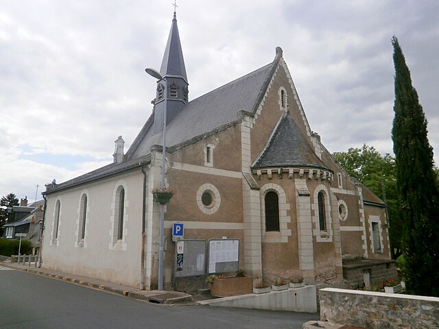
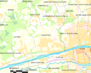
Fondettes (Fondettes)
- commune in Indre-et-Loire, France
- Country:

- Postal Code: 37230
- Coordinates: 47° 24' 15" N, 0° 35' 56" E


- GPS tracks (wikiloc): [Link]
- Area: 31.83 sq km
- Population: 10493
- Web site: http://fondettes.fr
- Wikipedia en: wiki(en)
- Wikipedia: wiki(fr)
- Wikidata storage: Wikidata: Q527676
- Wikipedia Commons Category: [Link]
- Wikipedia Commons Maps Category: [Link]
- Freebase ID: [/m/04cwjl]
- GeoNames ID: Alt: [3018124]
- SIREN number: [213701097]
- BnF ID: [15257660f]
- VIAF ID: Alt: [167848741]
- GND ID: Alt: [4663386-8]
- Library of Congress authority ID: Alt: [n97005703]
- PACTOLS thesaurus ID: [pcrtBUTyNPVBM4]
- MusicBrainz area ID: [6f40adf9-30f3-4974-9348-155c93ac72fb]
- WOEID: [591286]
- SUDOC authorities ID: [03095679X]
- ISNI: Alt: [0000 0001 2300 6593]
- INSEE municipality code: 37109
Shares border with regions:


Charentilly
- commune in Indre-et-Loire, France
- Country:

- Postal Code: 37390
- Coordinates: 47° 28' 10" N, 0° 36' 33" E


- GPS tracks (wikiloc): [Link]
- Area: 14.13 sq km
- Population: 1275
- Web site: [Link]


La Membrolle-sur-Choisille
- commune in Indre-et-Loire, France
- Country:

- Postal Code: 37390
- Coordinates: 47° 26' 17" N, 0° 38' 22" E


- GPS tracks (wikiloc): [Link]
- Area: 6.87 sq km
- Population: 3220
- Web site: [Link]


Saint-Genouph
- commune in Indre-et-Loire, France
- Country:

- Postal Code: 37510
- Coordinates: 47° 22' 42" N, 0° 35' 55" E


- GPS tracks (wikiloc): [Link]
- Area: 4.74 sq km
- Population: 1055
- Web site: [Link]


Saint-Cyr-sur-Loire
- commune in Indre-et-Loire, France
- Country:

- Postal Code: 37540
- Coordinates: 47° 24' 10" N, 0° 40' 41" E


- GPS tracks (wikiloc): [Link]
- Area: 13.5 sq km
- Population: 15911
- Web site: [Link]


La Riche
- commune in Indre-et-Loire, France
- Country:

- Postal Code: 37520
- Coordinates: 47° 23' 21" N, 0° 39' 38" E


- GPS tracks (wikiloc): [Link]
- Area: 8.17 sq km
- Population: 10403
- Web site: [Link]


Luynes
- commune in Indre-et-Loire, France
- Country:

- Postal Code: 37230
- Coordinates: 47° 23' 5" N, 0° 33' 16" E


- GPS tracks (wikiloc): [Link]
- Area: 34.01 sq km
- Population: 5153
- Web site: [Link]


Saint-Roch
- commune in Indre-et-Loire, France
- Country:

- Postal Code: 37390
- Coordinates: 47° 26' 43" N, 0° 34' 45" E


- GPS tracks (wikiloc): [Link]
- Area: 4.75 sq km
- Population: 1270
- Web site: [Link]
