Fontaine-Denis-Nuisy (Fontaine-Denis-Nuisy)

- commune in Marne, France
- Country:

- Postal Code: 51120
- Coordinates: 48° 37' 32" N, 3° 41' 11" E


- GPS tracks (wikiloc): [Link]
- Area: 13.17 sq km
- Population: 235
- Wikipedia en: wiki(en)
- Wikipedia: wiki(fr)
- Wikidata storage: Wikidata: Q769870
- Wikipedia Commons Category: [Link]
- Freebase ID: [/m/03qd6sr]
- GeoNames ID: Alt: [6435819]
- SIREN number: [215102369]
- BnF ID: [15262859s]
- VIAF ID: Alt: [310608952]
- INSEE municipality code: 51254
Shares border with regions:


La Celle-sous-Chantemerle
- commune in Marne, France
- Country:
- Postal Code: 51260
- Coordinates: 48° 36' 48" N, 3° 40' 40" E
- GPS tracks (wikiloc): [Link]
- Area: 12.03 sq km
- Population: 152
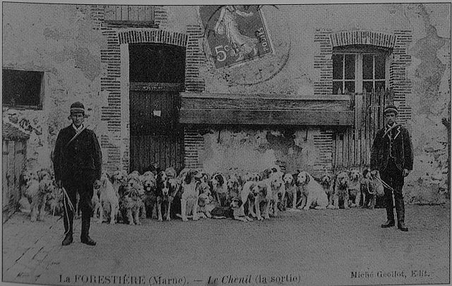
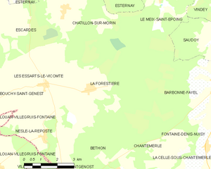
La Forestière
- commune in Marne, France
- Country:
- Postal Code: 51120
- Coordinates: 48° 39' 26" N, 3° 35' 34" E
- GPS tracks (wikiloc): [Link]
- Area: 22.67 sq km
- Population: 225
- Web site: [Link]


Saron-sur-Aube
- commune in Marne, France
- Country:
- Postal Code: 51260
- Coordinates: 48° 34' 7" N, 3° 43' 52" E
- GPS tracks (wikiloc): [Link]
- Area: 16.43 sq km
- Population: 301


Saint-Quentin-le-Verger
- commune in Marne, France
- Country:
- Postal Code: 51120
- Coordinates: 48° 36' 56" N, 3° 45' 0" E
- GPS tracks (wikiloc): [Link]
- Area: 10.63 sq km
- Population: 120


Chantemerle
- commune in Marne, France
- Country:
- Postal Code: 51260
- Coordinates: 48° 36' 44" N, 3° 39' 34" E
- GPS tracks (wikiloc): [Link]
- AboveSeaLevel: 162 м m
- Area: 8.51 sq km
- Population: 46


Barbonne-Fayel
- commune in Marne, France
- Country:
- Postal Code: 51120
- Coordinates: 48° 39' 26" N, 3° 41' 46" E
- GPS tracks (wikiloc): [Link]
- Area: 24.35 sq km
- Population: 498