
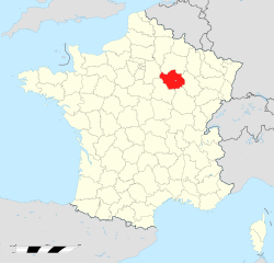
Marne (Marne)


- French department
- Country:

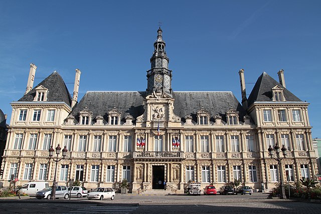
- Capital: Châlons-en-Champagne
- Coordinates: 49° 0' 0" N, 4° 15' 0" E


- GPS tracks (wikiloc): [Link]
- Area: 8162 sq km
- Population: 572293
- Web site: http://www.marne.pref.gouv.fr/
- Wikipedia en: wiki(en)
- Wikipedia: wiki(fr)
- Wikidata storage: Wikidata: Q12594
- Wikipedia Commons Gallery: [Link]
- Wikipedia Commons Category: [Link]
- Freebase ID: [/m/0lxyn]
- GeoNames ID: Alt: [2995603]
- SIREN number: [225100015]
- BnF ID: [11969202h]
- VIAF ID: Alt: [236350021]
- OSM relation ID: [7379]
- GND ID: Alt: [4115016-8]
- archINFORM location ID: [2040]
- Library of Congress authority ID: Alt: [n82088294]
- PACTOLS thesaurus ID: [pcrtT6hDSQ75Y8]
- MusicBrainz area ID: [5f729318-faae-4f0e-bab1-c402f3f84c4b]
- TGN ID: [7002967]
- Encyclopædia Britannica Online ID: [place/Marne]
- Gran Enciclopèdia Catalana ID: [0040471]
- NUTS code: [FR213]
- BabelNet ID: [03755504n]
- INSEE department code: [51]
- US National Archives Identifier: 10044266
- ISO 3166-2 code: FR-51
Includes regions:


arrondissement of Vitry-le-François
- arrondissement of France
- Country:
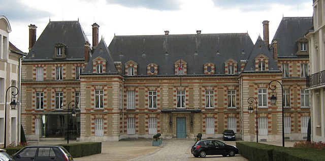
- Capital: Vitry-le-François
- Coordinates: 48° 45' 0" N, 4° 30' 0" E
- GPS tracks (wikiloc): [Link]
- Area: 1504 sq km
- Population: 47317


arrondissement of Châlons-en-Champagne
- arrondissement of France
- Country:
- Capital: Châlons-en-Champagne
- Coordinates: 48° 55' 0" N, 4° 20' 0" E
- GPS tracks (wikiloc): [Link]
- Area: 1778 sq km
- Population: 103441
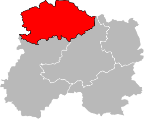
arrondissement of Reims
- arrondissement of France
- Country:
- Capital: Reims
- Coordinates: 49° 10' 0" N, 4° 5' 0" E
- GPS tracks (wikiloc): [Link]
- Area: 1702 sq km
- Population: 298134

arrondissement of Sainte-Menehould
- arrondissement of France
- Country:
- Capital: Sainte-Menehould
- Coordinates: 49° 5' 0" N, 4° 45' 0" E
- GPS tracks (wikiloc): [Link]
- Area: 1021 sq km
- Population: 13734


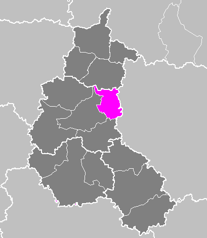
arrondissement of Épernay
- arrondissement of France
- Country:
- Capital: Épernay
- Coordinates: 48° 50' 0" N, 3° 45' 0" E
- GPS tracks (wikiloc): [Link]
- Area: 2156 sq km
- Population: 109667
Shares border with regions:


Haute-Marne
- French department
- Country:
- Capital: Chaumont
- Coordinates: 48° 5' 0" N, 5° 15' 0" E
- GPS tracks (wikiloc): [Link]
- Area: 6211 sq km
- Population: 179154
- Web site: [Link]


Meuse
- French department
- Country:
- Capital: Bar-le-Duc
- Coordinates: 48° 57' 56" N, 5° 22' 40" E
- GPS tracks (wikiloc): [Link]
- Area: 6211 sq km
- Population: 190626
- Web site: [Link]

Seine-et-Marne
- French department
- Country:
- Capital: Melun
- Coordinates: 48° 36' 0" N, 3° 0' 0" E
- GPS tracks (wikiloc): [Link]
- Area: 5915 sq km
- Population: 1390121
- Web site: [Link]


Aisne
- French department
- Country:
- Capital: Laon
- Coordinates: 49° 30' 0" N, 3° 30' 0" E
- GPS tracks (wikiloc): [Link]
- Area: 7369 sq km
- Population: 538659
- Web site: [Link]


Ardennes
- department in France
- Country:
- Capital: Charleville-Mézières
- Coordinates: 49° 34' 43" N, 4° 35' 12" E
- GPS tracks (wikiloc): [Link]
- Area: 5229 sq km
- Population: 277752
- Web site: [Link]

Aube
- French department
- Country:
- Capital: Troyes
- Coordinates: 48° 20' 0" N, 4° 10' 0" E
- GPS tracks (wikiloc): [Link]
- Area: 6004 sq km
- Population: 309056
- Web site: [Link]