Fontevraud-l'Abbaye (Fontevraud-l'Abbaye)
- commune in Maine-et-Loire, France
- Country:

- Postal Code: 49590
- Coordinates: 47° 10' 56" N, 0° 2' 59" E


- GPS tracks (wikiloc): [Link]
- AboveSeaLevel: 80 м m
- Area: 14.82 sq km
- Population: 1528
- Web site: http://www.fontevraud-abbaye.fr/index.htm
- Wikipedia en: wiki(en)
- Wikipedia: wiki(fr)
- Wikidata storage: Wikidata: Q632276
- Wikipedia Commons Category: [Link]
- Freebase ID: [/m/080dpt]
- GeoNames ID: Alt: [3017850]
- SIREN number: [214901407]
- BnF ID: [152617416]
- VIAF ID: Alt: [148567937]
- archINFORM location ID: [8809]
- Library of Congress authority ID: Alt: [n80113323]
- PACTOLS thesaurus ID: [pcrt4JJvZVv7N9]
- MusicBrainz area ID: [21b5d1c1-6189-4617-b032-794e01fc3e02]
- Encyclopædia Britannica Online ID: [place/Fontevrault-lAbbaye]
- EMLO location ID: [adb3ed73-0252-4d24-88a8-abe4a475cd03]
- INSEE municipality code: 49140
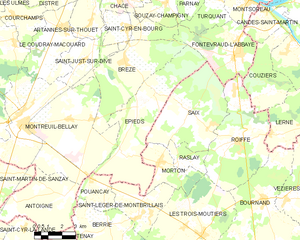
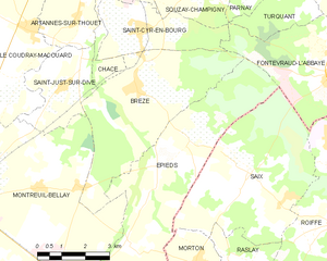
Shares border with regions:


Épieds
- commune in Maine-et-Loire, France
- Country:

- Postal Code: 49260
- Coordinates: 47° 8' 38" N, 0° 2' 46" E


- GPS tracks (wikiloc): [Link]
- Area: 26.99 sq km
- Population: 738


Brézé
- commune in Maine-et-Loire, France
- Country:

- Postal Code: 49260
- Coordinates: 47° 10' 17" N, 0° 3' 30" E


- GPS tracks (wikiloc): [Link]
- Area: 20.05 sq km
- Population: 1271
- Web site: [Link]


Couziers
- commune in Indre-et-Loire, France
- Country:

- Postal Code: 37500
- Coordinates: 47° 9' 32" N, 0° 4' 56" E


- GPS tracks (wikiloc): [Link]
- Area: 12.05 sq km
- Population: 123


Turquant
- commune in Maine-et-Loire, France
- Country:

- Postal Code: 49730
- Coordinates: 47° 13' 22" N, 0° 1' 40" E


- GPS tracks (wikiloc): [Link]
- Area: 7.86 sq km
- Population: 593
- Web site: [Link]


Saint-Cyr-en-Bourg
- commune in Maine-et-Loire, France
- Country:

- Postal Code: 49260
- Coordinates: 47° 11' 38" N, 0° 3' 38" E


- GPS tracks (wikiloc): [Link]
- Area: 8.63 sq km
- Population: 894
Roiffé
- commune in Vienne, France
- Country:

- Postal Code: 86120
- Coordinates: 47° 7' 29" N, 0° 3' 8" E


- GPS tracks (wikiloc): [Link]
- Area: 24.3 sq km
- Population: 754
Saix
- commune in Vienne, France
- Country:

- Postal Code: 86120
- Coordinates: 47° 8' 14" N, 0° 0' 1" E


- GPS tracks (wikiloc): [Link]
- AboveSeaLevel: 115 м m
- Area: 22.55 sq km
- Population: 290


Candes-Saint-Martin
- commune in Indre-et-Loire, France
- Country:

- Postal Code: 37500
- Coordinates: 47° 12' 39" N, 0° 4' 24" E


- GPS tracks (wikiloc): [Link]
- Area: 5.77 sq km
- Population: 226
- Web site: [Link]


Montsoreau
- commune in Loire Valley, France
- Country:

- Postal Code: 49730
- Local Dialing Code: 2
- Coordinates: 47° 12' 59" N, 0° 3' 25" E


- GPS tracks (wikiloc): [Link]
- AboveSeaLevel: 27 м m
- Area: 5.19 sq km
- Population: 447
- Web site: [Link]


Souzay-Champigny
- commune in Maine-et-Loire, France
- Country:

- Postal Code: 49400
- Coordinates: 47° 14' 10" N, 0° 0' 27" E


- GPS tracks (wikiloc): [Link]
- Area: 8.92 sq km
- Population: 772
