Fontgombault (Fontgombault)

- commune in Indre, France
- Country:

- Postal Code: 36220
- Coordinates: 46° 40' 27" N, 0° 59' 6" E


- GPS tracks (wikiloc): [Link]
- Area: 10.58 sq km
- Population: 247
- Web site: http://www.fontgombault.com
- Wikipedia en: wiki(en)
- Wikipedia: wiki(fr)
- Wikidata storage: Wikidata: Q623804
- Wikipedia Commons Category: [Link]
- Freebase ID: [/m/03nv9x1]
- GeoNames ID: Alt: [6448614]
- SIREN number: [213600760]
- BnF ID: [152573807]
- VIAF ID: Alt: [236059813]
- WOEID: [591536]
- INSEE municipality code: 36076
Shares border with regions:


Sauzelles
- commune in Indre, France
- Country:
- Postal Code: 36220
- Coordinates: 46° 39' 51" N, 1° 0' 9" E
- GPS tracks (wikiloc): [Link]
- Area: 12.86 sq km
- Population: 241


Preuilly-la-Ville
- commune in Indre, France
- Country:
- Postal Code: 36220
- Coordinates: 46° 41' 48" N, 0° 58' 5" E
- GPS tracks (wikiloc): [Link]
- Area: 4.23 sq km
- Population: 166


Lurais
- commune in Indre, France
- Country:
- Postal Code: 36220
- Coordinates: 46° 42' 16" N, 0° 57' 2" E
- GPS tracks (wikiloc): [Link]
- Area: 13.61 sq km
- Population: 247
- Web site: [Link]

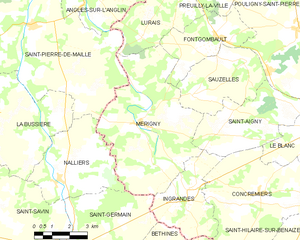
Mérigny
- commune in Indre, France
- Country:
- Postal Code: 36220
- Coordinates: 46° 37' 52" N, 0° 55' 33" E
- GPS tracks (wikiloc): [Link]
- Area: 31.77 sq km
- Population: 533
- Web site: [Link]


Pouligny-Saint-Pierre
- commune in Indre, France
- Country:
- Postal Code: 36300
- Coordinates: 46° 40' 51" N, 1° 2' 21" E
- GPS tracks (wikiloc): [Link]
- Area: 47.45 sq km
- Population: 1090