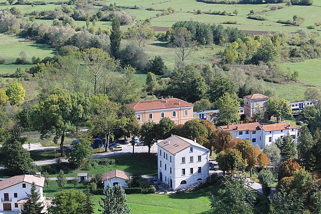
Forlì del Sannio (Forlì del Sannio)
- Italian comune
 Hiking in Forlì del Sannio
Forlì del Sannio is a charming village located in the Molise region of Italy, nestled in the Apennine Mountains. This area is known for its stunning natural landscapes, rich history, and excellent hiking opportunities. Here are some key points to consider if you're planning a hiking trip there:
Trails and Routes:
-
Scenic Trails: Forlì del Sannio offers various hiking trails that wind through lush forests, along ridges with breathtaking views, and across pristine rivers. Some trails may lead to historical sites or offer panoramic views of the surrounding mountains.
-
Difficulty Levels: There are hiking trails suitable for all skill levels, from easy walks to more challenging hikes. Be sure to check the trail difficulty before setting out.
-
Natural Parks: The nearby Abruzzo, Lazio and Molise National Park is a short drive away and provides even more extensive hiking opportunities. Trails range from easy to strenuous and showcase diverse flora and fauna.
Essential Tips:
- Equipment: Bring good hiking shoes, plenty of water, snacks, a map, and a first aid kit. Trekking poles can also be useful for more challenging terrain.
- Local Guidance: Consider hiring a local guide or joining a hiking group if you're unfamiliar with the area. This can enhance your experience and ensure safety.
- Weather Conditions: Check the weather forecast before your hike, as conditions can change rapidly in mountainous regions. Be prepared for rain or sudden temperature drops.
Cultural Aspects:
- As you hike, take the opportunity to explore the local culture. Forlì del Sannio has historical sites, small churches, and local culinary offerings that can enhance your experience.
- Engaging with locals can provide insights into the area’s history and natural environment, making your hike more enriching.
Wildlife and Nature:
- The region is home to diverse wildlife, including species like wolves, deer, and various birds of prey. Keep an eye out for wildlife and take time to appreciate the natural surroundings.
Hiking in Forlì del Sannio can be a rewarding experience, offering not just stunning views but a chance to connect with the natural beauty and culture of the Molise region. Enjoy your adventure!
- Country:

- Postal Code: 86084
- Local Dialing Code: 0865
- Licence Plate Code: IS
- Coordinates: 41° 42' 0" N, 14° 11' 0" E


- GPS tracks (wikiloc): [Link]
- AboveSeaLevel: 610 м m
- Area: 32.56 sq km
- Population: 683
- Web site: http://www.comune.forlidelsannio.is.it
- Wikipedia en: wiki(en)
- Wikipedia: wiki(it)
- Wikidata storage: Wikidata: Q279177
- Wikipedia Commons Category: [Link]
- Freebase ID: [/m/0gq_fy]
- GeoNames ID: Alt: [6539344]
- VIAF ID: Alt: [143228206]
- OSM relation ID: [41450]
- ISTAT ID: 094020
- Italian cadastre code: D703
Shares border with regions:


Isernia
- Italian comune
Hiking in Isernia
Isernia, located in the Molise region of Italy, offers a variety of hiking opportunities surrounded by stunning landscapes, historical charm, and rich biodiversity. Here are some highlights and tips for hiking in and around Isernia:...
- Country:
- Postal Code: 86170
- Local Dialing Code: 0865
- Licence Plate Code: IS
- Coordinates: 41° 35' 49" N, 14° 14' 7" E
- GPS tracks (wikiloc): [Link]
- AboveSeaLevel: 423 м m
- Area: 69.15 sq km
- Population: 21666
- Web site: [Link]


Acquaviva d'Isernia
- Italian comune
Hiking in Acquaviva d'Isernia
Acquaviva d'Isernia is a lovely town situated in the Molise region of Italy, surrounded by beautiful landscapes that are ideal for hiking enthusiasts. The area offers a range of trails that cater to different skill levels, allowing hikers to explore its stunning natural beauty, historical sites, and charming villages....
- Country:
- Postal Code: 86080
- Local Dialing Code: 0865
- Licence Plate Code: IS
- Coordinates: 41° 40' 0" N, 14° 9' 0" E
- GPS tracks (wikiloc): [Link]
- AboveSeaLevel: 730 м m
- Area: 13.51 sq km
- Population: 413
- Web site: [Link]


Cerro al Volturno
- Italian comune
Hiking in Cerro al Volturno
Cerro al Volturno is a picturesque area located in the province of Isernia, in the Molise region of Italy. This destination is particularly popular among hikers and nature enthusiasts due to its stunning landscapes, rich biodiversity, and cultural heritage. Here’s what you can expect when hiking in and around Cerro al Volturno:...
- Country:
- Postal Code: 86072
- Local Dialing Code: 0865
- Licence Plate Code: IS
- Coordinates: 41° 39' 0" N, 14° 8' 0" E
- GPS tracks (wikiloc): [Link]
- AboveSeaLevel: 572 м m
- Area: 23.79 sq km
- Population: 1250
- Web site: [Link]


Fornelli
- Italian comune
Hiking in Fornelli
Fornelli is a charming town located in the Molise region of Italy, known for its picturesque landscapes and cultural heritage. The area offers a variety of hiking opportunities, catering to different skill levels and interests. Here are some key points about hiking in Fornelli:...
- Country:
- Postal Code: 86070
- Local Dialing Code: 0865
- Licence Plate Code: IS
- Coordinates: 41° 36' 24" N, 14° 8' 25" E
- GPS tracks (wikiloc): [Link]
- AboveSeaLevel: 530 м m
- Area: 23.17 sq km
- Population: 1929
- Web site: [Link]
Rionero Sannitico
- Italian comune
Hiking in Rionero Sannitico
Rionero Sannitico is a picturesque village located in the Molise region of Italy, surrounded by the stunning landscapes of the Apennine Mountains. Hiking in and around Rionero Sannitico offers a unique opportunity to explore both the natural beauty and the cultural heritage of this lesser-known area....
- Country:
- Postal Code: 86087
- Local Dialing Code: 0865
- Licence Plate Code: IS
- Coordinates: 41° 43' 0" N, 14° 8' 0" E
- GPS tracks (wikiloc): [Link]
- AboveSeaLevel: 1051 м m
- Area: 29.22 sq km
- Population: 1130
- Web site: [Link]

Roccasicura
- Italian comune
Hiking in Roccasicura
Roccasicura, a small town in the Molise region of Italy, offers a beautiful setting for hiking enthusiasts. The area is characterized by its picturesque landscapes, rolling hills, and nearby mountains. Here are some key points about hiking in and around Roccasicura:...
- Country:
- Postal Code: 86080
- Local Dialing Code: 0865
- Licence Plate Code: IS
- Coordinates: 41° 42' 0" N, 14° 14' 0" E
- GPS tracks (wikiloc): [Link]
- AboveSeaLevel: 742 м m
- Area: 28.61 sq km
- Population: 559
- Web site: [Link]


Vastogirardi
- Italian comune
Hiking in Vastogirardi
Vastogirardi is a delightful hidden gem located in the Molise region of Italy, known for its stunning landscapes, rich history, and outdoor recreational opportunities. Here are some highlights of hiking in Vastogirardi:...
- Country:
- Postal Code: 86089
- Local Dialing Code: 0865
- Licence Plate Code: IS
- Coordinates: 41° 46' 0" N, 14° 16' 0" E
- GPS tracks (wikiloc): [Link]
- AboveSeaLevel: 1200 м m
- Area: 60.71 sq km
- Population: 684
- Web site: [Link]