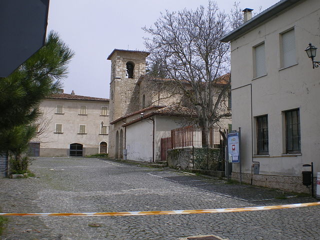
Fossa, Abruzzo (Fossa)
.svg)
- Italian comune
 Hiking in Fossa, Abruzzo
Fossa is a charming village located in the Abruzzo region of Italy, surrounded by stunning natural landscapes that make it an excellent destination for hiking enthusiasts. The area boasts a rich variety of trails that cater to different skill levels, from easy walks to more challenging hikes. Here are some highlights about hiking in and around Fossa:
Landscape and Scenery
- Natural Beauty: Fossa is situated near the Gran Sasso and Monti della Laga National Park, providing breathtaking views of mountains, valleys, and diverse flora and fauna.
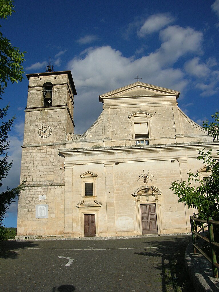
- Historical Sites: As you hike, you'll encounter medieval architecture, ancient villages, and ruins, giving a rich cultural context to your outdoor experience.
Popular Hiking Trails
- Sentiero del Cervo: This trail offers a moderate hiking experience with opportunities to see wildlife, including deer.
- Gran Sasso Trails: The trails around the Gran Sasso mountain range provide routes that vary from easy to challenging, with incredible vistas and opportunities for rock climbing and other activities.
Tips for Hikers
- Preparation: Always check the local weather conditions before heading out. Abruzzo's mountainous terrain can lead to quickly changing weather.
- Gear: Wear sturdy hiking boots and bring plenty of water, snacks, and a map or GPS device. Some trails might not be well-marked.
- Local Guidance: Consider hiring a local guide or joining a group. They can provide valuable insights into the region's natural and cultural history.
Wildlife and Flora
Hikers can expect to see a variety of wildlife, including birds, deer, and perhaps even wolves. The area is also rich in diverse plant species, especially in spring when wildflowers bloom.
Accessibility
Fossa is conveniently located near larger towns such as L'Aquila, which provides easy access to transportation and accommodations.
Safety Precautions
- Always inform someone about your hiking plans.
- Stay on marked trails to protect the local ecology.
- Be mindful of the time; it can get dark early in the mountains.
In summary, hiking around Fossa offers a perfect blend of adventure, natural beauty, and cultural exploration. Whether you're looking for a leisurely walk or a challenging climb, there are plenty of options to enjoy in this picturesque part of Abruzzo.
- Country:

- Postal Code: 67020
- Local Dialing Code: 0862
- Licence Plate Code: AQ
- Coordinates: 42° 17' 34" N, 13° 29' 16" E


- GPS tracks (wikiloc): [Link]
- AboveSeaLevel: 644 м m
- Area: 8.71 sq km
- Population: 705
- Web site: http://www.comunedifossa.it
- Wikipedia en: wiki(en)
- Wikipedia: wiki(it)
- Wikidata storage: Wikidata: Q50093
- Wikipedia Commons Category: [Link]
- Freebase ID: [/m/0fg4s4]
- GeoNames ID: Alt: [6541920]
- VIAF ID: Alt: [145752114]
- OSM relation ID: [41944]
- Library of Congress authority ID: Alt: [no2001101172]
- DMOZ ID: Alt: [Regional/Europe/Italy/Abruzzo/Localities/Fossa/]
- Google Maps Customer ID: [290851176775805792]
- ISTAT ID: 066044
- Italian cadastre code: D736
Shares border with regions:


L'Aquila
- Italian city, capital of the Abruzzo region and of the Province of L'Aquila
Hiking in L'Aquila
L'Aquila, located in the Abruzzo region of Italy, is surrounded by stunning landscapes, making it a great destination for hiking enthusiasts. The area is characterized by the Gran Sasso and Monti della Laga National Park, which offers a variety of trails suited for all skill levels, from casual walkers to experienced hikers. Here are some highlights of hiking in L'Aquila:...
- Country:
- Postal Code: 67100
- Local Dialing Code: 0862
- Coordinates: 42° 21' 14" N, 13° 23' 31" E
- GPS tracks (wikiloc): [Link]
- AboveSeaLevel: 714 м m
- Area: 466.87 sq km
- Population: 69627
- Web site: [Link]


Barisciano
- Italian comune
Hiking in Barisciano
Barisciano is a charming village located in the Province of L'Aquila, in the Abruzzo region of Italy. The area is known for its stunning landscapes, historical architecture, and proximity to the Gran Sasso e Monti della Laga National Park, making it a fantastic destination for hikers and outdoor enthusiasts....
- Country:
- Postal Code: 67021
- Local Dialing Code: 0862
- Licence Plate Code: AQ
- Coordinates: 42° 19' 31" N, 13° 35' 36" E
- GPS tracks (wikiloc): [Link]
- AboveSeaLevel: 940 м m
- Area: 78.49 sq km
- Population: 1764
- Web site: [Link]

Ocre
- Italian comune
Hiking in Ocre
Ocre is a beautiful region in Italy, known for its stunning landscapes, charming villages, and outdoor activities, including hiking. While there may not be extensive information specifically about hiking in Ocre, I can provide general insights about hiking opportunities in the surrounding Abruzzo region....
- Country:
- Postal Code: 67040
- Local Dialing Code: 0862
- Licence Plate Code: AQ
- Coordinates: 42° 17' 10" N, 13° 28' 31" E
- GPS tracks (wikiloc): [Link]
- AboveSeaLevel: 850 м m
- Area: 23.6 sq km
- Population: 1159
- Web site: [Link]

Poggio Picenze
- Italian comune
Hiking in Poggio Picenze
Poggio Picenze, located in the Abruzzo region of Italy, is a charming destination for hikers. Nestled in the beautiful Apennine Mountains, it provides a scenic backdrop of rolling hills, lush forests, and stunning landscapes. Here are some highlights and tips for hiking in this area:...
- Country:
- Postal Code: 67026
- Local Dialing Code: 0862
- Licence Plate Code: AQ
- Coordinates: 42° 19' 14" N, 13° 32' 25" E
- GPS tracks (wikiloc): [Link]
- AboveSeaLevel: 756 м m
- Area: 11.46 sq km
- Population: 1105
- Web site: [Link]


Sant'Eusanio Forconese
- Italian comune
Hiking in Sant'Eusanio Forconese
Sant'Eusanio Forconese is a picturesque village located in the Abruzzo region of Italy, nestled in the Apennine Mountains. This area is known for its breathtaking natural landscapes, rich history, and diverse hiking opportunities. Here are some key points to consider when hiking in Sant'Eusanio Forconese:...
- Country:
- Postal Code: 67020
- Local Dialing Code: 0862
- Licence Plate Code: AQ
- Coordinates: 42° 17' 18" N, 13° 31' 28" E
- GPS tracks (wikiloc): [Link]
- AboveSeaLevel: 591 м m
- Area: 7.94 sq km
- Population: 394
- Web site: [Link]